Self ..The Tarn of Auber ..Dingoes of Alalya ..Cleland Hills ..A Remote Track ..Sandy Blight Junction Road ..An Unmarked Track ..Prehistoric sites ..The Vale of Tempe ..Finke River Gorge ..Panaramitee Petroglyphs ..Sturts Meadows Petroglyphs
Self
2013 was the year that my life would change forever.
My alarm bells rang when my weight gain reached 121.5kgs on 1st February 2013. Worried about the possible onset of diabetes, I resolved to cut out certain foods to try and regulate my weight. So I ceased eating snacks, biscuits and sweets and cut out adding sugar to tea, coffee or breakfast cereals. I stopped 95% of my alcohol intake and only rarely will I enjoy a glass of wine with a meal. The result to date is that I shed 13kgs by 1st May and my target was to reach 100kg by 7th June.
My 70th birthday was coming up the next month and so I just kept my mind busy and my body active. I was feeling better though the pain was still there and extreme at times, which, without taking NSAIDS can be debilitating but I put up with the cards that have fallen my way.
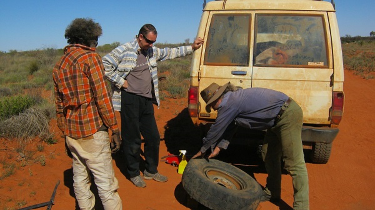
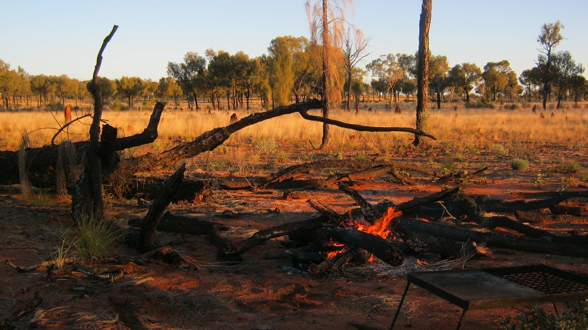
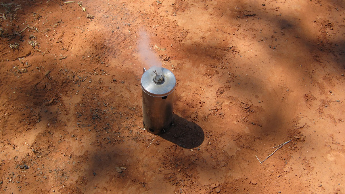
Ankle Bone Spurs: I have had them from time to time. The last one was in May 2009 and in May 2013 and I had another one. Methinks it may be a seasonal thing. One goes on to the Internet to look for possible cures but many of those just don’t work. The last time I had one an occasion arose where I was repairing a flat tyre on the Canning Stock Route in Western Australia. I had two friends helping. One of them was being mischievous and hit me on the ankle with a dumpy hammer when I wasn’t looking. The pain was excrutiating but when that subsided I found that the Spur Pain had eased. The next morning I hit the Spur one more time with the hammer and the Spur and pain dissolved! I had broken the spur off by all accounts.
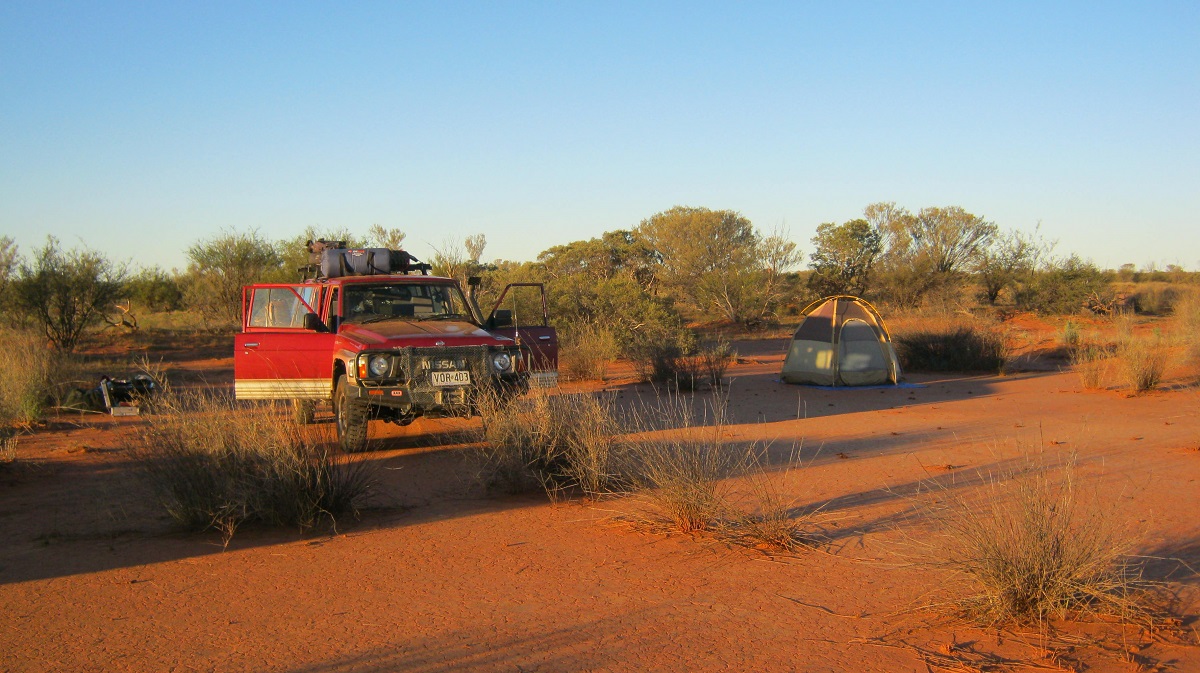
Before leaving on our next trip to the Cleland Hills we were visiting friends in Alice Springs. They had just installed a new padded vinyl floor and I tried to slide on it with my woollen socks. I lost my balance and fell backwards hitting my head quite hard on the ‘soft’ floor. I was stunned for a few minutes but then got up and seemed O.K.
Later in the week I was out camping in the Gibson Desert and went to pick up the frying pan off the fire. I found that I could hardly lift it with my left hand. I was at a loss to know why this had happened virtually out of the blue. This condition persisted and I was taking Diclofenac (Voltaren) as a pain killer for my back troubles. I think though that the pills might have had some negative effect to my system and I stopped taking them. During August and September of 2013 I have either tripped or have lost my balance and have fallen quite hard on the ground. I noticed that I am sometimes unstable when getting up from the bed, chair or when getting out of the car. So I am watching what I do carefully. My toes and the front pads of my feet have also been effected by my back pain. I find it uncomfortable walking barefoot outside, an event which I have enjoyed for many years each summer. I was visiting a Physiotherapist twice a month in late 2013 and although the massages were good my condition reverted back by the afternoon after a massage. I had lost a total of 21 kilograms in my weight-loss endeavour by November 2013.
My condition for my back and neck deteriorated and I went to see a local GP in January of 2014. What followed was a 7 month saga of seeing a different Locum every time I went to the clinic and getting nowhere near the correct medicines. I had a Cat-scan done and the principal doctor of our clinic reluctantly referred me to nerve specialist in Adelaide. On 4th July 2014 I was put on a waiting list at the Royal Adelaide Hospital for an appointment with a spinal specialist, which, by all accounts, is 3 years of waiting ones turn. November 2016 am I am still on the list.
I battled on with what medicines I had been given. The pinched nerve in my neck caused my whole upper body to feel as if I had sunburn. I carried on going about my business of getting around and doing things but life was uncomfortable.
The evening before we were due to leave on our trip, I slipped on Bill’s new lounge floor vinyl. I grabbed hold of an arm-chair and that gave way and pitched me even further back and I hit my head with some force on the floor. Although the vinyl was soft my head still jarred on then concrete below the vinyl. I was stunned for a few seconds but came good soon after and we left on our trip the following day.
The Tarn of Auber 2013
This tale is almost mythical.
It dates back to October of 1872 in Central Australia. The modern day explorer, Ernest Giles and two companions started off from Port Augusta on a quest to seek out good pastoral lands. This expedition was sponsored by Thomas Elder and William Hugh of South Australia.
Edge of Great Sandy Desert
On their return trip to the south and travelling south, south-east from Mount Udor, on horses, and being two full days without any water, Ernest Giles recalls in his diary;
“Looking about with some hopes of finding the place where these children of the wilderness obtained water, I espied about a hundred yards away, on the opposite side of the little glen or valley, a very peculiar looking crevice between two huge blocks of sandstone, and apparently not more than a yard wide. I rode over to this spot, and to my great delight found the most excellent little rock tarn, of nearly and oblong shape, containing a most welcome and opportune supply of the fluid I was so anxious to discover. Some green slime rested on a portion of the surface but the rest was all clear and pure water. My horse must have thought me mad, and anyone who had seen me might have thought that I had suddenly espied some basilisk, or cockatrice, or mailed saurian; for just as my horse was preparing to dip his nose in the water he so greatly wanted, I turned him away and made him gallop off after his and my companions, who were slowly passing away from this liquid prize. When I hailed and overtook them they could scarcely believe that our wants were to be so soon and agreeably relieved. There was abundance requirement for all our need her, but the approach was so narrow that only two horses could drink at one time, and we had great difficulty in preventing the horses from precipitating themselves, loads and all, into the inviting fluid. No one who has not experienced it, can imagine the pleasure which the finding of such a treasure confers on the thirsty, hungry and weary traveller ; all his troubles for the time are at an end. Thirst, that dire affliction that besets the wanderer in the Australian wilds, at last is quenched; his horses unloaded, are allowed to roam and graze and drink at will, free from the encumbrances of hobbles, and the travellers other appetite of hunger is also at length appeased, for no matter what food one may carry, it is impossible to eat it without water. This was truly a mental and bodily relief. After our hunger had been satisfied I took a more extended survey of our surroundings, and found that we had dropped into a really very pretty little spot”. Ernest Giles records later “The receptacle in which I found the water I have called the Tarn of Auber after Allan Poe’s beautiful lines, in which that name appears, as I thought them appropriate to the spot.
He says:-
It was in the drear month of October,
The leaves were all crisp and sere,
Adown by the Tarn of Auber,
In the misty regions of Weir “
Having read that bit and having researched to find the right spot for this place I came up with an estimate of where it might be. It appears that very little has been written about it since Ernest Giles’s visit. I have heard that certain people may have been there but I have not been able to make contact with them. The 1:1,000,000 Geoscience map shows the water hole at a certain place and I believe that it may be reasonably correct.
So I worked out via Google Earth Mapping where I wanted to go and after completing the run out to Thomas Reservoir continued in a south-easterly direction along the extension of the same shot line we had been driving.

Mulga country
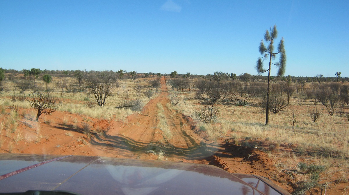
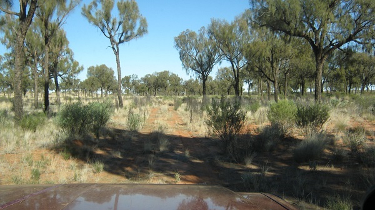
The first 10 kilometres of the shot line was not too bad, with low grasses and shrubs growing in our path. But then a split in the line appeared and we were heading almost due east. The straight line of the seismic track was over grown although it shows up on Google Earth map as trafficable. I did some more mapping calculations and saw that the new shot line should take us in a direct line to The Tarn of Auber. With that in mind we continued along this shot line. But the track was becoming very overgrown and I was driving more off the line than on it. Spindly trees and Mulga started making their appearance and not long after we were in Gidgea country.
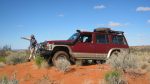
I had deliberately come out here with my ‘soft’ tyres shod to the Datto as we were on a 5 month extended tour and running the 16ply Cross-ply tyres was not an option for such an extended trip. I had taken the chance with the wider tyres running them at a higher than normal pressure so as to provide a little more resistance to sidewall stakes.
This was the track
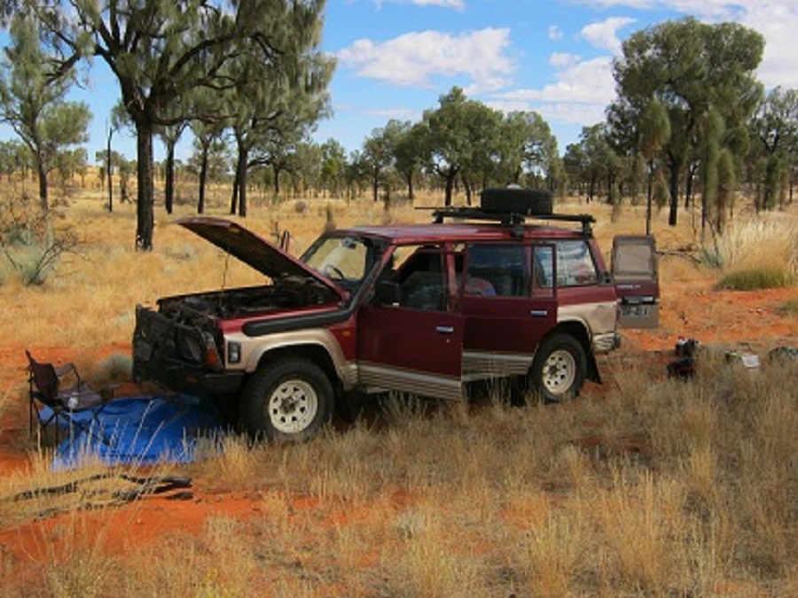
At 4pm we had come 26km from the access track and it was time to camp. I pulled into a Gidgea thicket with some open space on the side of a sand hill and we made camp. We had driven the 26km in two hours. I refuelled, cleared some seed from the front of the 4×4 and checked and repaired damaged wheel arch flares. We settled down for the night. I looked at my mapping again and saw that we may only be 12 kilometres from the Tarn of Auber but to me the terrain was getting too rough. I awoke with a start at midnight and decided to turn back in the morning and that the Tarn of Auber will have to wait for another time when I am better prepared. I would also approach this feature through the Mereenie Oil and Gas Field via some of their tracks if permission could be gained.
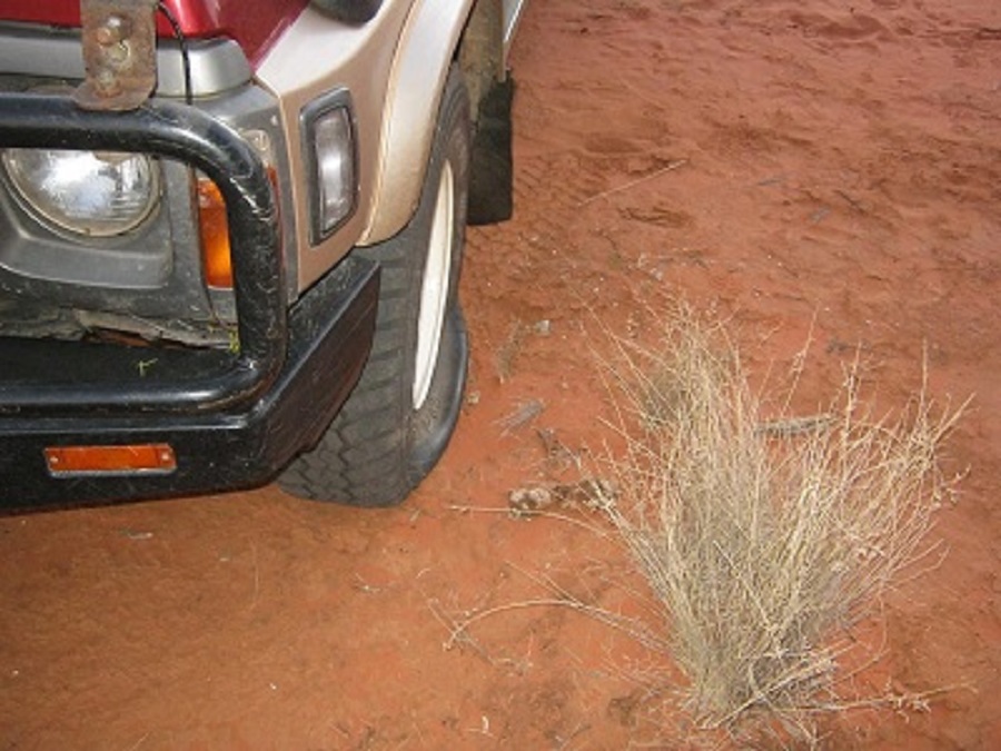
Flat tyre
At first light I was up and about to find the left hand front tyre flat. It seems that we had collected a Gidgea stake whilst driving the 50 metres in to our camp spot. We plugged the tyre and pumped it up before breakfast and then once we had had a feed, made our way back to the access track. This time around it took 3 hours instead of 2 and we wondered how we had got that far the day before. In less than 3 kilometres I had slashed the sidewall of the right hand rear tyre. Four tyre plugs fixed the air leak and that tyre got us home.
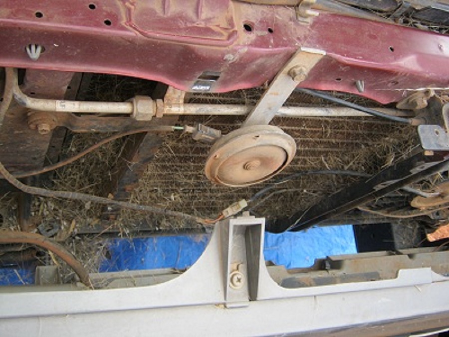
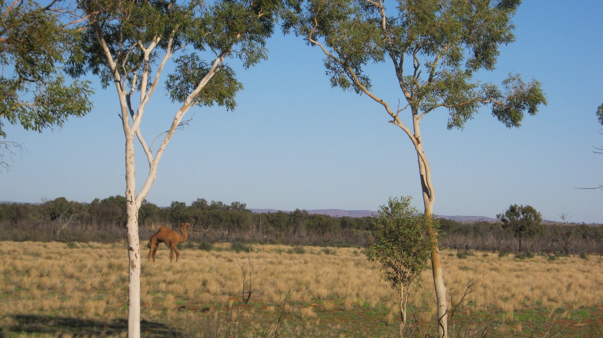
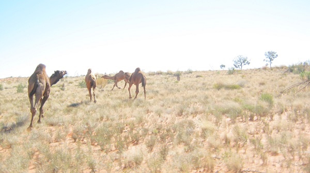
Today we saw those elusive camels. There were six of them and they were of a darker colour than the normal fawn. At the access track intersection we stopped for around an hour for more repairs. Another tyre had to be plugged as it had a slow leak and we had to remove quite a lot of sticks and twigs from underneath the vehicle. We removed the grill so as to be able to get the majority of grass seeds out of the radiator.
Blocked Radiator
Trackside repairs
*****************************************************************
Fast forward to July 2013…..
Having had to back off from my attempt to reach this place lastyear due to sustaining multiple punctures to my vehicle driving along an old seismic line, I had resolved to find this place on my next visit, and with the vehicle shod with tyres to suit the terrain. Later research via the internet brought up a Northern Territory Government website with the latitude and longitude co-ordinates of the Tarn. Locals I know from Alice Springs told me that they had been there years ago but could not remember just how to get there.
The Tarn of Auber lies within the Haasts Bluff Aboriginal Trust Lands and we had obtained verbal permission from the Traditional Owner of these lands to access the area. Access however depended on using old seismic lines and driving through country which has been held by Oil Exploration and Mining Companies for many years. Having driven along the western edge of this area where the seismic tracks were put in in the late 1970’s and early 1980’s some were hardly discernible and could only be seen where the cleared path through the larger trees was visible.
Modern technology, however, comes to the rescue when searching for co-ordinates. I now have a small computer mounted on the Datto’s dashboard which runs digital maps and which also has a plug-in GPS. Progress through an area is denoted by an arrow on the map which moves in the direction one is taking. The digital mapping which is produced by a Federal Government Authority shows existing tracks or roads over an area. They do not show the condition of the roads or tracks, but that one has to work around.
It was exactly 280km out of Alice Springs to where we turned off the Mereenie Loop Road. The latter being a drive promoted for tourists to take as a short-cut to the Watarrka National Park where the majestic ravines of Kings Canyon are purveyed by the wandering masses(tourists). The road has some sealed sections and some horrific gravel sections through Aboriginal Lands and the Mereenie Oil Field.
Our initial track had been disused for quite a while but after a relatively short distance we came to a newly cleared track. We had no idea what level of activity was happening in the Oil Field as they had been in operation since the late 1970’s. Initially they had supplied Gas to run the Darwin Power Station some 1700 kilometres way, but that had come to an end a few years back when the gas source was depleted. They were producing some Crude Oil but that also seemed to come to an end. Now, as we discovered soon after our entry onto the Oil Field, they are renewing their search for Fossil Fuels, no doubt working on seismic data from long ago in search of more supplies.
Cleared track
We headed west into the late afternoon sun following fresh wheel tracks over the soft sand dunes until we crested a dune to see a large mining camp set up in the sand swale. But no one seemed to be present and we slid past quietly hoping not to be noticed. Soon we were out of sight and the next thing to affront our senses was a sign denoting a type of ‘apartheid’ which exists within the framework of the Australian psyche. We had our permission of course and so the sign did not apply to us.
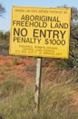
No Entry
My mapping showed that we needed to take a northwest direction and we found old unmarked tracks leading that way and then found a faint track that lead right to the Tarn of Auber.
Faint track
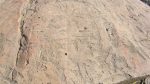
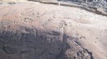
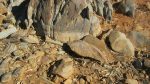
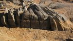
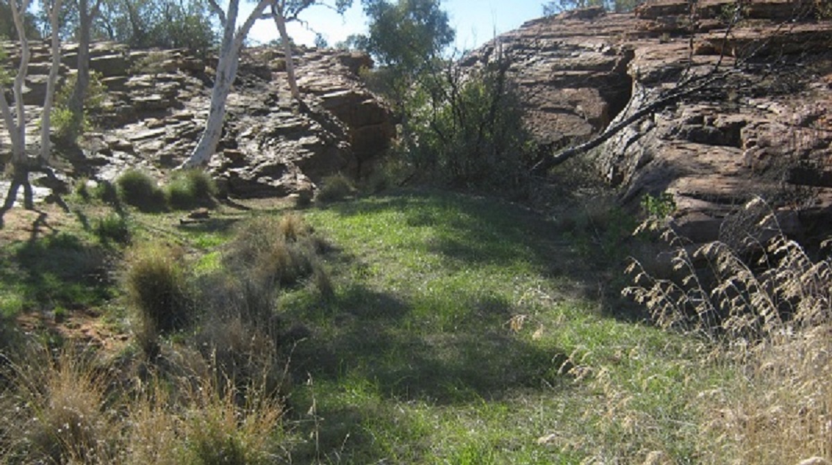
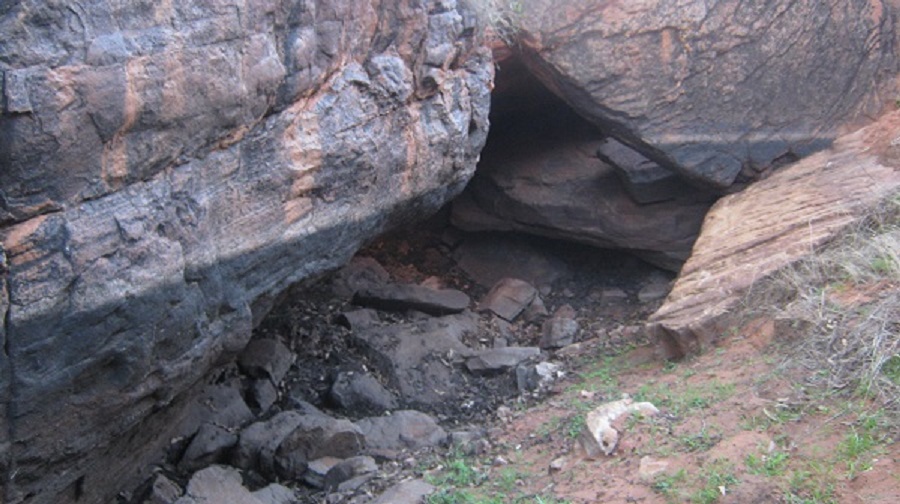
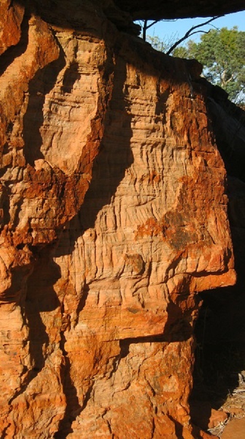
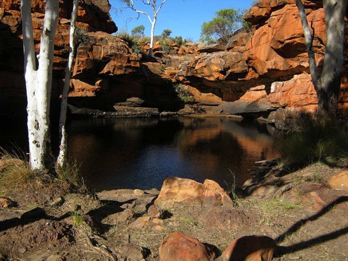
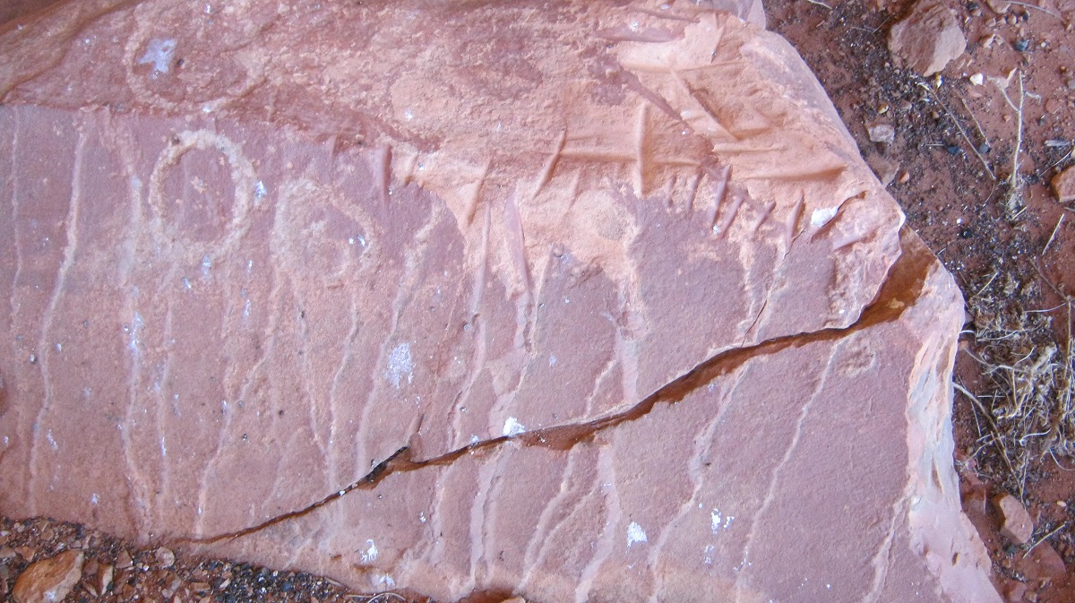
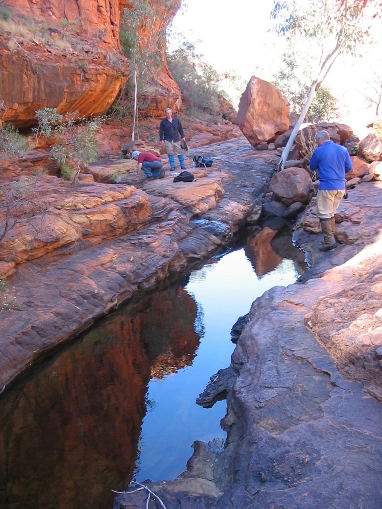
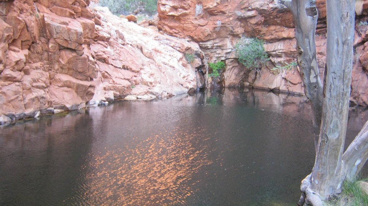
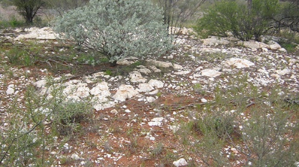
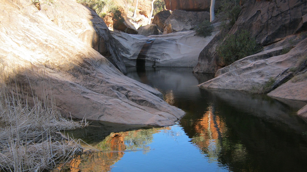
The faint track took us right to the spot and we were soon marvelling at the massive sandstone rock overhangs which are found along the low hills behind the Tarn of Auber. Unfortunately this year the Tarn is dry and the rotting carcass of a dead camel shows that life and death at this water hole can be fragile. As Ernest Giles found out, there is little water in the area and that camel must have made its last attempt for sustenance making for this water hole. To its dismay it was dry and the energy being spent on getting to the water had taken its final toll.
Tarn Entrance
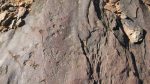
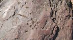
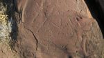
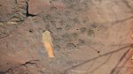
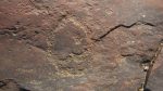
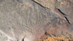
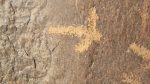
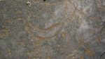
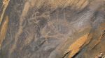
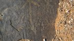
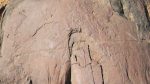
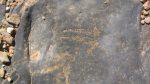
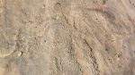
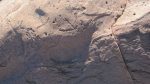
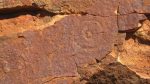
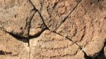
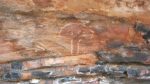
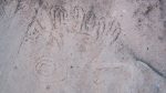
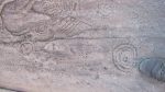
We were delighted to find that the ancients had used the overhangs for their temporary shelters making fires and painting their totemic beliefs in red, white and yellow ochres. Nearby there were many
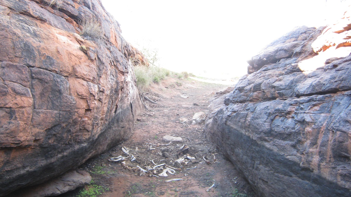
Camel bones
The Tarn of Auber
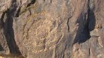
rubbing stones they used to crush seeds and flowers to make a paste for their dietary needs. It would appear that this place was a regular visiting area for these nomadic peoples. Archaeological research done at Puritjarra, some 50 kilometres to the west, shows that the people of the Cleland Hills, used this area from 30,000 to 22,000 years ago when the seasons allowed them to stay for longer periods.
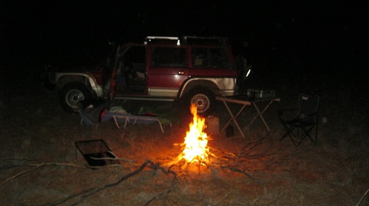
We spent the rest of the afternoon climbing in, around and under rock overhangs looking for any new bit of art or artefact we could find. We made camp at a small inlet in the rocks and soon had a fire going. It had been a good day of travelling and discovery.
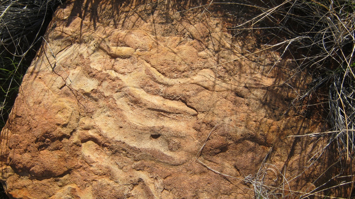
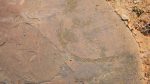
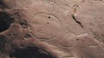
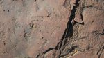
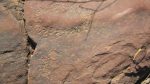
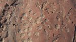
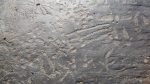
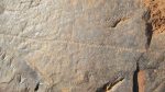
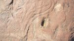
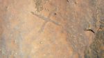
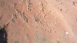
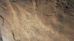
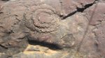
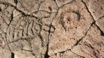
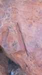
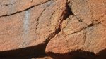
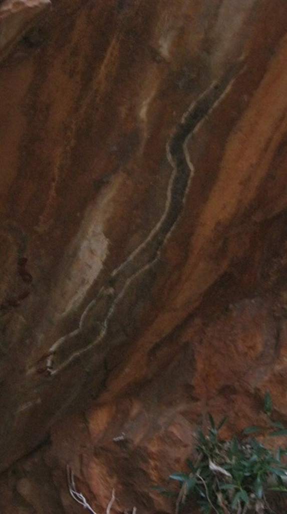
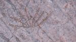
Snake imprint
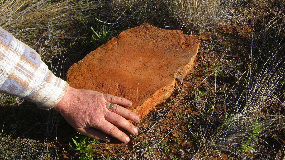
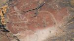
Smoothe grinder

Deep grinder
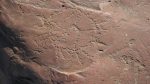
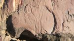
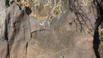
Shelters
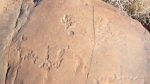
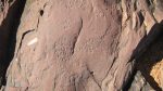
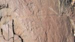
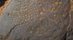
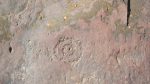
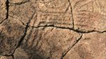
Line groove markings
Visitor looking for water
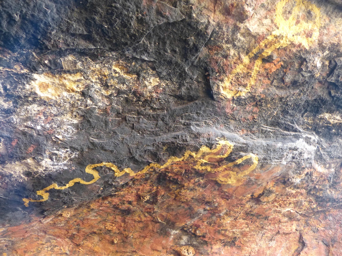
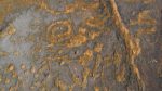
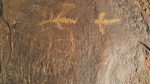
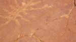
Yellow snakes
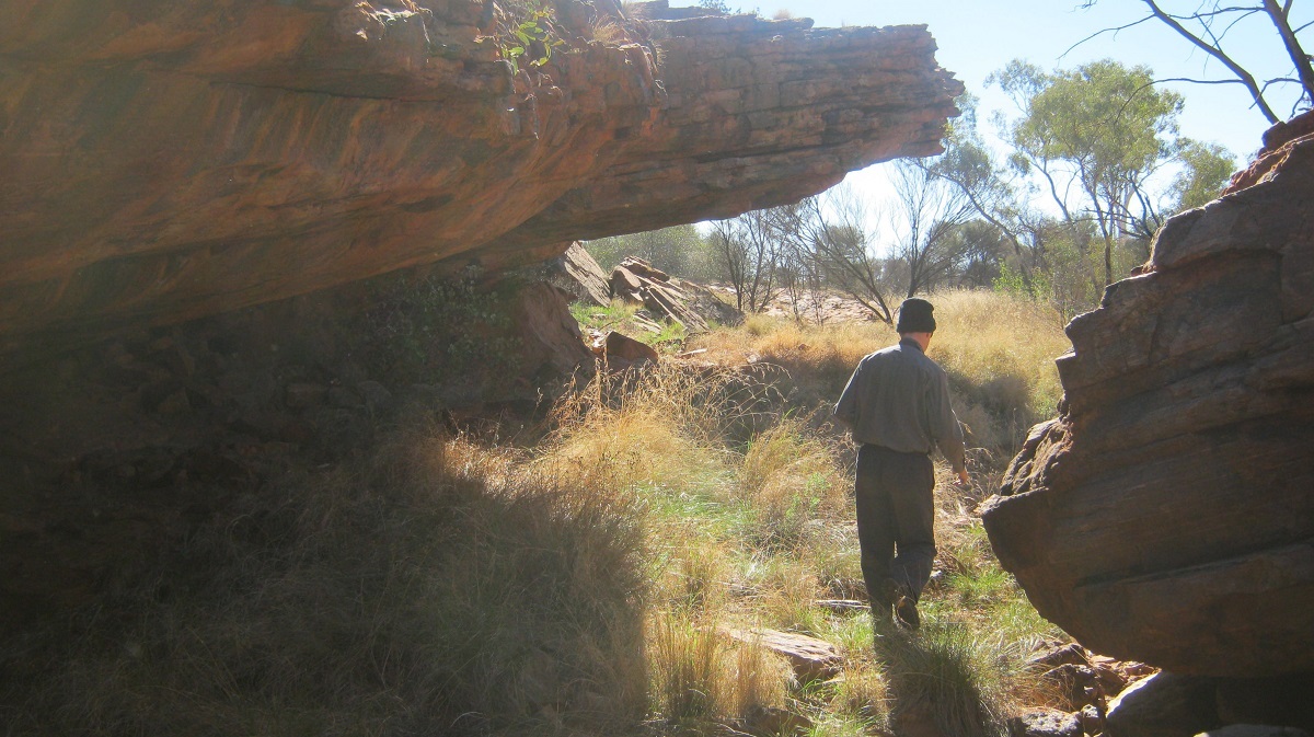
Exploring the overhangs
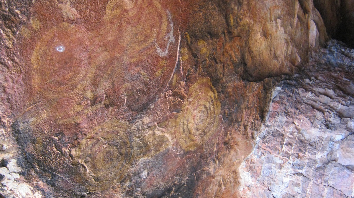
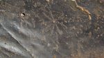
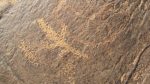
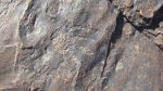
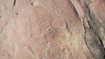
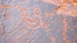
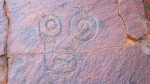
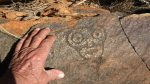
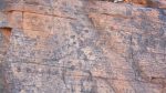
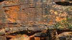
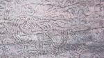
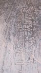
Rock art
Dingoes of Alalya 2013
Alalya
I always seem to miss something that may be important when visiting a place.
Last year when we were at Alalya Waterhole, also known as Thomas Reservoir, we walked in from our camp for a distance of about two kilometres. I was quite tired after such a walk with my prosthetic knees and did not do half the things I had hoped to do whilst in and around the waterhole. I studied the gorge on the walk in and reckoned that I could drive in there if a next visit was on the cards.
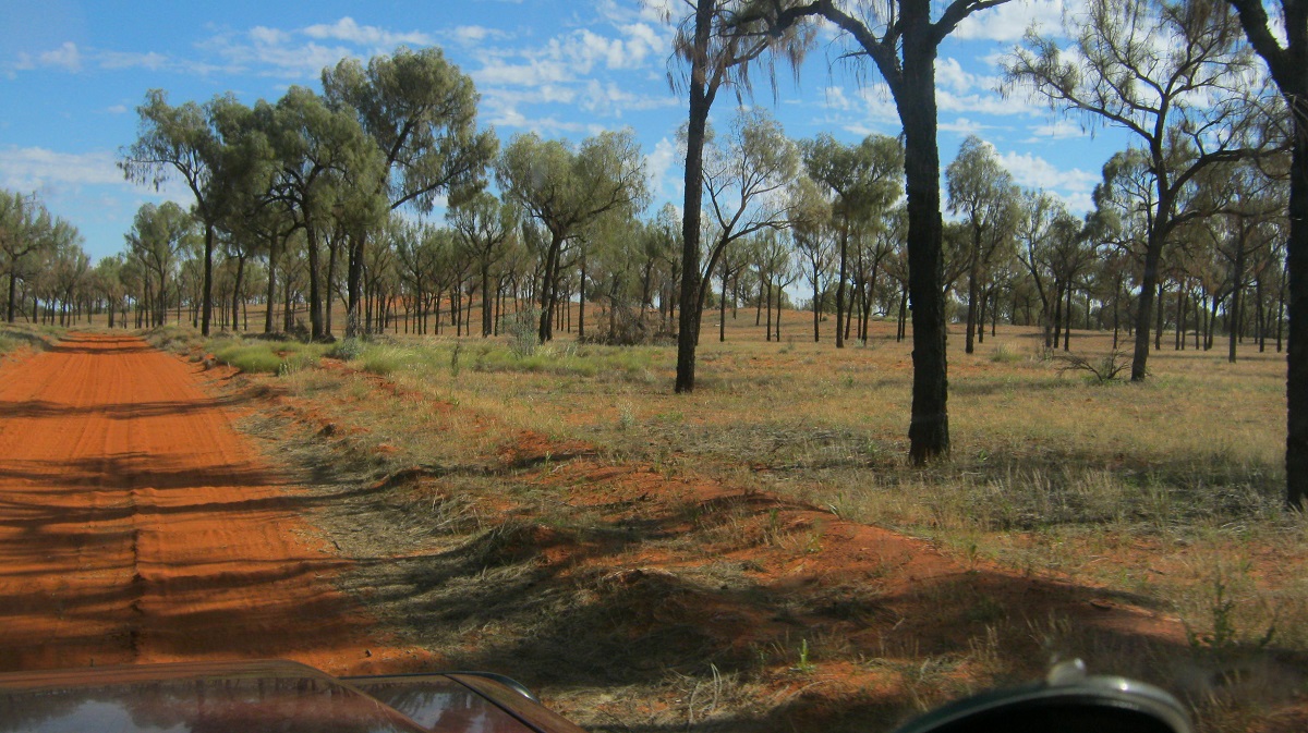
Now, in 2013, my opportunity came again as we left the Tarn of Auber. The distance to Alalya was around 70km from our last camp and over many sand dunes and through stands of Mulga, Gidgea, Desert Poplars, Desert Oaks, shrubs and grasses. Some of the flora remnants, when dried for many years and baked in the relentless desert sun, become rock hard and sharp, and spare no thought for the soft rubber compound of a passing tyre.
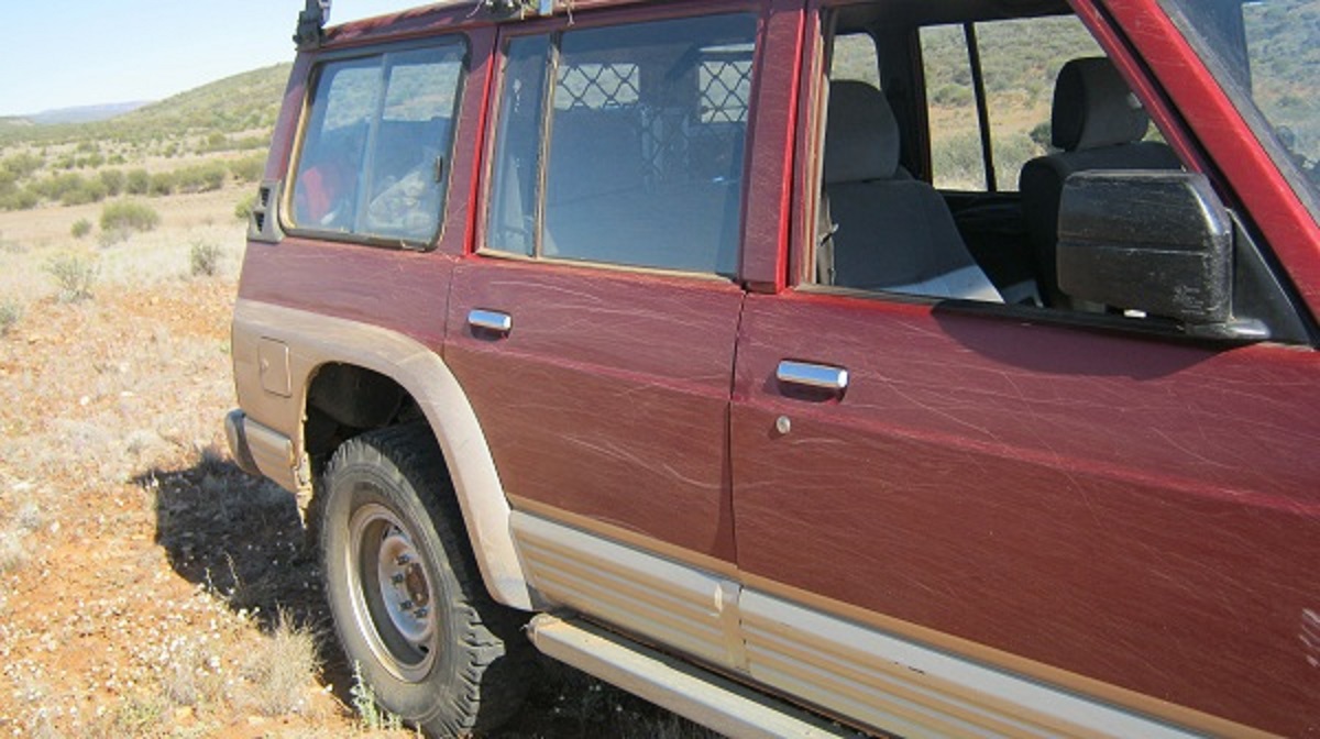
This year I towed my trailer to Alice Springs with my MRF Cross-ply nylon tyres on board so that I could have some defence against the flora as I made my way through the foliage. The MRF (Madras Rubber Factory) tyres are fitted with tubes to split rims, are 16 ply having 10ply tread and 6 ply sidewalls and serve much better in the fight against multiple punctures. The downside of using these tyres is their narrowness and their poor ability to flotation over soft sand. They are known colloquially as ‘Cheese-cutters’. Running these tyres at lower air pressures is a must but you have to experiment with what amount of pressure you need to keep your vehicle moving at a safe and economical speed through the bush. I ran them at 22psi and suffered no punctures.

MRF Super Lug
MRF Super Lug Tyres…..almost invincible
I had decided to drive along the freshly graded seismic line hoping that it would take us to the Deering Creek Track and perhaps, beyond. We were indeed blessed, as all the bad bits where dry foliage had staked my tyres last year, had been cleared by heavy machinery, all the way to our designated track and we made good time.
A cleared track
It took a while to locate the seismic track we had used last year as the graded part ended at the Deering Creek Track. Once located, I could not see any evidence of our tracks we had made on our previous visit. The seismic line however is quite clear as it cuts a swathe through the vegetation and that after being pushed through by a bulldozer some 32 years prior! But the track is overgrown by small trees, bushes and shrubs.
Seismic track
Seismic track
About half way to our turn-off point to Alalya another seismic line comes in from the south. Here I saw vehicle tracks coming in. It looked like the tracks were made quite recently. I subsequently found out that acquaintances of mine had been in that area a few weeks prior. It appears that they had a Quad bike in tow as the narrow tracks were visible in places as they used it to scout for the best track to take.
The last four kilometres to the small gorge is proper cross country and driving blind most of the time and one has to take care not to get the vehicle snagged up in some hidden hole in the grass or fallen tree. Once there I drove with great care over some large rocks and through small washouts. Then I did not see a large rock sticking out of the ground although my passenger tried to warn me. The front differential touched the rock and pulled it out of the ground and the 4×4 lifted off, or so it seemed, and eventually the rock rolled out the other side. Initially damage seemed little but a while after I noticed that the exhaust had been bent and pushed up against the chassis rail. It defied being worked on and stayed like that until I reached home again three weeks later. I believe that we may be the first people to drive in and camp in this small valley.
Driving blind
Driving blind
Through the Gorge
Thump! I hit a submerged rock! It dislodged and then rolled underneath the chassis lifting the Datto off the ground before exiting near the left rear wheel. I could not se any damage at first but on late inspection I found that the exhaust pipe and mufflers had been pressed up an were touching the chassis (it was not all that serious and my mechanic at home was able to repair the damage with ease)
Differential thump
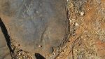
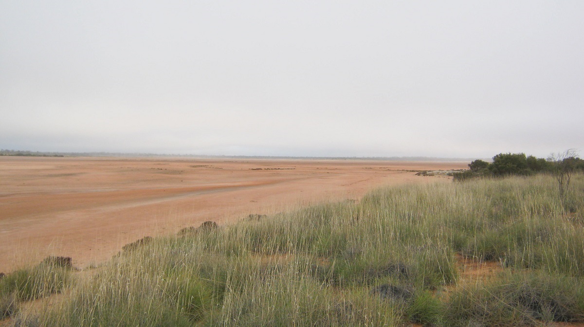
To our great dismay we found Alalya Waterhole totally dry. We estimated that its capacity was around 50 million litres and that it had lost that water within the thirteen months since we had been there last. A Camel had perished of thirst right at the base of the pool. We had been looking forward to using the water for washing our clothes and keeping ourselves clean. But it was not to be this time around.
2012
2013
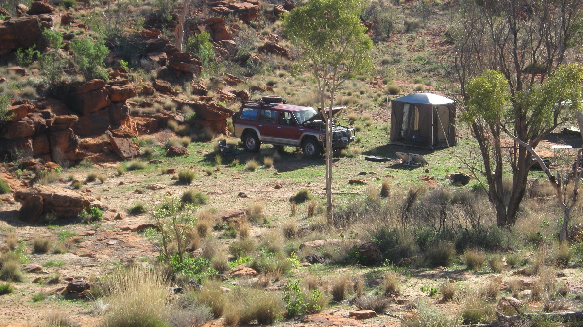
Our camp
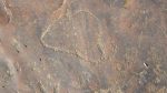
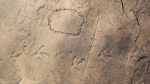
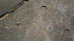
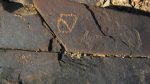
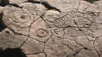
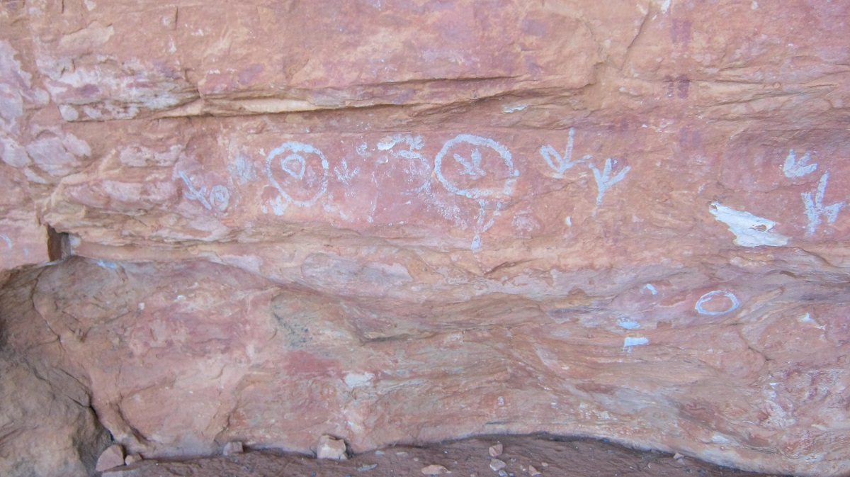
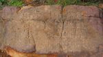
We set up camp about one hundred metres from the waterhole and as we were intending to stay two days, I erected my screen tent. After collecting enough fire wood for the night and getting our camp organised we were soon scouring the surrounding valley walls for rock art amongst the tumbled rocks. Some good finds were being reported and I intended to walk to all the places of interest the following day having renewed my acquaintance with some of the petroglyphs (rock carvings) which I had found last year. There always seems to be something appearing that you may have missed last time. On both sides of the small valley the strata rocks are angle up from the waterhole so that walking to the top of the range is relatively easy. At Alalya we have found no Pictographs, only Petroglyphs. This is in contrast with The Tarn of Auber some 70km to the east where only Pictographs exist. It would seem that the visitation by humans at Alalya may have occurred at an earlier period in time. Whatever the history of the place is, there are no rock paintings visible. It may be that those who came later shunned the area due to cultural reasons and as a place of habitation and only used it for sustenance when the rains had fallen.
After we had cooked our evening meal and had settled down around the fire for a chat about the day’s events we thought that we heard the short bark of a dog. Shining the big beam torch into the dark brought up nothing but very soon after a Dingo started howling at the top of the ridge behind us. Although Dingoes are not considered dangerous they can be if they are hungry enough and in a pack. Their mournful howl can send shivers down your spine in the darkness of the night. The howling intervals increased as other Dingoes in the area responded to the first caller. Soon the cacophony became overbearing and not knowing the numbers of Dingoes I brought my rifle out just in case. One Dingo was lurking at the top of the ridge as we shone the torch and found the reflection of its eye and then moved down to within about one hundred metres of our camp. Not wanting to hurt the animal I fired a shot over the top of it and with this it sped away from us….for the time being. A short while later it was up on the ridge again, voicing its displeasure at us or calling its mates. Periodically through the night it voiced its concern by giving that mournful howl. We turned in around 11pm and by 1am the Dingo had plucked up enough courage to come closer to the camp. It growled behind my tent at one stage and I worried about Bill who was sleeping out in the open (he erected his tent the next night). I was up three times during the early hours of the morning waving the torchlight at the dog. Around 5am the Moon came up and the Dingo settled down and probably caught some shut-eye as well.
Dingo
During our wanderings over the rocks the next day Jeremy could hear faint noises under a rock-ledge. He managed to get some rare video footage of three Dingo puppies in their lair not forty metres from where we were encamped. No wonder the Mother-Dog was upset! The following night however, the Dingoes were not heard. Either the mother dog had moved her pups or had accepted us as temporary intruders into her space.
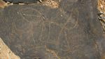
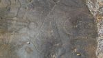
Our day was taken up discovering the ancient ‘faces’ and totemic drawings as marked on the rocks all that time ago. On the lower rocks the faces are more irregular depicting to what I see as links between waterholes and not faces but higher up on the rocks real faces appear in ‘Al Johnson’ style. One can only but guess as to the reason for their origin. In the afternoon Jeremy went for a long walk and came back later with the news that he had not found any more overhangs but that there was a grave behind the top of the East Ridge. We all went for a walk with me actually climbing up and scrambling over rocks with some difficulty. The grave is neatly marked with a cross and rocks around the perimeter. Stones have been laid on the grave and painted white. A rubbing stone is visible as a headstone. At one stage there were four fence-posts denoting the corners of the grave but two of them have been burnt to their foot-ends by bushfires. We can only think that an elder of the Ikuntji Clan is buried there. We had enquired from the Traditional Owner about sacred sites in the area but were told that there were none.
When looking for rock art and especially petroglyphs I am always puzzled by art work which is high up on a cliff face. At Alalya there are some petroglyphs that are at least four metres from the ground and one metre from the skyline with no rock-ledges in between to hold a sculptor or artist in balance, to perform their work. One may think of many scenarios such as rock falls or land subsidence but no one answer is forthcoming.
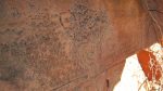
Another phenomenon about ancient art is that one seldom finds galleries of either pictographs or petroglyphs no more than 200 metres from waterholes. Yes, there are incidents where such art is found away from a water-source but multiples of art are usually found close to water. Rubbing stones, seeds grinders. Decorative rock art pieces and spear sharpening grooves are all found within 200 metres of Alalya. As we stood there amongst all these ancient artefacts we conjured up a scene depicting the peoples and their daily lives in transit, using this valuable place for their rest and recreation. There are no shelters of substance at Alalya so we guessed that it was used on the way past to better hunting grounds.
All too soon our time was up at Alalya and we bid this ancient place with its mysteries and its Dingo guardians farewell, and drove off again, out through the passage between the hills.
It had been a rewarding experience
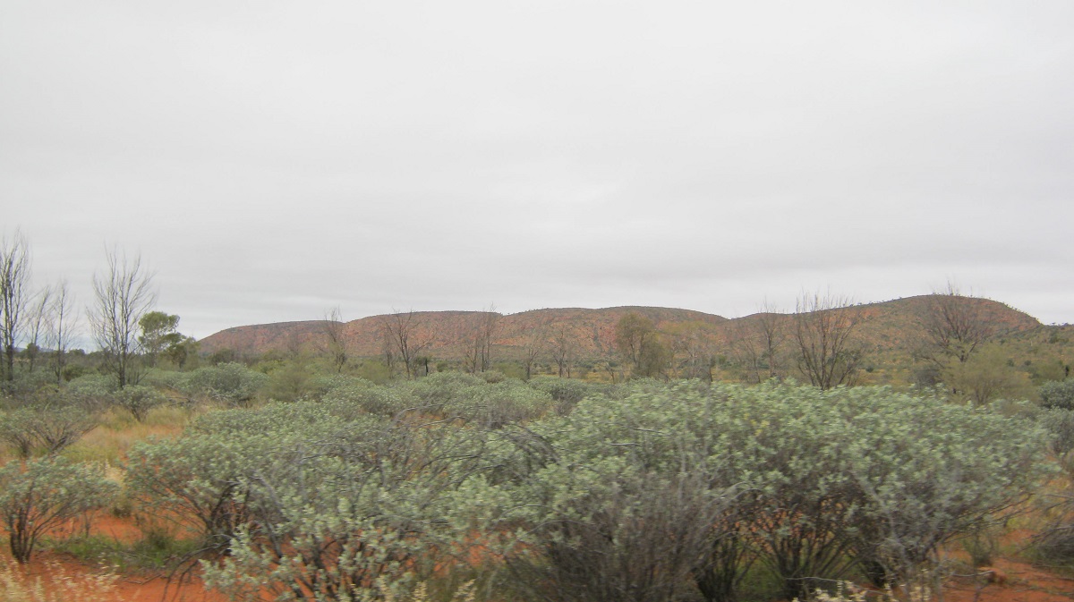
Cleland Hills 2013
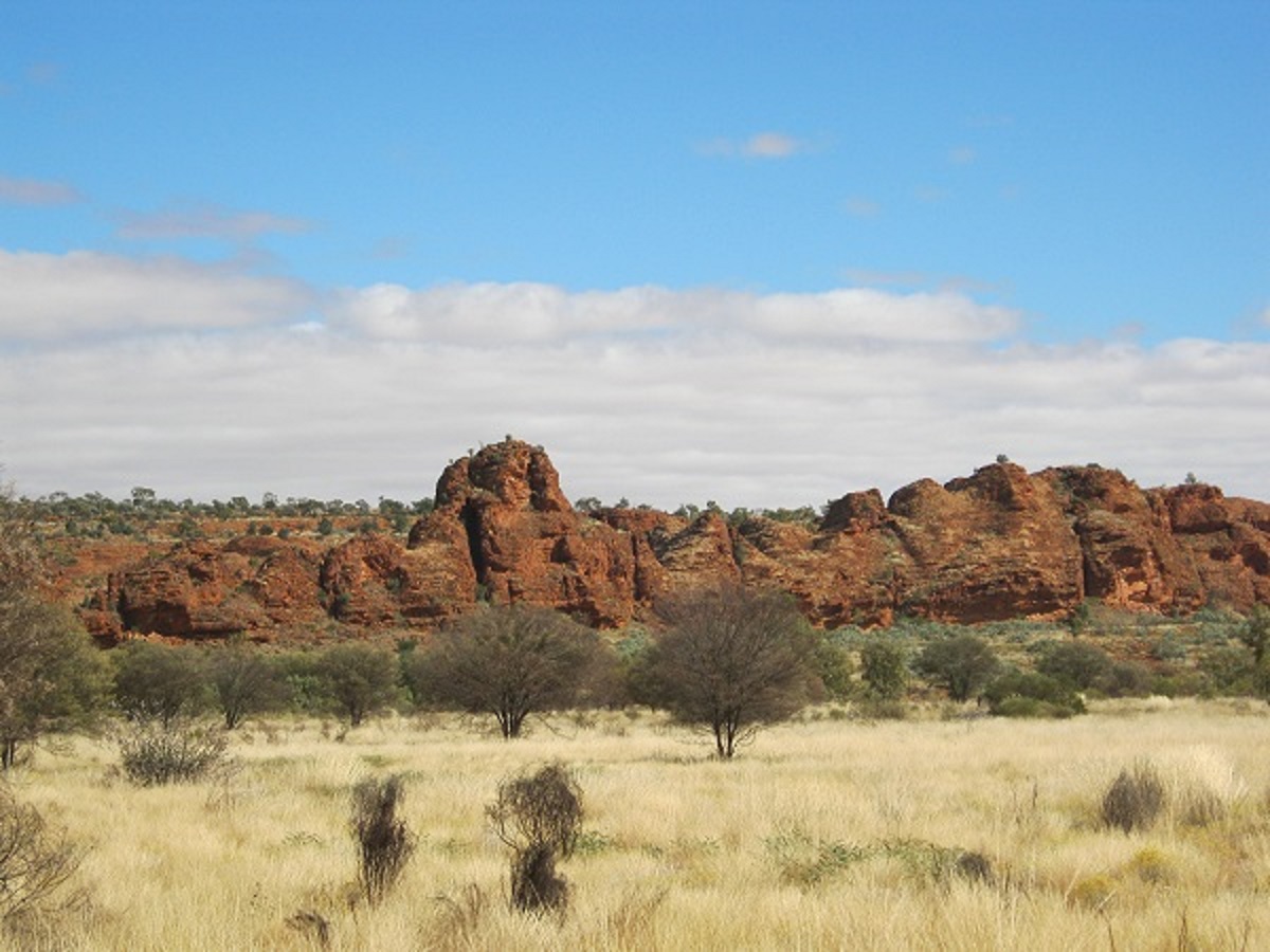
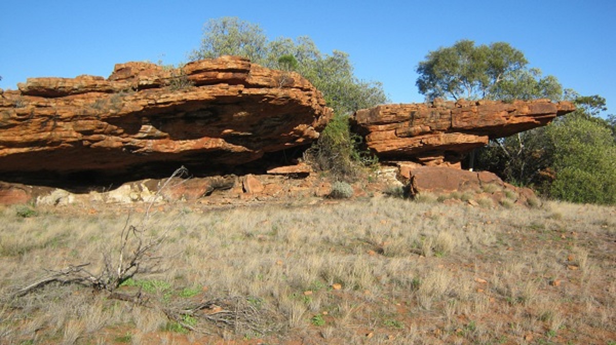
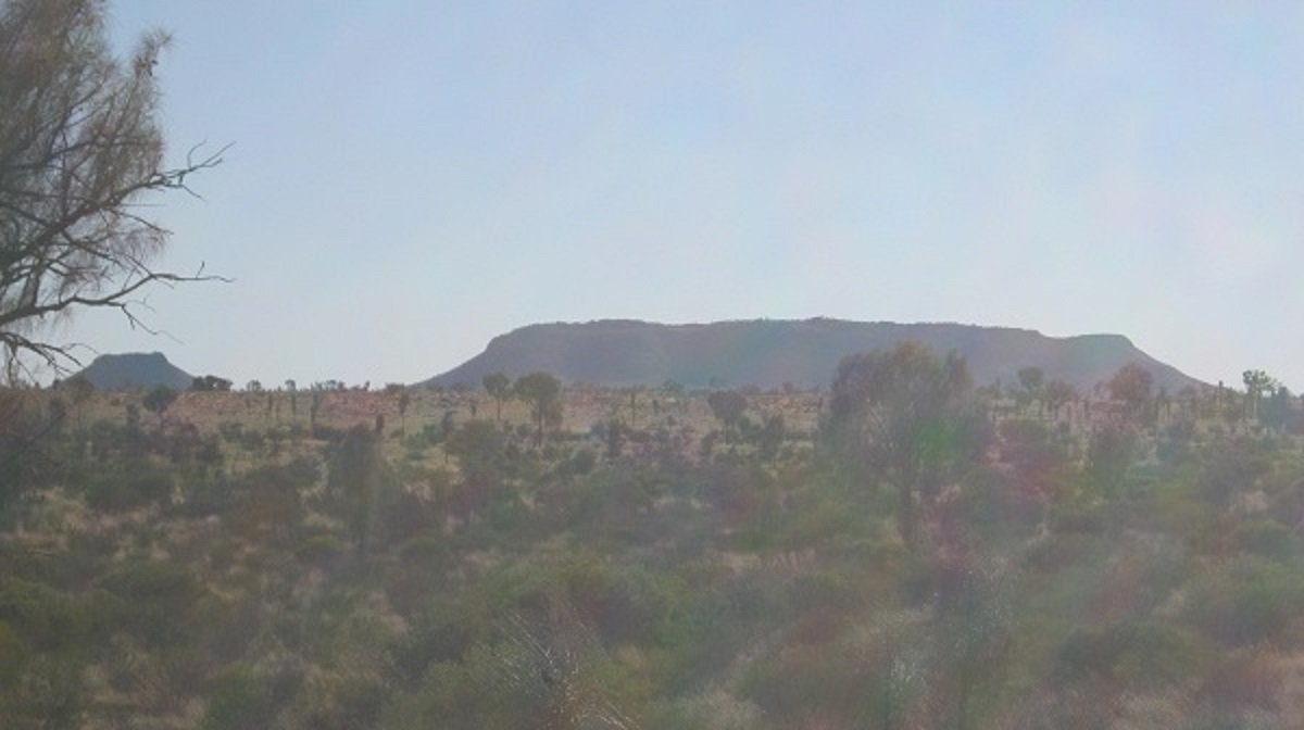
Cleland Tower
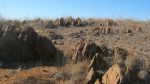
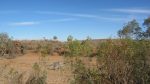
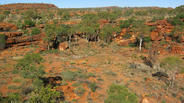
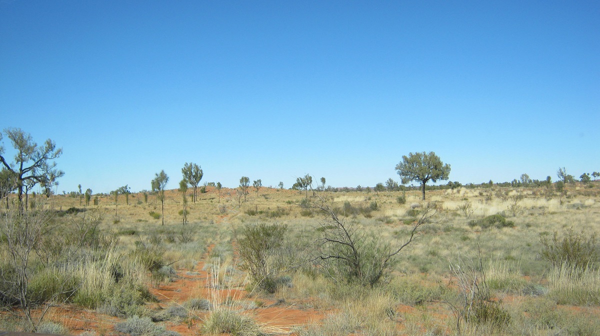
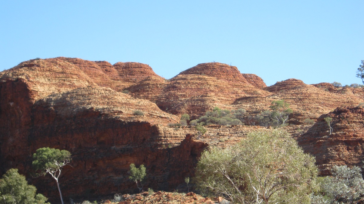
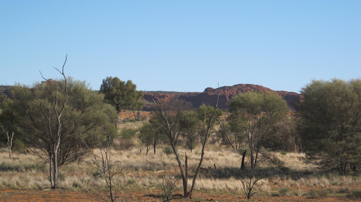
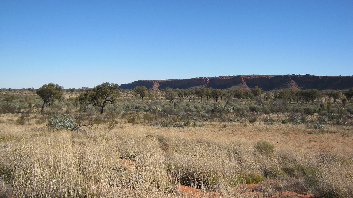
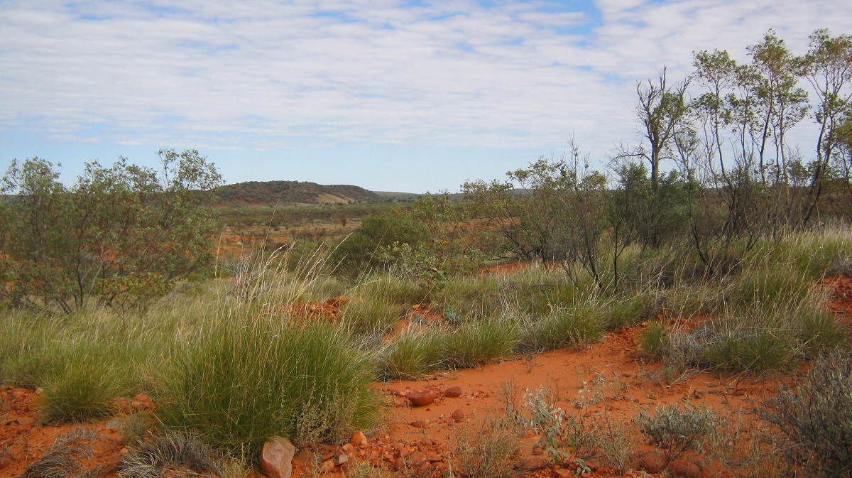
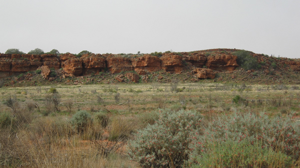
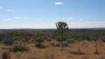
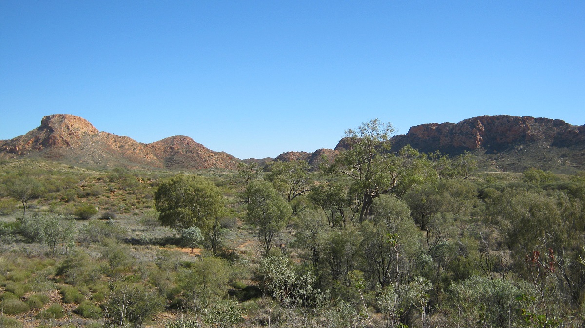
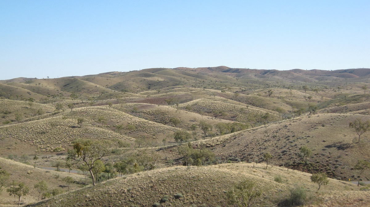
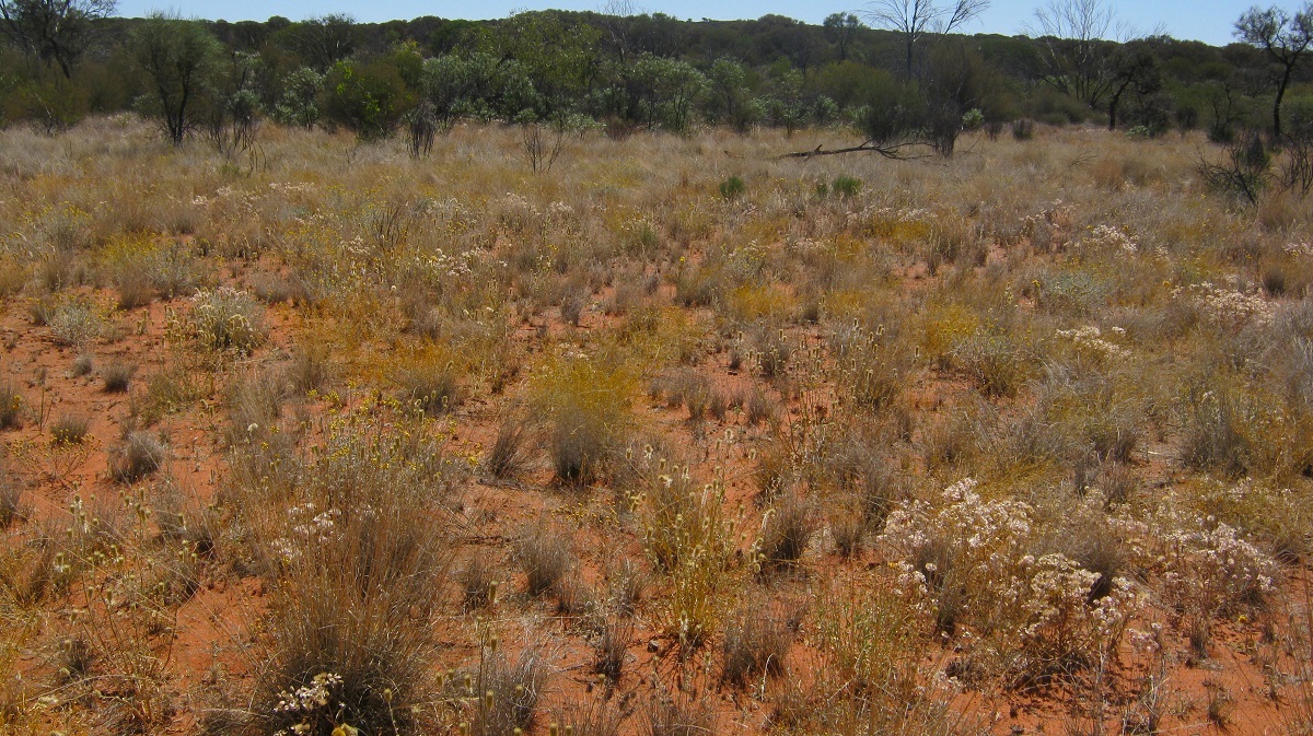
The Cleland Hills, outliers of the George Gill Range, are surrounded by sand plains and dune fields in the predominantly flat landscape on the edge of the Great Sandy Desert. The hills are mostly composed of porous Mereenie sandstone which can hold water and that will support some plant species within a restricted range. The highest points are Mount Winter 800m above sea level and Mount Forbes 759m above sea level. The Cleland Hills support the surrounding open-woodland with an understorey of spinifex or porcupine grass. Buffel grass is also present and this advances summer wildfires which burn the country from time to time.
The Cleland Hills and surrounding areas, lie entirely within the Haasts Bluff Aboriginal Land Trust. The main land use is Indigenous. Threatened species of wildlife include the Emu, the Princess parrot, the Blackfooted Rock Wallaby and the Long-tailed Dunnart. This year was my third visit to the area since 2006, and, as in all instances, access had been granted with Traditional Owner permission to camp and explore the hills and surrounding landscapes.
Mike Smith, Australian Archaeologist of renown, did a four year (1986-1990) ‘dig’ at Puritjarra, a large sandstone overhang along the eastern side of the Cleland Hills. Dating back to before 22,000 years ago this site was used as an occasional resting and transit place by the ancient peoples who lived in this land then. Right next to Puritjarra there is a small water collection point as it seeps through the rocks, enough to give the transients sustenance on the nomadic journeys. Ochre remains were found at Puritjarra dating back between 13,000 and 32,000 years before the present. Less than five kilometres to the north lies the permanent water hole of Muranji and the level of water had not changed in the three visits I had been there over the past seven years.
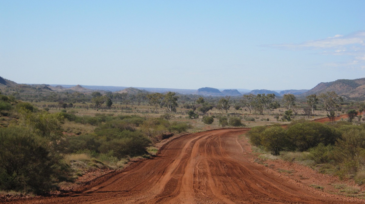
There is a defined track leading to the Cleland Hills that runs partially along Deering Creek and for all intents and purposes I have called it the Deering Creek Track. The area surrounding the Cleland Hills has been subjected to Oil and Gas exploration since the late 1970’s and on from that time. Various seismic tracks scar the landscape if you look carefully for them or via Google Earth on the internet.
In 2006 inland Australia was in drought condition. By 2012, however, the drought had been broken and the desert landscape was lush with grasses, healthy spinifex clumps, low shrubs and trees. We were fortunate then also to come across a small flock of Princess Parrots which roam a limited area close to the Cleland Hills. Now, in 2013, the drought conditions have returned. Only one water catchment had water in it and that is Muranji Rockhole. In fact the level of water at Muranji has stayed pretty constant during all my visits there. But all other waters have dried up. Due to this phenomenon we noticed a distinct lack of wildlife in the area apart from the ubiquitous Camels who roam these dry inland plains. Even Camels come to grief at times as we witnessed dried up Camel carcasses at the base of two waterholes.

Muranji
On a previous visit to this area I had started to drive close the sand stone escarpment of the Cleland Hills but that proved too difficult as the sand is extremely soft and after a short while I turned around and made for known seismic tracks.
This time we veered off our Alalya Waterhole access track (which had taken us to the western extremity of the Cleland Hills) along another overgrown seismic link track which took us to the access track from the Deering Creek track to Muranji Rockhole. This required careful driving as there were many dried out trees with sharp wood splints that stake tyres with impunity. This track joins the Deering Creek track again at the disused airstrip about 5 kilometres to the south of the Cleland Hills.
Faint seismic track
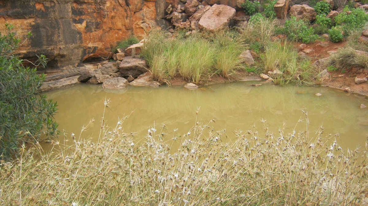
We were pleased to find Muranji Rockhole full of water, green with grass and that the dreaded burrs, which we had encountered there in 2006, had disappeared. I do know that volunteers had been to Muranji prior to that time to try to clear the area of these burrs but had not heard of subsequent visits. Close-by to the Rockhole there is a carport type structure and some rubbish bins. The Traditional Owners obviously come here from time to time. The place has also been used as a camp for archaeologists and other researchers who may have visited the area. This time the “Carport Campsite’ was reasonably free of rubbish as it looks like someone has been and tidied up since last year.
We set up camp and then decided to go for a walk along the escarpment. I chose to drive as my walking days are virtually over due to prosthetic limbs. Bill decided to come with me. First, however, there were two dry creek-beds to cross and after doing some roadwork with the shovel we made it to the other side. Our journey took us along the front of the Cleland Hills escarpment whilst Jeremy opted to walk up the valley behind. We stayed in contact via two-way radio. We would not have made a distance of two kilometres before the sand became incredibly soft and the wheels started digging in deeper than they usually do. I decided then to turn around and to follow Jeremy up the valley instead.
A gully to cross

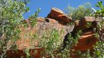
Sandstone walls
Overhangs
When looking at these sandstone walls we keep an eye out for overhangs where the ancient nomads may have stayed on their travels. We also look out for signs of where water may accumulate in storage ponds or seepage out of the fissures within the sandstone crevasses.
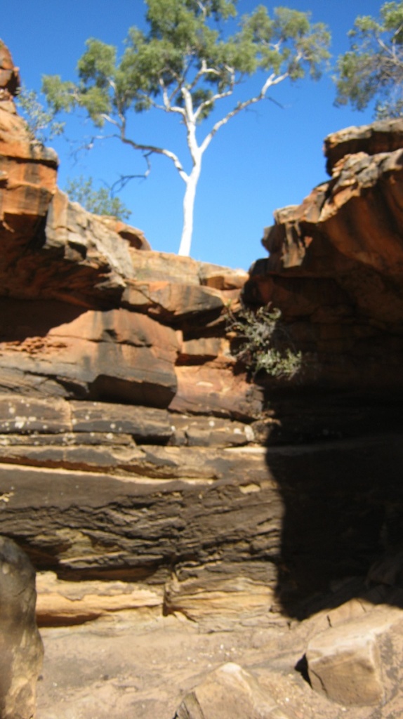
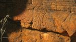
A window appeared in the sand stone with overhangs to each side. This seemed like an ideal place for transients to rest as they pursued their nomadic life. Some faint paintings are to be seen. The roof of the cave has fallen in somewhat and the living space has been minimised. Ripple rock effects adorn the ceiling remnants of an era too long ago.
In the afternoon Bill and Jeremy went for a long walk along the escarpment and found various places where the ancients had had some activities, such as cave painting or spear sharpening.
Early morning brought vivid colours to the escarpment around Muranji Rockhole. The night before one of my two faithful fold-up camping chairs collapsed in a heap, and now Bill had nothing to sit on. After breakfast he went for a walk and found an old plastic chair left behind by itinerant campers at the ‘Carport Campsite’ and claimed it as an asset and vowing that he would return it one day. It looked strange travelling along on top of the roof-rack.

Muranji Sentinel
Golden reflections
A faint wheel track follows the escarpment to the south but after only and few kilometres it peters out and disappears at a small creek crossing. On previous visits we followed the creek up stream until we found a place to cross but this time we managed, by careful wheel placement over the rocky ledges, to cross without too much effort.
Across the rough stuff

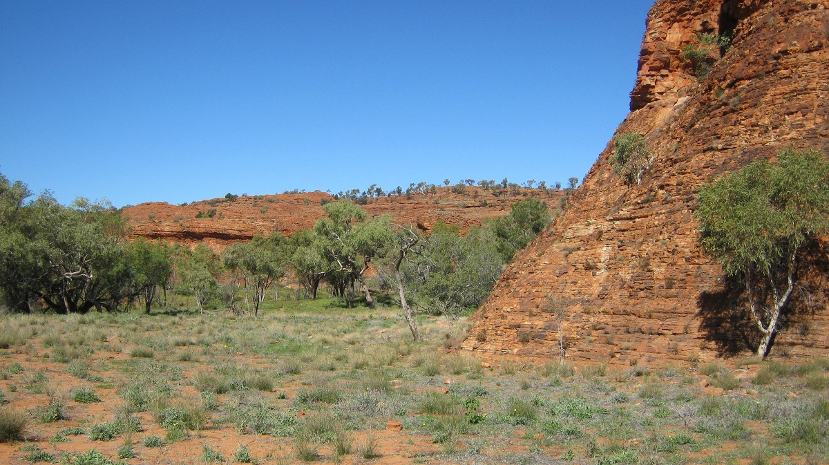
Spear grooves
The Eastern aspect of the Cleland Hills has a number of sandstone overhangs which have from time to time been used as shelters by the ancient nomads. Hand stencils and other ochre based rock paintings can be seen. The largest of these overhangs is Puritjarra which spans around 45 metres and is 20 metres in height. We spent a bit of time here looking at everything that was unusual in the sandstone formation. Puritjarra has pictographs, petroglyphs and stone artefacts. The shelter itself would not protect you from the wind but it would keep you dry in times of rain. One can only sit a while and think what it must have been like for those travellers and short time visitors of so long ago. After the four year archaeological dig Mike Smith reported that he had returned the site to its original condition so that no one could say that it had ever been disturbed. And so it looked every time that we have visited there. Even after only one year no footprints were visible which concludes that not many people visit this site
Puritjarra
Puritjarra
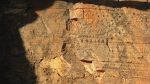
Petroglyphs
Pictographs
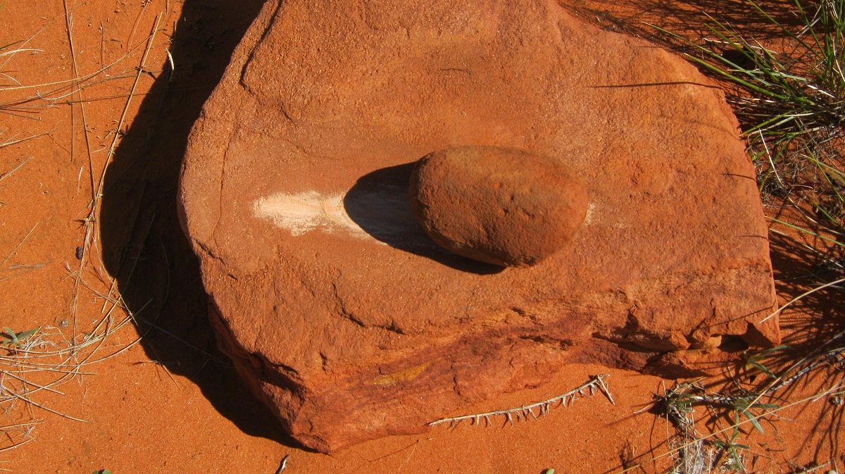
Seed grinder
Further along the escarpment we looked at numerous places where the ancients might have visited but found no other art. In the absence of wildlife we were pleased to see a track made by a large goanna, most likely a Perentie which pleasing to know as they are not seen too often these days.
Southern Cleland Hills
Always aware of the sensitive nature of the country and our ability to leave marks with our travels we tend to minimise out impact as we travel dodging foliage where possible and choosing the right direction when crossing creeks and also knowing when to back-off.
We made progress this day as far as Gill Creek and made camp there after going for a walk up the creek to look for rock pools. Water was not to be seen this time. We did however find some rather strange looking art objects on a low line of rocks which border the creek.
Gill Creek

Strange painting
Gill Creek camp
We camped for the night on the banks of Gill Creek. This part of the journey was the end of our visit to the Cleland Hills. I had envisaged to circumnavigating the hills but time constraints and the difficulty of the terrain made me change my mind. Next time !
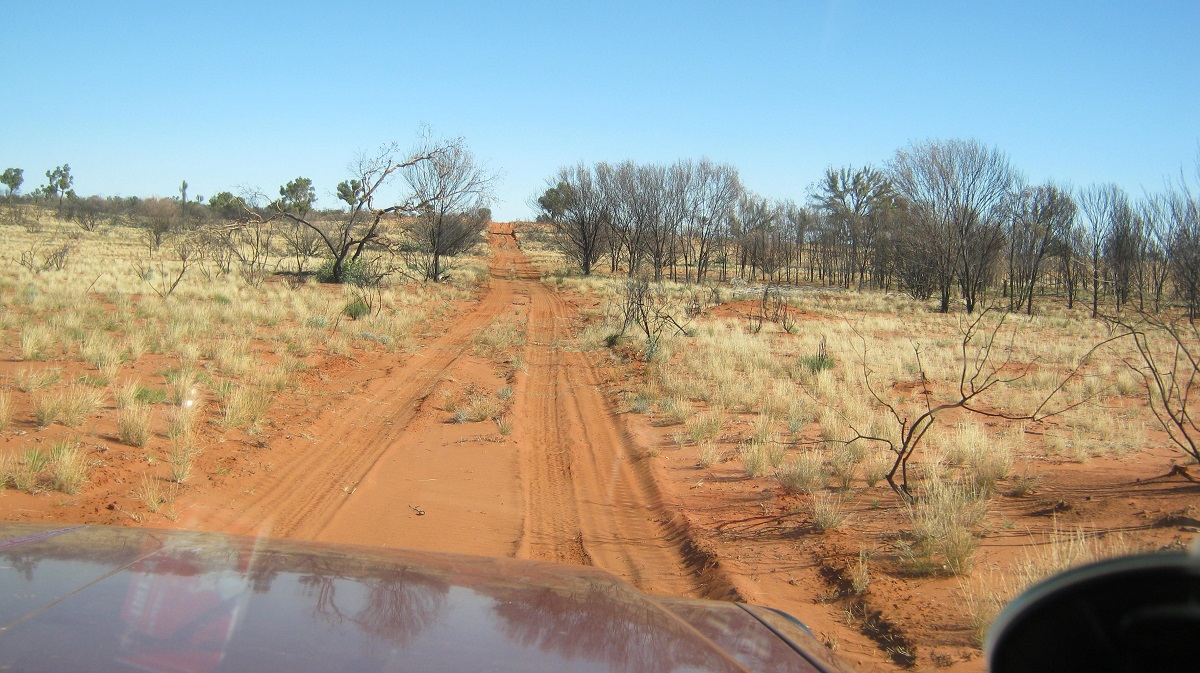
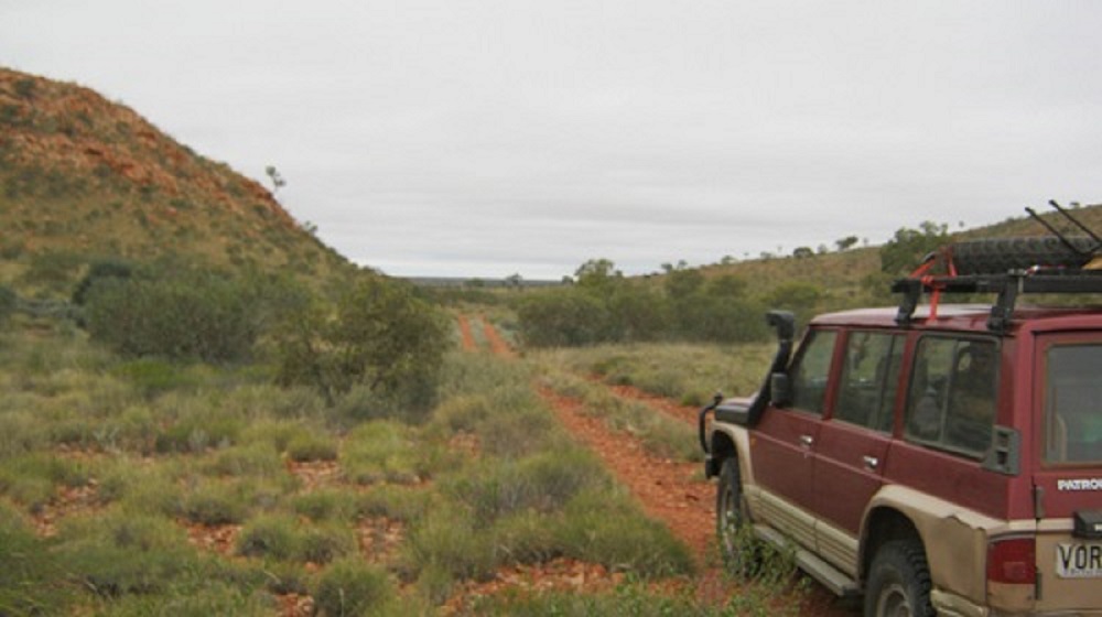
A Remote Track 2013
The old airstrip at the end of the Deering Creek Track, and about 5 kilometres from the Cleland Hills and Mount Winter, was most likely put there to supply food, fuel and parts for the machinery that made the seismic tracks way back in the late 1970’s and early 1980’s. Now totally overgrown, there are only bits of scrap to be found lying about the place, a 44gallon drum with some very offish diesel fuel in it and a bottle from the Adelaide Bottle Company with lettering on the base stating that the bottle always remained their property!
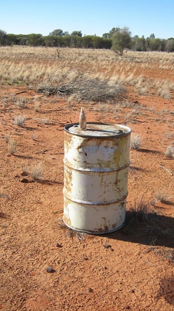
Drum and bottle

Airstrip
A track heading west from this point is shown on the digital government mapping that I have and taking a Waypoint to Waypoint reading via my mapping software, the distance showed up as 200km in a straight line or as the Flow Cries (Crow flies). So, taking into account most bush track scenarios, like tracking around steep dune ends and washed out sections and new tracks skirting wet areas, I considered the distance could be up to 230km. This is a seriously remote track through country which is seemingly devoid of water except when it rains.
Start of track
Cleland Hills
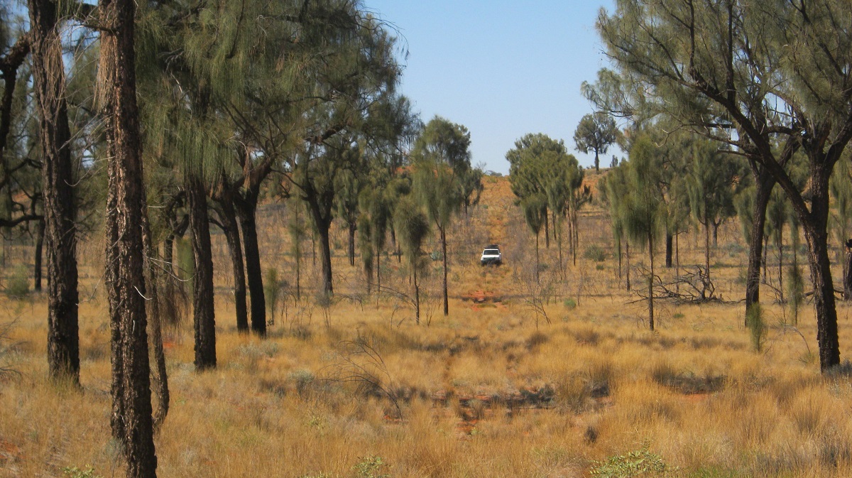
As per usual the track was very overgrown in places but there were fresh wheel tracks (maybe a week or two old) ahead of us for a round 150km when they seemingly disappeared into thin air. At one time I had missed a turn-off and also followed these same wheel-tracks but then, as I noticed on my mapping, I was heading in the wrong direction and I saw that the previous traveller had also turned around. I then took a bearing cross country and found the original track a few kilometres on. At that point we lost Jeremy in sight and radio contact and so I had to backtrack about 10 kilometres in all to find him and lead him back to our desired route.
Cross country
I carried 230 litres of diesel for our journey and Jeremy, having a petrol-powered 4×4, carried 280 litres of petrol and 70 litres of LPG. These amounts of fuel we had estimated would be sufficient, in a worst case scenario, to have a range of at least 1000 kilometres. Our distance from Hermannsburg (last fuel) to Docker River( next fuel)via all our roads, tracks, backtracks and cross –country driving was estimated at around 800 kilometres and so we decided that the estimate was good and that we should be safely within our range of fuel supplies. Things can go wrong out in remote country but if you prepare well and drive with safety in mind at all times then you should be able to complete the journey without issues. This I have done for the past 45 years with only minor incidents happening in remote country. I was able to remedy all issues in the bush over the years.
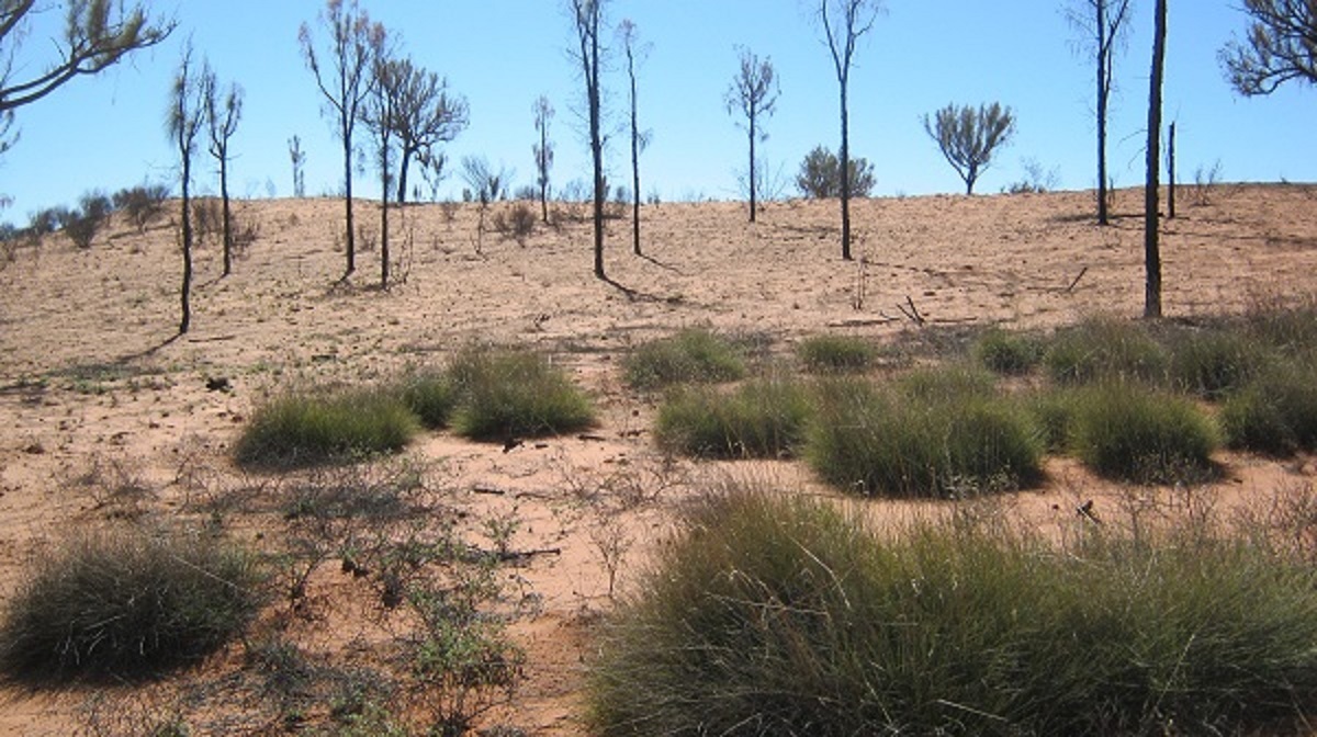
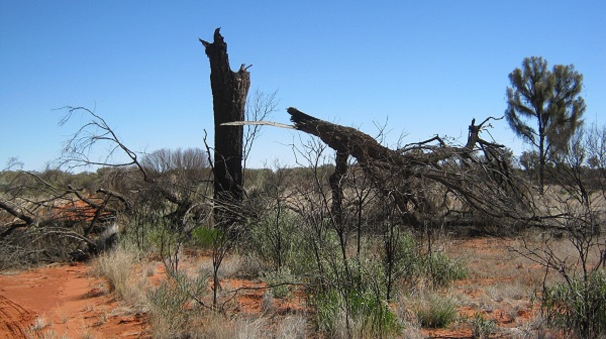
In 2006 this country was very dry as we were then in the middle of a serious drought. By 2011, with two years of good rains, the countryside had improved tremendously. But later that year devastating fires took hold in Central Australia and cut a swathe through some of the desert areas.
Denuded grasslands
Dancing camels
The vagaries of termites and fires
Fires in the modern era have a great impact on the remote areas of inland Australia. It is a well-known and researched fact that Aborigines had a fire management regime for their own tribal areas. They had ‘cool’ burns after the growing season, either to flush out wildlife or to regenerate the flora into new growth at an earlier period. But then the invaders came along and soon Aboriginal People lost their tribal areas and were settled on Mission Stations. The years passed and Aboriginal Land Trusts came into being encompassing the lands of many tribes and forcing them to live together in closer knit communities. The whole life cycle changed for them and soon there was no need to go out and hunt and manage the environment. Subsequent rainy seasons brought on luxuriant growth and when drier times came along a tremendous amount of dry undergrowth promoted the rapid onslaught of bush fires. With no one ‘out there’ to manage these large areas, the environment has been burned in ‘hot fires’ changing the ecological make-up of our natural world. There is no simple answer to this modern day phenomenon as the world revolves around money and its availability to solve problems.
Eaten out
Lone Ghost Gum
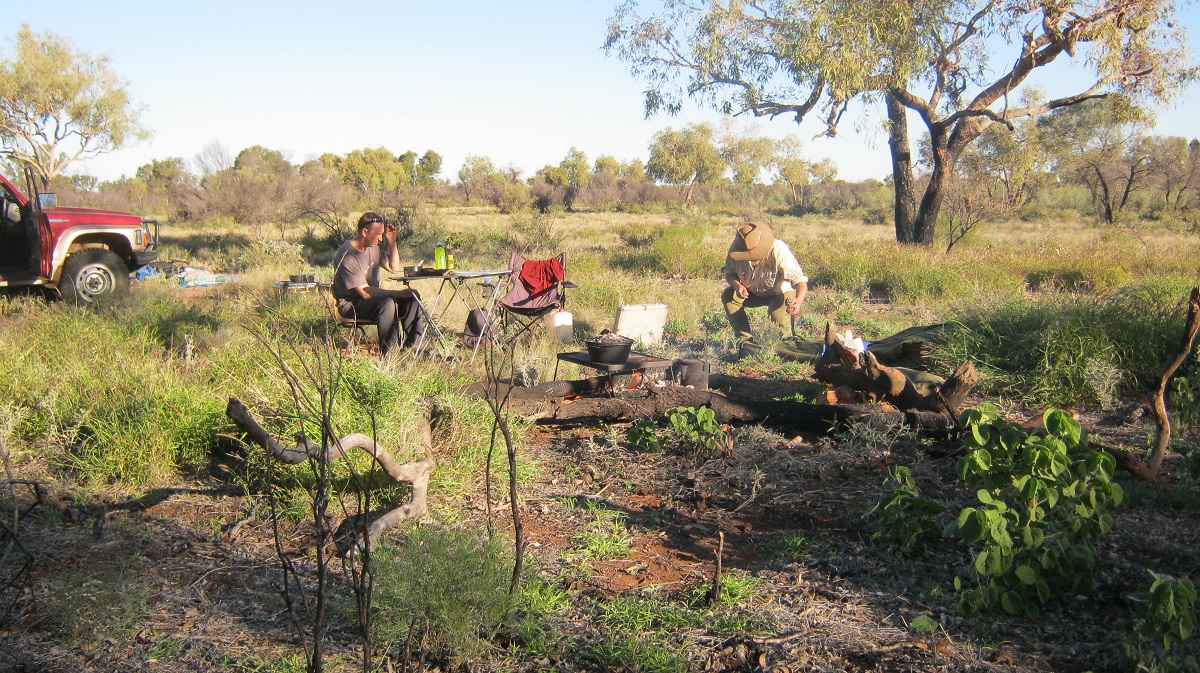
We stopped for a bite to eat and I had to refuel from my jerry-cans in the shade of a Desert Oak. After our brief lunch and a laze in the shade we continued on our journey to the west just following along a very faint track.
Faint seismic line
My mapping showed some clay-pans coming up later in the afternoon but suddenly the track veered away from them in to an unmarked new direction. After a while tracks appeared at all angles and I managed to drive down two dead-ends. Eventually I noticed where earlier traffic and been more often and followed that way into the setting sun. Not long after, my mapping showed that we were now heading in the right direction and just before sundown we made camp on a dry clay-pan. The quiet of the bush set in with only the crackling flames of the fire denoting our presence.
Claypan camp
\
Early morning and with the sun on our backs we made better progress as we started to get into an area where there has been some mineral exploration over recent years. The countryside is pretty featureless with only the occasional sand dune to cross. The flora is mainly spinifex with some low scrub and scattered eucalypt trees. We searched for Wylookarri Rockhole as denoted on our mapping but could not find it. We had crossed a rocky outcrop but most of this was covered with red desert sand. There was an enclosed hollow surrounded by sand and we figured that this may indeed be a water catchment when the rains came.
There is another world below the sand
Hopping mouse tracks?
By now we could see Johnstone Hills in the north every time we crested a dune. We had come on to a wider track by now which had been graded not so long ago. At Nguman Outstation Airstrip we turned west again towards Yuwalki Outstation as shown on our mapping. We could now see Mount Rennie rising out of the mirage to the north and stopped to take some photos.
Mount Rennie
A short while later we suddenly came across a great wide graded road which ran in a north south direction via a large S-bend. At the intersection was a large sign stating that we were now on the Surprise Oil Test Well access road. The track beyond the S-Bend was graded too for a short distance but then fell back into only two wheel tracks through the bush. So even when you think you are travelling across a lost world you you find the march of progress has beaten you to it !

Graded track
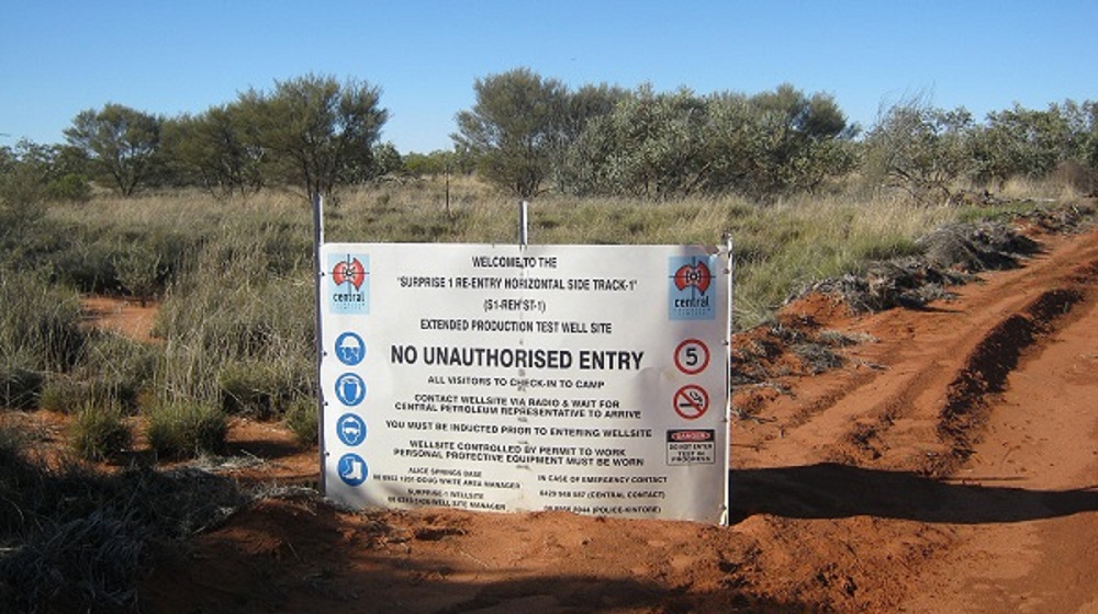
Surprise indeed
Where the track turns north once again I looked for the access track to Yuwalki but saw none. A subsequent Google Earth search does show some buildings there but whether the Outstation is inhabited, is a guess.
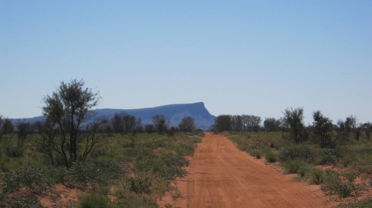
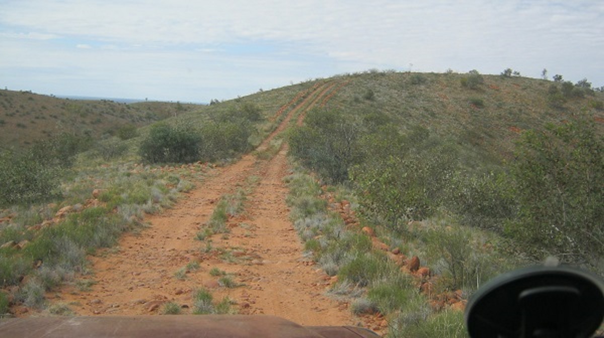
My mapping showed a track continuing on in a westerly direction but upon further investigation we could not see one at all and so I opted to take the access track to the north that eventually heads for the Sandy Blight Junction Road and Kintore. In the morning sun Mount Strickland in the Kintore Ranges loomed in the distance. We were heading right for it and the distance was 28 kilometres.
Mount Strickland in the Kintore Range
We came to the intersection of Sandy Blight Junction Road and Kintore Back Access Road around midday and turned south.
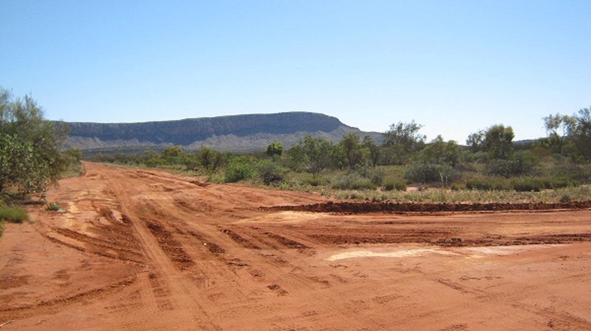
Our run across this dry and desolate terrain was done. The distance travelled from the Cleland Hills was 211 kilometres
Sandy Blight Junction Road 2013
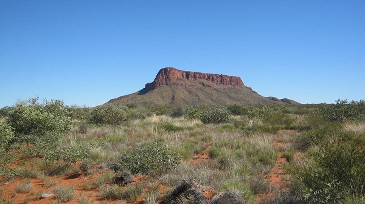
Sandy Blight Junction Road and Mt Leisler
Len Beadell, Surveyor and Road Builder of Australian Fame, constructed this road in 1960 as part of the Woomera Rocket Range access roads. The road was built from Giles Weather Station in Western Australia and heads north, skirting the Walter Range, and Rebecca Creek, Sir Frederick Range, Mu Hills until it crosses over into the Northern Territory just south of the Bonython Range. Then it passes Davenport Hills and the majestic Mount Leisler at 920metres above sea level, and later the Kintore Range and Mount Strickland, before meeting up with the Desert Road(also known as the Kintore or Gary Junction Road) which runs from Alice Springs in the Northern Territory to Port Headland on the coast in Western Australia. The road was going to connect up with the Tanami-Halls Creek Track eventually via Mount Doreen Station, but constructing the Desert Road to the west was more pressing at the time, and so the latter road project was abandoned after 20 kilometres past Sandy Blight Junction. Before the rest of the Desert Road could be continued however a road had to be constructed to Mount Liebig Community which was then at the terminal end of the Desert Road from Alice Springs.
A Len Beadell plaque
Len Beadell had been to Adelaide on business concerning the road construction projects. Just before leaving the city he got the sensation of an irritant under his eyelids. It felt like there are grains of sand wedged between his eyelids and eyeballs and he was in great discomfort. This condition is known to ‘bushmen’ as Sandy Blight. Len called in at Woomera where the local doctor gave him some ointment and told him to rest up but Len ‘escaped’ and kept on heading north back to his Construction Crew out in the bush. The Doctor however knew his route and where he was going to call in and left medical instructions via High Frequency Radio communications with stations along the way. Apart from the agonising pain the condition of Sandy Blight is accompanied by blurred vision. Before recovering from his ailment Len and his crew had completed the construction of the road and he named the intersection with this new road and the Desert Road as Sandy Blight Junction. Later he saw that maps included the road’s name as Sandy Blight Junction Road.
Australian names of places could be confusing at times. Although the Sandy Blight Junction Road was built as a road that skirts around sand ridges and made for access by ordinary vehicles, today, 53 years later, it is nothing but a track with single lane access for most of the way through various habitats and reasonably rough in places. Whereas another iconic road, the Oodnadatta Track, in South Australia, is today a big wide road which, at most times, is in good condition.
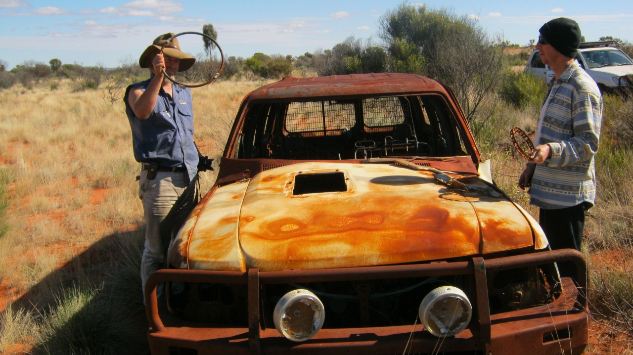
We turned left after reaching the Sandy Blight Junction Road and not long after that stopped to inspect a burnt and rusting Range Rover which had rolled over some time ago. This road is littered with burnt out vehicles which are made up from mainly cars, station wagons and four wheel drives and a bus or two. Research has shown, that, from an Aboriginal perspective, a vehicle that is no longer repairable is burned so that ownership is disassociated with the individual who had owned it. Non Indigenous Society would look on it from a re-usable resource point of view whilst Indigenous society looks at it as something that has passed on and is of no further use. Vehicles are replaceable. The trouble is that by doing this a roadside litter problem arises for Non Indigenous people whereas Indigenous society does not recognise it as litter.
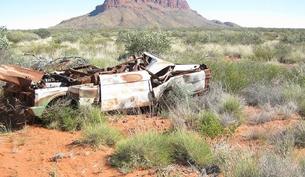
Demised range Rover
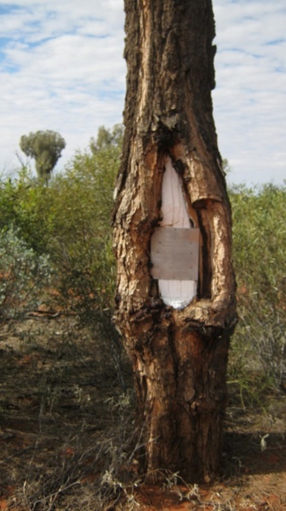
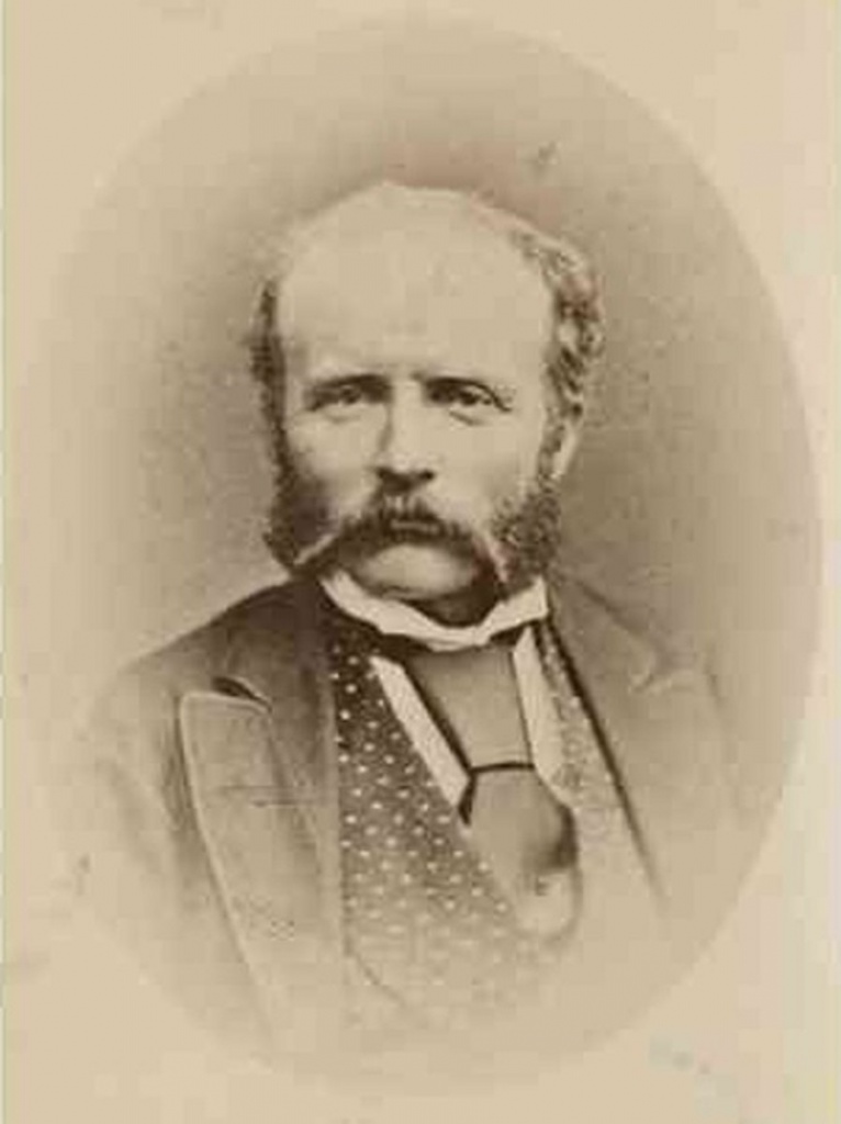
We stopped at the Tietkens Tree for a spot of lunch. William Harry Tietkens was second in command to Ernest Giles on expeditions to Central Australia in 1873 and on a journey from Beltana, South Australia to Perth, Western Australia in 1875.
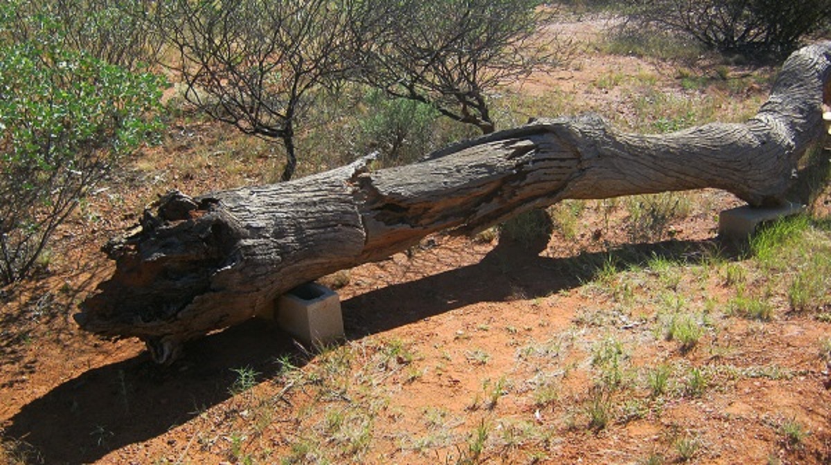
Remains of tree
In 1889 Tietkens led his own expedition west of Alice Springs to the vicinity of the Western Australian border. This expedition discovered Lake MacDonald, the Kintore Range, Mount Rennie, the Cleland Hills, defined the western borders of Lake Amadeus, and photographed Uluru and Kata Tjuta for the first time. The expedition collected new species of plants and rock samples allowed the South Australian government geologist to compile a ‘geological sketch’ of the country traversed. Tietkens blazed this tree near the base of Mount Leisler in 1889 . The tree has since succumbed to old age but lies propped up on bricks as a memorial to Tietkens. Mount Leisler was named by William Tietkens after a friend and benefactor from Victoria. It is known to the Pintubi as Yunytjunya.
Mt Leisler Yunytjunya.
Further down the road I saw a vehicle parked in the distance and a number of bodies walking around. This could only mean one thing….a broken down mob of locals. And sure enough, there was old Bundy and seven ladies, with an overloaded Toyota Troop Carrier and a number of flat tyres. We stopped to help. It took a while and I gave Bundy an old tube for his one tyre telling him that is had a slow leak but was better than no tube at all. Soon they were speeding off in a cloud of dust and out of sight heading for their homes at Tjukurla Community.
Tyre repairs
The original road made a point of skirting around the dune heads so as to facilitate access by two wheel drive vehicles. Later other travellers with 4×4 started cutting corners and made short-cuts over the top of dunes. At Davenport Hills there was one such long drive around the head of the dune and right at the apex I swung the Datto off the road, crossed three dunes and found a lovely camp spot in the shade of a clump of Desert Oak Trees.
Davenport Hills camp
Every cloud has a silver lining

Bill warming his bum
Day two saw us continue down along the road at a leisurely pace taking in the scenery. We met up with a convoy of travellers and then one other vehicle and that was it for traffic for the day. We crossed over the State Border into Western Australia and learned that an area along the road and spread out both east and west from there had been set aside as the Ngaanyatjarra Indigenous Protected Area.
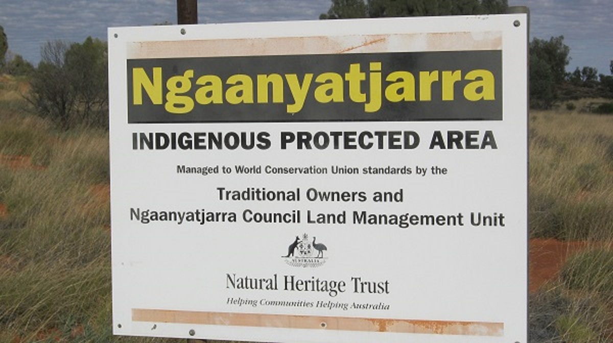
An IPA is an area of Indigenous-owned land or sea where traditional owners have entered into an agreement with the Australian Government to promote biodiversity and cultural resource conservation. Indigenous Protected Areas make a significant contribution to Australian biodiversity conservation – making up over a third of Australia’s National Reserve System.
Desert Oaks
The Mu Hills changed the scenery a little bit from driving through Mulga and Desert Oaks to scrabbling over some very rocky sections.
Mu Hills
Track up Sir Frederick Range
At the Sir Frederick Range, Len Beadell had scraped a track to the highest point of the hills and it rises deceptively over loose stones via some steep grades, but nothing that would require Low Range First Gear, however. The view from the top is great and you can see the Big Sky Country from there. The wind was quite fierce at the top and so we made our way back down again to have lunch at the foot of the hills.
View from Sir Frederick Range
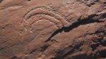
Next stop was at an emergency bore on the side of the road where I fill two water containers. The water was very brackish and not really palatable but would do in an emergency. The road was improving as we drove by stands of Desert Oaks and low grass plains. After the Tjukurla Community turn-off the road changed to being a proper well maintained one. We stopped for the night at Bungabiddy Rockhole (also known as Pungkapirri ). The wind was strong and cold as we walked the short distance to look at the narrow gorge and the rock pools. It was quite a pleasant sight and a pictograph of a snake can be seen on the rock wall adjacent to the main pool. We set up camp using the vehicles as a wind break. Later I had to call home for my scheduled check-in via Satellite Phone but could not raise a signal. So I drove out of the gorge the 1 kilometre back onto the road, and found a good signal and made my calls. Strangely enough, there was no wind out there. I mused that maybe the spirits of the place where trying to chase us off. On my return we cooked our food but turned in early as maintaining the fire with the wind was problematical.

Pungkapirri
Pungkapirri
Watersnake art
I went for a walk to the waterhole in the early morning again to take some photos.
We made the 50 kilometres to Docker River/Kaltukatjara for some fuel supplies at $2.35 per litre and I just bought enough to cover emergencies. By then we had crossed back into the Northern Territory again and our next adventure would take us back to our entry point off the Mereenie Loop Road.
An Unmarked Track 2013
Dark clouds
A little way out of Kalkukatjara (Docker River) Community, we swung off the Tjukaruru Road and headed along a little used track in a north-easterly direction. The track is marked on government mapping for a short distance but after that it disappears from the screen. It is definitely not shown on any other commercial maps available these days. The track passes through some very isolated areas and runs for around 260km up to where it meets the Alice Springs-Kings Canyon Loop Road in the Mereenie Oil Field. This junction is 280km west of Alice Springs.
Start of the track
We had obtained verbal permission from the Traditional Owner of these lands to drive the track. I have not established why the track was made as it is not used very often but it is a more direct route between Kaltukatjara and Areyonga Communities, cutting out a long drive via Uluru and Watarrka National Parks. For all intents and purposes it was made so that 2wd cars could use it initially, but in this year it is washed out in many places and not suitable for any vehicle other than high-clearance 4×4’s.
The day was dark and foreboding with the clouds hanging low over the Petermann Ranges, and we were wondering just what we might encounter further along when we started to approach the salt lakes.
A friend of mine drove this track in 2012 in his quest to find a hill named Mount Unapproachable. It was so named by the Explorer, Ernest Giles in 1872 when his horses became bogged in the quagmire of wet ground and try as he may, he could not reach it. The name of this hill always fascinated my friend and he made it one of his ambitions to get there one day. Having had experience with salt lake driving I tend to shy away from such ventures and all I could do was to hope that we may get a glimpse of this elusive place. William Tietkens also mentioned it in his account of his exploratory journey through the area in 1889. My friend did get there at the beginning of summer and through a rain storm and some anxious moments while crossing over the salt encrusted surface of Lake Neale to get to his objective. He reported to me on the through track, that it was an easy run although the track at times was hard to locate.
We dropped down through the dry Hull River and soon we were on a sandy track skirting the Ilyaralona Range of hills a short distance off to our east. The country is mainly grasslands with Desert Oaks and Mulga Trees. There are some hard sections of the sandy track and some stony areas as well, but for the first 100km the track is good and scenic as the Bloods Range of small ranges loomed in the distance. We passed by the Outstation of Walu. There was a locked one room dwelling, a water tank, long drop and a hand-pump for water which was no longer operational. Inscriptions of local visitors to the place were dated to 2006. It had obviously been abandoned from that time on. After a drive through rather flat country we passed a quartz protrusion and went to have a look to see if this may house the fabled Lasseter’s Reef, but it did not look like a candidate. We had lunch in amongst a Mulga clump of trees and out of the biting wind. I managed to slice my left hand index finger with my Leatherman multi-tool and cursed myself for being so careless.
Quartz Reef
Mulla Mulla
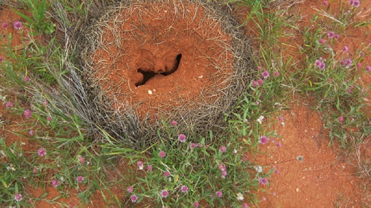
Mulga Ant Nest
After lunch, Bill, my passenger for the past ten days, went for a drive with Jeremy, who had been driving solo for the duration of our adventure. Now I had the freedom to play my preferred music as loud as I wanted to whilst driving the picturesque track up to Carruthers Gap in the Rowley Range, passing Mount Harris and Mount Carruthers to the west of me and then passing the Pinyinna Range
Carruthers Gap
Mount Carruthers
I saw what looked like a very large feral cat on the track but it disappeared into the scrub very quickly. Other than a few birds no other animals were seen and only one wrecked and burnt out car. Light rain had fallen the closer I got to the lakes and the sand was firm on the track and dune crossings.
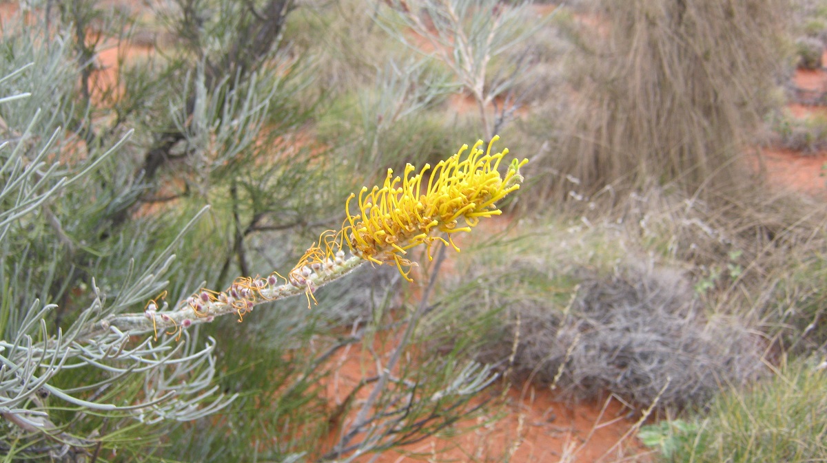
Honey Grevillea
At right on 3pm I had reached the cross over point between Lake Neale and Lake Amadeus and waited for the others to catch up. The crossing was sandy with no apparent salt about. Some shell fossils could be found in the watercourse. Faint tyre tracks led up stream towards Lake Neale and I wondered if they may have been made by my friends’ vehicle some eight months prior.
Crossing between Lake Neale and Lake Amadeus
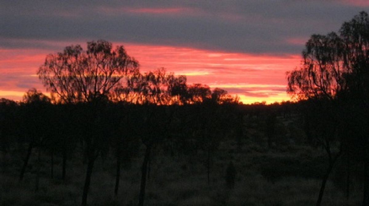
The dark clouds were still gathering and it was cold and we decided to camp just past the crossing. Some fallen tree trunks were soon dragged in to place and we made a fire that lasted all night on the shallow side of a dune. The sunset with the cloud formations was quite spectacular.

Settling down by the fire
Sunset
We woke to misty rain and the air was cold and damp and so we did not tarry in having breakfast and packing up. I decided I had to see Lake Neale so I took a digital compass bearing in the general direction of the lake and we set off cross-country. Misty rain and wet grass made the visibility quite difficult but we got to the lake after a short drive only to find that is was not salt at that juncture but rather hard leached sand. We took our photos and then I opted to drive east down the outlet of the lake towards where the track crosses. Always worried about sudden wet patches we made our way cautiously along the run out without an incident.
Lake Neale
Continuing along our destined track I was disappointed that I would not be able to see Lake Amadeus. Driving up near Longs Range I was tempted to go cross country for about two kilometres to the base of the range and then leave the vehicles and climb it. Rain, however, had fallen during the night and there were puddles of water on the road. I was cautious about the sandy grasslands to get to the range and did not think it was worth it just in case we got ourselves bogged. Walking it for me wasn’t an option and the others also declined the invitation. And so we decided to leave Lake Amadeus for another time.
Today the journey was slower as there were more washouts and fallen trees over the track. It is a scenic drive however, through grassed plains with stands of Desert Oaks, as the track meanders its way around dune heads and sandy patches. In the late morning Jeremy noticed a low ridge to the northeast and what looked like some overhangs and suggested that we take a closer look. The ridge lay about 1 kilometre off the track and we went to investigate. What we found was quite a rich frieze of pictographs on the walls and ceilings of the overhangs. There was a pool of water nearby and that was something unusual in this dry country.
Cave country
Welcome Oasis

Just twenty kilometres to the east of this point in a straight line, Ernest Giles had trouble finding water in 1872 when he discovered a meagre supply at a place he named Glen Thirsty (also known as Yatajirra) as he had to return there three times to save his party and the horses from dehydration.
Once back on the track we went to look at the western side of this ridge as it showed promise of many more overhangs but the crumbled sandstone did not lend itself to being inhabited. I would dare to say that the weathering was more severe due to it being exposed to the prevailing winds and harsh afternoon sun.
By now the clouds had dissipated and the sun was shining brightly and we found a shady tree to boil the billy and have a spot of lunch.
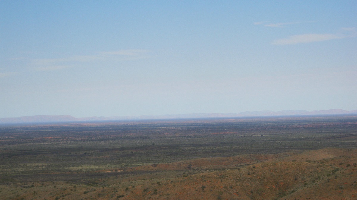
During the afternoon’s drive we encountered a number of sandstone ledges which we had to drive over. We surprised two old bull camels lying down close to the track. They rose with an effort and walked off away from us in disgust. At this point we were 762 metres above sea level and could see Mount Murray to the southwest from us.
As we were now getting closer to the area we had visited 10 days prior, I drove up on to a higher dune to get a look at the surrounding landscape. The Cleland Hills could be seen in the distance to the northwest.
-
- Over there…..
-
- ….lie the Cleland Hills
We were now back in spinifex country and I started to look for a campsite from about 3pm onwards. The spinifex clumps however were growing well in this area and I just could not find a place to pull off the track that was free from these prickly plants. What we did find was a late model Nissan Patrol completely burnt out. It looked like a government-issue vehicle complete with twin wheel carriers on the back.
Cooked Nissan
Just after 4 o’clock I found an open place amongst some Desert Oaks with plenty of firewood and we stopped for the day. It was time to crawl under the vehicles to remove any sticks and grass stalks or seeds which had accumulated in nooks and crannies and near heat surfaces, like the exhaust pipe, as vehicle fires are always a present danger. As a matter of principle I have always removed bash-plates from my vehicles when first purchased. Some say it’s a folly but I have never had an issue with damaging drive-line components under my vehicles even in the roughest cross country driving.
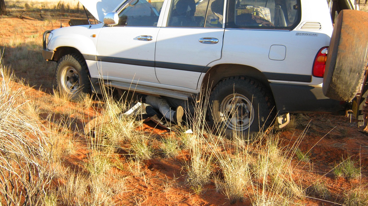
Clearing the grass out
Enough wood to keep us warm
After dark we could see a bright illuminated sky to the north and deducted that it must be the mining camp we had passed on our way to the Tarn of Auber ten days ago.
A fantastic sunrise had us all up early taking photos. We were now only about 20 kilometres from the point where we left the Mereenie Loop road on the start of our adventures. We had to drive through the workings of the Mereenie Oil Field and we heard on the radio that someone had noticed us although we did not see anyone.

Mereenie sunrise
We arrived at the Mereenie Loop Road at about 9.30am and re-inflated our tyres to a higher air volume to suit dirt road driving.
And so we had come to the end of our round trip through the edge of the Gibson Desert. It had been a great journey through very isolated and remote parts of Central Australia, but, as always, a very worthwhile experience seeing country and ancient art that has inherently not changed in the past 5000 years.
.
Prehistoric sites 2013
Mereenie Loop Road
Whilst re-inflating our tyres at the side of the road a number of mud splattered vehicles thundered past us on the corrugated Mereenie Loop Road. It always comes as a bit of a shock when you have not seen a soul for days on end to suddenly be confronted by the rip roaring noise of passing vehicles and it brings you back to the reality of where you fit in with society. Sometimes I yearn for being somewhere else instead.
It had rained a lot more here than where we had been as the road was inundated with pools of water and which were now rapidly changing into mini quagmires as the tourist hordes make their way to and from their destinations.
Mud
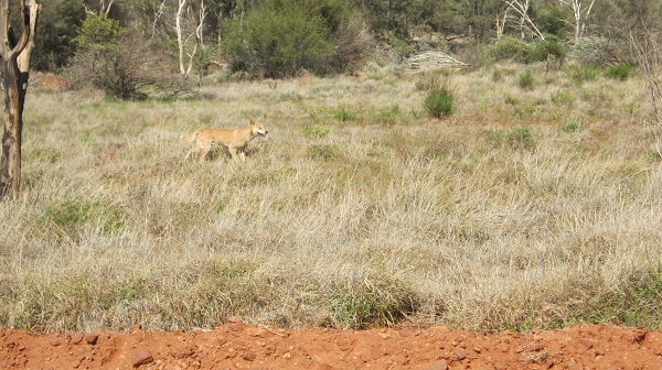
We were taking care driving along this byway and were frequently overtaken by tourists hurrying to wherever they were going. At one stage I stopped to look at a couple of Dingoes which were trotting through the grass just off the side of the road.

Dingo
About an hour into our drive we came across yet another Landcruiser Troopy with a flat tyre. The driver explained that they were now out of tyres as they had blown 2 spare tyres as well. They were ferrying friends from somewhere out in the bush to the airport in Alice Springs and had to be there by the following day. The problem stemmed from driving too fast with tyres overinflated to high pressures. I suggested that they could borrow my extra spare tyre and tube. They gratefully accepted that and soon the loan turned into a purchase and the bloke gave me $100. I said that it was too much and that $50 for an old tyre would do and so he gave the other $50 to Jeremy for his physical help (and he bought a slab of beer for us when we reached Alice Springs). We gave the driver strict instructions to not drive over 60km per hour as he was now running three radial tyres and one cross-ply tyre. The seven of them piled back into the Troopy and off they went, albeit very slowly. I subsequently found out that they made it to Alice Springs without any further mishap but had another puncture just near the airport!

Tyre troubles
Meanwhile the tourist traffic left us in their wake of mud stones and dust while we looked at the wildlife. We stopped for lunch at the entrance of a small gorge just off the road. Three wild horses walked by casually and gave us nary a glance. Later we came across a Grader cleaning up the road and the last few kilometres to a short section of sealed road to Katapata Gap was smooth as silk.
We made for an age old feature in Central Australia namely Gosse Bluff, or Tnorala, in the local language. Gosse Bluff is named after Henry Gosse, an explorer of the late 1800’s.

Tnorala from Tylers Pass
This crater is thought to have been formed by the impact of a comet about 140 million years ago, in Cretaceous Period., The original crater rim has been estimated at about 22 km (in diameter, but this has been eroded away over time to around 5 km in diameter. The sides of the crater reach up to 180 metres in height.
Inside Tnorala
The site is known as Tnorala to the Western Arrernte Aboriginal people, and is a place of significance in their Dreaming Stories. Folklore has it that a long time ago a man went out hunting and when he returned to his camp at Tnorala everyone there had been killed by the Kurdaitcha Men (Aboriginal Sorcerers). The man alerted other families and they hunted the Kurdaitcha men down. Tnorala then became a place you do not stay at and the Traditional Owners of today have requested that no one camps there.
I had been to Tnorala on a number of occasions before and had driven through the crater and had walked the rim a long time ago. There is even an Oil Well Drill Site right in the middle of the crater. After the lands were restored to the Traditional Owners and a Conservation Reserve established, the parameters changed so that the wishes of the owners could be met. As it is a Day Visit Point only, we could barely find parking at the Picnic Area due to the number of Interstate visitors at this time of the year and we spent just a minimum amount of time having a look before driving north again.
At Tylers Pass there is a nice sealed road to the viewing point and the Gosse Bluff profile is very prominent in the distance. After Tylers Pass the road has now been sealed all the way to Alice Springs. Bill and I had visited Roma Gorge some 20 years before and we wanted to show Jeremy the intricate petroglyphs of the place.
Undulating Hills near Tylers Pass
The access road to Roma Gorge (Moon Dreaming) has changed now and is no longer via Boomerang Bore as it passed by a watering point for stock on Glen Helen Station. Now you leave the sealed road at Davenport Creek and drive the 8 kilometres along the stony creek bed. It is an easy drive to the Day Car Park and there is a 200 metre walk into the gorge.

Driving up Davenport Creek
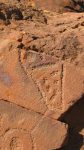
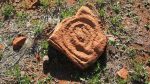
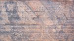
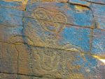
This petroglyph site is Men’s Business for the Western Arrernte People and is an initiation site for young men into adulthood and the meaning of the carvings cannot be revealed unless a person is initiated into Aboriginal Law. Only one carving may be talked about and that is of Itaya, the Moon Man. The rays show that he is shining like a diamond. The boomerangs shaped like a number 7 are killer boomerangs. Arrernte Men used boomerangs for fighting and not spears. They worshipped Itaya as their god. Some of the Dreamtime Events are recorded here. It is told that some of the symbols were made by human ancestors and some by the Spirits of the Dreamtime using a hammerstone and sharp pointed rock or bone chisel. It is thought that the carvings can be up to 10,000 years old. Some carbon dating put most of the carvings in this area at 6000 to 8000 years of age.
Roma Gorge


Petroglyphs explained
The sign at the entrance of the site asks that visitors do not proceed beyond the waterfall. And so we spent a good deal of time here.
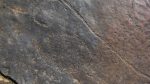
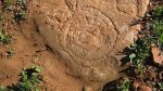
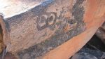
One aspect of petroglyph symbols is puzzling to me. Also pecked into a rock within the gorge is a much later petroglyph.
From what I have observed it reads:
Bertrom
25 27
Kenne ?
18(9)78
Dona
So how deep was the original carving and has it lasted only 35 years or 135 years? So where does this put the 6000 year old carvings? I hope to find an answer soon.
We camped outside the National Park in a secluded corner up from the creek bed and enjoyed a quiet night in the bush except for a distant croaking of some night animal. It sounded like an arid lands Frog but it could also have been a Night-jar. Bill went to inspect the sound but it went quiet when he approached and started up again after he left its immediate vicinity.
The following day it was a pleasant run back along the Mereenie Valley and Namatjira Drive to Alice Springs, arriving there just before lunch.
West MacDonnell Ranges
This denoted the end of our two week trip together. Jeremy and I left Alice Springs the following day bound for our respective homes. I have seen more places and new art and have new places to explore on my next visit to Central Australia.
The Vale of Tempe 2013
In October of 1872 the Explorer, Ernest Giles, wrote:
” At twelve miles we rode over a low ridge; the country in advance appeared no more inviting than that already travelled. Descending to the lower ground, however, we entered upon a bit better country, covered with green grass there was also some thick Mulga scrub upon it. Here we saw a few kangaroos and emus but could not get a shot at them. Beyond this we entered timber country again, the desert oak being quite the desert sign. In a few miles farther another ridge fronted us, and a trifle on our left lay a hollow or valley, which seemed to offer the best road, but we had to ride through some very scrubby gullies, stony and covered with Spinifex. It eventually formed the valley of a small creek which soon had a few gum trees on it. After following this for about four miles we found a place where the sand was damp, and got some water by scratching with our hands. The supply was insufficient and we went farther down and found a small hole with just a enough for our three horses, and now, having found a little, we immediately wanted to find a great deal more. At twenty six miles from the tarn (Tarn of Auber) we found a place where the natives had dug, and there seemed a good supply, so we camped there for the night. The grass along this creek was magnificent, being about eight inches high and beautifully green, the old grass being burnt some time ago. It was a most refreshing sight to our troidia-accustomed eye; at twelve o’clock the thermometer stood at 94° in the shade. The trend of this little creek, and the valley in which it exists, is to the south-east. Having found water here we were prepared to find numerous traces of natives and soon saw old camps and wurleys, and some recent footmarks. I was exceedingly gratified to find this water, as I hoped it would eventually enable me to get out of the wretched bed of sand and scrub into which we were forced since leaving the Finke, and which evidently occupies such and enormous extent of territory. Our horses fed all night, close at hand and we were in our saddles early enough. I wanted to go west , and the further west the better; but we decided to follow the creek and see what became of it, and if, any more waters existed in it. We found that it meandered through a piece of open plain, splendidly grassed, and delightful to gaze upon. How beautiful is the colour of green? What other colour could even Nature have chosen to embellish the face of the Earth? How, indeed, would red, or blue, or yellow pall upon the eye? But green, emerald green, is the loveliest of all Natures hues. The soil of this plain was good and firm. The creek had now worn a deep channel, and in three miles from where we camped we came upon the top of a high red bank, with a very nice little waterhole underneath. There was abundance of water for 100 to 200 horses for a month or two, and plenty more from the sand below. Three other ponds were met lower down, and I believe that water can always be got by digging. We followed the creek for a mile or two farther, and found that it soon became exhausted, as casuarina and troidia sand hills environed the little plain, and after a short course of scarcely ten miles, the little creek became swallowed up by those water-devouring monsters. I named this creek Laurie’s Creek. There was from 6000 to 10,000 acres of fine grassland in this little plain and it was such a change from the sterile troidia and sandy country outside it that I could not resist calling it the Vale of Tempe.”
Fast forward to September 2013:
Welcome sight on a corrugated road
I was on my own as my travelling mate suddenly had something else to do and pulled the pin on this trip. I headed west via the Ernest Giles Road from the Stuart Highway. This road is notorious for being rough as but on this day luck was with me as the Grader was working in smoothing the corrugations out.
Once I met up with the sealed Luritja Road which runs from the Lasseter Highway to Kings Canyon Resort, I stopped for a snack and boiled the Billy.
Boiling my Eco billy
The road gets deeper
A relatively short distance after passing the Kings Canyon Resort, and driving out from the Watarrka National Park, I swung the Datto to the west once again along a very faint track that was most likely the start of a seismic track further along.
Heading west
Having digital mapping at my disposal on the dashboard it a great help in find a route across open country. However, the mapping does not always relate from the map to what’s actually on the ground. My government maps with a scale of 1 to 250,000 is the best that I can afford but I would really like better mapping and will endeavour to get some soon.
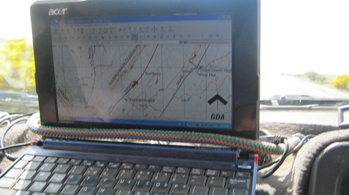
Digital mapping
Digital mapping makes searching for places a whole lot easier.
The Vale of Tempe is marked on my maps and it looks relatively easy to access. I had permission to enter the land area and looking at the map decided to see if I could get up and over a relatively easy ridge. Or so it seemed. On the plains the country had shrubs, buffel grass and majestic eucalypts. I started heading towards the flood-out of a marked creek and crossed over a shallow part before starting to slowly climb the rise. At first the rise was gentle and with few obstacles other than low mulga flora and other shrubs but then the further I went the bigger the mulga became. I started picking my way through the trees and the branches made horrific scratching sounds on the door panels. Still thinking that I had a good chance to clear the obstacles ahead and went even further and then got into some rough sandstone rock country to boot and with daylight showing over the bonnet of the Datto I decided to stop to see where I was at. Just as well I did as I was now very close to a sheer drop of 50 metres or so. Ahead of me was a large fallen tree stump and forward movement was no longer an option. So I decided to turn around and head back down the hill.
Heading for the rise
Some severe panel scratch
Bushed
The Vale of Tempe in the distance……. so close and yet so far

Vale of Tempe in the distance
Easier said than done. After a 9 point turn of forward and reverse I was facing in the right direction again but could not see where I had come from as the trees had stood up again. Then I got the Datto stuck on some rocks and after much mucking around I finally got going again. It took 10 minutes to get to where I turned around and half an hour to get back to level ground. I then drove along a valley which rose slowly in the west. A road grader had been that way a long time ago but the surface was very washed out by rain over the years. I picked my way in and out of the gullies until I came to a clearing where there was some short dry grass and gidgee wood on the edges. I could see an old wheel track rising over a sand dune as I was now entering into the dune field again. I decided to camp in the clearing for the night. I set up camp and also refuelled from my supply of diesel stored in jerrycans for this purpose.
The valley I drove up
Just on dusk I heard a strange noise and looked up to see a very large horse approaching my camp. It stopped about a 150 metres from me and snorted loudly. Then it ran in a semi-circle around my camp with its tail up and shaking its innards making a loud noise. It stopped every 100 metres or so stomping its hooves and snorting loudly. Once it was back in line of its original course it came closer for a while making loud snorting noises. After about 10 minutes it obviously decided that I was harmless and trotted off into the fading light. I have since learned that this horse may be related to Waler Horses which are now running wild on stations and aboriginal land surrounding Watarrka National Park. The Waler is Australian bred and combines a variety of breeds; particularly the Thoroughbred, Arab, the Cape Horse, the Timor Pony and perhaps a little Clydesdale or Percheron. At present there is a horse eradication program being conducted on Tempe Downs Station.
The night was deadly quiet and after my crackling fire had died down all I could hear was my own breathing. Just before sunrise a Mopoke Owl stirred me as it started its haunting call in the distance.
My camp

Morning light
By the time I had breakfast the bushflies were becoming friendly and I packed up and got going.
After I had crested the first sand dune I turned south along a gentle slope driving over small spinifex clumps which then gave way to grasslands and a variety spring flowers. I was now attempting to come in from the western approach to the Vale of Tempe. The first couple of kilometres of the terrain was covered in fine grassland, but then once again, I ran into shrubby country which only seems to grow in and amongst the sandstone rocks. Soon the rocks became too large to drive over. Being on my own out there, I was a little worried that I may push my luck too far and decided then and there that I would come back next winter and hopefully bring a friend along driving their own vehicle so that we may try to get closer and if not right into this fabled place.
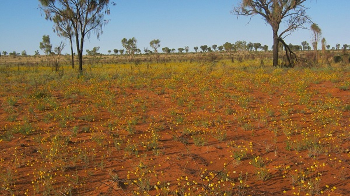
Field of Daisies
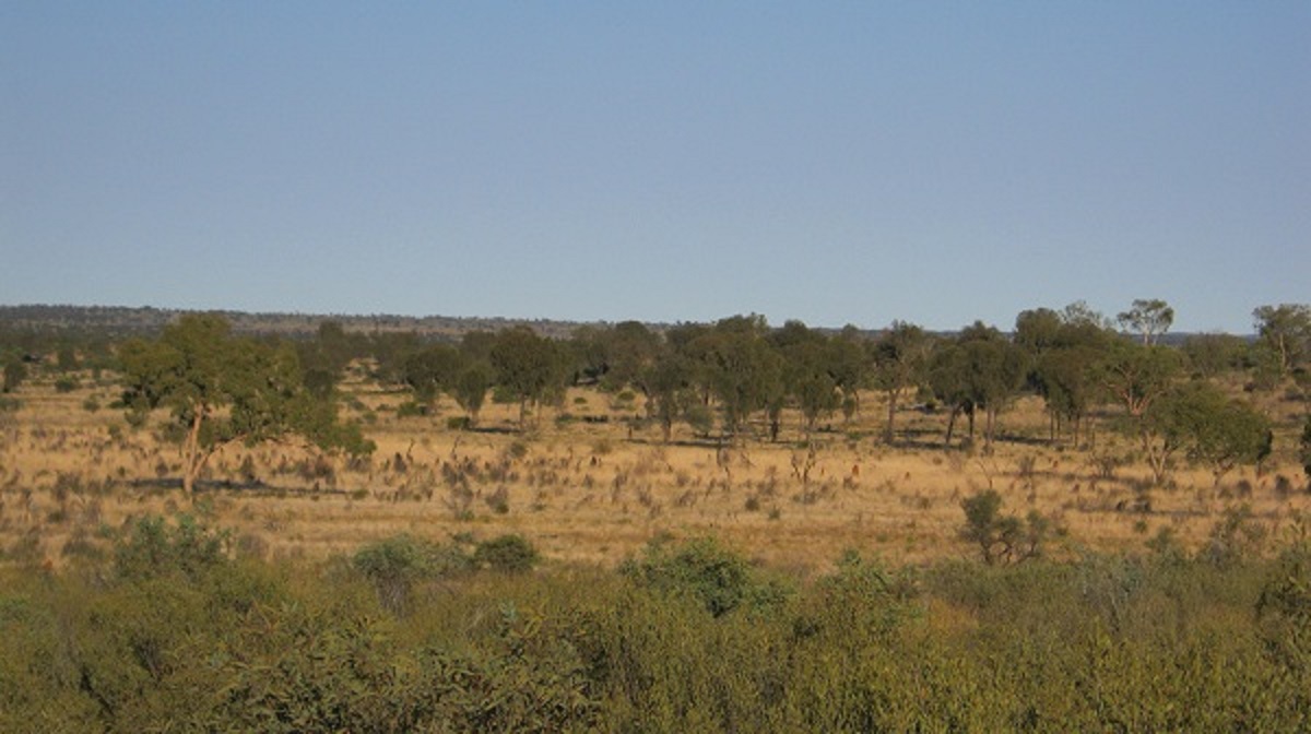
Coming in from the north
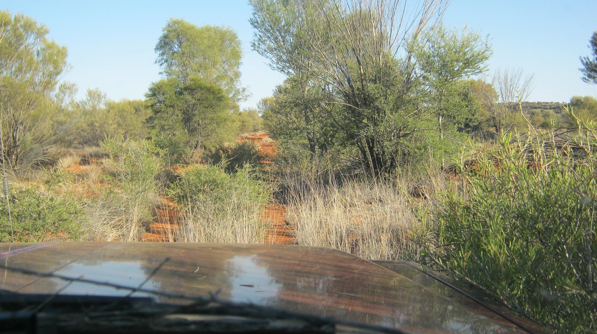
Overgrown seismic track
Back on the faded seismic track over the dunes I watched my digital mapping make a track where none existed. The countryside had low breakaway hills and some stony outcrops before I came out on the track we used some months previously. After that is was about 20km to the Mereenie Loop Road via some ‘Private’ mining roads.
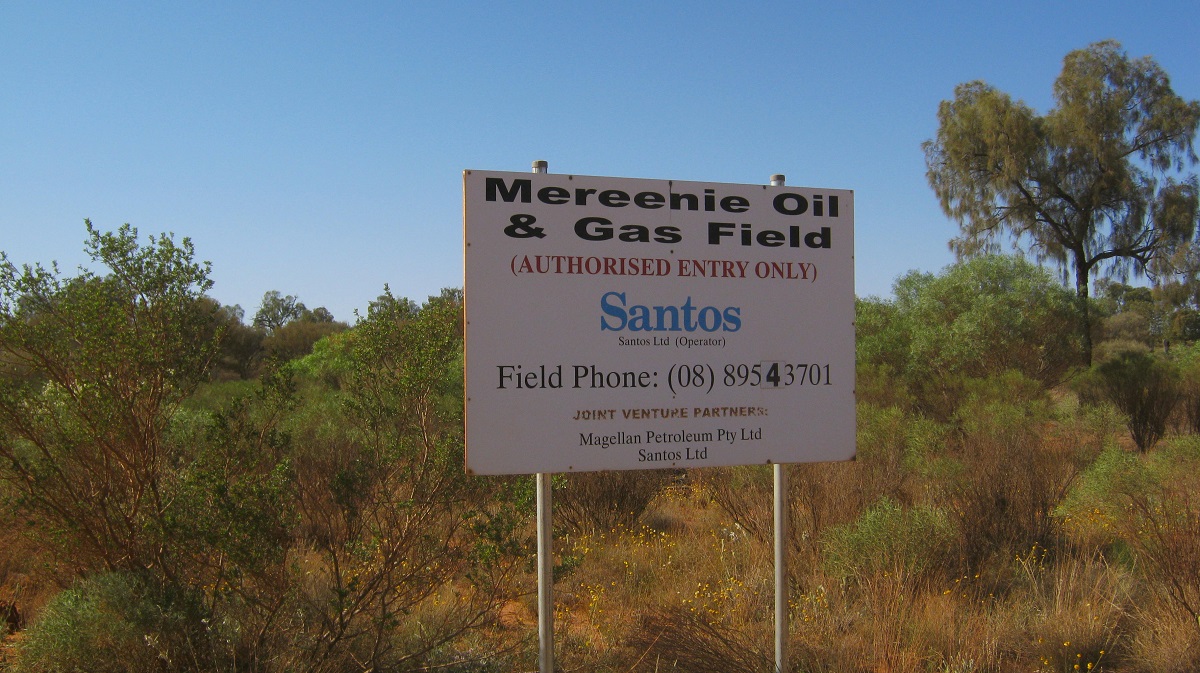
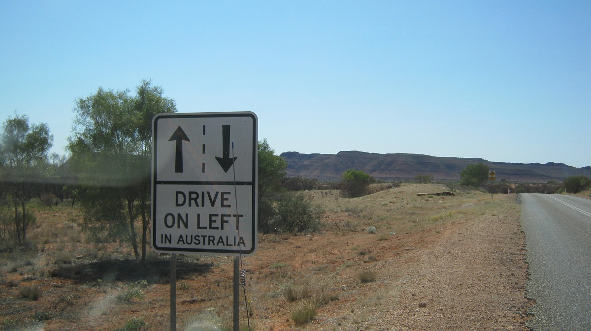
Once back in the main stream of traffic on the Mereenie Loop Road I wondered as the tourists flocked by towing their new vans over the horrendous corrugations and if anyone had told them about the condition of the road?

View of Kings Canyon in the distance
At Ginty’s Lookout over Morris Pass on the edge of the small escarpment, I looked in vain to see if the Vale of Tempe was visible from that height, but it appears that the rise of the hills in the valley below hides this elusive place.
Finke River Gorge 2013
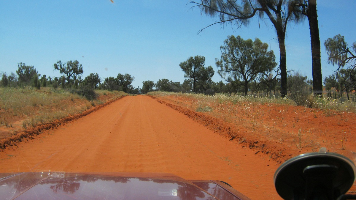
New road in from the south
I first drove this iconic track in 1978 in a Suzuki Ute and about 106 years after Ernst Giles and his party explored this region on horseback. Eighteen years have now passed since I drove this way last. We were then employed contributors to the Discover Australia by 4WD books, which were published by Random House Publishing, and needed to write up places to visit by 4×4 in the Northern Territory.
Now, at Rodgers Pass, on the Ernest Giles Road, at around 12 noon, I swung off to the north along a graded track which winds its way across station and community lands until it reaches the Finke River. This was a far cry from the bush track that straddled some sand dunes and clay-pans all that time ago.
The track reaches the river at Running Waters Yard. This is a pretty spot with Couch Grass growing on the river banks and a variety of waterbirds gracing the river margins. I have been here a number of times and the billabong has always had water in it. Only a few posts are now left of the old yards and I surmise that the timbers have been pilfered over the years by campers, for firewood. The land is part of Henbury Station, which has been in the spotlight in recent years due to a controversial Northern Territory Government Project about Carbon Farming.
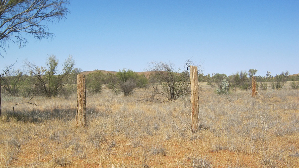
All that is left of the Yards
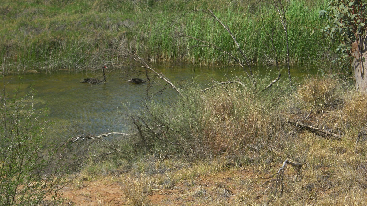
Black Swans
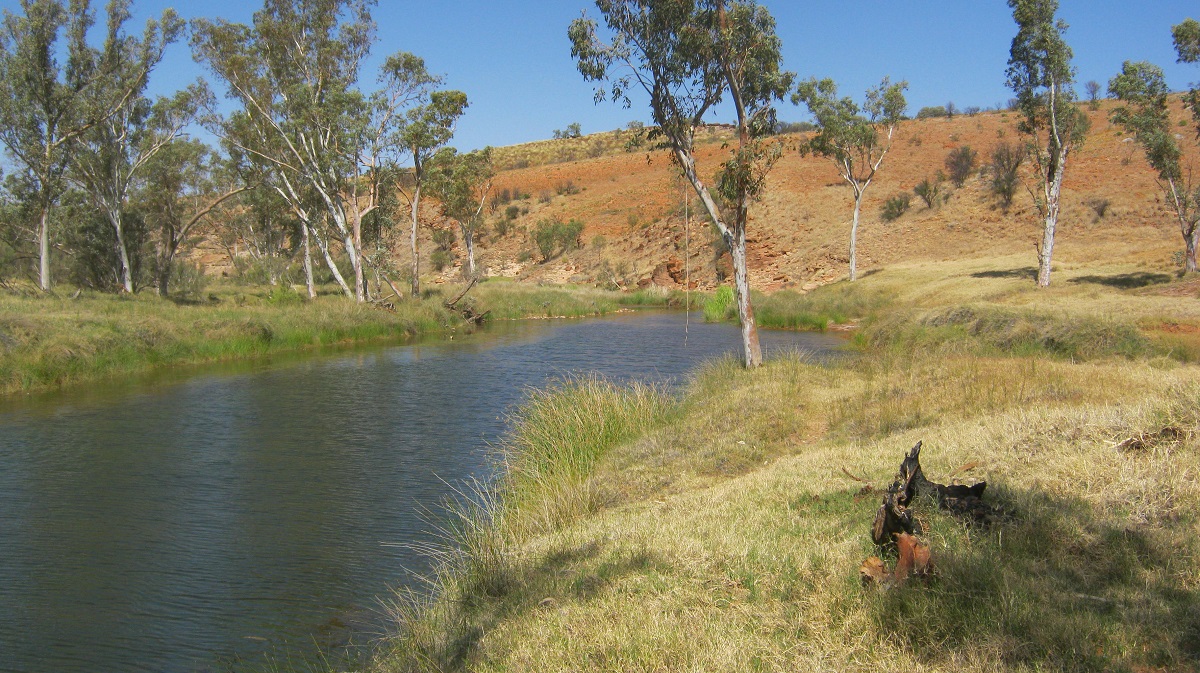
Running Waters Billabong
The real Finke Gorge Track starts at Running Waters Yard and runs for a distance of 44 kilometres to the Hermannsburg Community Township. You need to have a high clearance 4×4 for the journey. According to the National Parks and Wildlife Service, it is unadvisable to tow a trailer along the river track but in my opinion it shouldn’t be a problem as long as the driver is experienced in towing on soft sand.

Rocky Bar Crossing
The Finke River has its’ headwaters in the MacDonnell Ranges and is fed by the Davenport and Ormiston Creeks. It was so named by John McDouall Stuart after William Finke of Adelaide, who was one of the promoters of his exploration journeys, to find a route through the centre of Australia to the Arafura Sea. The river is called Larapinta by the Western Arrernte Indigenous People and has been a part of their Dreaming Tracks for as long as they can remember. The Finke River is regarded as one of the oldest rivers in the world as it has cut its way through mountain ranges dating back to the Devonian Period in our world’s history. It is normally a dry river but with numerous permanent water holes or billabongs which support a variety of inland fish and crustacean. They are Hardyhead, Purple Spotted Gudgeon and Desert Goby, Hyrtles Catfish, Desert Rainbowfish, North West Glassfish, Barred Grunter, Spangled Grunter and Boney Bream.
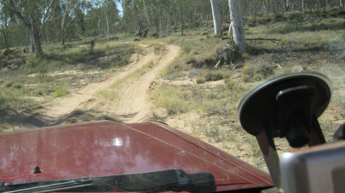
Finke Gorge Track
The Finke River flows through the southern part of the Northern Territory and eventually floods out into the western top half of South Australia and disappears into the Simpson Desert. In times of extreme floods though it will join up to the Macumba River and eventually its waters will reach Lake Eyre.
The Finke Gorge track meanders northwards, winding its way in and out of sandy and river-stone beds. A few kilometres before reaching the Finke Gorge National Park boundary a sign indicates that you should collect firewood before entering the parks as collection with in the park is not allowed. I did just that as flood debris of a time ago had accumulated around the trunks of trees close to the middle of the river. A sign also states No Pets and so I wondered about the 5 camels I saw just a short way in to the park.

Feral intruders
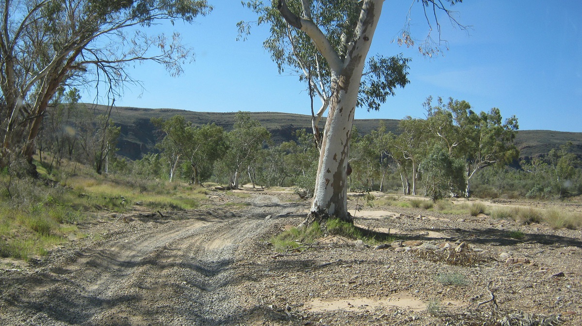
Finke River Track
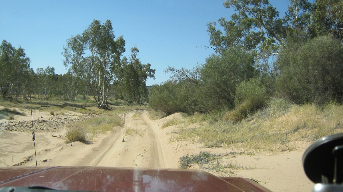
A sandy section
It is unclear where Boggy Hole derived its name from. The Western Arrernte People knew it as Alitera. In 1889 a police camp was set up to control the ‘hostile’ activities of local Aborigines. On the eastern bank of Boggy Hole, you’ll notice the stone remains of the first camp that was established by Mounted Constable William Willshire. The camp was abandoned when he was arrested for the murder of two Aborigines in 1891 near Tempe Downs.
The afternoon sun beat down through the windscreen on me as I made my way slowly over the rough terrain in and amongst the river gums and flanked by the red walls of the gorge. Arriving at Boggy Hole, after a four hour journey, and a distance of about 23 kilometres, I was keen to cool off in the green waters of the billabong. My thoughts of a swim were dashed when I broke the surface of a slimy black mud which oozed out a gaseous smell and I abandoned my attempt. It took a while to clean up the rank mud from my legs.

Boggy Hole
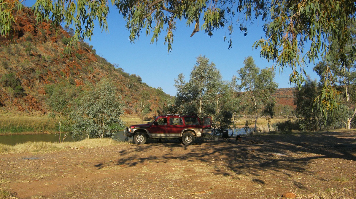
Boggy Hole Camp
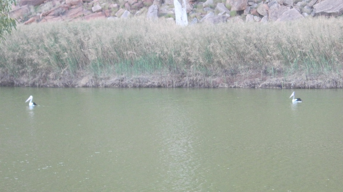
Pelicans a long way from the sea
As I had the whole of Boggy Hole to myself I settled down to cooking a stew and drowning a few icy cold beers whilst cranking my favourite music up that pulsated from the four speakers in the Datto, whilst Pelicans, Inland Dotterels and Honeyeaters took scant notice of me
I was busy cleaning up after my meal, just on dusk, when I had a feeling that there was something happening close to me. I turned around to find another 4×4 parked right next to me under the rivergum. A younger fellow got out and came towards me with his lips moving. Of course I had the music so loud that I could not hear any other sounds. After turning the noise off it turned out that this bloke was a tad lost and entirely out of his depth in 4×4 matters. He had taken the advice of the local Hermannsburg Policeman where he had sought information about camping somewhere and had been directed to Boggy Hole. His 4×4 experience was minimal and he was relieved to find another traveller as he had struggled to get this far with his Toyota Camper.He stayed where he was parked, about 3 metres from the Datto, and over the course of the evening I was regaled with his life story. Ho Hum……
Camp intruder
I slept on the other side of the Datto, so if my neighbour snored during the night, I did not hear him. I had to erect a tarpaulin over my bed though, as the moon shone so bright that it was almost like daylight outside. It was dead quiet apart from the faint night noises of some water birds far away. Then I slept soundly until a gust of wind sprang up in the early hours of the morning dislodging my tarpaulin tie-downs. I wearily dragged myself out of bed to tighten the ropes.
After breakfast the next morning my neighbour decided that he would follow me out as I seemed to know what I was doing, according to him. I made sure that his tyre pressures were low and mine were even lower but my tyres were not really compatible with soft river sands. The tyres were cold and not pliable and at one stage I was in low range first gear pumping diesel smoke to get to the other side of a long sand-drift. But I made it!

Soft sand
Serious sand

Finke River
The early morning light showed up the vibrant colours of the gorge as we made our way past reedy and open river sections. The sand decreased and the riverbed was covered in round river stones. Further north a much clearer waterhole looked as if it was swimmable but the early morning was too fresh for that.
It took exactly an hour and a half to negotiate the 21 kilometres to the Hermannsburg outstation on the banks of the Finke River where I bid farewell to my overnight neighbour who was going on to other adventures.
River reeds
Squeezing through
Driving out of the gorge
My mapping showed tracks that I could not find on the ground and so I drove up to a house in the scrub to ask the way to Wallace Rockhole Community, my next destination en route back to Alice Springs.
Panaramitee Petroglyphs 2013

As I follow my hobby of looking for and recording ancient petroglyphs, I am becoming more aware that the ancient peoples of this land lived a lifestyle which had given them time to develop their leisure time skills. Leisure time was there as a result of the ‘wetter’ period of the climatic condition of the world at that time, and with it, plentiful food.
The style of petroglyphs or rock engravings is known as Panaramitee Style Art. This style was coined by Lesley Maynard, Archaeologist, in 1976, when she took this evolutionary step of describing three types of petroglyphs on the Australian Mainland and Tasmania. The rock art is thought to be from the late Pleistoscene Era, from about 20,000 years ago. It includes the classic track and circle figures, the simple figurative and then the more complex figurative styles. Panaramitee is a sheep station near the small town of Yunta in the north east of South Australia and it lends its name to these styles of petroglyphs. The art style is mooted to cover areas from Panaramitee in a north westerly direction right in to Central Australia and to the eastern fringes of the Gibson and Great Sandy Deserts.
When visiting the regions of South Australia and New South Wales one is struck by how the climate has changed over the past 20,000 years. In order to maintain a good lifestyle for the stone-age peoples, there needed to be enough food, water and shelter available.
Whaleback rocks and other rocks protrude from the ground. The area must have been rich with emus and kangaroos as it is mostly their footprints, which are depicted on the rock surfaces. The cultural significance must have been deeply imbedded in the ancient peoples psyche over time. The engravings would have been done at various stages as some of the rocks are covered with a shiny smooth-like ‘desert varnish’ while others have been created after the desert varnish had settled upon the rock surfaces. Radio carbon dating puts the ‘desert varnish’ as no later than 7000 years before the present as stated by scientists. Desert varnish consists of clays and other particles cemented to rock surfaces by manganese emplaced and oxidized by bacteria living there. It is produced by the physiological activities of micro-organisms which are able to take manganese out of the environment, then oxidize and place it on to rock surfaces. Other carvings have been settled with Lichen which forms in the excavated cavities of the rock.
Some interesting reading here about rock engravings
http://www.janesoceania.com/australia_aboriginal_rockengraving/index1.htm
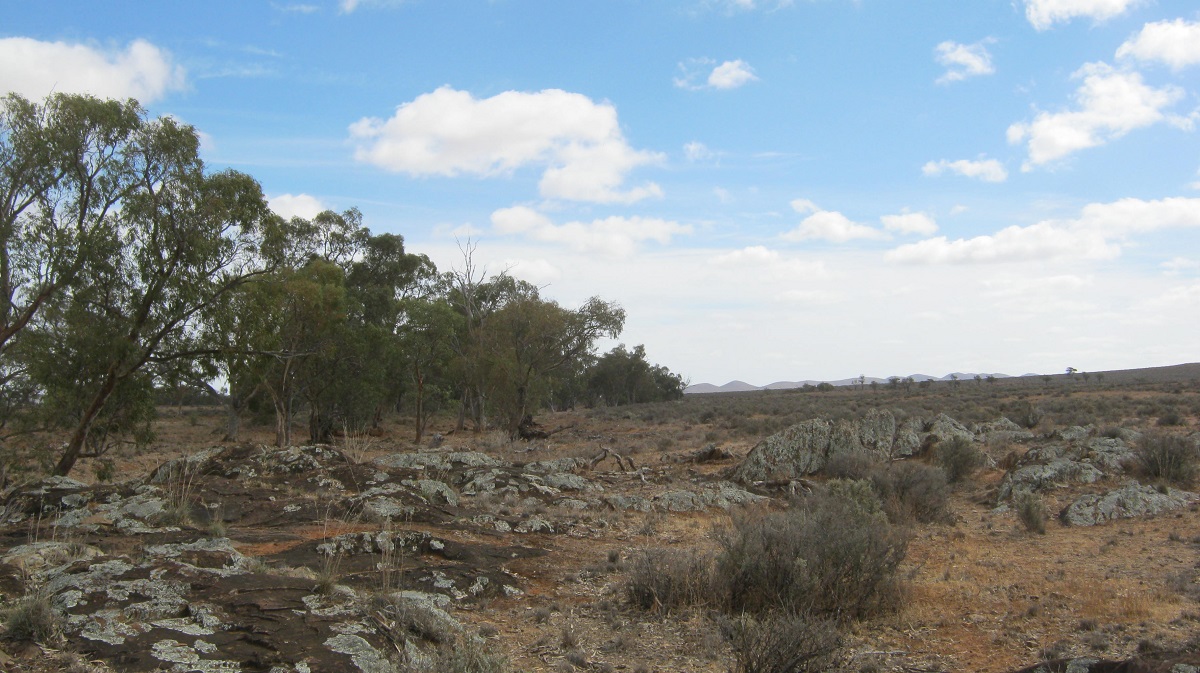
Panaramitee Site
A dolomite sandstone protrusion just above the surface layer of the ground follows along the lower hill line about 10km south of Yunta. Where it crosses Winnininnie Creek on Panaramitee Station, there are a number of ‘Tombstone Rocks’ scattered around with some whaleback rocks it between. The carvings, which were done with stone implements, are all on reasonably horizontal surfaces
(click on individual photographs to enlarge them)
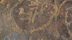
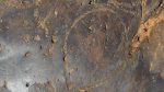
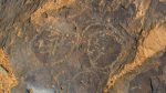
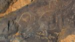
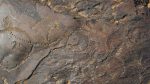
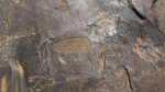
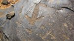
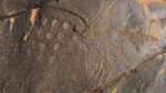
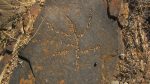
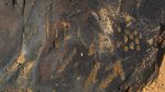
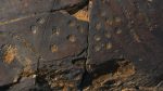
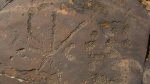
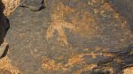
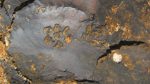
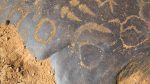
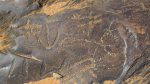
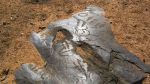
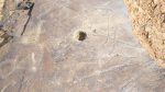
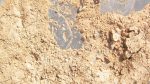
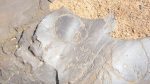
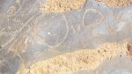
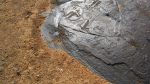

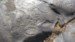
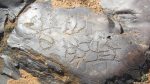
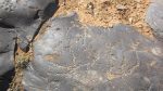
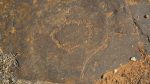
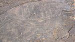

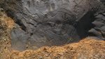
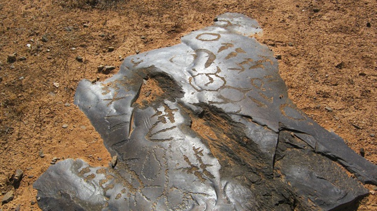
Desert Varnish
This is a drawing of a Crocodile Head petroglyph found at Panaramitee and which is now on display in the South Australian Museum
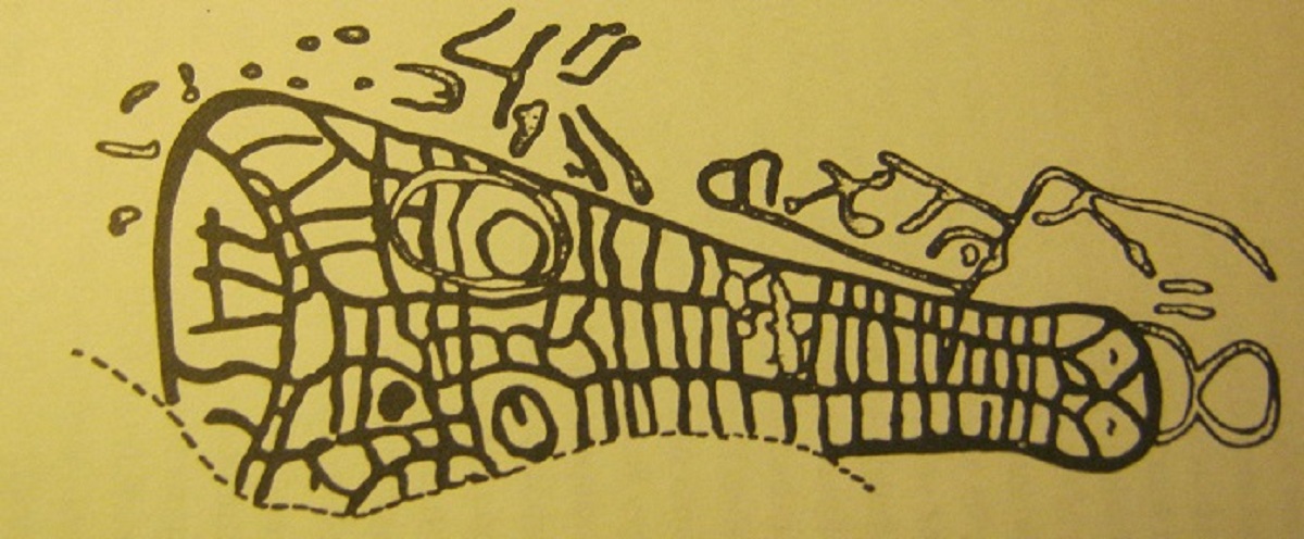
Crocodile head
Sturts Meadows Petroglyphs 2013
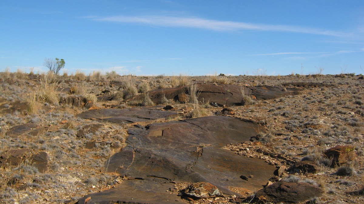
Whaleback Rocks
Although public access is allowed to the Sturts Meadows site one still has to contact the property owner to gain permission to come on to the station. I managed to do that through a local friend of the owner and it worked out well for me as I was able to see the stone carvings on a sunny day
The station was established by Abraham and Matilda Wallace in 1863, the name given to the property was taken from Charles Sturt whose expedition travelled farther to the west. The Wallaces travelled to the station from Mingarie in South Australia with 25 horses and 1,400 sheep via the Barrier Range in 1864, squatting at different water holes. Lack of water drove them further north and they didn’t return to the area until 1868 only to find that Joseph Panton had moved onto the property and named it Sturts Meadows. In 1869 the property was transferred to Abraham Wallace, but a continued lack of water meant the Wallaces stayed on the move. By 1876 a well on the creek near their original camp was providing permanent water and the station was 100,000 acres (40,469 ha) in size (ref:Wikipedia)
Either side of the emphemeral Eight Mile Creek, and a short distance from the present day homestead, the petroglyphs have been created on Whaleback rocks with ‘Tombstone’ rocks scattered in between. The same dolomite sandstone is present here.
A good description of rock carvings or petroglyphs may be read here
http://www.janesoceania.com/australia_aboriginal_rockengraving/index1.htm
There are reputed to be 18000 motifs chipped out laboriously with stone tools and for however long it took. I may have seen 1000 but then I did not walk the entire 20 acre fenced site or the adjacent rock formations on a hill nearby, and in places, there are motifs over motifs.
(click on individual photographs to enlarge them)