Perth ..Broome ..Darwin ..Cairns ..Burketown ..Cloncurry ..Darwin ..The Kimberley ..The Bungle Bungles ..The Secret Cave ..The Spinifex Trail
Back to Australia
Perth
Whilst we were away from Australia the dollar had been floated on to the international market which made it much stronger against the South African Rand. Our other money was still in transit and instead of having $10,000 to buy a car and a caravan we had $7500.
We had organised with our friend’s wife to pick us up at the airport but when no one turned up we rang them and the wife answered and she said that her husband was in a mining camp out in the bush and that she had no car and would explain all to us when we arrived at her place. So, it was an expensive ride there. The caravan we had left with them had been sold by them and the money had been transferred to South Africa the year before. We also left a Ford Ute with them for their use and as I had been thoughtful to help them out as they were always struggling, and stated the lower price in a letter should they want to buy it. In the meantime, they had lent the ute to my mate’s brother, who, had taken it to Melbourne and left unpaid parking tickets everywhere as the car was still in my name. This I found out later when letters of demand started turning up at our mail. Our friend’s wife paid us out for the Ford but at the discounted price. That is why I had to buy a vehicle. When I went to their shed to get my gear that I had stored there it was gone. Our mate had taken it with him and she had no money to pay us. Needless to say, the friendship was discontinued.
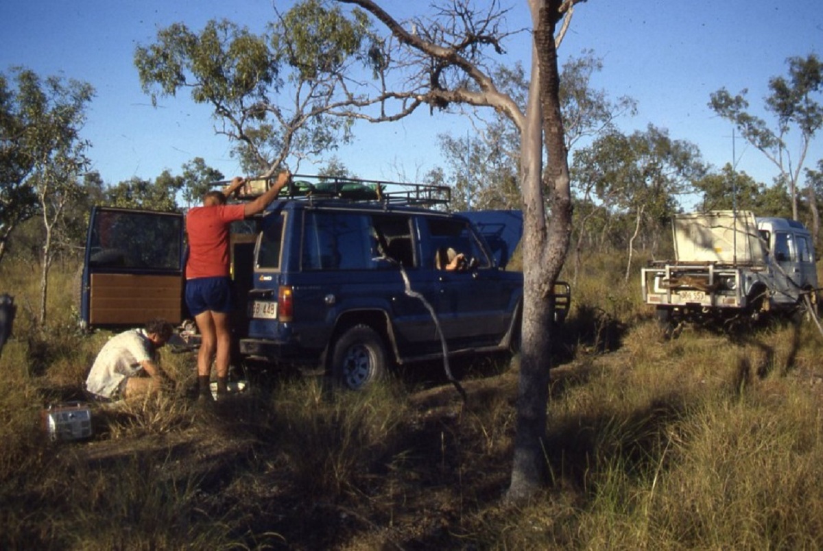
We shopped around and eventually bought an old Landrover Series 3 Station Wagon and a caravan with a pop-up bed. Judith hated the caravan and I disliked the Landrover. Nevertheless, we had to put our dislikes aside and get on with it. We stayed in a caravan park for a week while we waited for our box to be unloaded from the container it had been transported in.
Broome
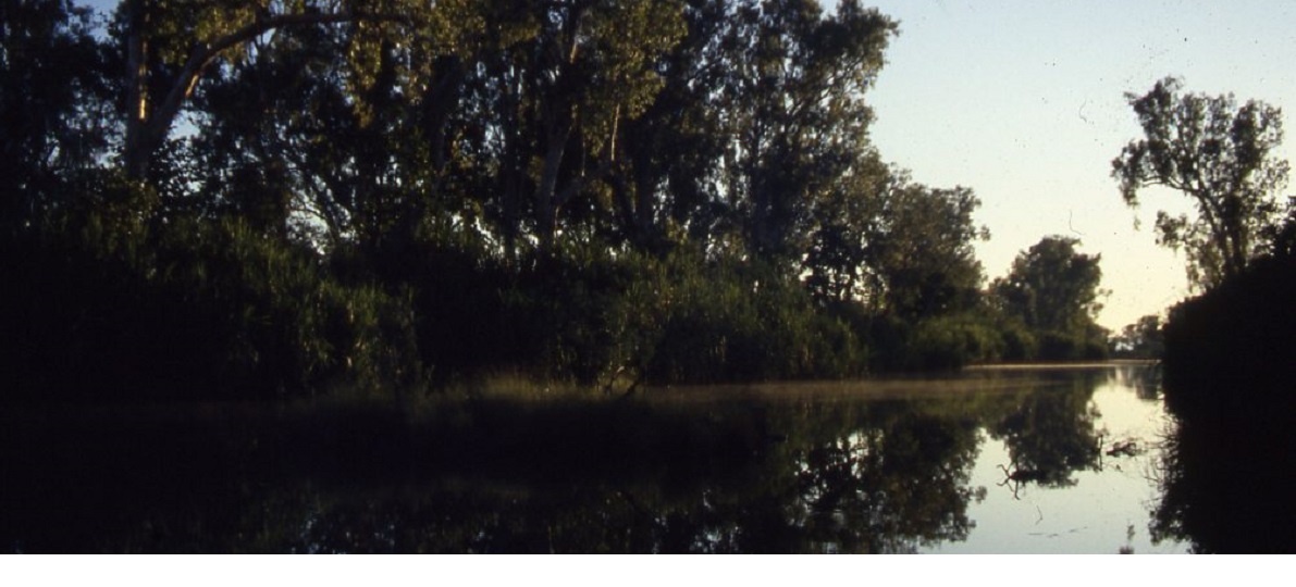
At last we were on the road heading north. We took a couple of weeks to get to Broome and then decided to stay there for a while. I had the phone company Telecom come and install a phone and then we were all set up in a shady spot in the caravan park. Life went on.
We became involved doing small manual labour and video jobs for Lord Alastair McAlpine, the British entrepreneur businessman from who was developing a Wildlife Park and some residential projects. About a month later we became involved with the tourist promotion association and both of us started working on a Welcome Tourist Booklet. About two weeks into this project Judith experienced rather amorous attention from a local and when he was told to bugger-off, he persisted. So, we packed our van and pulled the pin and took off for Darwin.
Darwin
In Darwin my mate George wanted me to paint the roof and the top caps on the outer walls of his units. The roof was OK as I did the middle area first. Then I lay an extension ladder up against the wall with the bottom legs firmly set into the car port roof to paint the wall and the caps. But I had to stand on the top rung of the ladder to reach the top caps of the wall and it was then that the ladder gave way. I tumbled down the roof, getting mixed up with the ladder with my shin and with paint from the full 4 litre paint tin. Red paint and blood from my leg mixed freely. The ladder bounced off the carport roof and clattered to the ground. I followed with the paint tin still swinging in my hand, bounced on to the carport roof causing two panels to bend slightly and rolled along stopping at the edge of the roof. My leg hurt and I was dazed. I looked at my shin and could see the shinbone with dark blood oozing through the paint. All was quiet as there was no one around.
Then I saw a man on the third floor outside walkway of the units behind where I lay and I called out to him. It took a while for him to register and then he saw me as I waved.
At first, he cried, “Oh No!” but I assured him that it was mostly paint and asked if he could come down and put the ladder up for me. This he did after walking down three flights of stairs, going out into the street and then walking around the building where I was lying to manhandle the ladder so that I could get down off the carport roof. I thanked him and told him that I would take myself to the hospital after I had cleaned up a bit.
I drove back to the house. The girls also got a fright when they saw me but Judith, being ever practical, told me to strip my paint clothes off and brought me some clean gear while I washed the water-based paint out of my hair and beard and exposed limbs.
We drove to the hospital Emergency Entrance where a nurse took one look at my leg, put me on a bed and wheeled me into the Emergency Theatre where my wounds were cleaned up. The cuts to my arms and head were superficial and only needed bandages but my leg received a number of injections and 21 stitches!
I lay up for a couple of weeks after that.
Then I started getting restless, and we took to the road again. This time to Cairns.
Cairns
I should have known better than to go to Cairns as Queensland employers were renowned for underpaying their staff. I thought of setting up a business just cleaning shop windows. I bought a bucket and some squeegees and flannel rags and I picked up some work but it would take a long while to build up clients as there was opposition and the shopkeepers were reticent in paying for work done. I was registered at the Commonwealth Employment Service and one day they left a message at the caravan park where we were staying to say that there may be a job opportunity for us both on a station. We had two interviews and the upshot was that these people were starting a tourist venture on their station and wanted workers with tourism experience.
In the mean time I met a pommy bloke who was very interested in my Landrover and offered swap his Nissan Patrol G60 for it. I said OK and the deal was done and he paid for all the transfer costs.
Burketown
We packed up and made for Escott Station in the Gulf Region, between Burketown and Doomagee. The owners wanted to start a tourist camping venture and we were to set it up. Our camp was 18 kilometres from the Homestead. We set up a vegie garden, our caravan on site and installed 6 luxury tents with beds. Now we were to wait until the Dry season for the tourists to start travelling. We used to go to the Homestead on a Saturday night for a drink in the bar or to buy stuff from the shop. The owns were difficult people to deal with. You were hard pressed getting them in to a conversation. On our way in one Saturday I saw a mob of wild pigs on the track and started chasing them with the Nissan. They got away but I found one piglet on the tack presumably dead and put it in the back of our truck. On the way back that evening the ‘dead’ piglet came alive again and squealed in the back of the truck. I threw some blanket over it and it quietened down. We left it in the truck for the night and the following morning I built a rough pen for ‘Pigsy’ and placed it in there. Judith started feeding it and after about two weeks ‘Pigsy’ was tame. We let her out to roam around but had to keep her away from the vegie patch. She followed Judith around every where she walked. She came into the van and slept on some old blankets in a corner under the table. One night, she woke us up squealing as wild pigs were nearby. I jumped outside with my rifle to send them off or knock one over but they disappeared into the night. I built another fence around our precious garden with some droppers and a straining fork which I found lying amongst some of the rubbish left behind from previous mustering camps.
After about three months we went in on a Saturday night and I asked when we were going to get paid as we were now running low on money. The owners said “There’s no pay here, mate. Everyone here is on the Dole” I said that our payments had been cancelled as we took on this job. We paid our own way there and I figured that they owed us $3000 before tax. I said” But you have brought us here on false pretences. It is illegal to employ someone and not pay them” The owners took us aside and said that if we didn’t like it, we could piss-off. I said OK but you will still owe us and we will come and collect our cheque on the way past. We had nowhere to go with “Pigsy” and left her on the station in a pig pen and the station mechanic said that he would feed her until the time was right. We packed up the van and we were sad to leave our spot on the edge of the Nicholson River. It was a Monday and we stopped at the Homestead and we were given a cheque for $1800 and told that they did not have more money. Take it or leave it. I took the cheque and we drove the 30 kilometres in to Burketown. At the post office we cashed the cheque. The Postmistress gave us a ‘chit’ to take to the Pub over the road to get the money as they had lots of cash on hand. One the way back to our car the Postmistress called us over to tell us that we were two minutes ahead of the Escott Station owners as they rang to cancel the cheque. We needed a spare tyre and went to the hardware store where the owners would not sell anything to us and told us to leave the premises. It was time to head out of Burketown.
We drove quietly away through the long grass which by now had covered the road as there had been little traffic in to Burketown. We camped near a creek and the mozzies drove us insane. The next day I managed to get a second hand spare at the Burke and Wills Roadhouse and we camped in the caravan park at Julia Creek that night. I put a tube in the spare tyre and we had a proper spare wheel again.
The following day we heard a grinding noise from the rear of the old Nissan and I guessed that the wheel-bearing and input shaft had broken in the differential. I climbed underneath and removed the rear driveshaft. I shifted the gears into four-wheel drive mode, locked the hubs and we continued on quietly all the way to Cloncurry.
The next morning, I tried to find a Nissan dealer in Queensland but after a number of blanks I went to the towns electrician who also sold cars on the side. We did a deal. I gave him the Nissan and $250 and he gave me a Valiant Station Wagon which we dubbed the Queen Mary. It had rego and all and looked good for an old car.
It got us back to Darwin.
DARWIN 1986 to 1992
We arrived in Darwin and set up camp at Frank Morandini’s Park at Buffalo Creek. We had a good site.
Judith dropped in to the NT News to catch up with some friends and was offered a job straight away. At least we would have some money coming in. She drove the Queen Mary to work and in the traffic all cars gave her a wide berth.
I bought a motorbike off a traveller and that became my conveyance for some time. It was dry season now and the bike went well.
One day the washing machine would not work. I took it outside on to the grass and found a Children’s Python in the. I pulled it out with great care. Holding the snake behind it head it wrapped itself around my arm. I was looking for a victim to play a trick on and found two older people sitting down in the shade. Walked over and the lady shrieked and tried to run away. I told her that the snake was harmless. I eventually took the snake to the perimeter fence and let it slither out towards the swamp. The couple I scared with the snake became our friends and we have kept contact over the years.
I did some odd jobs here and there and started buying and selling old cars which I bought at Garage Sales.
We left the caravan park and rented one of George’s unit again. I sold the van and a string of old bombs and was putting money away for a rainy day. One day I bumped in to Jeff Hardwick, then President of the Motor Traders Association and he told me that they knew what I was up to and that I had to stop doing it or rent land for a car yard and pay association fees. I stopped doing it.
I started doing odd jobs again but now I needed wheels. We bought a new Suzuki High Roof 4×4 for Judith and so I was using the Queen Mary. But then I sold that as well and bought a Daihatsu 4×4. Then one day Bill Solomon asked me if I would come and do some clerical work for Territory 4×4 business in Winnellie for two to three weeks and I was there for almost a year.
At this time, we moved to a unit in Packard Street as the rent was a lot cheaper and soon became friends with the neighbours, Trevor and Jan Riley. Later Trevor became Chief Justice of the Northern Territory. On the other side was another local whose boyfriend rode a big off-road bike and every time he took off or returned, he would rev the thing. I had a word with him…nicely, and he stopped doing it. Eventually he left for greener pastures and left us in peace. While we stayed there, we managed to find time to do a bit more travelling.
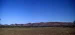
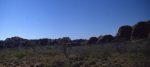
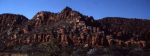
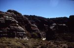
The Kimberley 1986
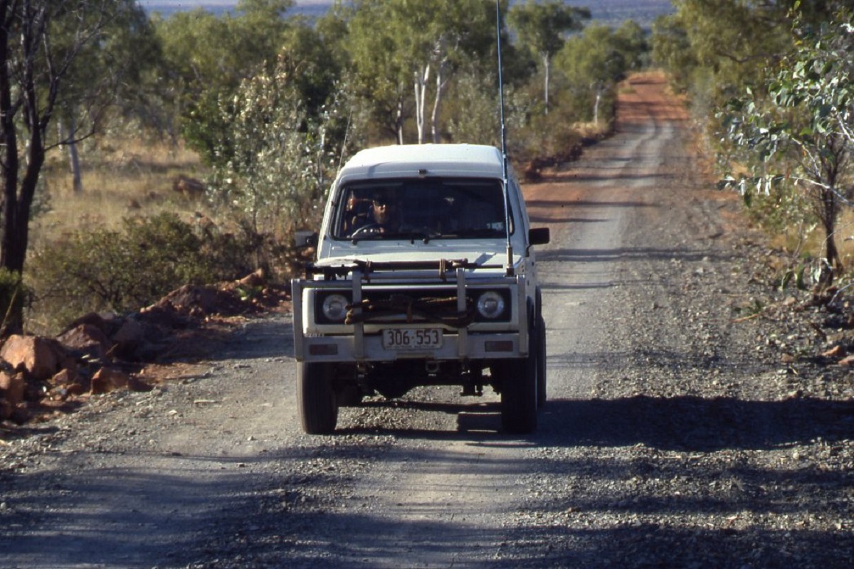
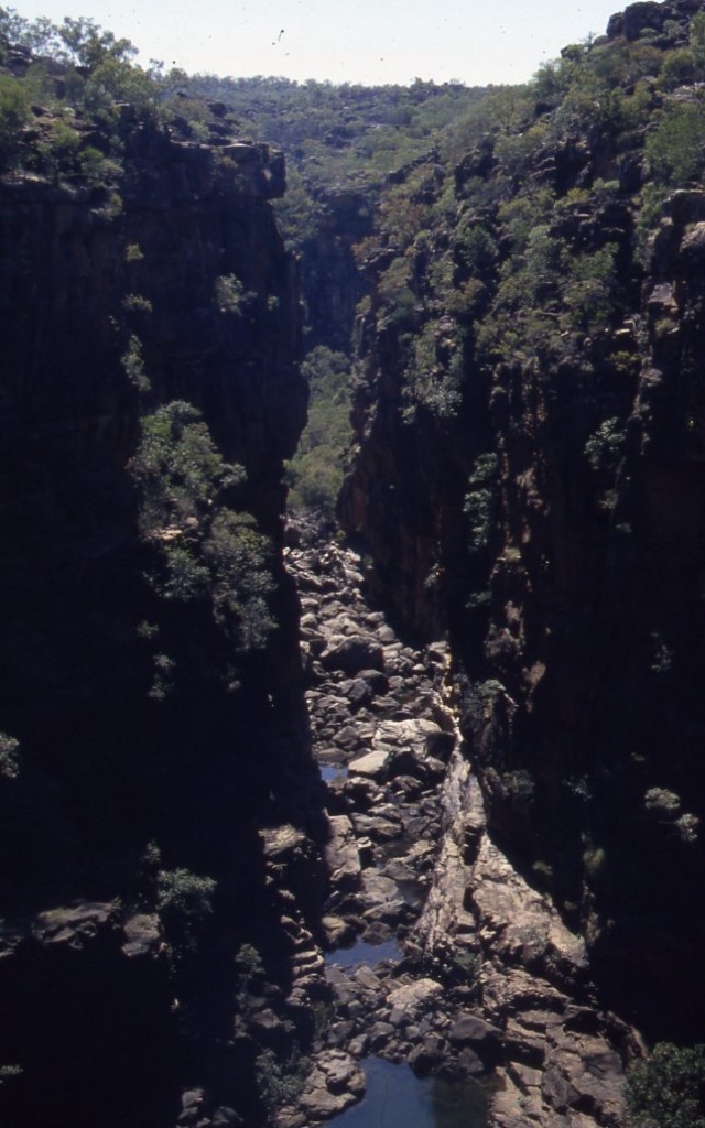
The Gibb River Road had always held a fascination for many overlanders and by reputation it is only a track that services half a dozen large cattle stations and provides a road connection between the towns of Wyndham and Derby. It is graded once a year just after the monsoon or “wet” season and from December to May it is usually impassable due to rising rivers which flow into the Timor Sea to the north.
The Gibb River Road is inherently a four wheel drive or heavy vehicle road and, as it receives very little maintenance at all, around 650km of its length is severely corrugated. Those brave and foolhardy travellers, who have attempted to drive across this unforgiving passage in ordinary cars or those who have towed caravans across it, have suffered the consequences. The attrition rate on these vehicles has been high.
Gibb River Road 1986
The day that we turned on to the Gibb River Road in 1986 was no different to any other day in the middle of the tourist season. It was about mid afternoon and we were heading west into the sun. Although it was July, and winter in the north, the daily temperatures still reached 35C, which are summer temperatures in southern Australia. Both vehicles in our party had been fitted with air-conditioning and that saved some of our sanity as the road conditions were poor. The road was very corrugated and rutted and on most of the middle road surface the top soil had been blown away by the wind, exposing a rocky terrain.
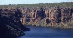
We stopped at the Pentecost River for a breather and to take some photos of the setting sun on the majestic Cockburn Ranges. We had a short chat to some fellow travellers and the common mechanical complaint related to the vehicle suspension. They were driving two Volkswagen Variants and would join the two cars together with a rigid bar when 4×4 was needed.
That evening I found a water hole a few hundred metres off the road and out of sight. Our companions tested out their new hot water shower unit whilst we boiled the billy to fill the plastic shower bag to achieve the same result. That night the dingoes with their mournful melodies, and the braying feral donkeys, kept the light sleepers awake. Just before sunrise a flurry of parrots woke us as they came down to the water for an early morning drink.
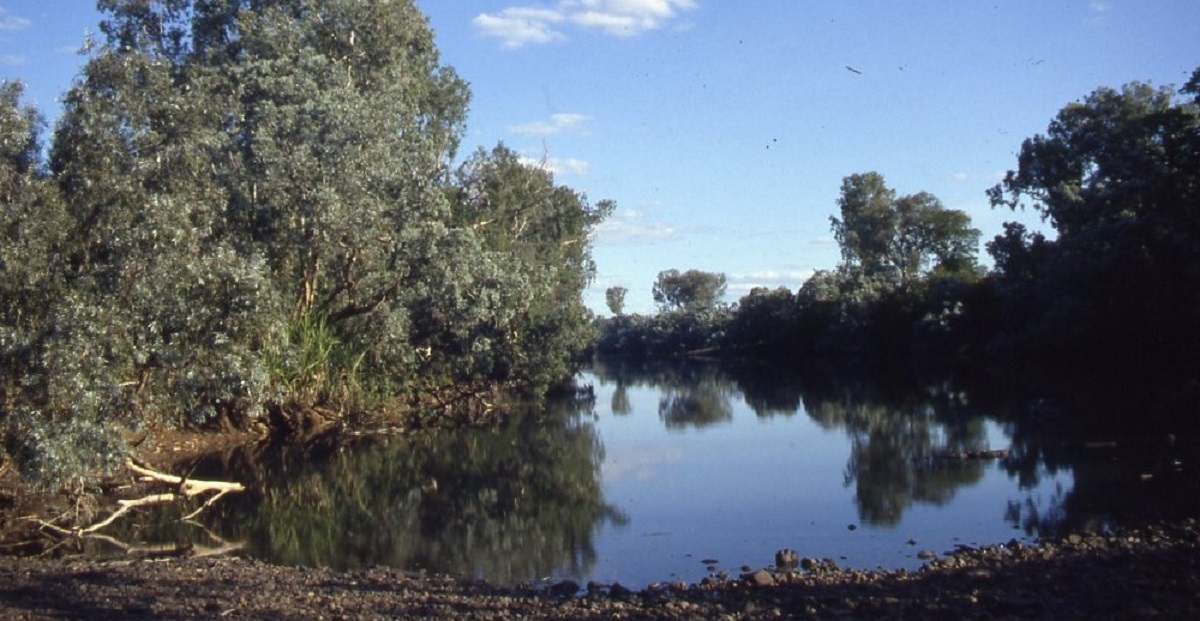
The next stage of our journey took us along the Gibb River Road to the turn off to the Kalumburu Mission Road short of Gibb River Station. Along the way we had passed El Questro and Home Valley Station which cater for tourists in a resort style manner.
Once on the Kalumburu Road it was a short distance to the Drysdale River where we had lunch. Just north of the river crossing lies Drysdale River Station where we stocked up on fuel and some groceries from the store. This station and Kalumburu Mission are the only two fuel and provisions outlets in the Far North Kimberley so care must be taken when working out your supply needs.
Drysdale River
Special permission is required from the Chairman of the Kalumburu Aboriginal Corporation to enter Kalumburu lands and this permission may be obtained via Radio Telephone through Derby Outpost Radio Service.
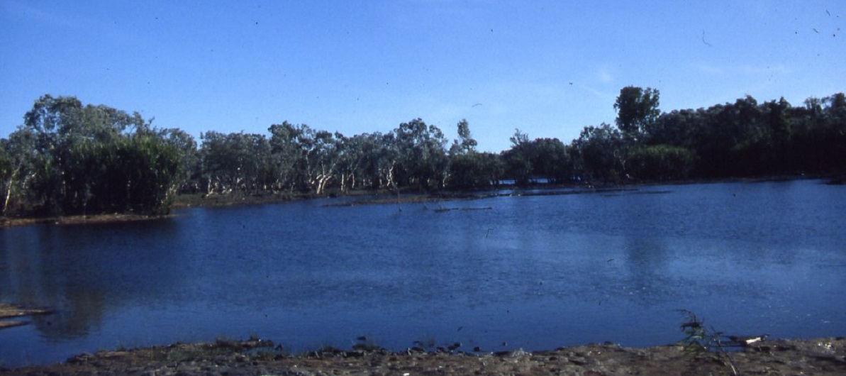
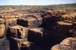
The road north from Drysdale River Station was corrugated for 119km interrupted only occasional sandstone ridges protruding from the road surface. These ridges had to be driven over with care. We turned off towards the Mitchell Plateau along a track marked by an old fuel drum. Seven kilometres along this very washed out track we came to the King Edward River and found a place to camp for the night.
The Mitchell Plateau contains many reminders of aboriginal occupation, as there are numerous art sites throughout the ranges and creeks of the plateau. The first recorded European contact of the area was made by Captain Phillip Parker King between 1821 and 1822. King named the natural harbour on Admiralty Gulf ‘Port Warrender’. In 1921 Robert Easton led a state government expedition into the North Kimberley country and was the first European to traverse the plateau. Easton named the Mitchell River after Sir James Mitchell, the then Premier of Western Australia. John Morgan surveyed the route from Gibb River Station to Kalumburu Mission in 1955. Then in 1965 extensive bauxite deposits were discovered by AMAX Exploration teams led by Ken Malcolm. He named the Mitchell Plateau after the Mitchell River and Mertens Falls after the zoologist Robert Mertens who discovered a specie of lizard.
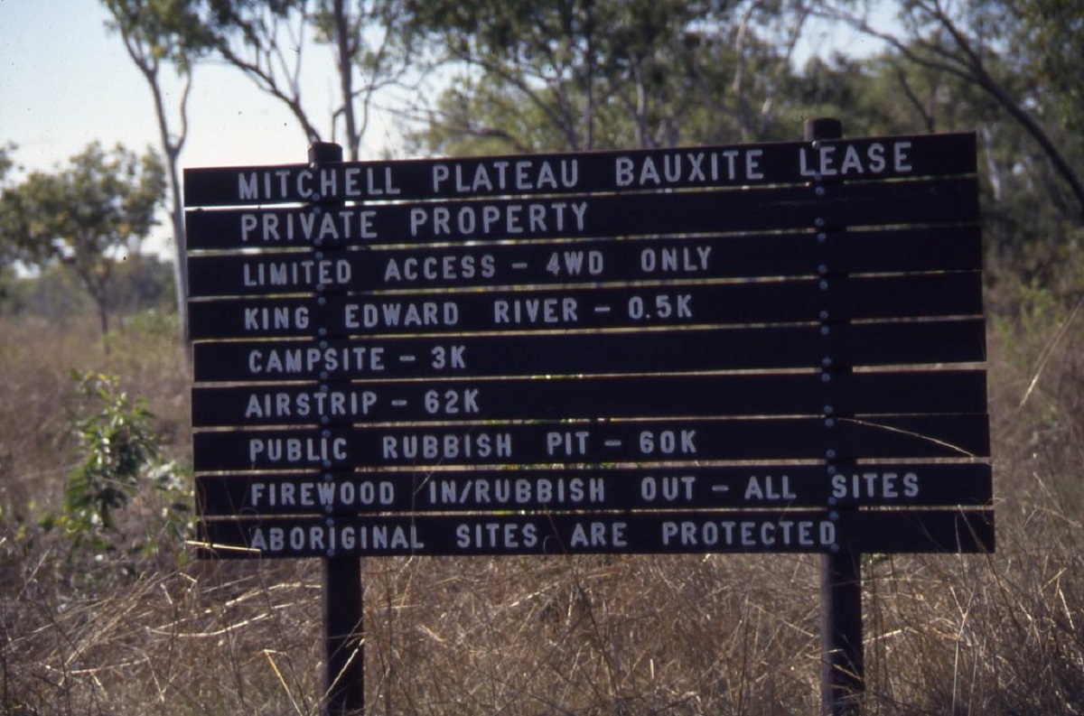
Mitchell Plateau sign
In 1980 the bauxite deposits were acquired under lease by the Mitchell Plateau Bauxite Company, a division of Conzinc Riotinto Australia (CRA) and for a while they have managed the public access into the area whilst doing further exploration. CRA relinquished it’s lease in 1986 and while much of the area is still under mining lease, two large areas around Mitchell Falls and the Lawley River have been set aside for inclusion into a national park.
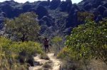
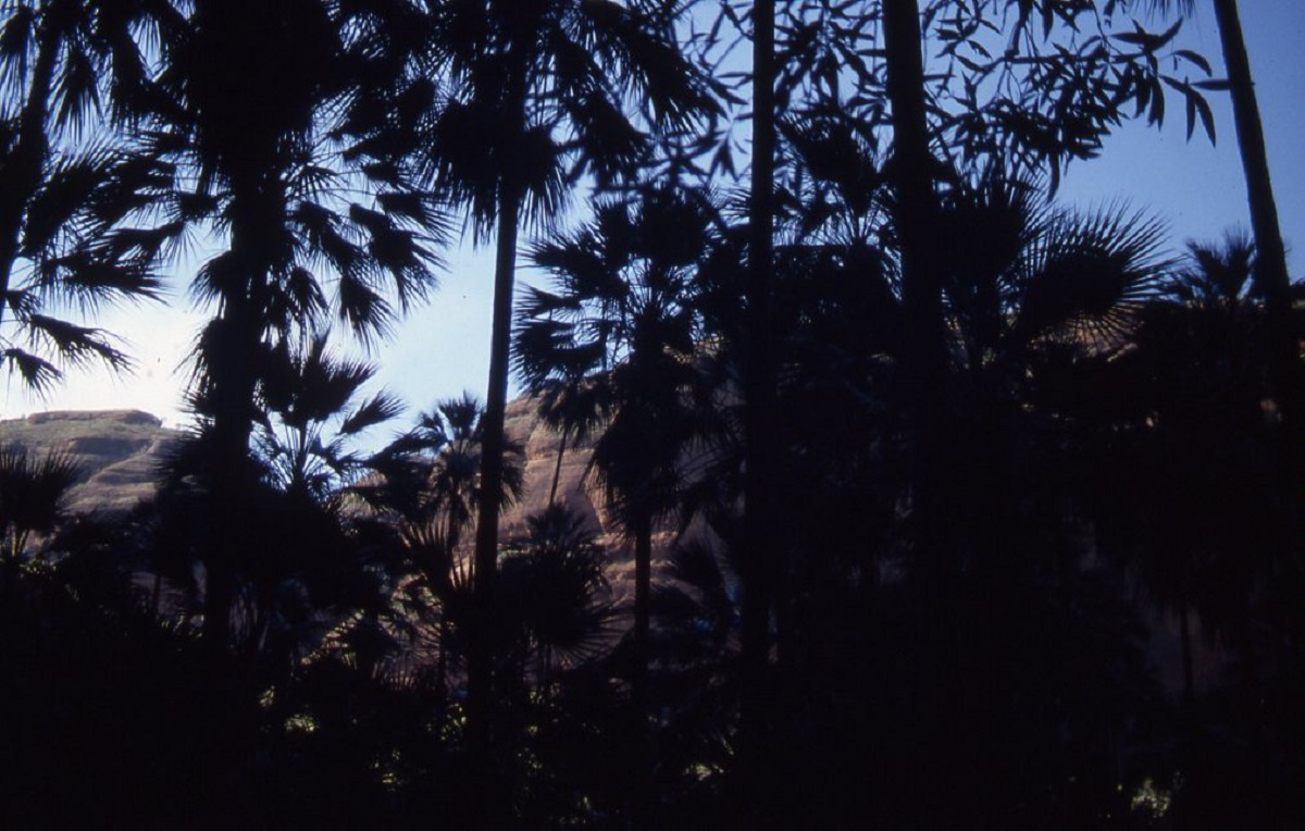
Soon after you leave the King Edward River camp site you rise up onto the plateau. The most striking aspect of the flora is the predominance of ‘livistonia eastonii’ Palms. There are literally millions of these palms growing in this harsh environment. Interspersed among the palms are eucalypts such as Stringybark, Woolibutt and Bloodwood. The soil formation is laterite and rocky ridges criss-cross the surface of the track protruding up 100mm above the ground surface. That is enough to make you bounce in your seat.
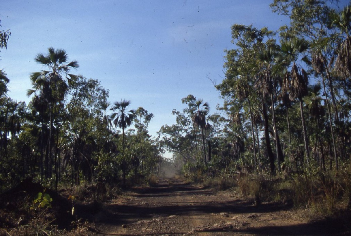
Mitchell Plateau track
The 70km to the old mining camp and caretakers lodge took about two and a half hours to negotiate. We camped near to the old mining buildings but that was not a good site. We would have been better off camping closer to Mitchell Falls.
The following morning we made our way along the 18km track to the start of the walk to Mitchell falls. A sign at the car park stated that it was a six hour return walk! It transpired to be just that. It is an easy walk and most of the time you are walking in the shade under the canopy of eucalypts and palms.

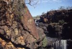
Top of Little Mertens Falls
Big Mertens Gorge
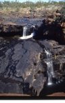
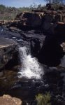
Along the walking track you first pass Little Mertens Falls, then Big Mertens Falls before culminating at Mitchell Falls. There are rock pools along the way for swimming and places to cool off in as well as numerous rock overhangs where we found quite a number of rock paintings in yellow and red ochre.
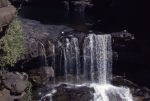
Although we were visiting the area in July which is the ‘dry’ season, we were in luck, as the countryside had had a considerable amount of rain some weeks prior to our visit and the falls were flowing.
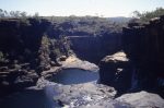
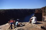
We arrived at Mitchell Falls after a three hour walk and we were entranced by the physical beauty of the place. The falls cascade over a large ledge and through a sink hole in the rock and down five giant steps to a large aquamarine pool at the bottom of the gorge. At the top of the falls there is a large pool in which to cool off and relax and you can clamber around either side of the gorge to get a good photographic position. While we were cooling off the resident Mertens Water Monitor lizard came by to inspect us, totally unafraid of our presence.
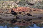
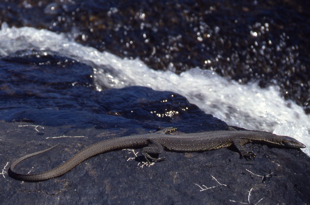
Mertens Water Monitor
Drysdale River National Park must be one of the most remote parks in Australia. We gained entry through Old Theda Station after asking for permission to enter the property from the owner, who just happened to be down at the mustering yards. He told us that there was an old mustering track entering the park from the north and that we were welcome to cross his property and to camp along the track on the Morgan or Carson Rivers which cut through his property.
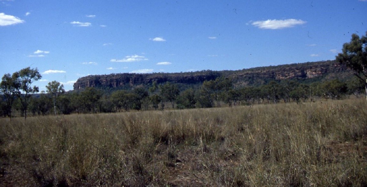
The 31km from Theda Station to the Carson River Escarpment is a pleasant drive albeit slow. We stopped on a hill to admire thousands of very shiny rock crystals. We figured that they were quartz crystals and possibly zircons. At the Carson River, which is also the boundary of the national park, we turned north and soon we were on Carson River station where they were mustering cattle. The mustering crew asked if we could stay out of the area for the next two days until the muster was completed. We acceded to their request and turned back to Old Theda Station and camped by the Morgan River.
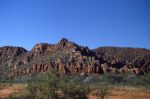
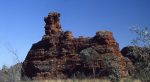
The Northern Kimberley is a very rugged area with numerous harsh mountain ranges, escarpments, gorges and creeks. The countryside is so rugged, it is said, that you could wear out a pair of boots within a week walking through these ranges. It is also cattle country and the bush flies drove us insane. The flora is tropical woodland savannah with eucalypt forests, interspersed with palm, cycads, wattles and grevilleas. The dingoes howled every night and so did the feral donkeys which roam the Kimberley in their thousands. We saw lots of kangaroos as well as wild scrub cattle. Bird life was prolific and in the rivers and streams we saw a number of fresh water crocodiles. Closer to the sea saltwater crocodiles are found in great numbers.
We spent two days on the Morgan River. We fossicked for gemstones, fished for bream and caught some too and baked fresh bush bread in the camp ovens. While scratching around in the river for agates a water snake sent us scurrying in all directions.
Morgan River
Our next camp was on the Carson River near the escarpment. We had found the old track mentioned by the owner of Theda Station, but after about 10km of faint track whilst pushing our way through quite dense scrub, it petered out and we could not even find it on foot. We made camp under some shady trees on the Carson and spent the next day fishing and repairing punctures. We also took a hike up into the escarpment to get a better view of our surroundings. This proved to be quite hazardous as the escarpment is made up of brittle sand stone formations and it is quite dangerous to walk on.
Carson River campsite
Carson River Escarpment
The following day we made for Carson River Station. Close to the homestead we came across the station manager who was driving a truck with a flat tyre and no spare. He was very friendly and after we had plied him with a few cold beers from our fridges, he invited us to camp down on the Drysdale River near Moonlight Yard. He also told us of some spectacular waterfalls on the King George River and that he had only recently bulldozed a track into that area and that only station workers had travelled down that track. We accepted his invitation but had to push on to Kalumburu Mission to refuel, buy some supplies and to take a look at Pago Pago Beach.
Kalumburu Vestry
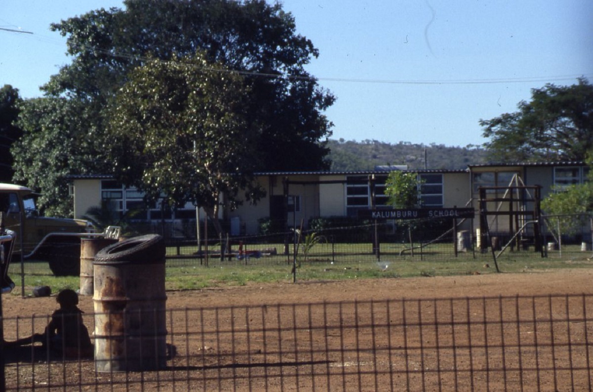
Kalumburu School
Kalumburu Mission is very well maintained with clean surroundings and brightly painted buildings. At the supermarket and art shop we spent some time and money and also met the chairman of the Kalumburu Aboriginal Corporation. Everyone was very friendly and helpful and pointed us in the right direction to Pago Pago ruins and beach.
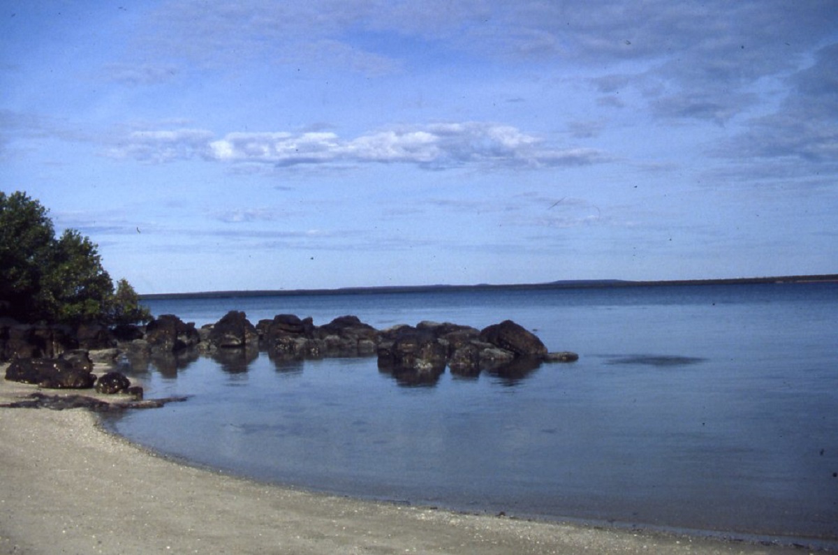
Once there we spent a lazy day fishing and eating oysters off the rocks. I managed to bog the Suzuki on the sandy approach to the beach but a winch job saw us back on hard ground again. Napier Broome Bay has unsurpassed scenery. Tranquil blue waters surrounded by white beaches and green mangroves. A sailing boat glided into the bay while we were relaxing on the beach. We camped that night near the ruins but the mosquitoes attacked us in earnest and we hid in our tents until dawn.

Napier Broome Bay
Oyster rocks at Pago Pago Beach

Hard tyres, soft sand
The next day we made for Carson River Station again. We missed going to Big Jumbo which is a Commonwealth Airfield and was used by Australian and American Aircraft during World War 2.
We made an early start from our camp at Moonlight Yard on the Drysdale River to drive the 117km mustering track to the King George Falls. By 9am I had had the first puncture for the day. Progress was slow along the track and it took us close to four hours to get to the turn off to the falls. The next five kilometres took one and a half hours to traverse and we were in low range second gear for most of the way. Once we were close to the river environs we had another ten minutes walk to the falls. This eastern side of the Kimberleys had not had as much rain as the Mitchell catchment area and the river was not flowing. Nevertheless the scenery was breathtaking. When in flood the King George River flows over these falls and plummets 230 metres into the sea below.

Hard track into King George Falls
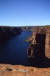
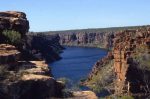
There had been less rain over in this part of the Kimberley and the falls were not flowing this time. The narrow gorge, only a few hundred metres wide, winds its way for many kilometres towards the open sea. It is possible to travel to the base of the falls by boat. We gingerly crept to the edge of the precipice and lay on our stomachs to view the scene below. Hundreds of box jellyfish could be seen floating on the surface and we could see turtle, sharks and a few crocodiles all going about their business. We spent quite a few hours exploring this magical place and taking in the scenery. We also found that the river bed contained agates and we spent some time fossicking for the prettiest stones.
We started our return journey in the late afternoon and on the rough section of the track I staked two tyres simultaneously. Now I had three flat tyres and we were going nowhere.
Puncture repairs
Two and a half hours later, a few cold beers and an encounter with an over inquisitive emu, saw us back on the track. But by now the sun had disappeared behind the horizon and we made our way home in the dark. We arrived at our base camp just before midnight and slept the sleep of the dead!
We spent another day at the Drysdale River doing minor repairs to trailers and suspensions and started on our journey back to Darwin after calling in at Carson River Station homestead again. Our friends had school aged children and were in a hurry to get home and we parted company at the Mitchell Falls turnoff. We continued on at a leisurely pace.
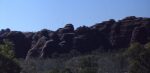
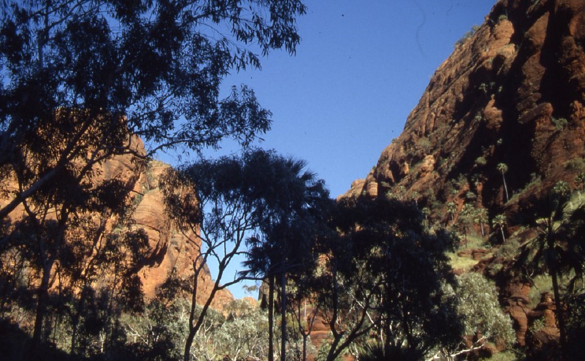
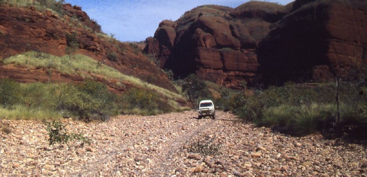
Bungle Bungles / Purnululu 1986

We drove in to the Bungle Bungles after taking the track in to Cattle Creek Yards off the Great Northern Highway. This firm track winds its way through narrow creek beds and quite undulating terrain. I noticed that the wheel tracks in front of us were making small corrugations and it seemed that someone ahead had been making heavy going of this track. Sure enough, at a likely campsite, we found fellow travellers on their first four wheel drive adventure. They had been driving in two wheel drive as they had been unsure on how the front hubs worked. I gave them a quick lesson. We decided to camp there as well for the night. The local resident, a three metre sand goanna, was unimpressed with our intrusion and harassed us until I grabbed a large stick and chased him off. That night a Frogmouth Owl made its calls from just above our tent.
We had heard of the Bungle Bungle weathered rock formations in the Osmand Range, and known as Purnululu by the Gija Aboriginal Group of the the East Kimberley a few years earlier, when an acquaintance flew into this area by helicopter just by chance. It had been know by the indigenous peoples for thousands of years and by white Cattle Farmers for a 150 years but not in the context of it being of heritage significance. ‘Discovered’ again in the early 1980’s by a film crew flying over the area, moves were afoot to declare it a National Park and we though it best to go and have a look before all sorts of unnecessary restrictions were imposed.
In the morning we made for Piccaninny Creek and after a couple of hours we got to the end of the track. We could have gone further but that would have meant some very hard off roading and with no back up I was not in the mood for it. So we left the vehicle and walked in and, at least 3 kilometres by our reckoning and mindful not to get lost, around these spectacular sandstone domes.
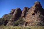
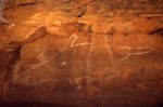
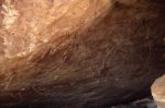
Back at the vehicle more travellers arrived with horror stories of the track in from Turkey Creek. This fellow had a spare fuel tank on the roof rack of his vehicle and the higher centre of gravity almost sent him over. Luckily there was a tree in the right spot and his vehicle just leant against it. We disengaged ourselves from these travellers and made for the track to Turkey Creek. We stopped at the Bungle Bungle Outstation Ruins and then found the entrance to a large gorge off Red Rock Creek. There was a faint track over the millions of river stones and we decided to explore. The track eventually petered out but we kept on driving looking for a good camp site. The gorge was spectacular and the most phenomenal feature is the palm trees which grow a hundred metres up along the sheer cliff face of the rock formations. We found a cave with fertility paintings in it. There were no other signs of footprints to indicate recent visitation. Eventually our progress was stopped by the fact the we could not get out of the vehicle as the gorge became so narrow and we had to reverse out for quite a way.
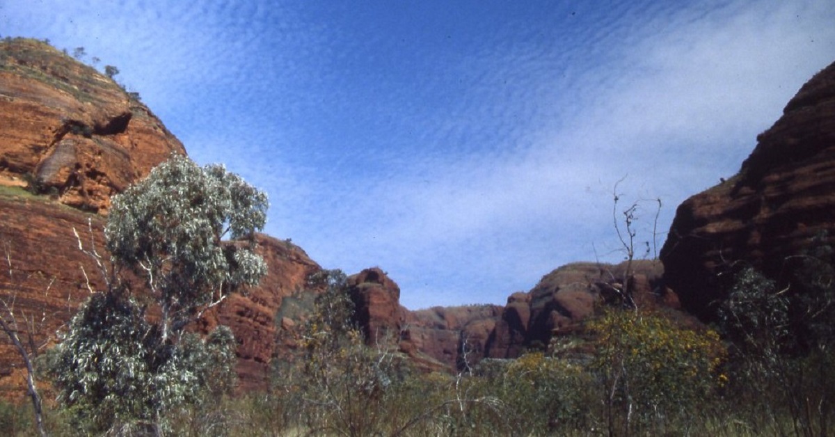
That evening we camped in this magnificent place where every sound was echoed through the valley. In the early morning the birds woke us with their cheerful calls and it was time to move again.
Leaving Red Rock Gorge
Just at the entrance of the gorge a rock formation caught my eye and on closer inspection we found numerous rock paintings which included crocodiles and what looked like stylised platypus.
The track disappeared for a while and we followed a compass bearing along Osmond Creek until we reached Palms Yard as marked on our map. The going was slow and we had to be careful not to stake any more tyres. We passed Winnama Yard and later saw the spot where the top heavy vehicle nearly met with an accident. Not long after that we were on the Texas Downs Station road which was graded and it was a quick run up to Turkey Creek on the Northern Highway.
The Bungle Bungles was declared a National Park on the day that we left the area.
The Far North Kimberley is a fascinating place to visit. It is still very remote and few travellers have ventured into this area on holidays. In the three weeks of our holiday in the Kimberley we only saw a handful of vehicles.
No doubt, this will change in the future.
The Secret Cave 1986
In another life, I was working for the Northern Territory Government. Part of my job was to evaluate the viability of small-scale business ventures in the outback. My travels took me on visits by chartered plane to remote locations in all areas of the Territory.
On one such a visit, to a station south of the Roper River, we were talking about the viability of including Aboriginal input to a tourism venture and in the conversation the station owner casually mentioned an area to the north, where, according to him, and, although he had never been there, a secret cave was to be found. My ears pricked up at this because there is nothing like a bit of adventure and mystery in looking for long lost places or objects. The proponent did mention that it was a very sacred and secret cave and that it had an aura about it, as aboriginal families living on the station had told him.
A while later, some months in fact, I was having a beer with locals in the Katherine Pub and the subject of the secret cave came about again. No definite details of where the place could be were offered but I had studied my maps beforehand and was forming an opinion of a likely location. Then later, by chance, I was at a Photographic Book launch in Darwin one day and whilst paging through the contents of the book saw a photograph named the Secret Cave. So I questioned the photographer about the whereabouts of it. He was very coy at first to state where it was and said that he had been flown over it by helicopter and noticed unusual rock formations along a ridge. I suggested offhand that it might be in an area south of the Roper River and he agreed that it could well be in that area. At last I was making progress!
The pastoral lease covering the land area in question had been resumed by the government some years before, and was for the time being, in the mid 1980’s, unalienated Crown Land. Now with all these snippets of information before me I spoke with a mate of mine in our 4×4 club, and we decided that we should go and have a look for this place. Word got out in the club and soon it was to be a club trip. It was the last long weekend of the year somewhere in September, I recall. Judith and I managed to get some days off from our respective jobs either side of the weekend and we were set for a ten-day holiday in the bush. The plan was that my mate and his family would accompany us earlier in the week and that the club would come down on the weekend. I gave the clubs’ trip leader some details of where to look for a ribbon in a tree or on a shrub by the side of the road.
The first night out we camped at Rocky Bar on the Hodgson River and travelled on early the next morning to look for the track to our perceived destination. Now, there was an old station track marked on my topographical map, but it took us two hours to find it. The track had not been used in years and was very overgrown. We were forced to cut back some shrubs so as to gain access to the track. I left a piece of cloth tied to the shrub for those who were to follow us later. Further along the track we came to a faint track heading northeast, and so we left a marker with stones to show in which direction we had gone. Our progress was slow along this overgrown track as we trundled along towards a wetlands area, which meandered through a natural gap in a low range of hills. The little used track through the gap was very washed out, and we packed stones for over an hour so as to make it driveable. We made camp on the edge of a small billabong. The children in our group had great fun playing games and splashing on the water’s edge. That night around the campfire we could see the red eyes of small freshwater crocodiles lurking in the darkness beyond. We were all a bit more wary of the billabong after that. An old saying though, confirms that if there are lots of freshwater crocodiles around, it is unlikely that an Estuarine Man-eating Crocodile would be nearby.
We spent two days driving through the long grass and walking around the foothills of the ranges looking for a likely cave and although we found some stone artefacts and some overhangs with rock art on them nothing showed up as a cave. We combed both sides of the creek along the lower rock ledges but still found nothing to excite us. Then I noticed a small aperture in the rock face across from the creek. This was the one place we had not searched as yet and it needed investigating. We needed however, to cross the creek, which filtered through the ranges, and formed part of the billabong where we were camped on. The sandstone rock face, which seemed unscaleable, dropped right down to the water’s edge. Thick Pandanus Palms grew either side of the rock face, and knowing of their capability to inflict serious prickle wounds, the destination seemed difficult to reach. We had to walk upstream for close on a kilometre before finding a way across the creek without swimming through crocodile infested waters and then made our way back towards where we had seen the hole on the wall. Some rock hopping was necessary and once we had climbed the small escarpment we found ourselves looking at a small pound surrounded by weird tower-like sandstone structures. At one end of this enclosed valley, we could see a low opening in the rock face, and so, with much anticipation, we made for that feature.
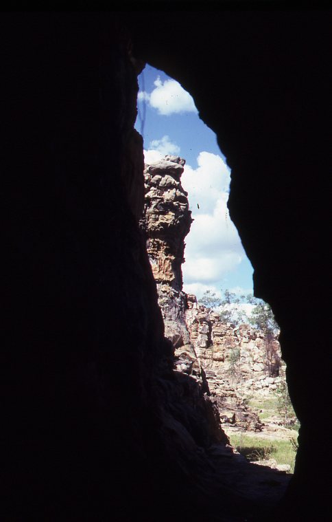
The window
The Secret Cave must have been a relic dating back to the days when the earth was still forming. The cave could have been part of a small lava flow rushing through the sandstone valley some millions of years ago. It is about 50 metres long and about 1.5 metres in height and on average 5 metres wide. It is open at both ends and in the middle of it there is a west window, an east facing aperture in the cave wall and a hole in the roof. These holes in the rock dome could have been made by trees caught up in a lava flow, and either burnt out or rotted away over time. It made for a perfect shelter by modern standards with entrances both sides, windows and a smoke outlet to boot.
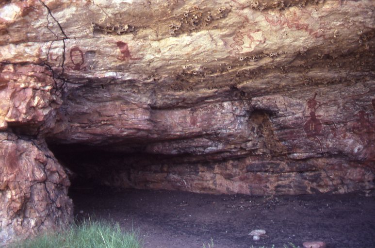
The entrance
The table
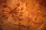
The cave floor had no human footprints and we ascertained that no one had been there for quite some time. Charcoal lay pretty well much scattered about 100mm thick through out the cave floor. There was a collection of painted bones. We did not see any human skulls but having researched the subject I knew that the ancients all over the
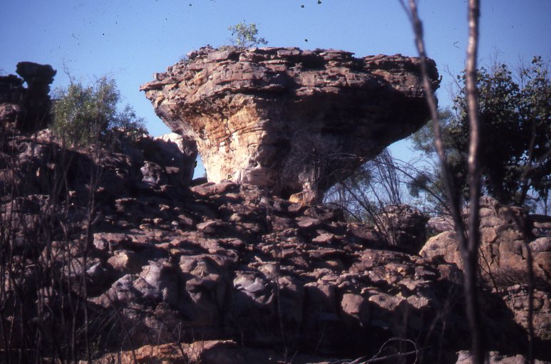
world, painted the bones, of the long deceased ancestors. There are a number of very nice rock paintings depicting mystical figures and we formed the opinion that this might have been a ceremonial cave. We must have spent and hour or so looking around the cave and savouring the ancient ambience of the place. Outside the northern entrance a tall sandstone pillar almost depicts a human face. When we left the cave we used some clumps of grass to sweep away any evidence of our footprints, so as to leave the cave as we had found it. That evening we had a long discussion about the ancients and how they must have lived their lives in this land so rich in resources of food and shelter. The cave is within a natural walled enclosure and it cannot be seen from ground level.
The Sentinel
It was lucky that for us the other club members never saw the piece of cloth which I had left on the side of the road to indicate where we had turned off, as we would not have liked people tramping all over this special place. I have never divulged the exact location of this cave.
In the year 2000 a Native Title determination was made to the Wandarang, Alawa, Marra and Ngalakan Peoples and that land encompasses the area of the Secret Cave. It has recently been included inside the Limmen National Park boundaries and is out of bounds for access.
The Spinifex Trail 1987
A 1987 Expedition: First published in 4×4 Australia Magazine 1988. Republished here 2002. Updated photos 2016
We had always nurtured the notion to visit the Simpson Desert since the early seventies when we started exploring Australia. Somehow the trip was moved back time and time again as we explored the far north instead. Magical names like “French Line” and “QAA Line”, “Poeppel Corner” and “Big Red’ milled around our heads as we dreamed about what it would be like out there.
Having been mildly lost once on the fringe of the Gibson Desert and having done a great journey through the Namib Desert on the west coast of Africa, our plans formulated for a trip of a lifetime down through the Simpson. As fate would have it, by the time we started planning our journey, just about everyone had been through and across the desert, and we, being avid off-roaders, decided that there just had to be that little extra challenge.
After reading books by Cecil Madigan and Warren Bonython and a recent article by Dennis Bartell, we decided to visit the Geographical Centre of the Simpson Desert and to do a north/south crossing. Now this centre, rightly or wrongly, has been suggested to be Latitude 25 degrees 22 minutes South and Longitude 137 degrees 5 minutes east, by Messrs Bonython and Bartell and for our purpose we chose that position.
The plan was to enter the desert by way of an access track through Atula Station in the Northern Territory, and drive on a compass bearing to the centre, then take the shortest route to Poeppel Corner, where three States meet and then head off along the French Line, the QAA line and Big Red to Birdsville.
At first we had mobs of takers for the trip. When one mentioned the Simpson eyes lit up and all were in readiness to take off at that minute. When, however, we gave further details of the proposed journey, participants died away like the wind at sunset. In the end it was only ourselves and our friend, Dave Hodgkinson, who were to brave the elements driving our Suzuki Sierra 1.3’s across the wilderness.
Heavy going across the spinifex
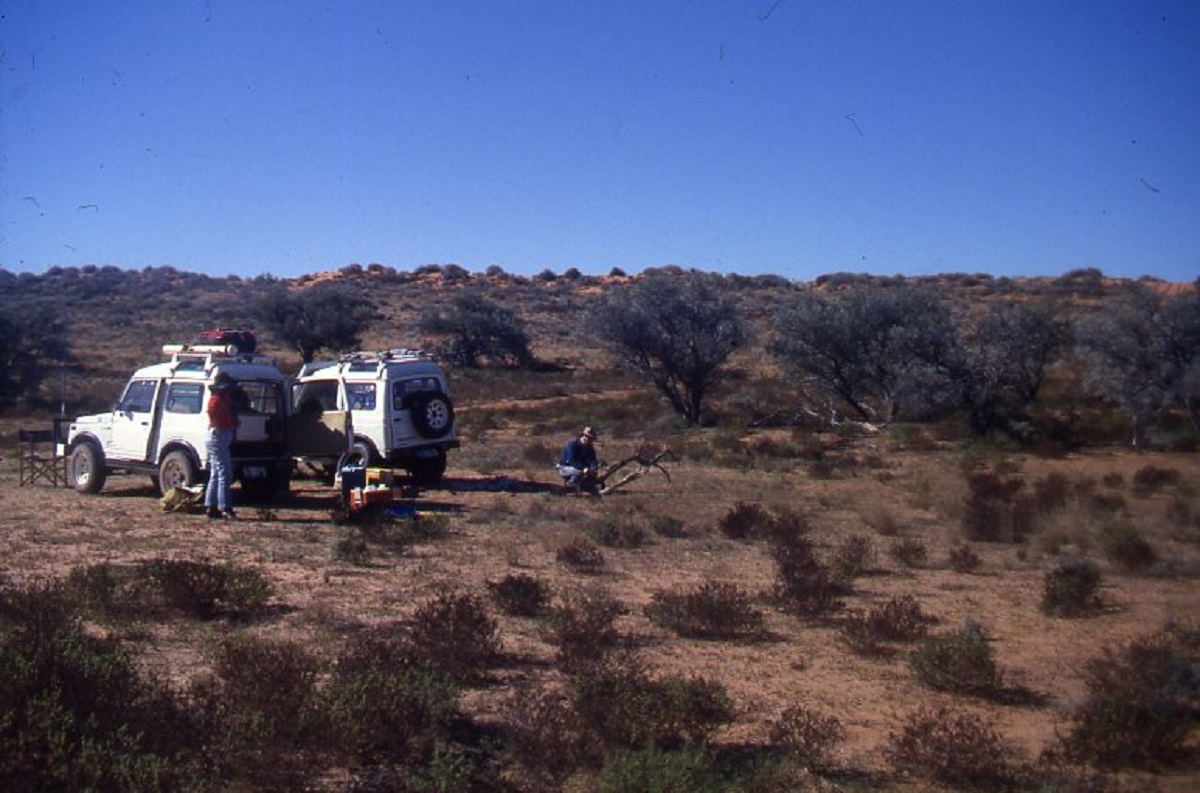
It had taken twelve months of careful planning for all requirements such as fuel and water quantities, food, spares, tools and pre-trip repairs. We replaced wheel bearings and kingpin bearings on both vehicles. Dave replaced his original suspension with a Lovells kit whilst I had the springs reset by the local spring works, keeping the original shock absorbers which were still in good condition. Our Suzuki was using a bit of oil as a result of high mileage in a short time as well as being used for mud racing on weekends and so we replaced the oil rings. The bearings were still in good condition and are still in use today.
I had estimated that at the worst we should not use more than 20 litres per 100km and that the maximum distance from Jervois Station (last fuel stop) to Birdsville would be 800km.( I was to be proved wrong on the fuel consumption). So we carried 160 litres of petrol each, 50 litres of water each, three spare tubes each, one spare casing each, enough patches for 50 punctures, one front and one rear main spring leaf, HF Outpost Radio Telephone, sextant, small computer, spare wheel bearings, rubbers, nuts, bolts, and all the other paraphernalia which you have to carry when you venture off into the unknown. Fit all of that, plus enough food for 21 days, cooking and camping gear, as well as camera equipment, reference books and winter woolies into a Suzuki Sierra 1.3 High roof and you have a minor headache on your hands. We made up a frame to carry six jerry cans behind the front seats to give us the fuel capacity. We had already installed stainless steel water tanks and a alloy tucker box which I had built myself as well as an inside roof rack to accommodate clothes etc in the space made by the high roof. We must have done 40 to 50 trial packs before hitting the right combination.
Hung up
We left a detailed trip schedule with Judith’s employer with an emergency date of the 10th of July. If he had not heard from us by that time then they had better activate a search party. I don’t think that her work mates took this thing quite seriously. With all this organising under our belts we set off for the Simpson.
I had obtained permission from the owners of Atula Station on the fringe of the Simpson, to cross their property and to draw water from the last bore before entering the desert. We arrived at Atula Station on the morning of the 30th June 1987, a day later than anticipated. While we were busy shutting a gate a Landcruiser came boring down on us. It was the Andersons. “You’re late” said Mrs. Anderson. “We expected you yesterday. I had it written in my diary”. After introductions and pleasantries the Andersons gave us valuable information with regards to the area we were venturing in to. They also told us that they thought that we were nuts attempting such a journey but that we had the right vehicles for the job. They used 5 Suzukis for their mustering needs. At least there was some encouragement!!
That afternoon we spent our time at Bore no.6, about 80 kilometres south of the homestead. We did all the necessary washing, filled our water containers and had the last shower we were to have for a week.
Around the bore the flies drove us insane but the thousands of budgerigars and zebra finches that flocked to the water made up for anything else. It was not long before they got used to our presence and the cameras clicked away. An old Chevy Blitz lay nearby in ruin and we wondered what it’s history was. Then we set off to look for a camp site near the electric fence on the boundary of the property. Along the way we were to look out for the remnants of a Bluestreak rocket which was fired from the Woomera Rocket Range in 1966.The electric fence is charged up to 8000 volts by two solar panels and runs for 12 kilometres across the dune channels. It’s main function is to scare off marauding wild camels. According to Roy Anderson it was not very effective as the camels got smart and walked to the end of the fence and around. We saw groups of camels inside the property boundary. A dead camel which has been zapped by the volts was lying near the fence.
Part of Bluestreak Rocket
It was just on dark when we arrived at the fence and after a long day we were asleep before the stars lit up. Normally we drive until 4pm in the afternoon which gives time to set up camp and to relax as well as a vehicle inspection for cracks and things which have rattled loose. When on main thoroughfares we normally leave the road and head bush for at least 2km for safety reasons. You can still do that in the Territory as fences are few and far between and as long as you take your rubbish with you and extinguish that camp fire.
Day two and we rose early and went looking for the rocket. A marked track showed us the way. After the obligatory pics were taken we turned the vehicles around, took a compass bearing due west, held the steering wheel firmly and drove off straight into the spinifex and red dune country.
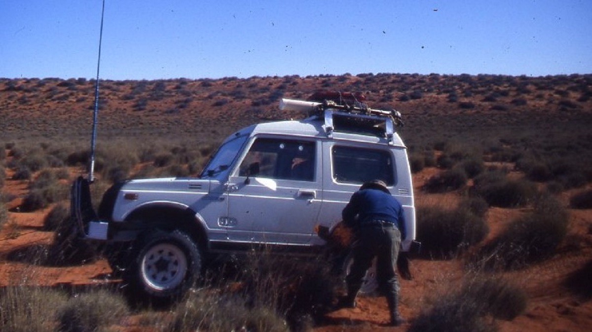
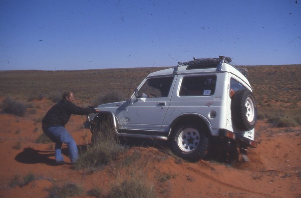
By the tenth sand ridge we started to get an inkling of an idea of what our trip was going to be like. Dave gave us a forlorn look and asked “Can I go home now, please?”. The sand ridges were becoming dunes and the little spinifex bushes were becoming large spinifex clumps. Within the first two hours I had to winch the Suzuki off a spinifex clump. and we had covered only eight kilometres!!
I was having fun. This was the real thing. We were averaging 4km/h and Judith was hanging on for dear life to the “sissy bar” on the dash. We were lifting wheels on every spinifex clump. The bigger the dunes got the more attempts had to be made to cross over. Our BF Goodrich Mud Terrains were digging in quite a bit but still giving lots of traction. Dave was doing better with his Desert Duellers.
We were heading towards some lakes marked on our maps which we had though might be full of water as good rains had fallen recently. Since the number of birds sighted, as we drove further west, seemed to increase, we expectantly drove over the next dune and the next and the next. Just to see another dune straddling our path.
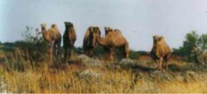
Desert Camels
We made camp at 4pm having progressed 34km for 8 hours of driving. We were totally exhausted. I was due to refuel early in the morning as my gauge was showing close to empty. The day had certainly been eventful and we were thankful for the rest period. We had seen a number of camels during the day and quite a few birds. Now it was time to take some readings with the sextant to pinpoint our position. As we were taking the readings so late in the afternoon our accuracy would be questionable but it would give us an indication of our approximate position. We were asleep by 7.30pm that night.
The following morning the sunrise temperature was .05 degrees Centigrade. Not quite freezing but definitely cold enough for us who reside year round in a tropical climate. A six dog night, we decided.
Survey peg in the middle of nowhere
It was not long before we were back into the spinifex and within a short while Dave radioed for help. He was stuck on a clump. Our Warn 5000lb soon had him moving again. Then I had to refuel. 6.2km/l or 17mpg. Not bad, I thought. But today we were in the big dune country and progress would be slow and a lot harder. We found that the best way up the dunes was to zigzag up the wind blows to be able to reach the dune apex. The spinifex got worse in number and size and we bounced and bounced and bounced. The corridors between the dunes were covered in spinifex, gidgee, grevillea, saltbush, daisies and cassia. We also saw Simpson Desert Seagulls (Crows), budgerigars, galahs, finches, geckos, lizards and more camels. There were lots of dingo and emu tracks to be seen but we never got a glimpse of them at all.
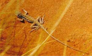
Central Netted Dragon
This day was probably the hardest off-roading we had done for some time. I had to winch up a dune once as we became stuck at a precarious angle near the top. Dave provided the anchor on the other side. My fuel gauge was showing near empty again and I looked under the vehicle for possible leaks. This day we managed 57km. More sextant readings and we see that we are getting closer to our objective. We had missed the lakes however. Well………maybe we will visit them some other time. Not likely says Judith !!
I must say that Judith took all this pounding and jarring to her system, very well. Just the sort of things to make you forget about advertising deadlines. Judith was also responsible for all the meals on the trip and kept us well fed.
The third morning it dewed heavily inside and outside the tents and the temperature dropped to -2 degrees without freezing. We built a big fire of gidgee and tumbleweed to dry out our gear. The tumbleweed burns fiercely, but not for long, as it is severely dried out in the desert air. Luckily there was ample supply for our needs. This day we were hoping to get closer to the centre of the desert. Once again the going was rough but by now we knew what we were doing and could pick out easier driving terrain at a distance. At 2pm that afternoon I had to refuel again. 111km travelled and 37 litres of fuel used. It worked out to 3km/l or 33l/100km ! The gear lever had remained in first gear since leaving the station track. The only lever that had moved was the transfer lever from Low to High and back again.
Stuck on a spinifex clump
I had definitely underestimated the roughness of the terrain. Would we make it to Birdsville? That was a bit of a worry. We took some more sextant readings and estimated that we were about 10km west of the centre of the desert. The following day we found out that we had actually driven over the point that we had calculated as the centre.
Not long after refuelling, Dave yelled out over the radio that he had made a discovery. A very faint seismic track was running north/east, south/west. We were elated in finding reprieve in driving conditions and sped along the track at breakneck speeds of up to 40km/h. Five kilometres further on the track ended abruptly at the base of a large dune. It was time to set up camp again and take more sextant readings. We had covered 63km for the day.
Working up a sweat
Day four and the early morning temperature dropped to -6 Centigrade. Judith had left a wet tea towel out over a bush and it was frozen solid. Both vehicles had ice up to 5mm thick on the roof and bonnet. Even our tent fly was frozen. It was here that our Suzuki’s starter motor started playing up. Sometime during the night a group of camels had walked right through the middle of our camp without touching or knocking anything over. It had been an 8 dog night, we decided.
We spent the morning taking numerous sextant readings including one at noon, to establish our latitude. Previously we had estimated our position incorrectly and with that we had overshot the centre. When we finally pinpointed our objective we packed up camp, put a bottle of champagne on ice in the Engel fridge, and set off for the centre. We retraced our steps for six kilometers along the seismic track and then three kilometres due north.
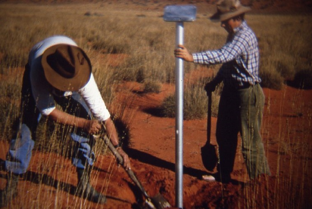
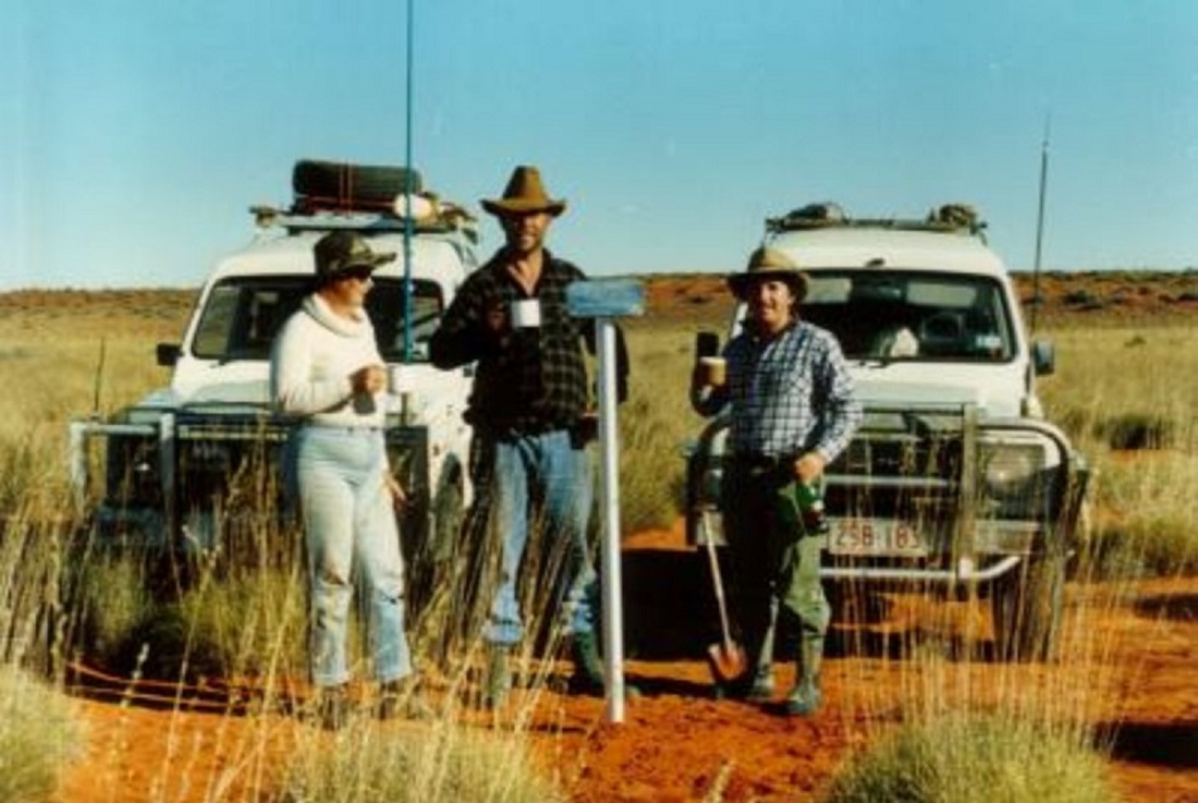
Burying the plaque
At 3pm on 4th July 1987 we planted our aluminium stand and plaque in what we believed was the Geographical Centre of the Simpson Desert. We planted the stand on a spinifex plain in the corridor between two dunes. The tripod was erected, champagne cork popped and many pics taken of us, the vehicle and the stand. We then buried the empty bottle alongside the stand with a message in it.
‘Approximate’ Geo Centre
Back on the seismic track we made 20km before pulling up for the night to camp. We were very pleased with our efforts for the day and had an extra beer each out of our rations.
Day five and we rose quite late at 7am. The temperature was 0 degrees C. Not so cold, we thought, must be getting used to it. Soon we were out along the seismic track and after 5km turned south along a branch line of the track. But this track soon started to veer off in the wrong direction and it was back into the rough stuff again. This day proved to be the roughest of them all. We managed however, to do 60km in our eight hours of driving for the day. There were Suzi size holes in between the spinifex clumps. Driving was horrendous in the endless sea of spinifex. At 4.30pm we managed to find a clearing in the spinifex for our camp site. There I discovered three broken spring leaves on the right rear suspension and it was time to play bush mechanic again. I dug a hole in the sand under the Suzuki so that I could have easier access to the nuts and bolts. I reworked the springs so that I used one of the longer bits that were left over and clamped a front main leaf which we had brought along for emergency purposes to the rear main leaf and managed to get the lot held on by the U-bolts. This did look somewhat like wrought iron work around the porch but it held fast and saw us back to Darwin.

Rough country
Dave was in his element giving me a hard time as he had fitted a new suspension and was getting far better fuel consumption out of his standard carburetor whilst my Weber carby was sucking the juice. I listened to his ramblings while working the spanners under the car. You just wait me lad, thought I, we are not out of the mire yet.
That evening Judith and Dave successfully made beer bread in the camp oven which I enjoyed once I had crawled out of my hole from under the vehicle. It was past midnight when we turned in.
On day six we had covered just eight kilometres when we came upon another seismic track. Now we were following this very faint track. First east, then south, then south east. Rains had fallen in the desert about a month prior and the dunes were covered in fields of yellow and white daisies. There were also many other wild flowers in bloom. The desert was starting to flatten out a bit with wider corridors between the dunes and we had a distinct feeling that we were closing in on Poeppel Corner.
The first salt lakes that we encountered were those of Mirranponga Pongunna. It was good to be able to get into two wheel drive again and in my exuberance to drive on this hard surface I decided to take a short cut across a corner of a small salt lake. I had been warned against such a folly and my actions nearly proved disastrous. We were doing about 100km/h when we broke the surface of the salt crust. From there on it was a frantic down changing of gears and sliding the transfer lever into low range at speed. Doing a huge U-turn and red lining it at 7000rpm we just managed to crawl out of the ooze in four wheel drive on to the hard surface again. This time the mud terrain tyre tread saved the day.

Suzuki’s on Lake Mirranponga Pongunna
At 1.30pm we drove right over the top of the French Line, 27km west of Poeppel Corner. This track proved to be very bumpy probably due to tour operated buses with large wheel diameters or travellers towing trailers. There are also many travellers with high powered vehicles who insist on driving in two wheel drive mode and then axle-tramp corrugations into existence. This makes it quite difficult to get a run up to the top of a dune when it is too chopped up. Nevertheless we reached Poeppel Corner on Monday 6th of July 1987 at 3pm. There I discovered three broken springs on the left rear suspension. Now we had to take it gently gently to Birdsville. Shortly after reaching the QAA line and after having travelled 120km for the day we made camp and luxuriated ourselves with a shower as we still had plenty of water. Mind you, we were a bit on the nose by then.
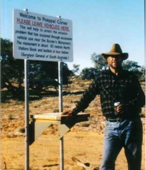
Poeppel Corner
Day seven and we were heading for Birdsville. The QAA line was just as bouncy as the French Line. I had to take things easy with the broken springs and only just made it over some of the higher dunes. Dave sped up ahead. About an hour later we found Dave at the bottom of a dune looking forlorn. Yep! He had broken a right rear main leaf spring. Luckily we still had a spare main leaf and three hours later Dave’s Suzuki was back on the track again. Much sweat and dust was mixed especially changing the pressed metal suspension rubber carrier.
Desert repairs
Then rumble rumble and four Sydney based Range Rovers and a sole Landcruiser trundled over the dune. They stopped for a chat and went on their way again. The first human contact in a week!! We pushed on for Big Red and spotted a large feral cat along the way. It was gone before I could get my hands on the equaliser.
Just before sunset we approached Big Red. Dave made it three quarters of the way up. I made it a little further. The sand at the top was smooth and windblown. So as to save my vehicle from more strain I turned sideways along the dune and powered my way over the top using spinifex and grass for traction and lots of wheel spin. The track on the eastern approach looked easy but we were too tired to play games. Dave followed in my tracks and made it over in one go.
 Crossing Big Red in the late afternoon
Then it was on to the gibber plains and heading for Birdsville. My fuel gauge was nudging towards empty and Dave refuelled from his last jerry can. In our wisdom we decided to wash the salt off our cars by driving through some puddles left by the recent rains. That was the closest we had been to getting bogged for days.
We pulled into Birdsville at 7.30pm on 7th July. It had taken eight days from Jervois Station. I had only 5 litres of fuel left in the tank and all six jerry cans were empty. Dave had quarter tank of fuel left. We had had no punctures for the entire trip.
We were grateful to get the last room in the Birdsville Pub and enjoyed a very good feed there as well. Later that night we raged with some 200 tourists till the wee hours of the morning.
The next morning I managed to obtain some Suzuki spring leaves from Peter Barnes, the local mechanic. They all drive Suzukis out there in the Channel Country. While I did another bush mechanics’ job on the springs, the others wandered around town taking pics and phoning all to say that we had crossed the desert and had arrived safe and well in Birdsville. At midday we said our goodbyes as Dave was heading for Brisbane and we were heading back to Darwin away from the cold weather. Eighty kilometres out of Birdsville the left hand front shock absorber broke in half. I removed it. After that it was plain sailing and we made it back to Darwin in 36 hours for the 2200km.
It had been a very worthwhile experience to drive through the Simpson and I am certainly looking forward to future forays into the desert. I doubt however if my travelling companions feel the same. We have called this way through the Simpson Desert, “The Spinifex Trail”, for all those who may be crazy enough to drive it in the future.
( Our plaque was found for the first reported time, in 2015, by Maurice Joe Baldi , Les Skinner and Dennis Cowling, each driving a vehicle. Joe made contact with me in 2017 and then gave me the co-ordinates to where we placed the plaque. He said that it would nothave been seen but for the angle of the sun at that precise moment. It lies 19 kilometres northwest from the REAL Geographic Centre in the same swale between dunes. I was going to attempt to go out there in 2017 but only got as far as Farina where I became ill and had to turn around and head home where I was convalesced in our hospital for four days with a chest infection. Joe was of the opinion that our plaque will become a good reference point in the future as some Hema Maps show it, as it is. )