Kakadu ..Self ..4×4 Training ..A flying Bow Shackle ..Down along the Douglas ..Cobourg Peninsula ..Litchfield .. Remote Fitzmaurice ..Self ..Adelaide River ..Dreamtime and Diggers ..Self ..Back-up! on Palm Creek ..
Kakadu 1987
Published in 4×4 Australia Magazine 1987
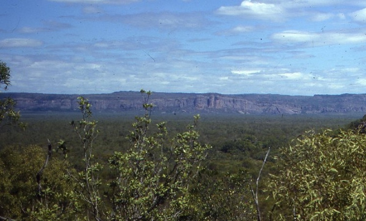
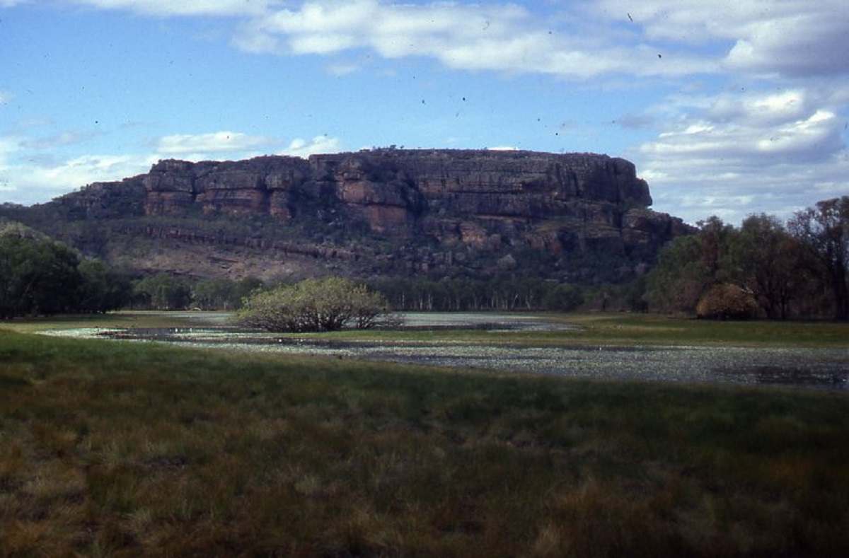
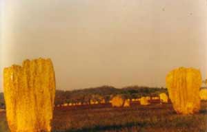
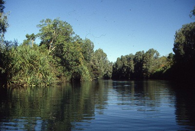
Arnhem Land Escarpment
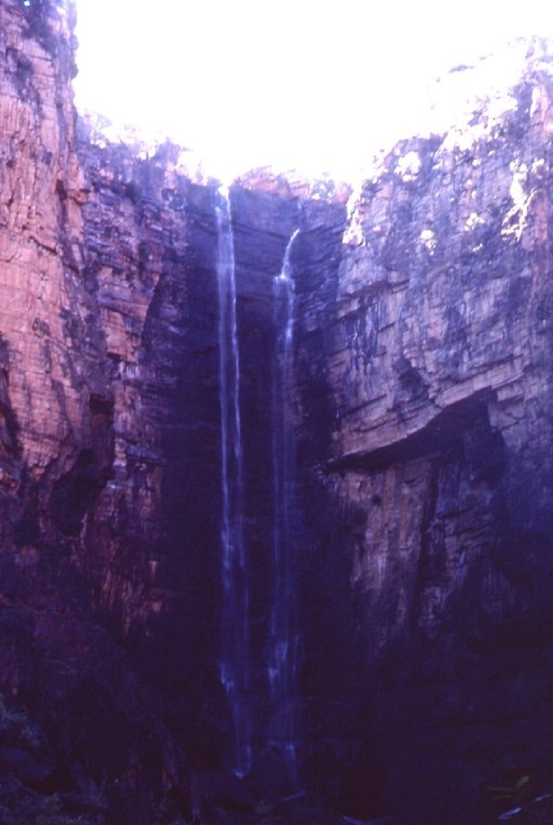
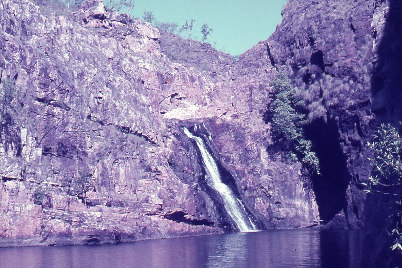
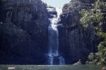
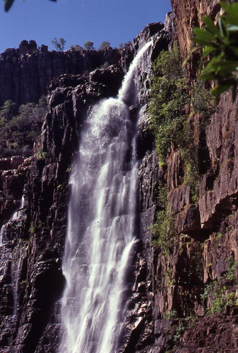
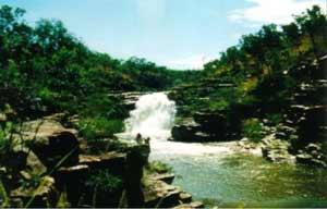
Jim Jim Falls
The Gagudju clan of Aboriginal people has lived in this land for eons. Some would say 40,000 to 50,000 years. This land with its prolific plant life, with its vast expanse of waters, with it’s teeming wildlife. This land with its tropical climate, its large rock shelters, its abundance of food.
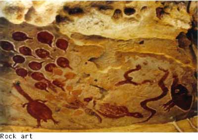
Here the Gagudju lived, loved, procreated, hunted, fished, danced and told campfire stories to their offspring of the DREAMING and the DREAMTIME. The land was good to them and they were good for the land. They taught an oral history to their descendants and left an indelible mark on the rock faces of the Arnhemland escarpment with their stylised X-ray paintings in the pastel colours of ochre.
As the environment around them changed throughout the millennia, so they adapted to these forces and altered their lifestyles. They lived in harmony with nature and became part of the ecosystem of Arnhemland.
Thousands of years marked time in which a deep traditional culture grew as the Gagudju people retold their history and related their dreaming of the Sun, the Moon, the Stars, Fire and Water and the Great Earth Mother, Imberombera, the symbol of fertility and creator of life, the original great ancestress from whom all things emanated.
The first Australians had arrived across the land bridge, which had existed at that time and now formed the big escarpment on the western edge of Arnhemland.
Then, about 3000 years before the present time, the Egyptians sent out world expeditions by land and sea. They skirted the northern coast of Australia and were seen and made contact with the people of Arnhemland. Time passed and then the Macassans from the islands in the Indonesian Archipelago started trading with the peoples of Northern Australia. Then came the Dutch explorers, the French and finally the British.
Our recent history records show that Jan Carstensz, a Dutch navigator, aboard the yacht ‘ Arnhem ‘, first made contact with aborigines in 1623. Then came Pool, Tasman, Dampier, and later, in 1802, Matthew Flinders added some features of the Arnhemland coast to his charts. In the year 1818, Captain Phillip Parker King ‘discovered’ and misnamed the Alligator Rivers. Then in 1845 Ludwig Leichhardt walked across the Australian continent from the city of Brisbane. It took him fifteen months to achieve this goal under trying conditions. He was the first white man to stand on the edge of the Arnhemland escarpment. Over the next 142 years the white man was to leave his impact on the people of Arnhemland forever by being responsible for the destruction of an age-old culture and by decimating the indigenous peoples of the north.
The lush environment, which supported thousands of inhabitants over the ages, was suddenly introduced to the Asian water buffalo, Timor ponies, pigs, camels, goats, horses, donkeys and a variety of exotic flora including salvinia, water hyacinth, mission grass, rubber grass, Para grass, hyptus and the dreaded mimosa pigra.
-
- Deaf Adder Gorge

-
- Lily Lagoon

-
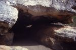
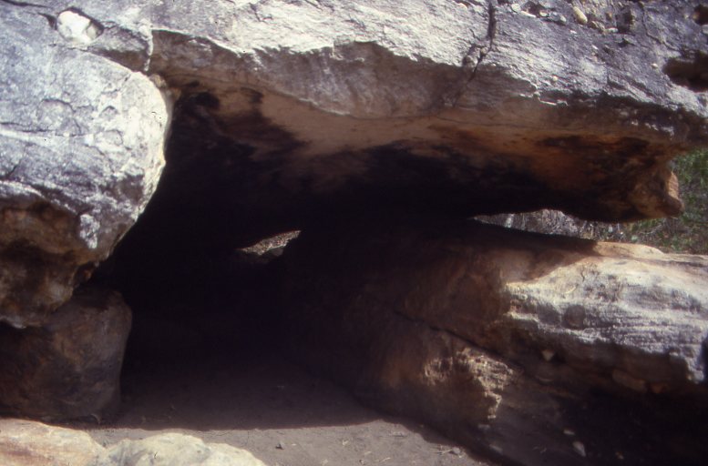
- Ancient Shelter
-
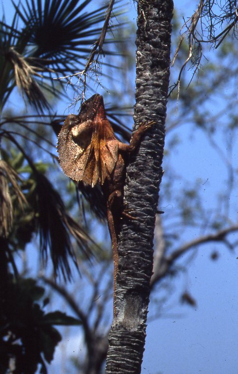
- Frill Neck Lizard
-
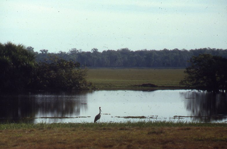
- Jabiru at Ja Ja Waterhole
-
- Maguk/Barramundi Falls
-
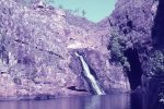
- Gunlom Falls 1977

-
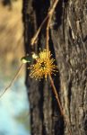
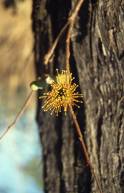
- Eucalyptus Miniata
By the early 1970’s moves initiated by the then Northern Territory Reserves Board, were under way to establish a National Park in the northern portion of the Northern Territory. In 1972 the Alligator Rivers Wildlife Sanctuary was proclaimed. A review report on the Alligator Rivers Region environmental fact finding study, commissioned by the Federal Government and the Mining Industry, recognised the national park values of the area. This, in particular, included the wide variety of unique landscapes, vegetation and wildlife types, it’s great biological, anthropological, archaeological and scientific significance, and it’s value for a variety of recreational activities.
On 5th April 1979, Stage One of Kakadu National Park was proclaimed encompassing an area of 6144 square kilometres within the Alligator Rivers Region with the exclusion of the Ranger Uranium Mineral Leases. On 28th February 1984, Kakadu Stage Two was proclaimed encompassing an area of 6929 square kilometres within the Alligator Rivers Region. Then in June 1987 Stage Three came into being which included the total area of the Goodparla and Gimbat Station pastoral leases. They encompassed an area of 6726 square kilometres bringing the total area of Kakadu National Park to 19799 square kilometres.
The Gagudju Association, who was granted the land under the terms of the Aboriginal Land Rights Act, owns Kakadu National Park. The park is leased back to the Commonwealth Government for an indefinite period. It is staffed and managed by the Australian National Parks and Wildlife Service and employs 55 staff. Included within the staff make-up are Aboriginal Traditional Owners who serve in an advisory capacity and also Aboriginal Rangers and administrative staff.
Kakadu National Park became a World Heritage property in 1981. At the end of this same year I ceased my tour business into the Alligator Rivers and Kakadu area. Being one of the early tour operators in this area I was on hand to see the development and had been involved in the original plan of management of Kakadu representing the Northern Territory Four Wheel Drive Association.
Due to overseas travel and other interests, it has taken six years to finally revisit legendary places like Jim Jim Falls and Twin Falls. On this, my 75th journey on the Jim Jim track, it was to be a nostalgic return to the magic of the Kakadu bush.
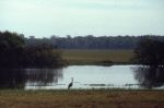
It was early morning as we sped past the famous watering holes of the Humpty Doo Pub and the Bark Hut Inn along the Arnhem Highway. This sealed road was started in the early 1970’s and completed as far as the Ranger Uranium Mine during 1978. It straddles all the major rivers and their floodplains. Early morning wildlife included birds such as pelicans, Jabiru storks, egrets, hawks, kingfishers, kookaburras, and some wallabies. Sadly though, the teeming herds of water buffalo, which used to roam the Marrakai Plains, have disappeared due to culling and the brucellosis eradication program.
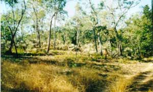
Leaving from Darwin it is 40km to the Arnhem Highway turnoff. The western boundary is 107km from this point, marked by an appropriate signs and information boards. The flora of this part of the country is tropical woodland savannah as indeed is most of the flora of the north. Tall eucalypt trees, together with palms= trees and grasses, form the heartland of the bush where the Gagudju people roamed for millennia.
Our first port of call was at 2 Mile and 4 Mile holes. The turnoff is 18km from the entrance to the park. Although the sign reads ‘4×4 only’, the track has been upgraded for 2wd access with small camper trailers.
2 Mile Hole: 13km north from the Arnhem Highway. A cleared camping area with fireplaces, wood, rubbish bins, boats and fishing, no swimming (crocodiles!!), no toilets, no tap water. A very pretty spot with lots of bird life and fishing possibilities.
4 Mile Hole: 34km from the Arnhem Highway. Drive past a large billabong on the way, which is choked with Salvinia weed. Bird life here includes Jacana, Ibis and Egret. Lots of camping space but very little shade close to the water. Popular boating and fishing spot. Very scenic. No swimming, no tap water, no toilets.
Red Lily Lagoon: Turnoff 37km from 2 Mile Hole exit. Turn right off highway. 23km to the lagoon. 4×4 recommended. Boating and fishing. No facilities. Definitely no swimming. This track also follows through to the old Jim Jim road.
Kakadu Holiday Village (formerly South Alligator Motor Inn)
5km from the Red Lily Lagoon turnoff along the Arnhem Highway. All amenities including fuel. Camping, caravans, chalets, motel accommodation, restaurant, river cruisers, bar, store, 4×4 tours. The holiday village lies 2km from the South Alligator River.
South Alligator River Bridge: River cruises, picnic area, toilets, rubbish bins, boat ramp, no drinking water. A popular area where recreational fishermen launch their boats in search of the elusive Barramundi. WARNING. Large crocodiles are prevalent in this area. The river is tidal and flows at 10 knots on an outgoing tide.
Mamukala Nature Trail: 7 kilometres east along the Arnhem Highway from the South Alligator Bridge.
East Alligator River turnoff: 37 kilometres from the South Alligator River Bridge. Here we leave the comfort of the sealed highway and drive along a well-corrugated gravel road to the East Alligator River, which is the border of the Kakadu National Park and the Arnhemland Aboriginal Reserve. Along the way we visit the following places:
Gadjuduba camping area: 9 kilometres along the East Alligator road on your left. 2km track in. Grassed camping area set amongst tall melaleuca paper bark trees. Fireplaces, very little wood, toilets, rubbish bins, bush boat ramp, fishing. No tap water and no swimming. This campsite is on the edge of the Magela Swamp. It is very picturesque and is teeming with water birds including Pacific black duck, Magpie goose, Teal duck, Burdekin duck, Whistlers, Jabiru, Pelican, Cockatoo, Kookaburra, and other parrots. We camped here overnight and during the night Black footed Native rats visited our camp. Later feral pigs, buffalo and crocodiles could be heard making their nightly calls. WARNING: Definitely no swimming and take plenty of mosquito repellent.
Jabiluka billabong: 12 kilometres from the Gadjuduba exit and 5 kilometres along a winding track. Very scenic, no facilities, no caravans, no swimming, bush camping only.
East Alligator River: 16 kilometres on from the Jabiluka billabong exit. This is the border crossing into Arnhemland Aboriginal Reserve and Gurig National Park. Permits are required to visit these places. Cahill’s Crossing across the East Alligator River is named after legendary buffalo shooter, Paddy Cahill, who lived in this area around the turn of the century. The crossing was the scene of a recent fatal crocodile attack. The river is tidal and fast flowing. WARNING: Crocodiles and sharks frequent this area. Picnic area for day use, boat ramp, popular but dangerous fishing area, toilets.
The Border Store: At the East Alligator River. Store, petrol, no diesel, soft drinks, no alcohol, some groceries, souvenirs and snack foods.
Mel Camping Area: Near Border Store. Caravans, camping, tap water, showers, toilets, and disabled facilities.
Ubirr (Obiri Rock): Day use only. 3km from the Border Store. 1km nature walk. Toilets. No camping. At Ubirr the many fantastic rock paintings gives one an impression of how life might have been thousands of years ago. The paintings are set under large overhangs in the rocky Kombolgie sandstone outcrops, created natural living shelters for the pre-history dwellers. The scenic beauty of the Ubirr area is breathtaking and must be one of the highlights of a visit to Kakadu. Most of the paintings depict hunting, fishing, family life, spirit figures and warring clans. There is also a distinct painting of a Thylacine (Tasmanian tiger). The rock art also depicts more recent times with men carrying firearms and axes.
Back along the Arnhem Highway it is 3km to the township of Jabiru.
Jabiru Town: Fuel, newsagent, post office, supermarket. No caravan park, no camping, no motel accommodation. The town houses employees of the Ranger Uranium Mine.
Ranger Uranium Mine: 11km from Jabiru. Conducted tours of the mine. Airport, and aerial tours of the Kakadu Wetlands.
Kakadu National Park Headquarters: 2km along the Kakadu Highway. All information about the park and its history. Avery good display.
Malabanbanju Camping Area: 13km along the Kakadu Highway from Park HQ. Caravans, camping, toilets, no tap water. No swimming.
Baroalba Camping Area: Adjacent to Malabanbanju. Caravans, camping, toilets, no tap water, no swimming.
Iligadjarr Nature Trail: This walking trail is situated between Malabanbanju and Baroalba camping areas. The distance of the trail is 3.8km across a grassy floodplain and wooded areas. Views of many water birds and prolific flora in the area. You may even be lucky to see a crocodile sunning itself. An informative step-by-step guide is available from Park HQ. Iligadjarr is the name of the spirit File Snake.
Nourlangie Rock, Nangaloar and the Blue Paintings: 4km south along the Kakadu Highway from the Baroalba camping area, you turn off along a sealed road towards Nourlangie Rock. 6km down this road another track turns off to the Nangaloar fertility paintings, Koongarra saddle and Baroalba Spring.
Nourlangie Rock
Nourlangie Rock is another main rock art site where occupation in the shelters of the rock formations took place over the millennia. ANPWS have constructed boardwalks to, and along the main galleries to give visitors easy access, and to protect the paintings from dust and human interference. Toilet facilities and Picnic tables at Nourlangie billabong. No camping. Day use only. The Blue Paintings art site is situated close to Nourlangie Billabong. A 1.4km nature walk links all the sites together. No facilities and restricted access.

Pig Nose Turtle

Pig Nose Turtle
Muirella Park: Back on the Kakadu Highway it is 7km to the Muirella Park turnoff and 6km of sealed road to this recreational site. Caravans, camping with generators, camping without generators, toilets, showers, disabled facilities, tap water, boat ramp, fishing. No swimming. A pretty spot good for boating and fishing. Nature walk through swampland.
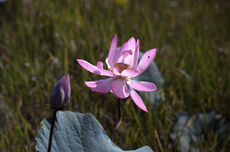
Pink Lily
Sandy Billabong: 5km from Muirella Park along a rough track. No caravans, no facilities, and no swimming. Beautiful billabong with a profusion of lilies and bird life. Good for the serious photographer and a quiet place to relax. Day use area.
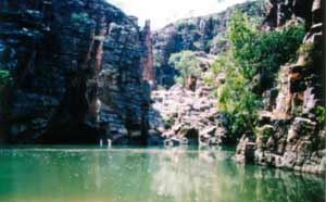
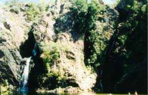
Twin Falls
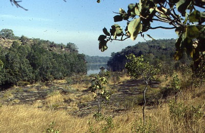
Jim Jim Falls/Twin Falls: This 75km track turns off the sealed road 13km from the Muirella Park entry/exit. The track has always been a notorious 4×4 route and sometimes a trap for the unwary. Some have ventured in with 2wd’s and some have not returned as evidenced along the way. ANPWS have embarked on a three-year program to build a new track, which is shorter in distance, and to upgrade to a 2wd access track for dry season usage as far as Jim Jim Falls. Progress has been slow and parts of the new track have had maximum usage resulting in rapid deterioration. Along one section the bull dust is one metre deep and continuous for three kilometres. The old track is still in existence and although it is corrugated it is in better condition. One and a half to two hours is required to drive the 65km to the Jim Jim Falls car park. From there it is a 1km nature walk to the base of the falls. The camping area is situated just 3km from the car park on the banks of Jim Jim Creek. There, toilets, tables and firewood are provided. Set amongst tall shady trees there is ample camping space. Although the creek runs most of the year it is very shallow. There are however, some waterholes further downstream to cool off in. The creek water is also drinkable. This camping are also serves Twin Falls, which is a day use recreational area only.
It is not known where the name for Jim Jim Falls originated. The falls are fed from the plateau above the Arnhemland escarpment and the water plunges more than 200 metres into a large pool below. The sun never reaches the waters of this pool and consequently it is most likely the coldest water in Northern Australia. Close to the base of the falls there is a rock fall and it is possible to climb up to the top of the falls via this route. At the height of the wet season the waters thunder over the drop but by September it is reduced to a mere trickle. Twin Falls lies a further 10km from the camping area along a very sandy 4wd track. These must be the prettiest falls in the whole of the Top End. Crystal clear waters and high cliffs make this a beautiful setting for a place to relax. A 500-metre swim on your floatie and you will arrive at a pure white sandy beach at the bottom of the drop.
Cooinda and Yellow Waters: Located 2km off the Kakadu Highway and 6km from the Jim Jim turnoff. Cooinda has full motel facilities, including a pub and swimming pool, Caravan Park, camping, fuel supplies and store. The motel is owned by the Gagudju Association and operated by the Four Seasons Motel Group. Bar, fuel and other charges are excessive in comparison to nearby outlets. If you are on a budget holiday, buy elsewhere.
Yellow Waters Billabong: Boat tours, boating, fishing for barramundi, caravans, camping, toilets, disabled facilities. A very scenic place with a good chance of snaring a barramundi. Wildlife abounds including large crocodiles.
Mardugal Camping Area: Adjacent to Cooinda. Caravans and camping. Toilets, tap water, disabled facilities. No swimming.
Jim Jim Billabong: On Jim Jim Creek and the upstream part of Yellow Waters billabong, 2.5km off the Kakadu Highway. Camping, toilets, fishing. No swimming.
From Cooinda/Yellow Waters it is 160km to Pine Creek on the Stuart Highway between Katherine and Darwin. Of this distance 27km is sealed road. The rest of the road is good gravel with corrugations in places. There is also an alternative route to return to Darwin via the Old Jim Jim road. This distance is 220km with 120km being gravel road.
NOTES: Most visitors come to Kakadu during the months of June, July and August. The average daily temperatures range from 20c minimum to 30C maximum. Others prefer to visit during the wet season when most of the floodplains are covered in metres of water. This is the period from January to April. Although road access is restricted to some areas other hard to get at places are accessible by boat. Scenic flights to view the roaring waterfalls are also available.
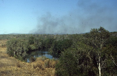
Areas not mentioned in this article but also under development by ANPWS include Barramundi Gorge and Graveside Gorge (4×4 only). With the proclamation of Kakadu Stage 3 further areas will be developed and upgraded. Areas such as Black Jungle, Waterfall Creek (UDP) Falls, Koolpin Gorge, Christmas Creek art site and Sleisbeck ruins come to mind.
Kakadu National Park is a wonderful place that has been saved from the ravages of mankind for all Australians and overseas visitors to experience and enjoy.
Don’t miss it on your holiday around Australia.
Plumtree Waterhole
Self
Two years of adventures, taking in most of Judith’s annual holidays, was enjoyable. We sat the wet season out in Darwin watching ‘Hector’ build Cumulus clouds to the north and sometimes it rained so hard it hurt. It could also rain in strips whereby one side of the street could get a soaking whilst the opposite side remained dry. The build-up starts in September and November heat and humidity became oppressive. In the old days it was known as suicide month but in 2019 that would be a most inappropriate word to use. The big rains came in February and then it rained up to 2500mm in a good year. The countryside became inundated and soaked and some times we chose to go camping. There could be boggings and lots of mud and winching and so on. It seemed to be fun in those days.
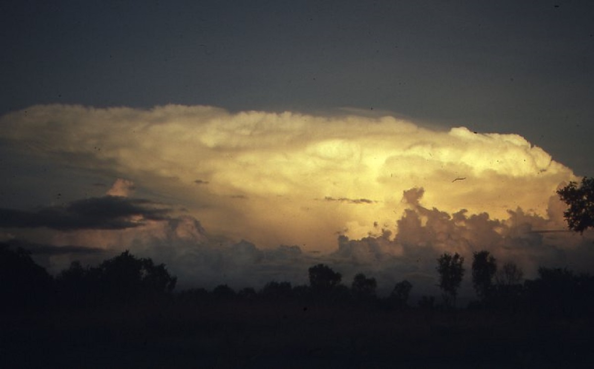
Storm coming
4×4 Training and Competition
1988 was the bi-centenary year and during a conversation with the head of the Army in Darwin he suggested that they might be ale to build an offroad testing and competition track for us. We had some land allocated at the Hidden Valley Motor Sports Complex and I submitted the drawings to the Brigadier and he said No worries it will be done.
At the end of February, he left a message for me that the bulldozer was coming the next day. I made myself available and when the loader came with the bull-dozer I told the young fella that they really should come at the beginning of June when the Dry Season had set in. No, it had to be done today. It was a huge bulldozer. Bigger than a D9. I protested that you are going to bog this thing the driver said “Never”. I told him that I have lived up north for twenty years and have the experience. I had the track laid out and with the bulldozer unloaded the task began. Within half an hour the bulldozer was bogged. The more the driver tried to get out the deeper it sank until just the seat and cab were showing. The boy and the truck left and later they came back with a tank and really strong looking chains. They hooked the lot up and because the crust of the area had been broken water was seeping in and another half an hour and now the tank was bogged. What a mess. So, they returned to their base and the following morning they brought a huge crane down. They could not budge the tank. Off they went in a 4×4 and came back with a whole platoon of blokes with shovels. They virtually dug the tank out, then they dug deep around the dozer and by sunset they were almost ready to lift. But the sun beat them and it was dark and the mozzies came out in force in the swamps. I escaped into my car and to get away from the stinging buggers. Sentries had to be left overnight in shifts to guard the machinery but they sat in airconditioned 4×4’s with a great big light shining on the equipment. The following morning the troops with the shovels returned and dug a great big opening around the dozer and the crane crane dragged it out. Then the mud hard to be dug out before it went on to the low loader. The Army came back in June and completed the job.
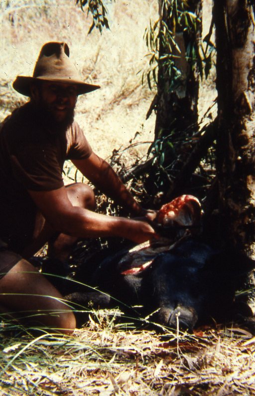
A Flying Bow Shackle 1988
It was February. Darwin was hot and humid and 1500mm of rain had fallen since September. Despite this, the Club decided to put on a day trip and young Tony put his hand up to be Trip Leader. Someone suggested Chewing Gum Falls, as it was only about 30km along the ‘Old’ Stuart Highway from the township of Adelaide River, and the bush track, which we had previously made, in was only 4km in distance.
Chewing Gum Falls was our own name for the place, as I had led a number of ‘dry’ season trips to Wrigley Creek Falls, by pushing a track in on the outer boundary of Crown Land and Tipperary Station. One could see that water flowed in the wet season where the small creek tumbled over the escarpment, discolouring the rocks. The track included a couple of steep climbs, some flat marshy country and a creek or two. The area was quite remote and hidden from the naked eye. We had also found some unusual plants growing there and this made the place more interesting.
We met on the Saturday morning at 7am at the Axe, adjacent to the Berrimah Research Centre. The convoy was made up of 3 Suzuki 1300’s, 1 Nissan 720 Ute, a Mitsubishi L300 with a Lobo 2.6lt Conversion and huge tyres, a brand new 4Runner and two Range Rovers. The drivers of the last two vehicles mentioned, both had cans of VB in their hands at that time of the morning. Young Tony, being a single fella at the time, had a good-looking bit of skirt as his co-driver. She was wearing very little in the clothing department. I could see trouble brewing.
We set off at a steady pace and stopped at Adelaide River for refreshments and more beers, and then sped on to our turn off point, which was quite close to where the Daly River Road meets the Old Stuart Highway.
More beers.
After a brief discussion as to how we were to tackle the track, which was about 300mm under water, Tony and his co-driver took off, beckoning us to follow. By this time of the year the spear grass can be up to 2 metres high in places and as no one had ventured down this faint track since the beginning of the wet, the trip leader was driving blind. Thirty seconds later he was down in the mud, having broken the thin surface crust of the soil. A quick snatch backwards and he was out of trouble. The fella in the L300 said that he had a better view of the scenery from up high, and thought that ‘his’ angle would be better. He barely made 200 metres when the van went down to its numberplate. This was a winch job. One of the fellas in a Range Rover winched him out, Fairlead in one hand, beer in the other.
Now at this stage, it might have been prudent to suggest, that we look for an alternative venue, for the day’s entertainment.
“Noooooo wayyyyyy”, said the Trip Leader, trying to impress his co-driver.
“I think,” he said, producing a map, ” that we if we could get up on to that ridge over there,” pointing at the map and with a wave of his hand, to a stony rise to the right, ” we could get to the track and cut out this boggy section. Then there is only the marshy bit to negotiate and from there on in the track should be hard.”
Yeah????
Well, we had to give the 4bies their all. Second gear low range, screaming up the rise, wheels spinning at top revs in the wet undergrowth, dodging Zamia Palms, and a rock or two. But we made it up to the top in typical club fashion, giving whoops of satisfaction as we thought we had achieved greatness.
“Err, mates”, said the fella in the 720 on the CB, still down below. “I think I will give it a miss, and go home”.
“What? Jim, you old woman!!!!” came the retort from the ridge.
“Oh, OK then, but reverse out, as the ground around you looks very wet”.
No, don’t take our advice.
He turned the 720 around, and it sank to the axles.
“If you are still here when we get back we will winch you out” the trip leader called out cheerily and with that we got back in to the vehicles and made our way down the incline on the other side.
From the higher vantage point we could pick a better track though the grass and palms and we managed to skirt the marshy bit. Feeling very pleased with ourselves we managed to crest the next rise to find another low-lying area which was inundated with water. Somehow, we had forgotten about this one. It was pretty much flat country for about 100 metres and we could see our track on the other side traversing hard ground.
The Trip Leader gave it heaps and bogged just short of the hard ground. While he was winching I took a different tack through the mud and made about 70 metres with the muddies churning the soft stuff skywards. A winch job for me too. The rest of the participants only made it to the beginning of the swamp and bogged the two Range Rovers, the L300, the 4Runner and the other Suzuki.
We had no option but to return the way we had come to try to assist the others. This time with a higher gear and higher revs we made it back without incident. We also realised that this was the end of the trip as the way to the falls was now too badly churned up.
I managed to winch the Suzuki and the L300 out of trouble and on to higher ground. They in turn went to help the Range Rover boys while Tony and I set about helping the family in the 4Runner.
This is where the real story begins.
The 4Runner owners had only bought the vehicle two weeks prior and this was their evaluation trip to see how they would fit in with the club members and what sort of 4×4-ing we did. They had never been out bush in a 4×4 before and had no idea.
By now it was after midday and lunch was called for. We sat down for sandwiches while the vehicles settled down in the mud. A thunderclap brought us out of our reverie and we saw storm clouds approaching. This one thing we did not need right now, was more rain.
Tony said, as raindrops started falling, “Quick, I will snatch him out”.
“No”! said I, “the bloody Suzuki is too light, it won’t move the Runner, it will have to be a winch job”.
“Oh, stop arguing”, (the beer talking), ” the Trip Leader makes the decisions” said Tony, “and anyway I think you are wrong.”
I shrugged my shoulders and moved the Suzuki and the missus, out of harm’s way. The others attached the strap, with bow shackles to the proper recovery points on the Suzuki and the 4Runner. Now as the Suzuki did not come with recovery points from the factory. Tony had welded a steel hook on to the chassis frame of his little vehicle and it looked pretty strong. They placed a blanket over the snatch strap and Tony let the strap have a little bit of slack
“Now you get in your truck,” said Tony to the driver of the 4Runner, “and put the rear window down. Select Low Range reverse and start spinning the wheels slowly when I start to move….OK?”
“Now stand clear everyone”, Tony instructed.
The first snatch did not produce much. So, Tony reversed and gave the strap, a bit of slack. He then gunned the Suzuki and at the optimum point the 4Runner moved some centimetres. Encouraged by this, Tony reversed again and gave the strap about 4metres slack for the third attempt.
He dropped the clutch and took off.
As the strap tightened fully the blanket fell off on to the ground. Then there was a loud BANG! The welded hook could not take the strain and snapped off. It all happened in slow motion. The bow shackle was now a projectile hurtling back towards the 4Runner faster than a speeding bullet, or so it seemed at the time. Luckily, the hook had fallen to the ground.
THUDDDDDDDDD!!!!!
The bow shackle passed through the tailgate, through the window glass and embedded itself halfway through a brand-new Engel fridge.
Jaws dropped in awe. The 4Runner driver emerged from his vehicle slowly with his eyes as wide as saucers. His wife started crying and the kids didn’t know whether to laugh or cry.
At the same time the fella in one of the Ranger Rovers took his eye off the winch job for the moment and burnt the winch out.
For while everyone was speechless.
It was raining now and we were getting wet. But we were so stunned, not much was said. I commandeered Tony to turn his vehicle around so that we could both winch the 4Runner out of the mire and with the two small winches, using snatch blocks, we managed to extricate the truck.
Then it took three winches to get the Range Rover out and by 4pm we were ready to head back to the bitumen. Easier said than done. It took a further two hours to do the 1km back to the Highway with two more winch jobs along the way.
Our offroad excursion was 2km in distance overall and lasted 8 hours!
Once at the bitumen, the 4Runner occupants bade a hasty farewell and sped home. The rest of us made for Ida Hot Springs arriving there just on dark. We drank some beers and other stuff, ate cold food and slept on camp beds while the rainwater ran through the tents.
The next day the warm tropical sun soon dried everything out except those who were extremely hung over!
The 4Runner owners claimed insurance, had the truck repaired and traded it in on a Commodore. They never joined the Club. Once was enough with the Mad Hatters. Tony (a fictitious name to protect the innocent or guilty) got nowhere with the skirt and he laid low for a while. Jim, (also a fictitious name) managed to dig himself out of trouble and had left by the time we got back to the highway.
Cobourg Peninsula 1988
Published in 4×4 Australia Magazine 1988
Squinting at a map of the Australian continent you will see a piece of land jutting out of the north western end of Arnhemland, almost as far to the north in degrees latitude as the tip of Cape York itself.
This bit of landfall is Cobourg Peninsula. It is as remote for vehicular access as you can get. The entire peninsula is encompassed by Gurig National Park.

Cobourg Seascape
A veritable haven for tropical living, Cobourg Peninsula has provided shelter, fresh water and food aplenty for its Aboriginal inhabitants for thousands of years.
Known historical events date back as far as the 16th century when European explorers, Macassan fishermen and trepang traders started visiting Australia’s north coast. Trepang, also known as Sea Cucumber, is an Asian delicacy with reputed aphrodisiac qualities.
Trepang
The Macassan trading continued until 1903 when the British Government imposed a customs tax. This discouraged the continuation of the harvesting of trepang.
The British Government had tried unsuccessfully, to establish Victoria Settlement on Adam Head in Port Essington in 1837 after a first failure some ten years earlier at Fort Wellington at Raffles Bay. Captain Bremer, aboard the HMAS Alligator had been commissioned to establish a settlement on Cobourg Peninsula. The main purpose was for defence and a haven for shipwrecked seamen.
The indigenous peoples of Port Essington, well fed on fresh fish, turtle and dugong, had been trading with the Macassans for centuries. They were not afraid of new arrivals and maintained a friendly stance. The British settlers however, steeped in their tradition, insisted on wearing their red button-up tunics and some of the brave garrison ladies, who had ventured to this far away place, their frilled dresses. Needless to say, in such a harsh tropical climate, this sort of living brought on all types of heat related ailments and diseases. Later, scurvy, parasites and cyclones drove the new settlers away. In 1849 the British Garrison packed up and left, abandoning the settlement. The indigenous people, who were friendly towards the settlers, also became infected with numerous European diseases and their numbers were decimated. In the ensuing years they drifted away from the peninsula as the development of the north by the white men brought radical changes that influenced their society.
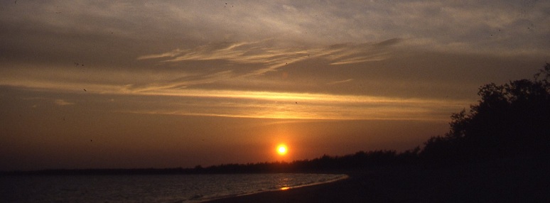
Cobourg sunrise
Cobourg Peninsula was recognised as an area of significance to the Aboriginal people who had affinity with this land. As early as 1940 an area was set aside for them to utilise.
The drift towards the developed areas of the Northern Territory continued however, and by the 1970’s there were no aboriginal inhabitants left on the peninsula. After the Northern Territory Land Rights Act of 1976 had been passed interest was shown again in re-establishing occupation of the land. By 1980 small groups of aborigines started to return. In 1983 the sea waters surrounding the peninsula were declared a marine park.
Today Gurig National Park is managed by the Cobourg Sanctuary Board and the Conservation Commission of the N.T. on behalf of the traditional owners. There is also a training program in place to teach the locals how to become self sufficient and administrative within the confines of the national park.
Visitor access is allowed to tourists and holidaymakers during the period from May until the end of October. This access is on the basis of only 15 vehicle permits issued at any given time for any one day. From the beginning of November to the end of April all of the tracks to and within Cobourg Peninsula may be impassable due to flooding. Access is still possible by sea or air. Permits are required to enter and they are available upon application at the offices of the Conservation Commission of the N.T.
As this remote area is very popular it is advisable to apply for permits to enter well in advance. The permit that is issued also covers transit through Arnhemland Aboriginal Reserve but camping along the way is not allowed. At present the entry fee is $10 per person with a $4 per three persons per day camping fee. Persons under the age of 17 years are exempt from fees.
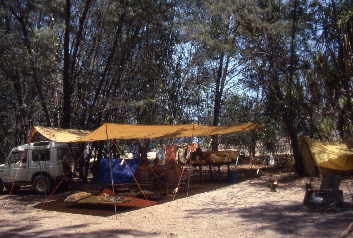
Our camp
Tour operators also run fly-in and sailing tours to the National Park.

Hopping Mouse
Further information may be obtained from the N.T.Tourist Bureau, 31 Smith Street Mall, Darwin, 5790 or your travel agent.
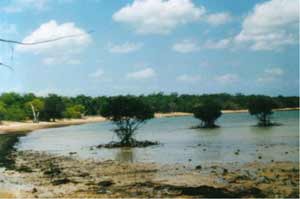
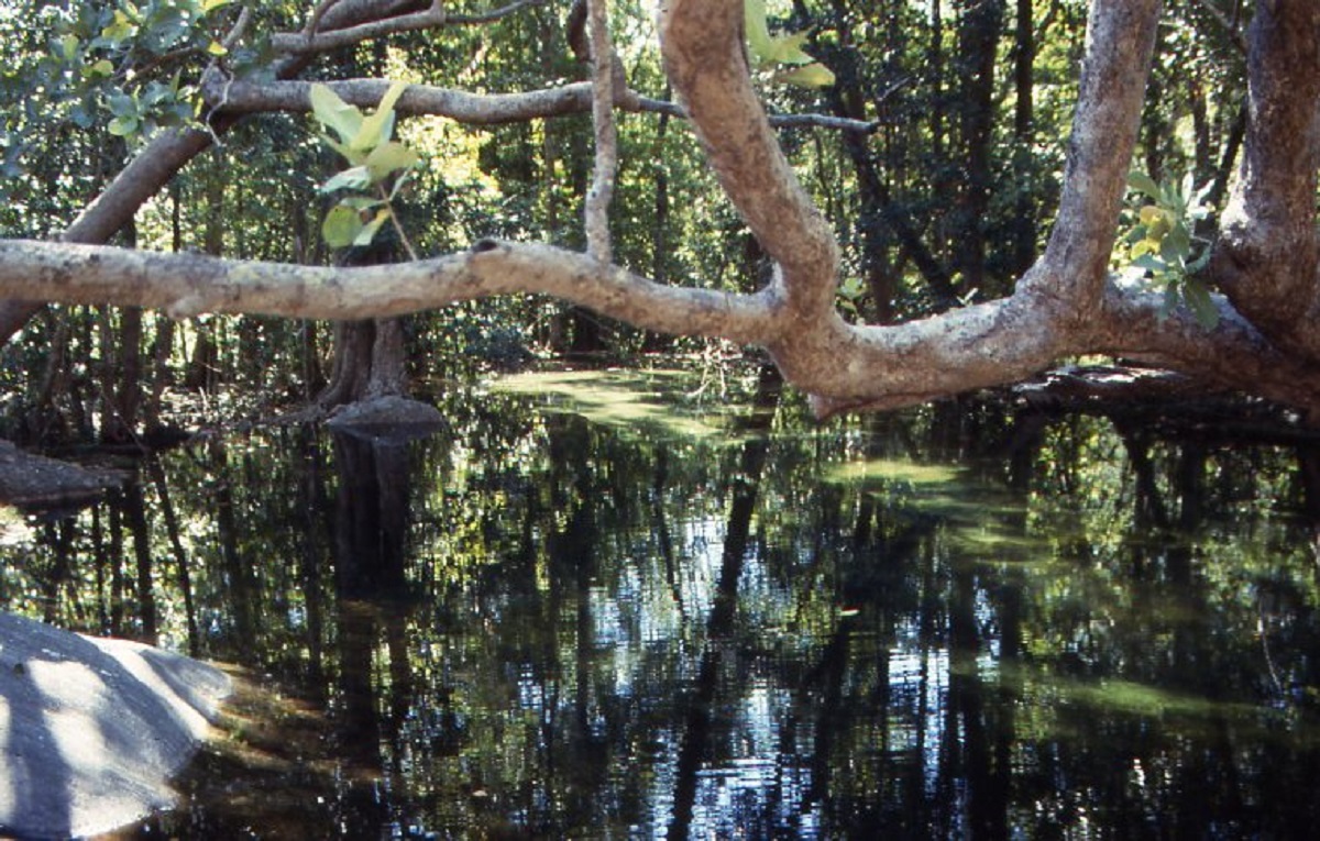
Mangrove Trees
Getting there:
Gurig National park lies some 570km from Darwin, east along the Arnhem Highway or 580km north from Katherine along the Stuart and Kakadu Highways. The road from Darwin is sealed to the Ubirr/East Alligator turnoff and from Katherine for 90km along the Stuart Highway to Pine Creek. It is 198km from there to the Ubirr turnoff on the Kakadu Highway. Of this distance 90km is sealed. From Ubirr turnoff to the East Alligator River crossing it is 37km of corrugated road. The river crossing is tidal and it is advisable to cross at low tide due to the fast outgoing current and the presence of man-eating salt water crocodiles. Quite a number of vehicles have been washed over the side of the concrete causeway in past years.
Leaving the East Alligator Crossing, also known as Cahill’s Crossing, so named after a famous Territory buffalo shooter Paddy Cahill, it is 43km to the turnoff to Murgenella. This stretch of graded road is in reasonable condition with patches of bulldust. It is 95km from this turnoff to Murgenella, an aboriginal outstation. The road is normally in good condition up to and 30km beyond Murgenella. From this point it becomes a sandy track with long stretches of bulldust for the 95km to it’s termination at Smith Point on the coast. The last 70km is badly corrugated. Caravans should not be towed over this track as it is an invitation to trouble. Only sturdy off-road and boat trailers with high ground clearance could be safely towed along these tracks.
The Ranger Station and store is at Black Point, 7km back from Smith Point. Signs showed the way.
Fuel en route to Cobourg Peninsula may be obtained from Jabiru township in Kakadu National Park and also at Wimray Safaris at Black Point. It is advisable however, to carry enough fuel for the return trip to Jabiru.
Camping facilities are provided at the designated area near Black Point airstrip. One pit toilet and one shower services the entire camping area. Each camp site has a sturdy timber table, concrete fireplace and dingo proof rubbish bin. Dry wood is provided and bins are cleared daily.
The beach lies 100 metres from the camp site. The pristine white sands are used by turtles that come up to lay their eggs. Crystal clear waters support a variety of fish. Crocodiles also roam these waters so care must be taken. Almost the whole of the Cobourg Peninsula has white sandy beaches, with low tide reefs jutting out close to and within 50 metres of the shoreline. Most of these reefs are covered in rock oysters while black lip oysters are found on reefs further out to sea. The waters abound with snapper, barramundi, mullet, spotted fish, stingray and many others. Dugong and dolphins also prevail. Fishing for certain species is allowed within the confines of the marine park.
Much of the peninsula is covered by open forest of mixed eucalypts. Various palm species are found throughout the forests and the tall Kentia Palm is the most prolific of these. In places along the coastal margins the forests are replaced by coastal heath land. Here Wallabies, Water Buffalo and wild Banteng cattle graze peacefully.
Lagoons and swamps are intertwined in the low-lying areas and support a great variety of bird life, including large flocks of Brolgas. Waterfowl, water monitors and crocodiles also live in these swamps. A scenic bush track skirts Port Bremer Bay and there are other bush tracks meander in and out of the eucalypt forests.
If you are looking for an uncrowded holiday in the bush where you may fish, bushwalk, study nature or just loaf around, the Cobourg Peninsula and Gurig National Park is the place to visit.
Squinting at a map of the Australian continent you will see a piece of land jutting out of the north western end of Arnhem Land, almost as far to the north in degrees latitude as the tip of Cape York itself.
This bit of landfall is Cobourg Peninsula. It is as remote for vehicular access as you can get. The entire peninsula is encompassed by Gurig National Park.
A veritable haven for tropical living, Cobourg Peninsula has provided shelter, fresh water and food aplenty for its Aboriginal inhabitants for thousands of years.
Known historical events date back as far as the 16th century when European explorers, Macassan fishermen and trepang traders started visiting Australia’s north coast. Trepang, also known as Sea Cucumber, is an Asian delicacy with reputed aphrodisiac qualities.
The Macassan trading continued until 1903 when the British Government imposed a customs tax. This discouraged the continuation of the harvesting of trepang.
The British Government had tried unsuccessfully, to establish Victoria Settlement on Adam Head in Port Essington in 1837 after a first failure some ten years earlier at Fort Wellington at Raffles Bay. Captain Bremer, aboard the HMAS Alligator had been commissioned to establish a settlement on Cobourg Peninsula. The main purpose was for defence and a haven for shipwrecked seamen.
The indigenous peoples of Port Essington, well fed on fresh fish, turtle and dugong, had been trading with the Macassans for centuries. They were not afraid of new arrivals and maintained a friendly stance. The British settlers however, steeped in their tradition, insisted on wearing their red button-up tunics and some of the brave garrison ladies, who had ventured to this faraway place, their frilled dresses. Needless to say, in such a harsh tropical climate, this sort of living brought on all types of heat related ailments and diseases. Later, scurvy, parasites and cyclones drove the new settlers away. In 1849 the British Garrison packed up and left, abandoning the settlement. The indigenous people, who were friendly towards the settlers, also became infected with numerous European diseases and their numbers were decimated. In the ensuing years they drifted away from the peninsula as the development of the north by the white men brought radical changes that influenced their society.
Cobourg Peninsula was recognised as an area of significance to the Aboriginal people who had affinity with this land. As early as 1940 an area was set aside for them to utilise.
The drift towards the developed areas of the Northern Territory continued however, and by the 1970’s there were no aboriginal inhabitants left on the peninsula. After the Northern Territory Land Rights Act of 1976 had been passed interest was shown again in re-establishing occupation of the land. By 1980 small groups of aborigines started to return. In 1983 the sea waters surrounding the peninsula were declared a marine park.
Today Gurig National Park is managed by the Cobourg Sanctuary Board and the Conservation Commission of the N.T. on behalf of the traditional owners. There is also a training program in place to teach the locals how to become self-sufficient, and administrative within the confines of the national park.
Visitor access is allowed to tourists and holidaymakers during the period from May until the end of October. This access is on the basis of only 15 vehicle permits issued at any given time for any one day. From the beginning of November to the end of April all of the tracks to and within Cobourg Peninsula may be impassable due to flooding. Access is still possible by sea or air. Permits are required to enter and they are available upon application at the offices of the Conservation Commission of the N.T.
As this remote area is very popular it is advisable to apply for permits to enter well in advance. The permit that is issued also covers transit through Arnhem Land Aboriginal Reserve but camping along the way is not allowed. At present the entry fee is $10 per person with a $4 per three persons per day camping fee. Persons under the age of 17 years are exempt from fees.
Getting there:
Gurig National park lies some 570km from Darwin, east along the Arnhem Highway or 580km north from Katherine along the Stuart and Kakadu Highways. The road from Darwin is sealed to the Ubirr/East Alligator turnoff and from Katherine for 90km along the Stuart Highway to Pine Creek. It is 198km from there to the Ubirr turnoff on the Kakadu Highway. Of this distance 90km is sealed. From Ubirr turnoff to the East Alligator River crossing it is 37km of corrugated road. The river crossing is tidal and it is advisable to cross at low tide due to the fast outgoing current and the presence of man-eating salt water crocodiles. Quite a number of vehicles have been washed over the side of the concrete causeway in past years.
Leaving the East Alligator Crossing, also known as Cahill’s Crossing, so named after a famous Territory buffalo shooter Paddy Cahill, it is 43km to the turnoff to Murgenella. This stretch of graded road is in reasonable condition with patches of bulldust. It is 95km from this turnoff to Murgenella, an aboriginal outstation. The road is normally in good condition up to and 30km beyond Murgenella. From this point it becomes a sandy track with long stretches of bulldust for the 95km to it’s termination at Smith Point on the coast. The last 70km is badly corrugated. Caravans should not be towed over this track as it is an invitation to trouble. Only sturdy off-road and boat trailers with high ground clearance could be safely towed along these tracks.
The Ranger Station and store is at Black Point, 7km back from Smith Point. Signs showed the way.
Fuel en route to Cobourg Peninsula may be obtained from Jabiru township in Kakadu National Park and also at Wimray Safaris at Black Point. It is advisable however, to carry enough fuel for the return trip to Jabiru.
Camping facilities are provided at the designated area near Black Point airstrip. One pit toilet and one shower services the entire camping area. Each camp site has a sturdy timber table, concrete fireplace and dingo proof rubbish bin. Dry wood is provided and bins are cleared daily.
The beach lies 100 metres from the camp site. The pristine white sands are used by turtles that come up to lay their eggs. Crystal clear waters support a variety of fish. Crocodiles also roam these waters so care must be taken. Almost the whole of the Cobourg Peninsula has white sandy beaches, with low tide reefs jutting out close to and within 50 metres of the shoreline. Most of these reefs are covered in rock oysters while black lip oysters are found on reefs further out to sea. The waters abound with snapper, barramundi, mullet, spotted fish, stingray and many others. Dugong and dolphins also prevail. Fishing for certain species is allowed within the confines of the marine park.
Much of the peninsula is covered by open forest of mixed eucalypts. Various palm species are found throughout the forests and the tall Kentia Palm is the most prolific of these. In places along the coastal margins the forests are replaced by coastal heath land. Here Wallabies, Water Buffalo and wild Banteng cattle graze peacefully.
Lagoons and swamps are intertwined in the low-lying areas and support a great variety of bird life, including large flocks of Brolgas. Waterfowl, water monitors and crocodiles also live in these swamps. A scenic bush track skirts Port Bremer Bay and there are other bush tracks meander in and out of the eucalypt forests.
If you are looking for an uncrowded holiday in the bush where you may fish, bushwalk, study nature or just loaf around, the Cobourg Peninsula and Gurig National Park is the place to visit.
Down along the Douglas 1988
Published in 4×4 Australia Magazine 1988. Republished here 2002. Photos revamped 2011
Has it ever crossed your mind to hook up that camper trailer or caravan to the rear of your four wheel drive, to attach the dinghy to the roof rack and to set off on a journey of a lifetime around Australia? Has it ever crossed your mind that there is life out the beyond the city limits? That you may drive for days and camp by a lonely stream with only pure nature around you to arouse your spirits? Have you ever felt that you have had enough of the rushed merry-go-round of corporate life or answering to the boss every morning?
Of course you have. That is why you bought that four wheel drive. That machine that will take you away from the crazy rush to nowhere that is part of city life today.
Time is always available. But to utilise it you must plan to suit. Thousands of Australians have made that move to see their country, but millions haven’t. Are you going to become part of Australia?
We made that move.
One morning we decided that living under the pressure of the bank manager, the building society, the local council demands, the water board, the electricity board, the licensing board and the building board was just not worth all the stress. Within three months we had liquidated our tour business, sold our house and acreage, sold our furniture and the rest of our accumulated junk, hooked the 25ft Franklin van on behind the F100 4×4 and set off on our journey of peace and quiet.
Highway One was still unsealed in places in those days but that did not deter us as we threw all convention out of the window and did as we pleased, diverting into relatively unknown areas, camping along hidden tracks and taking that caravan into many out-of-the-way places. We would stop whenever we wanted to, be it at a creek crossing, an old station track, near a deserted beach or an isolated town in the Australian Outback. We fished, took thousands of photographs, and studied the rocks, the birds, the reptiles, the marsupials and the stars. We painted and fossicked and swam in the crystal clear mountain streams. It was an idyllic time and part of our lives that we will always cherish. One day turned onto another and we lost track of time as days became weeks and weeks became months.
One of the places we spent some time at was at the Douglas River catchment area in the Top End of the Northern Territory. In those days this area was only known to some locals. Since the beginning of the 1980’s however, it has been opened up to visitors and now it is able to cater for travelers who may want to stay for longer periods. While most of the Douglas catchment area has two wheel drive and caravan access, in some places you do need a four wheel drive vehicle to gain access. We recently revisited this charming area.
Douglas River in the ‘wet’ season
The Douglas River has its headwaters in the hilly goldfields of Pine Creek and Hayes Creek. It is spring fed and runs permanently throughout the year. It flows through Butterfly Gorge, Douglas Hot Springs, the Corn Patch Riverside Holiday Park, the Douglas/Daly Agricultural Experimental Farm, over Crystal Falls and into the mighty Daly River.
Access to this area lies 160km north of Katherine on the Stuart Highway. From there it is 31km to the turnoff to Douglas Hot Springs of which 20km is a well formed and maintained gravel road. This main access road is known as the Oolloo Road and it runs down as far as the Oolloo Crossing on the Daly River. From the Oolloo Road turn-off to the hot springs it 8km and a further 17km to Butterfly Gorge.
Butterfly Gorge
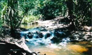
Butterfly Gorge Nature Park: The track is graded and maintained during the dry season but during the wet season it is impassable. Although it is accessible by a conventional car it is advisable to access this park by 4×4. Large Maleleuca paper bark trees and Leichhardt Pines conceal the entrance of this small gorge, so named after the swarms of butterflies which frequent it from time to time. The gorge had colourful scenery and safe swimming but a 300 metre walk is necessary to get a good view of the gorge. There are no facilities. The park is managed by the Conservation Commission of the N.T.
Douglas Hot Springs Nature Park: Artesian waters bubble continuously from the depths of Mother Earth at the hot springs. And believe me, they are hot!! The constant temperature of the springs is 40 degrees Centigrade which may be a bit hot for some. There are however cooler areas in the river. The springs are reputed to have therapeutic values for tired old bones and joints. The park has bush toilets, water on tap, picnic facilities, walking tracks, designated camping areas and fishing is allowed. The hot springs are popular on weekends and locals from surrounding towns frequent them. During the week it is normally quiet and a good place to relax and ponder life.
Douglas Hot Springs
The Corn Patch Holiday Park provides a store, Restaurant, Bar, Caravan and camping sites. There are more hot springs along the banks of the river near this park and fishing is allowed.
Down the Oolloo Road, Lukies farm offers Bush style camping with facilities, on the banks of the Daly River, as well as home cooked meals and entertainment.
At the Oolloo Crossing on the Daly River there is bush camping with no facilities and canoeing and fishing.

Oolloo Crossing
In recent times there has been a change of ownership at these two retail outlets and access conditions may have changed.

Giant Cathedral Anthill
The Douglas area is a must on your way around this big country.
Amazing Litchfield 1988
Published in 4×4 Australia Magazine 1988
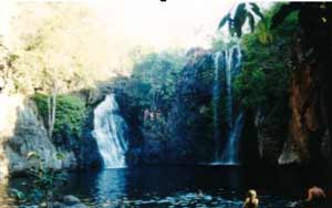
Florence Falls
Trust the Northern Territory Government to come up with a breakthrough in the conservation of our natural heritage. Far away from the hustle and bustle of southern politics and bureaucratic bungling all interested parties have had an input into the Territory’s newest conservation and recreation park. The politicians wanted it, the conservationists wanted it, the 4×4 and other recreationalists wanted it and the general public wanted it. Everyone who had an interest in the creation of this park was asked to put up or shut up. And they all did!! The net result is that a park of national standard is being implemented to satisfy the needs of all bush recreationalists.
Litchfield Park, not graded as a National Park as yet, but to my mind worthy of it, lies 130km south of Darwin and encompasses the Table Top Range of escarpments with tropical woodland savannah and remnants of rain forest pockets in it’s deep gorges.
Over the past 20 years the area has been part of a pastoral lease and has only been accessible by four wheel vehicles and bush walkers. The escarpment boasts no less than fifteen major waterfalls and numerous streams and springs, some of which, are perennial. The park has been named after Fred Litchfield, a Territory pioneer. When the first survey party to the Northern Territory established themselves at Escape Cliffs on the Timor Sea in1864, Fred Litchfield was dispatched south-west to the Daly River. He is credited for naming Mount Tolmer and the Reynolds River. Mount Tolmer was named after a man who has been described as Australia’s’ first police detective and the Reynolds River, after Thomas Reynolds, Treasurer of the South Australian Government of 1868. The Hundred of Blyth, Hundred of Finniss and Florence Creek were all named by Goyder’s’ Surveyors in 1869.
Mount Tolmer tin mine was operated, with some success, by various miners, from 1889 to 1899. The Hundred of Blyth became a grazing lease in 1882 and the Old Blyth Homestead, which is located at the foot of the Mount Tolmer escarpment, was probably used by various lessees over the ensuing years. The lease changed hands many times until it was acquired by the Sargeant family in 1923. It was eventually named the Stapleton pastoral Lease and this lease was taken up by an American family, the Townsends, in 1964. The NT Government excised the Litchfield Park Crown Lease from the Stapleton pastoral Lease in 1985 compensating the Townsend family for their loss.
Magnetic Termite Mounds
During the late 1960’s four wheel drive clubs, like the Landrover Owners Club, were starting to emerge. Out of Darwin, the Table Top range, also known as the Batchelor Escarpment, became the area to explore by weekend 4×4 enthusiasts and campers. Permission had been granted by the Townsend Family for Clubs to utilise the northern area of the Batchelor Escarpment for camping purposes as this country was not suitable for pastoral purposes and was only mustered every once in a while to look for stray cattle. Tracks were established to all major waterfalls over the next twenty years. The main waterfalls visited were Florence Falls, also known as Ida Falls, Wangi Falls, also known as Gwendoline Falls, Tolmer Falls, and Sandy Creek Falls, also known as Woodcutters Falls.
Wangi Falls
At present the park covers an area of 65700 hectares. This will no doubt increase in the future as an agreement has been reached with the owners of Tipperary Station and the NT Government to excise some of Tipperary Pastoral lease and to join it to Litchfield Park.
Litchfield Park is being administered and managed by the Conservation Commission of the Northern Territory, the latter managing all parks in the NT other than Kakadu and Uluru which are managed by ANPWS. During the late seventies and early eighties the various 4×4 Clubs in the Top End as well as the NT Four Wheel Drive Association urged the Government to declare the Table Top Range a conservation park. Eventually, after tour operators started using the area, the value of this unique landscape became commonly known and the government was spurred into action.
The flora of Litchfield Park is tropical woodland savannah with eucalypts, wattle, melaleuca, pandanus palms and cycads in abundance. Lush rainforest pockets occur in the gorges of the escarpment fed by perennial streams of crystal clear water. The park is home to colonies of the endangered Orange Horseshoe Bats which live in the caves at the base of Tolmer Falls. Large colonies of Ghost Bats as well as Fruit Bats (Flying Fox) are also present within the park. A rare specie of marsupial mouse, a rare bush hen, a potentially vulnerable frog and the endangered and primitive Archer Fish all occur in and around Wangi Falls. Twenty eight species of mammal occur in the park and bush land bird life is prolific.
Zamia Palms and woodland savannah
I have deleted the rest of this article as so many changes to access rules and regulations have been made to Litchfield National Park since this article was written. Please use a Search Engine to find updated information on this very unique recreational area.
Remote Fitzmaurice 1988
Published in 4×4 Australia Magazine 1988. Republished here 2002. Photos updated 2011
It took me more that a few minutes to catch my breath, and regain my composure, as I stood poised on a scraggy sandstone pillar on the edge of the Koolendong Valley.
I had just completed a seven kilometre bush walk from our camp site over some very rough terrain and through some of the most remote country in the Northern Territory. I gazed across the valley with it’s unspoilt open plains, described by scientists to be in pristine condition, and the Fitzmaurice River, slowly meandering through the tropical savannah woodland. Wild cattle grazed peacefully near the banks of the river, seemingly oblivious to the dangers that lurked beneath the surface of the waters.
Fitzmaurice River
This particular river is the habitat of some of the largest saltwater crocodiles seen in tropical northern Australia. One old crocodile stands out from the saurian crowd. Known affectionately as “Mogo” in Aboriginal folklore, those who have seen the monster estimate it’s length to be 9 metres (30 feet)!!
An acquaintance of mine, whilst fishing the river one day, saw quite a few salties lurking in the reeds. During the course of the morning a huge wild boar came down to the river for a drink. My friend shot the pig and he and his mates tied it to a fair sized tree close to the edge of the river embankment with some spare anchor chain. The idea was to come downstream early the following morning for some good photographs of crocodiles feeding.
They returned to the next day only to find the pig carcass, the chain and part of the tree missing, presumably dragged into the depths of the Fitzmaurice. Massive claw marks were seen in the mud along the embankment and a belly slide imprint of around five feet in width between the claw marks.
My friend swears to the authenticity of this tale. Others who have caught a glimpse of the old croc from the air have verified that he may just be that size. There are some lesser crocs of around 6 metres to be seen in the river and further upstream in the freshwater regions one may find numerous Johnston River crocodiles. These are harmless to man.
With all this information at hand I decided that it was prudent not to venture down the escarpment on to the floodplain.
It had taken us three days to reach our destination on the Fitzmaurice River from Darwin. As this was our first trip into this area and wheel tracks were not well defined, we got bushed a number of times by consensus. Logic does not always prevail. A section of the track into this area had been graded for cattle mustering purposes the first time since it was first bulldozed in 1962. There were also wheel tracks running in different directions making choices difficult and impeding progress.
The soil cover throughout this area is sandy loam and very fragile. Once the surface is broken tracks turn into bull dust. The last 180km into our camp site was constant bull dust.
The turn-off to Wombungi Outstation along the Dorisvale Road is 21km south of Pine Creek along the Stuart Highway. From there it is 278km to the first habitable camp site on the Fitzmaurice.
The track was bulldozed in 1962 to provide access to a water gauging station on the river. Access to the river is by way of the Dorisvale Road, Claravale Crossing on the Daly River, Dorisvale Station, along Waterbag Creek, some Crown Land, Laurie Creek, and a small section of the Daly River Aboriginal Reserve. Careful negotiation of the high northern river embankment brings one down to a pleasant camp site on the river next to a small set of rapids. The southern embankment of the river is the northern boundary of Coolibah Station Pastoral Lease.
I used 1:50,000 Topographical Maps which are ideal when doing exploring like this. Pinpointing ones position is so much easier with a larger scale map as one can relate to various topographical features within sight shown on the map.
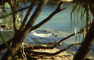
On our arrival at the camp site we did a quick croc check for saltwater crocodiles and soon after the all clear was given as we had seen two freshwater crocs. Salties eat the Freshies so there was a good chance there were no Salties.
A rock which looks very much like a crocodile
Over the next three weeks our party would go on a few excursions, do a few night walks; fishermen fished and were successful in snaring barramundi, whilst others painted, studied nature nor just lazed around at this idyllic spot. We camped under the shade of fresh water mangroves and paperbarks.
The Fitzmaurice and its tributaries are very old rivers, having been cut deep into the earth’s crust by the floodwaters of time. As the fall of the rivers is quite steep, water rushes down the ravines during the wet season and by June settles down to a steady perennial stream. Many large billabongs have been hewn from the sandstone formations. Fertile soil, deposited on the fringes of the billabongs and rivers, has given growth to an extraordinary variety of pandanus palms (the prickly kind), fresh water mangroves, wattle, eucalypt and milk wood trees as well as a host of unidentifiable species. All of this under growth makes access to the water quite difficult if you need to launch your boat into the river. The billabongs are teeming with Catfish also known as Silver Cobbler in Western Australia, Barramundi, Black bream, freshwater Saratoga and large freshwater Yabbies. Downstream, beyond the tidal change, barramundi and seagoing fish may be taken. Crocodiles and sharks abound.
One day we studied our maps and decided to make for a waterfall to the south of our campsite. The first obstacle was to cross over the river to the other side. We found a likely place and budding road construction engineers with a star picket and manual labour took the best part of the day to make a drivable track.
The next day we tested the track across and made for four large Boab trees on the far side through some rocky terrain. We were now on Coolibah Station Pastoral Lease. Inscribed on the largest of the boab trees is the name of Rob.T.Quilty 9/10/42. The Quilty’s were former owners of Coolibah Station.
The bush south of the Fitzmaurice had not had a fire through for many years and bush orchids (cymbidium canaliculatum) were growing no less than two meters above the ground. Progress was slow as we were driving ‘blind’ through three metre high grass with visibility ending at the bullbar.
We came upon a very deep channel which we had to skirt around. We eventually found a place to cross the channel but it proved more difficult than anticipated and needless to say we had to get our winches going to make the crossing. As luck would have it there was a sturdy tree just in the right place to use for a winch anchor.

A winch job
Our trip leader for the day took us right to the edge of the waterfall, which was quite a feat in itself as we were relying on compass bearings to negotiate our way through the tall grass. This wet season waterfall lies on an unnamed creek and for the wont of a better name we marked it as Crocodile Falls on our maps. Floating lazily in the iridescent waters freshwater crocodiles were unaware of our presence. Archer fish, bream and Saratoga could be seen. I ventured down to the pool after all the pics had been taken, for a refreshing swim. The noise and vibrations of human intrusion sent the crocs to the bottom of the pool. I did not spend a long time in the water as I was not sure if there were any larger crocs lurking somewhere out of sight.
Then one of our crowd spotted some wild pigs. We raced back to the vehicles to gather up our arsenal and that night we feasted on shoulder of pork cooked to perfection by Judith and her bush recipe.
Bushtucker
On our return to camp we were able to negotiate the deep creek without having to winch this time as the exit was of a shallower incline. Keeping the revs up in the soft sand did help a bit.
Some days later we decided to travel to that section of the river where the tidal change occurs. We were camped only two kilometres from this place but had to drive a 25km detour around Alligator Creek so as to gain river access and place to launch our boat. We had an 8 foot punt and 2 horse motor and trips to the Koolendong Valley had to be done with only two passengers at a time. Anticipating on seeing large crocodiles we carried our .3030 rifle as insurance. Happily though, we only saw smaller crocodiles on our journeys there and back, as they silently slid down the muddy embankment of the river.
From the tidal change it is about 60km to the open sea. At the mouth of the river the channel is about 8 kilometres wide. Modern day explorers chartered the river in 1839. Captain John Lort Stokes and his crew aboard the HMAS Beagle found the mouth of the river full of treacherous eddies and whirlpools. The river was named after L.Fitzmaurice, First Mate aboard the HMAS Beagle. Later H.Y.L.Bown, the well known Australian pioneer and biologist, walked the area along the banks of the Fitzmaurice in 1909. Then in 1977, the well-known Territory bushman (and the man who is reputed to have the Crocodile Dundee films based on his exploits), Rod Ansell+, spent four months surviving off the land after his dinghy capsized and sank at the mouth of the river. He spent a good deal of time living in a tree to get away from marauding crocodiles. His book ‘To fight the wild’ relates to the stuff real adventures are made of. There are not many other records relating to the exploration of the Fitzmaurice River. The Miramannidu and Al-ura aboriginal clans have long since vacated the areas near the river. Rough seas near the inlet and a good 800km round trip without refuelling by land, had discouraged many from visiting this isolated place.
On our return trip we searched for and found the ruins of Coolamon Station Homestead as shown on out maps. It was abandoned in the 1960’s. We were able to find, hidden away behind a line of hills, a magnificent valley and gorge with a continuous line of unbroken rock overhangs. We spent three days exploring the valley and found numerous caves, well over 200 rock paintings, burial sites and painted human bones. The latter being part of the aboriginal culture.
The area had obviously been a major burial site for the clan who had frequented this valley. But we were not the first explorers to find this place. Nearby there had been a stock mustering camp and close to 700 empty beer cans were found in a dump. We dug a hole away from the creek and buried the rubbish. Apart from that we took good care to leave everything that we had found untouched. A walk up the gorge yielded a magnificent rainforest pocket and a cascading waterfall with water tumbling through sandstone tunnel formations weathered out over the millennia. The water was bitterly cold but very refreshing to swim in. Although it was the month of July in the tropics the day temperatures still reached 30 Centigrade and the nights dropped down to a cool 10 degrees.
The Fitzmaurice River area is definitely a place to see if you have the time and the resources to convey you there and back. It is a wonderful place to get away from it all. There is good fishing, hard offroading or a bit of hunting if you are so inclined. Or you may go out there and just listen to the river………
Self
At the end of ’88 our Suzuki had done almost 100,00km and we were keen to sell it. We took it to the auctions and sold it successfully, paid off monies owing and pocketed $3000. We then bought an Isuzu Piazza (Holden import) and for once we were without a four-wheel drive. But it was the Bi-Centenary year and I suggested that we go and visit Judith’s family over Christmas. And that we did.
That 2litre Turbo-charged and Intercooled Piazza could fly.
1989 was quite an upheaval in our lives. We went to visit my Mother in South Africa and then flew to London for a week and then on to Los Angeles where my brother, Bernie was living.
We were away from Australia for a month. And on our return to Darwin we were offered a good job helping to run the Country Store in Adelaide River with fuel bowsers while the owners went away overseas. Judith quit her job at the NT News and we moved our meagre belongings to our room in the shop Annexe.
Adelaide River
A car dealer rang me one day asking if we would sell the Piazza as he had a clientin Perth who was looking for one. We said yes and unloaded the car at a profit. Now we had no wheels but in the end, we bought a petrol powered Toyota Bundera. Top of the range with an electric sunroof and all. I managed to find a Power Take Off winch and fitted it to the Bundera
Once again, we struck an owner who sulked at times and one day, I made a silly joke about something, I forget what and on New Year’s morning, as I was working in the refrigerator room I was told that our services were no longer needed. If we could pack up and go it would be a good thing. We were given one month’s salary in advance to leave that day. Disappointed we packed our Art Gallery caravan and moved down the road to a place by the river and contemplated what to do. In the afternoon one of the town’s ladies came down and said that if we would like to, we could look after the old Railway Station we could stay there for free. And that we did.
Dreamtime and Diggers 1989
Published in 4×4 Australia Magazine 1989. Republished here 2002. Photos updated 2011
Like the Gagudju Clan of Aboriginal people, who spent the past millennia in the northern half of the Western Arnhemland and the Kakadu Escarpment, the Jawoyn people inhabited the upper reaches of what white man named the South Alligator River, to the north, and the Katherine Gorge area to the south.
This fertile valley, that sustained so many generations in harmony with nature, is due to become the centre of controversy as the modern day Twentieth Century comes to a close in the confines of our time.
The South Alligator River, with all of its tributaries springing from the Kakadu Escarpment, is the major renewable resource for the present and future flora and fauna ecology of the wetlands of Kakadu National Park. It is the life blood of all living things over a vast expanse of country.
Koolpin Gorge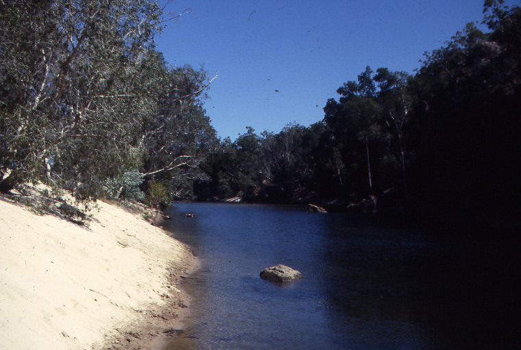
The tranquillity of the existence of the South Alligator River system could change in the near future if our land managers made the wrong decision.
In the biggest land grab since Captain Cook took possession of Terra Australis in 1788 (without even, I might add, asking permission from the local inhabitants), the Australian National Parks and Wildlife Service took possession of a further 6726 square kilometres to the south and south-east of the existing Kakadu National Park boundaries extending the park area to a grand total of 19,799 square kilometres. This annexation of more land meant excising the Goodparla and Gimbat Pastoral Leases plus the removal of cattle, horses, feral water buffalo and feral pigs.
Kakadu National Park is now one of the largest national parks in the Southern Hemisphere. Its ecological importance to the flora and fauna of the western Arnhemland spectrum is immense as it now encompasses the whole of the South Alligator River system, the whole of the East Alligator River system, the whole of the West Alligator River system and parts of the Wildman and Mary River systems – all very important ecosystems in the make up of the far northern wetlands of Australia.
Recorded history shows that, during October 1845, the intrepid explorer, Ludwig Leichhardt and his companions, descended into the South Alligator Valley after an arduous thirteen month overland journey from Moreton Bay in Queensland.
Al the way north after crossing the Roper River, to where Leichhardt descended into the South Alligator Valley, his party was beset by hostile native inhabitants. They were objecting to this intrusion into and across their land and they harassed the explorers to no end. Leichhardt was passing through Bulajang country, sacred to the Jawoyn, with its totemic spirit values. Bula for short, the spiritual guardian of the upper reaches of the South Alligator Valley, demands that the earth not be disturbed by man or a terrible will overcome those who do so. So is the legend of the Dreamtime, carried forward into the twentieth century by the present day Jawoyn. This land is also known as the Sickness Country. One wonders what the pretext to land disturbance might have been a thousand years ago.
Later, explorers such as John Macdouall Stuart (south/north crossing of the continent in 1862) and George Maclachlan (Overland Telegraph Route 1870) also reported hostile inhabitants. When the pastoralists moved in along with prospectors and miners, their opposition waned and very soon they were dispossessed of their ancestral land.
Then in 1976 the Northern Territory Land Rights Act was promulgated and the Jawoyn people have since then been fighting to have their traditional rights restored to them. Recently they were successful and have been granted a part of Katherine Gorge National Park which includes the famous and scenic Katherine Gorge.
But nothing comes easy these days. Right in the middle of this very fragile land area at the head waters of the South Alligator River, a Conservation Zone, better understood as a Mining Corridor, has been declared at the same time as the declaration of Kakadu Stage Three.
Exploration for minerals commenced in the 1950’s and to date considerable quantities of gold, uranium, platinum, palladium and other precious metals have been found. There are numerous old mine workings in the very rugged conservation zone which have ceased to operate – mines such as Rockhole, El Sherana, UDP and Sleisbeck. Mineral exploration has been continuing at Coronation Hill by the Australian mining giant, BHP Corporation.
If mining uranium in Kakadu Stage One was not enough a can of worms has been opened here with Kakadu Stage Three. Clearly the Federal Government, through the ANPWS and pressure groups throughout Australia, like the Australian Conservation Foundation, has proclaimed the area part of a national Park partly because of its ecological significance and partly because of its will to stem the tide of corporate ownership and exploitation of this resource rich land. But with it comes a great dilemma. With Australia’s foreign debt into hundreds of billions of dollars, new wealth has to be found to drive the country out of a possible recession, here at Coronation Hill mining experts say that the extracted raw the material will earn Australia the necessary capital to wipe out our foreign debt within ten years.
Conservationists throughout the country are aghast that the Federal Government may just give in to big business and that mining may commence. Fears are also held that, if toxic waste from the mines found its way into the South Alligator River System, it could spell absolute disaster for the environment.
In between the Mining Lobby, the Federal Government, the Northern Territory Government, the conservationists, the scientists, the great unwashed professional rent-a-mob protesters, the sometimes biased and ill informed print and electronic media, the general public and the ANPWS, the Jawoyn people patiently wait for an outcome.
ANPWS is stuck with a problem: How to develop a huge extension to a national park when resources are stretched to the limit. To cap it all off, the government of the day, cannot make a decision as to what to do with mining in national parks.
Aesthetic values:
Kakadu Stage Three is an added bonus to the already magnificent attributes of the World Heritage Listed areas of Kakadu Stages One and Two.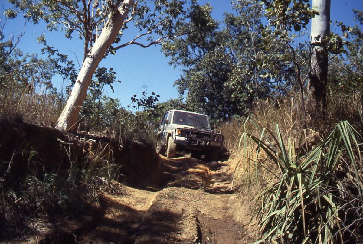 Track in to Koolpin Gorge
Stage Three consists of the South Alligator Valley with its numerous tributaries running in from the escarpments. To the north the continuation of the Arnhemland Escarpment provides for magnificent gorges and waterfalls with remnant rain forest pockets scattered in tranquil valleys. Prolific flora, on the banks of many creeks and rivers, is home to a plethora of animal life. One third of all Australia bird species, a quarter of its fish species, 50 mammal, 75 reptile, including salt and fresh water crocodiles, and 25 frog species live here. A recent scientific survey has discovered a rare miniature marsupial called the Red Cheeked Dunnart- a mouse-like creature. Other rare species are the Pig-nosed Turtle and the Hooded Parrot.
The magnificent sandstone escarpments are home to one of the twelve most important rock art regions on Earth. They also provide some of the best bush walking country in the top of Australia. Although Stage Three at present will be catering for coach and 2wd tourists, there are some 4×4 tracks which provide a challenge to those adventurers who wish to hide away from the general throng of holiday makers.
Stage Three Development
The main areas of development will be at Barramundi Gorge, Graveside Gorge, Gunlom Falls and Koolpin Gorge. There are some other remote areas where existing tracks have been used in recent times but there is no development strategy at this time and access has not been restricted. There are also quite a few areas of lesser significance that will attract minimal development. The head waters of the South Alligator River however, including the Christmas Creek Rock Art site, the Gimbat area, Coronation Hill, Motor Car Creek and Sleisbeck ruins are closed to public access until further notice. Many of the old mining tracks in the vicinity of El Sherana have also been barred from entry.
Access to Stage Three is restricted to the months of May through to the end of December. Flood waters usually make access to most of Kakadu impossible from January until the end of April.
Development Areas
Barramundi Gorge. Good camping and swimming area. 4×4 access only.
Graveside Gorge. 4×4 only. Remote camping.
Shovel Billabong. 2wd access. Picnic Area
Goodparla Plains track. 4×4 only. Shortcut to Old Jim Jim road.
Buk Buk Lookout. 2wd access
Kombolgie Creek crossing. 2wd access and camping.
Plum Tree Falls. Magnificent rain forest pocket. Picnic area and walking access only.
South Alligator River crossing. Sand camping. 4×4 only.
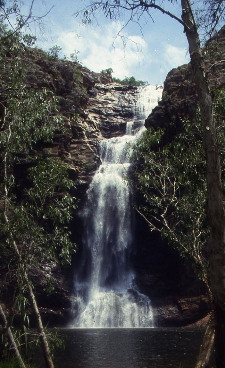
This magnificent waterfall thunders over the escarpment in the wet season. Also know as UDP Falls or Waterfall Creek Falls. 2wd access.
Koolpin Gorge. Another magnificent gorge. 4×4 only but being upgraded to 2wd access.
Christmas Creek Aboriginal Rock Art site. Earmarked for future development but closed to public access for the present.
Gimbat and Sleisbeck. 2wd access in the future for day visitation. No public access at present.
The Rock Hole. Great swimming hole. 4×4 access only.
Upper Mary River. No development at present but 4×4 access for remote bush camping at present.
Mary River Crossing Motel and Roadhouse.
ANPWS Entrance Station
(Description of areas have been deleted due to the changing nature of access requirements).
Self
The year of 1990 was fraught with sadness and other things. Judith’s Father passed away from throat cancer at the age of 69. Judith flew down to his funeral. I got caught out by the RBT one night coming back from town. Lost my licence for 6 months. It was a hard pill to swallow but I got over it. Then we blew the motor up of the Bundera and that had to be repaired. Leno lent me his small Tip Truck while he fixed the Bundera but as I had no licence, Judith had to drive it.
Life at the Old Railway Station went well for us. I managed to get a sample of how to make Boomerangs and with a saw and angle grinder I set about making various Boomerangs. When finished I would sand the timber down and a apply a base coat of water-based paint and then pass it on to Judith for her to paint various designs on them. When her job was completed, I would spray the Boomerang front and back with Cabothane, an oil-based Polyurethane which sealed the surface to a shiny finish when dry. We put a sign out on the road to catch customers. I also made Clapsticks. At this stage I acquired a Scroll Saw which enabled me to cut intricate designs out of MDF wood. That started a whole new world of designs where we had 38 different designs in out catalogue. They were mainly Welcome signs, Toilet and Bathroom signs and a host of different key holder designs depicting Australian Fauna and Flora. I cut my fingers four times with the scroll saw and after that, never again
I also took over a Lawn Mowing round from a bloke who had a contract with a Mining Company for gardening services. I expanded on that and bought myself a 250cc Yamaha Chainsaw. That brought in more work.
Eventually at the end of the wet season in 1991 we gave up our railway hide-away as external forces in the small community were becoming untenable and we took our stuff and moved back in to town (Darwin).
We landed a house-sitting job for six weeks and then when that finished, we moved back in to the caravan park on Buffalo Creek.
One afternoon we went for a walk on the beach and bumped into Barbara Moore from the NT News and she wanted to know if Judith wanted a job again and when she said yes Barbara said “O.K. You start on Monday”
Once again, I needed wheels as we had quit the Bundera and were driving an old Valiant for the time being. Judith used the Valiant for work and I found myself a 1979 Toyota FJ55 at a car-yard for little money. It had air-conditioning, a 205litre fuel tank and a full roll cage and roof rack. It had been a government vehicle used for long outback trips.
The same week I landed a job with a Builder- Developer. He was a diminutive man of Italian background and he needed me for back-up support when he collected his rents from a large building of units. I worked for him for most of the year until one day he just disappeared. His wife paid me for services done but said that she could not-pay me anymore as she had no access to money. He had apparently skipped the country when the local Mafia wanted some money back at an exorbitant interest rate.
I went and helped mat old mate George, with a job out in the bush on a mining site and we had fun with his old tip truck which kept on catching on fire. Once I abandoned it while it was still moving.
Judith and I also did Markets at Mindil Beach on a Thursday night and also at Palmerston and Coolalinga. In the mean time an old friend, Theo, asked me if we would like to live on a bush block he had bought near Yarrwonga. Our job was to be a prescence there and to plant trees and look after things in general, rent free.
One night coming back from Mindil Beach Market the lights on the Toyota failed and we had to use a torch to get home. Quite funny it was, driving by torchlight.
The living conditions at Theo’s block were not up to scratch and we moved back to the caravan park which had en-suites. We traded the old Valiant in on a little Toyota van which I drove and Judith had the Toyota.
I was doing odd jobs contracting my labour out at the beginning of 1992 Judith came home and asked if I would like to go and live in Alice Springs, which lay 1500km south of Darwin. She had the offer of a transfer to Alice Springs after Easter to a management position and the job included a shared car. I said No Worries and we started packing our gear into the van.
But before we went south, we drove out to Palm Creek!
Back-up ! Back-up, on Palm Creek 1992
Published in 4×4 Australia Magazine August 1992. Some photo updates 2011

Palm Creek Billabong
Back up! Back up! I called to my mates on the radio. Once again we had come to a creek at a point that was impossible to cross. I got out of the vehicle and walked through the six feet high spear grass to find a suitable crossing place. During our ten day adventure into this remote part of the Northern Territory we crossed no less than 90 creeks and washouts.
Judith and I in our FJ55, together with friends George, Maureen and young Christopher in their HJ60 and Milton and Ruth and ‘Puppy’ in their FJ47 set off on a ten day exploration holiday that would cure us of four wheel driving for a while.
These days, with costs running sky high on everything, one can barely scrape the money together to go on a camping trip every three months let alone every other weekend. Gone are the days of the 2 stroke Suzuki when you could go bush for $50 for a weekend.
This trip was six months in the planning. I obtained permission from Tac Hall, owner of Innesvale Station and Ian McBean, owner of Bradshaw Station, for the purposes of camping and having a look around. Tac Hall is considering supplementing his cattle business with a tourism venture and I understand from local sources that a tour operator is going to run tours into Bradshaw Station in the near future. Well, I hope that the latter has plenty of stamina and plenty of winch cable because where we went was hard going all the way. Ian McBean commented that the area we were going into had not been mustered for ten years as the terrain was too rough.
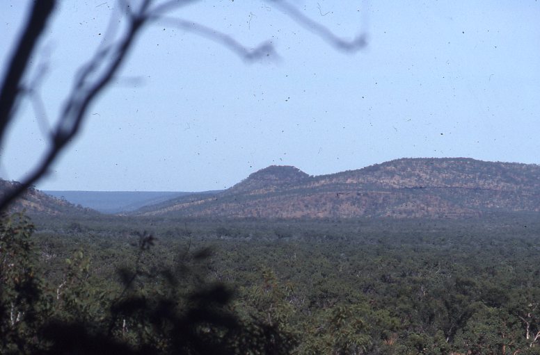
Yambarran Valley
We left the bitumen 24km south of Pine Creek, passed through Claravale Station and Dorisvale Station along a public road, crossing the Daly River and travelling on to Wombungi Outstation where we were to begin our trip along Palm Creek. Although we had had a poor wet season this past year there had been enough rain to make the floodplains wet and boggy and the tall spear grass ten feet high in places. Palm Creek is a major tributary of the Fitzmaurice River and joins the Fitzmaurice in a long floodplain basin, and flanked either side by a 250 metre high escarpment. The floodplain is 15km wide and 40km in length. My 1:50,000 Australian Survey maps showed a track that followed the escarpment to the north and crossing over the floodplain just west of the junction of Palm Creek and the Fitzmaurice River. The track, shown in dotted line format also has ‘Approximate Position’ written next to it. According to Ian McBean it was doubtful if that track was still in existence.
George had borrowed a Sony Pyxus GPS from a mate to try out. At $2000 each, this equipment is still very new on the market and now comes in hand held form. Hopefully prices will drop in the future. Previous models were cumbersome boxes. We took numerous readings whilst we were on our holiday and it proved to be invaluable to pin-point a position to within 100 meters.
In the afternoon, whilst driving west into the sun, I got snagged up on a large piece of no.9 fencing wire in a rather damp area. It took more than an hour to cut away the wire which had wrapped around the axles and springs and we decided to call it quits for the day and camp. We backtracked to the Wombungi Road and camped on a running creek near the abandoned outstation for the night.

Wombungi Outstation Ruins
In the morning we ascertained that the floodplain was too wet to cross and we made for the hilly country on the fringes of the northern escarpment. I pointed the FJ55 into the tall grass and made for the nearest rise. It was hard going, bouncing over rocks and crawling up and down some very steep hills. We had to cross over a number of small creeks that run out of the escarpment and we were driving ‘blind’ through the tall grass in the gullies. On a couple of occasions I made it 90% to the top of the hill only to lose traction and then having to reverse down the steep incline, being aware that if the vehicle slid sideways, a roll over was possible. All the gear in the vehicle blocked the back vision and I had to be directed down by the vehicle behind me. I reversed into two trees doing this. My little mate sitting next to me was not amused and opted to get out and walk at the first sign of danger.
By the end of the day we had driven 14km but had gained only 5km in real distance. Once out of the hills and on higher ground I felt that my power steering was acting contrary to normal. On inspection it revealed that the tie rod was bent right up against the sump. With the help of Miltons’ PTO winch and a sizeable log we soon straightened the tie rod. It was time to camp.
On the third day we drove off on a north-west bearing across the plains in search of the track. The first challenge of the day came when I entered a four metre deep dry creek. The sides of the embankment were dry and brittle and the weight of the vehicle broke the surface and made a slide into the creek bed. But it was so steep that I slid off the seat. The bulbar, with a low slung protector bar at the bottom, dug into the soft creek sand as I pushed forward ever so gently. Halfway through this descent I had to turn to the left and then as the vehicle came into the creek bed, gun the accelerator so as to get enough momentum to clear the embankment on the other side. By the time the last vehicle came through the driver asked what the fuss was about as it was an easy track. Many of the following creeks that we had to cross were of this nature and it was slow going. Just ease her down.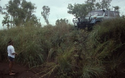
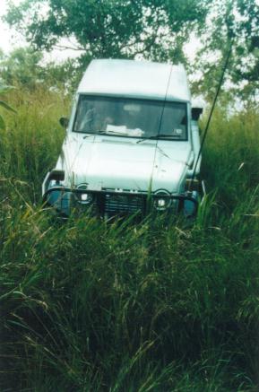
Palm Creek Offtrack
About mid morning we came across the track after hours of straining ones neck in the tall grass. According to the GPS the track was 1km out of line with the map. Suddenly we were back in High Range again and speeding along at 20kmh. The track was very faint and could only be found at times by looking for the windrow made by the grader blade sone seven years prior. The grass was still over the top of the bull bar in places and more times than I like to recall I had to say ‘Back Up, Back Up’ on the radio and go in search of a presentable creek crossing. George got the HJ60 hung up in a creek and had to use the Warn 8000 and a snatch block to extricate himself. The 8000lb winches just seem a tad too light for the heavy Landcruisers and almost every time that you have to use the winch you need to use the snatch block as well.
Then I entered a creek bed that looked dry but was in actual fact an underground creek. Once the FJ55 had broken the surface it was pure ooze beneath and we settled in the mud right down to the chassis rails. Milton and George found a dry crossing and with all three winches working in unison with snatch blocks and about 36000lb pull we managed to get the old girl out of the mire. Mind you we also had to do some excavation work on the opposite embankment and the vehicle was being pulled into the bank instead of up and over. Two hours later we were moving again.
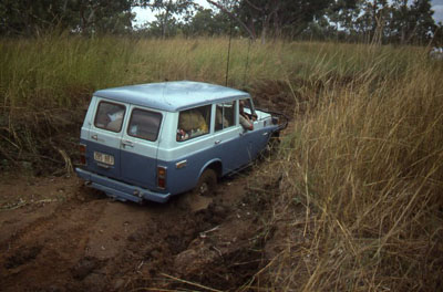
Mega bog near Palm Creek
A Barking Spider entertained us for a while as somehow it had entered the vehicle and was walking towards us along the hood lining. There was a general “abandon ship” cry as we flung ourselves from the car. With great difficulty we coaxed the spider out of the car and into the scrub.That night we camped in ‘Old Fella’ Gorge, a name that I gave, after some of the erotic aboriginal paintings under the overhangs along the escarpment. This gorge is seven kilometres long and has high cliffs of red sandstone. We camped there for three nights getting back our strength and exploring our surroundings. Apart from feral donkeys, one feral cat and the odd dingo or two we were conscious of the absence of kangaroos, wallabies and feral pigs. There were no signs of any cattle inhabiting the area at all. We did see rock wallaby droppings in the escarpment but those shy animals kept a low profile and out of our sight. Bird life was prolific as usual.
We followed the faint track south from the escarpment and crossed the Fitzmaurice River, downstream from the junction with Palm Creek. The river was flowing but was not very deep. Both embankments were steep however and it was another winch job which took more than two hours to get the three vehicles to the other side.

Stuck in Palm Creek
I had seen a spot of greenery on the southern escarpment from a distance. Our faint track veered away from this place so I swung the nose around and off the track and went bush heading for the green. On approaching the small tropical rainforest I got hung up on some rocks and had to be winched backwards as moving forward was not an option. This small rainforest pocket had a natural clearing right in the middle and made an ideal camp site and we were able to take all three vehicles in without damaging any of the foliage. We named our camp Water Snake Springs as young Christopher discovered the reptile. We checked our reference library and the snake turned out to be a Macleay’s Water Snake and quite harmless. Later we were to take photos of the snake and its partner. They were quite unperturbed by our presence. One night we had a visitation from a Brown Tree Snake which leapt from one branch to another. We also had a visit from the biggest Perentie lizard any of us had ever seen. It strolled around our camp with disdain using its tongue to sniff out any possible delicacies. In the end we had to make a loud noise to scare it away as it came too close to our food supply. We were protected from the harsh sun by the rain forest canopy and just thirty metres away there was a lovely swimming hole which was fed by the spring. We could all fit in the water hole at once and enjoyed many relaxing hours there.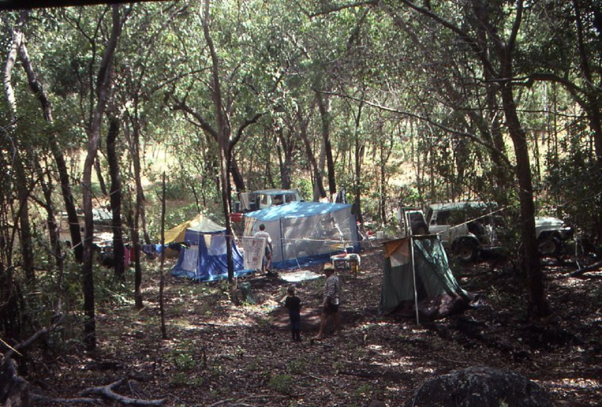
Water-snake Camp
Before we left this idyllic campsite we went exploring and drove west along this escarpment and entered a very large gorge. This was a boy’s trip while the girls stayed at the camp and baked bread and other treats. We drove up the gorge for a little way and then walked about 2 kilometres. Found some good aboriginal rock paintings and a nice swimming hole. It was very hard going though as the grass was very thick in places. On the way back to camp I hit another hidden stump and it was time to straighten the tie rod again. This time I used my own winch via a snatch block attached to Milton’s truck.
On Easter Sunday we started making our way back to Wombungi. Driving cross country again, George split one of his wide tyres. And the spare was also flat. So we had to pump the fresh tyre up after fitting a tube. It was there that we discovered that all three air pumps were not working properly and we had to take one apart and repair it. Lesson learned. Service your air pump regularly. Luckily George had the presence of mind to have his puncture in the shade of a nice big tree so that we could stay cool.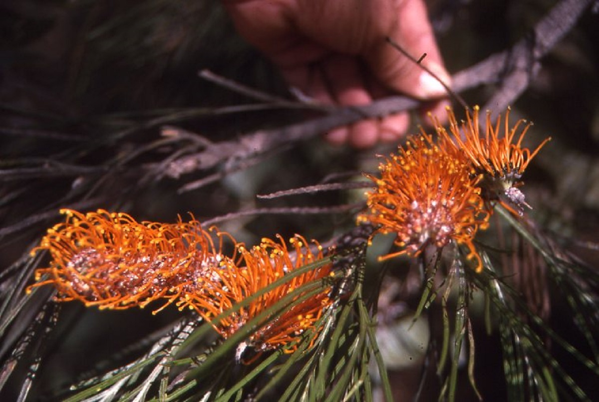
We were still looking for the mustering track when I came across a boggy gully. After a cursory look I decided to cross over. That was a mistake. The front wheels dropped right down into the mud while the back wheels got hung up on a ledge. At the same time the positive cable to the winch had rubbed through its rubber coating on the chassis causing a dead short and draining the battery within seconds.
It was another winch job as a snatch strap proved to be ineffective. While everyone was standing about giving advice I sent the girls on a mission to find a suitable place to cross. It was not long before they returned excitedly claiming to have found the lost track. And there it was, just 100 metres away from my bog hole. Once I was mobile again after some temporary repairs and a jump start we were on our way.
Offtrack driving
The track was very faint in places and it was slow going and I got bogged in a swamp and had to be winched out again. We crossed several very deep creeks and not without some minor panel damage before finding Palm Creek again. It was time to camp. The blokes tried their hand at fishing and landed 3 bream, 2 catfish and a Saratoga in a short time. A cheeky goanna came along and tried to knock off some of the fish. Palm Creek also gave up some lovely quartz crystals and each vehicle left with added weight. By this time the flies were annoying us intensely. They say that out in the Australian bush the best time of day is that half hour between when the flies go to sleep and the mosquitoes come out to annoy you. The mozzies annoyed us to no end and we were forced to put up the tent.
On our last day, we had a 14km drive to get back to where we had left the station road and another 400km back to Darwin. We crossed seven creeks on the way out, some with difficulty and lost the track more than once.
Back on the Wombungi Outstation road it was time to de-grass the radiator guards. The quickest way to do this is that after you have removed the grille and the gauze, you pull any exposed wiring out of the way and put a match to any grass that has found its way through the guard. The grass burns quickly with a ‘whoosh’ and presto!! You have a clean radiator. Normally the air-conditioning radiator cops all the grass and saves the vehicles cooling system from clogging up.
It had been a good holiday with plenty of four wheeling and a relaxing time out in the bush.
Self
We left for The Alice, as it is affectionately known, after the Easter Long weekend, with me towing our van with the FJ55 and Judith coming behind or in front with the little Panel van.
At Katherine I decided to weigh the van on the Weighbridge just a few kilometres south of the town.
It looked that there was no one there behind the blackened glass made it so that you could not see through. The caravan weighed in at 4.4 ton. Out of nowhere a short little man in a khaki uniform came out to me berating me for having an inferior tow ball on the Toyota. Just then a big road train lumbered in and the bloke asked me to move so that he could deal with this huge truck and talk to me afterwards I drove off and kept on going.
We were pulling off the road at Bonney Well for morning smoko just south of Tennant Creek when the tow ball snapped. That little man was right. The A-frame of the van pushed a big dent into my back door and I had quite a job fixing it. I had to leave Judith there with the caravan and the little panelvan and drive 90 kilometres in to Tennant Creek to buy a heavy-duty tow ball. I got the rifle out for Judith just in case. As it was, a group of Aborigines stopped there to see if they could help. I arrived shortly afterwards and the group said goodbye and left us to our own devices. They were very friendly though all the way to Ali-Curung Community. We stayed the night there after I had fitted the new tow ball and hitched the van up again
We kept on driving to Alice Springs for another 400km.