Northern Exposure ..Fossils and Fords ..Maytown ..Cape York ..Elim Beach ..Beachcombing the Eyre
Northern Exposure 2011
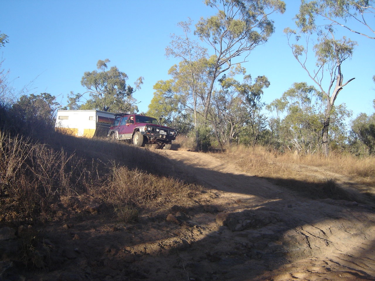
The cold set in around the beginning of May this year and so we brought our travel plans forward by a week and set off heading north east. Our leisurely pace took us to Broken Hill where we topped up with groceries and last minute reminder items, refuelled and then set our sights on heading due north along the Silver City Highway. Broken Hill is lovely town with a great mining history as this is where our greatest mining icon, BHP, was born. This town in New South Wales, which lies only 50km from the South Australian state border, has more affinity with the city of Adelaide than with its parent city of Sydney. It has wide suburban streets, quaint laneways with refurbished old time miner’s cottages and with the city blocks crammed in to relatively small space so as to make parking near your favourite shop a hassle. But the city was built in the late 1800’s and thus did not account for modern day expansion and cars!
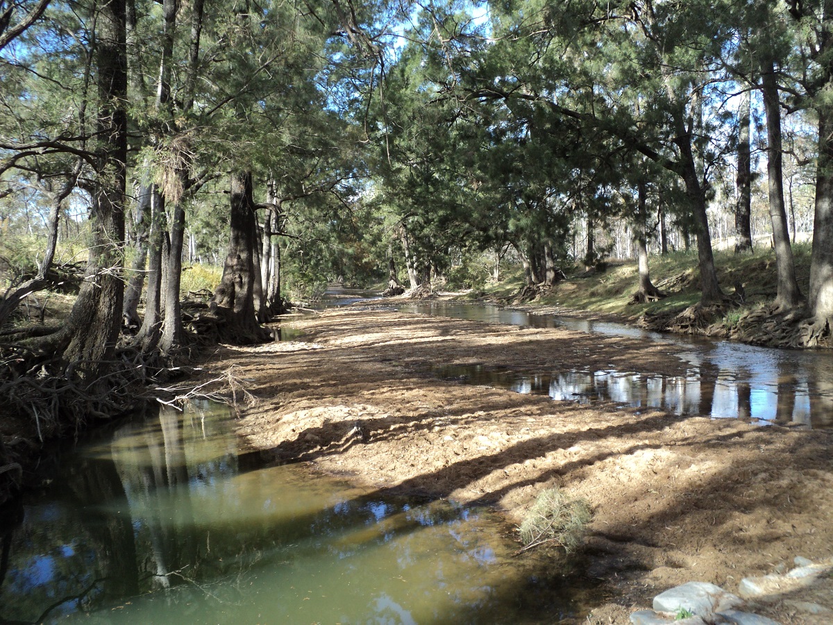
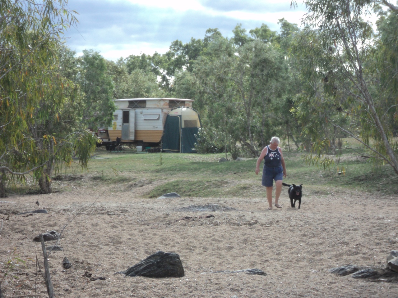
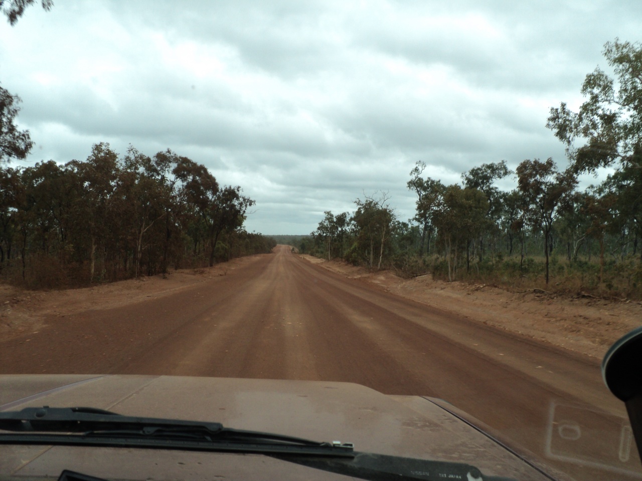
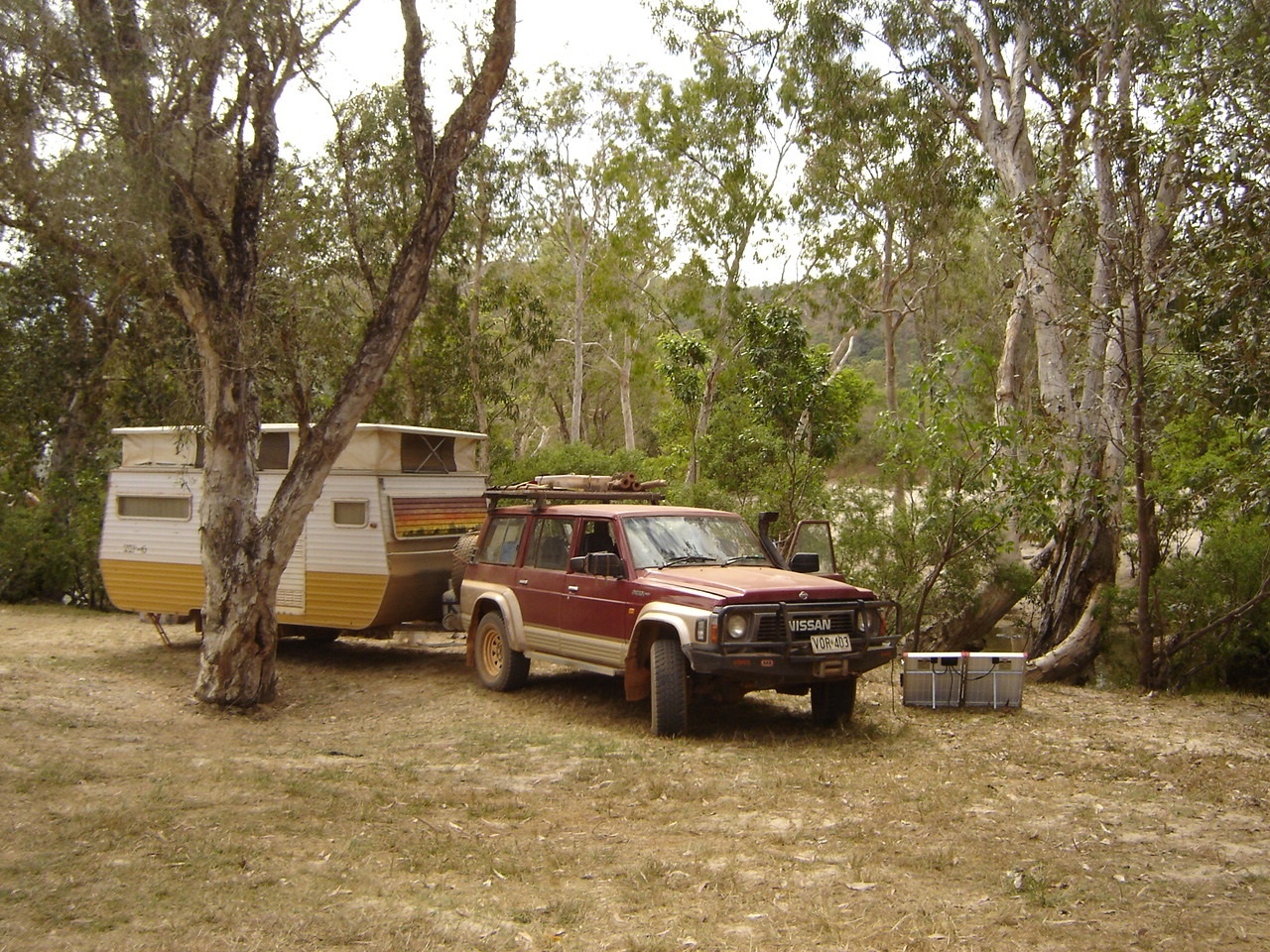
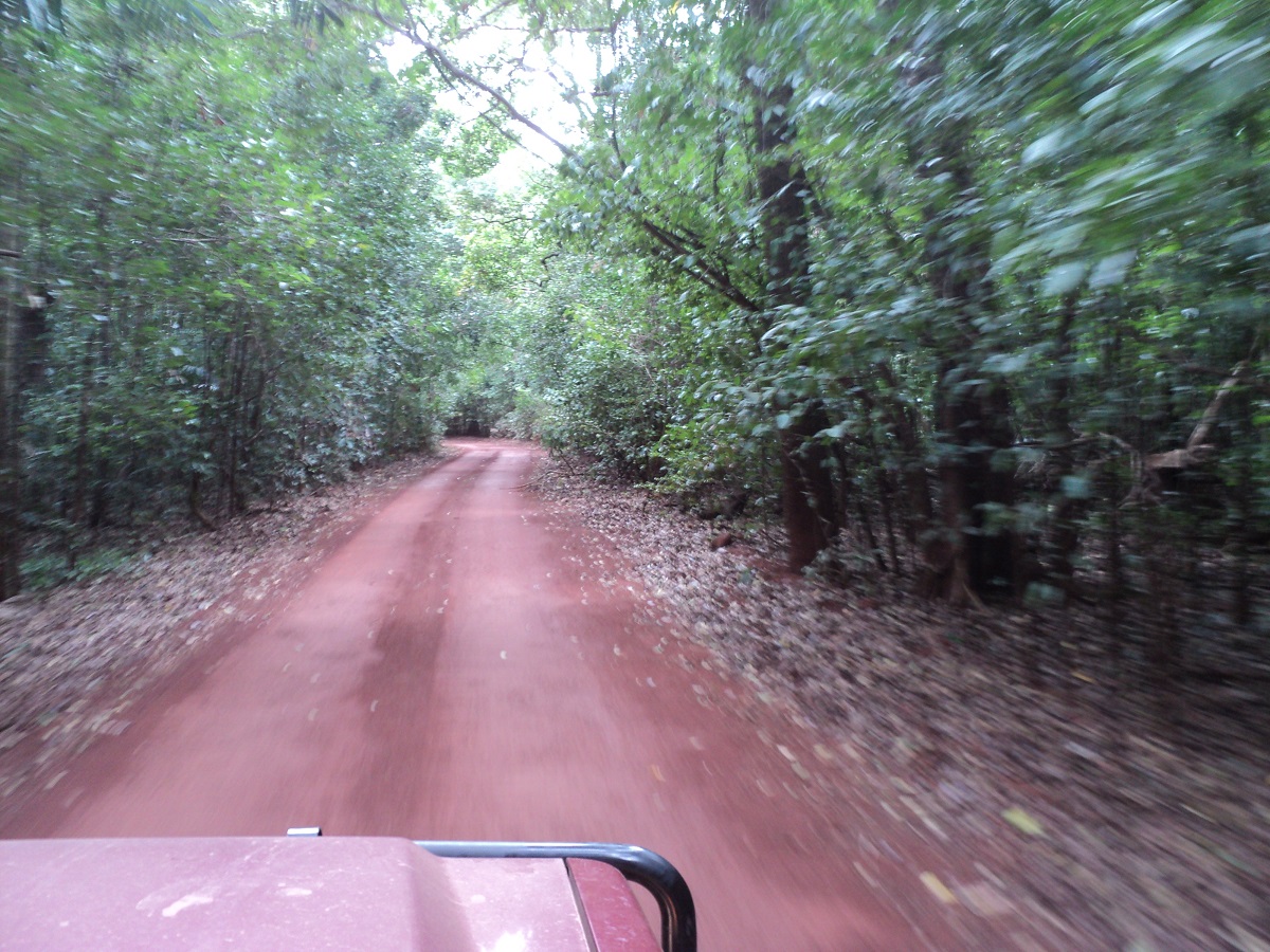
This year we have updated our Camps Australia book to number 6 and look for free campsites along our journey. Having travelled the Silver City Highway a number of times I have been at a loss to understand the logic of the building of this road with unequal distances of sealed road and gravel road. Once off the sometimes heavily corrugated or washed out gravel road it is a relief to be back on the sealed section. But just as you get used to it you revert back onto gravel again. The Fowlers Gap free camp was uninspiring and so we travelled a short way further to find a good campsite on the banks of Fowlers Gap Creek amongst the river gums. We relaxed by a good campfire made from wood scavenged from the creek and only a small number of B-double trucks trundled past our camp carting what looked like giant pipes.

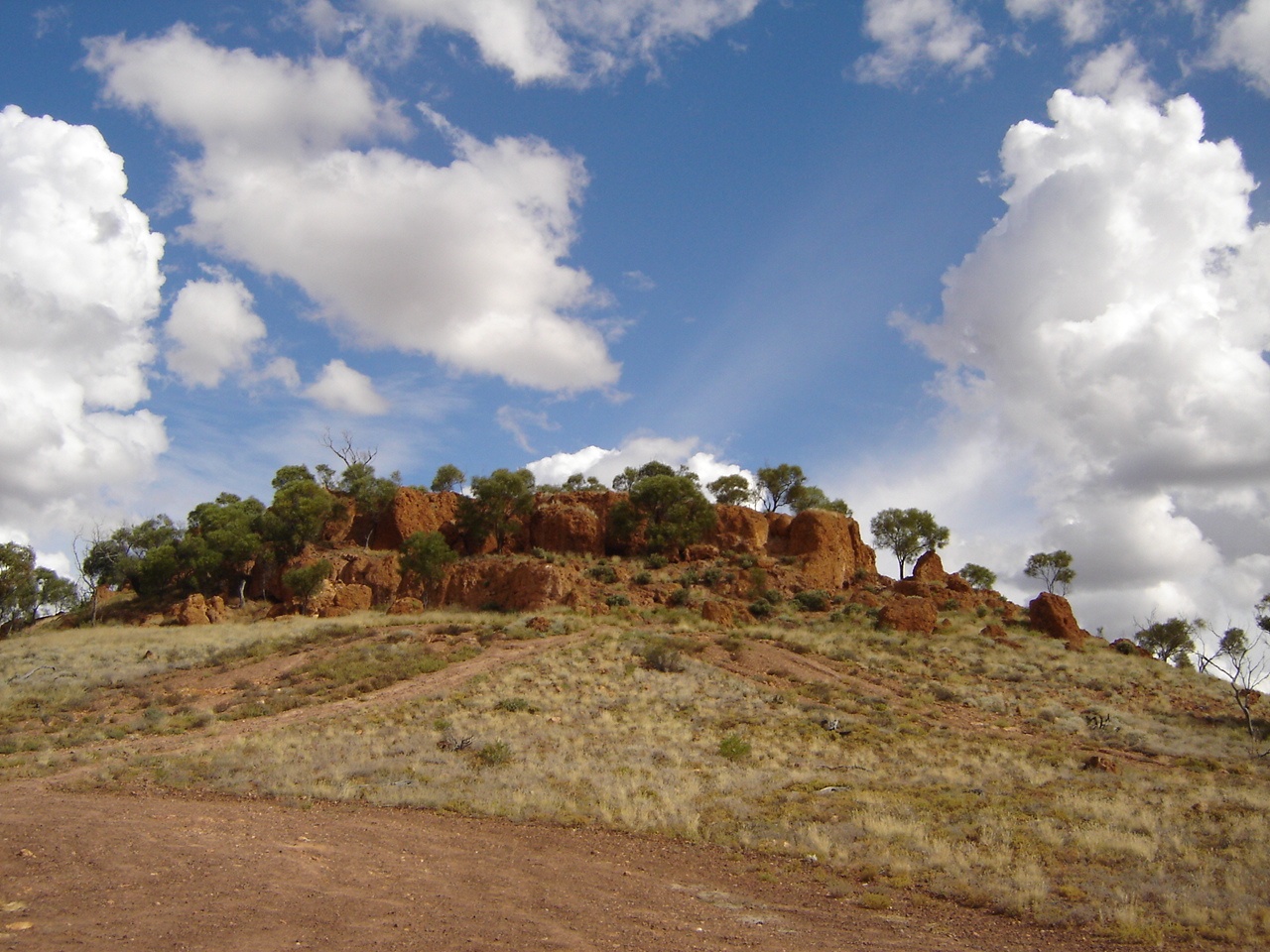
Silver City plains
Milparinka is a ghost town with one house and the restored Court House as an Information Centre. We had a good camp down on the east side of the creek having arrived there at an earlier time to secure the best site. About four other rigs drove in but camped away from us.
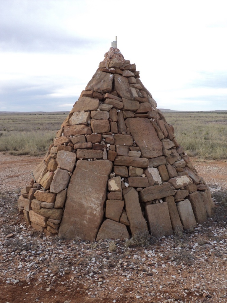
Milparinka Cairn
On the road to Tibooburra the golden glare of the grass made for a spectacular sight after all the good rains of the past season. We found Tibooburra un-exciting. It seemed neglected, dull and dreary. The National Parks office had a good display of Historic and pre-historic stuff. We decided not to refuel as the price of diesel was 30 cents per litre more expensive than Broken Hill.
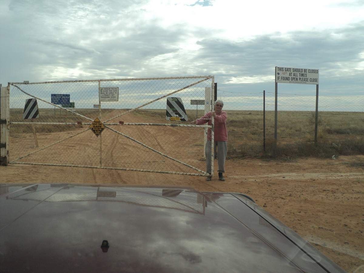
Warri Gate
We pushed on for Warri Gate Dingo Fence thoroughfare on the border of New South Wales and Queensland.
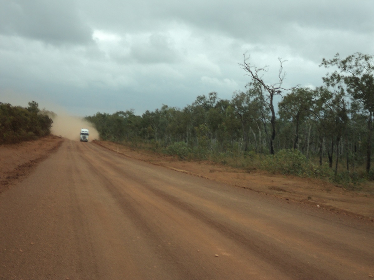
At 12 Mile Creek there was a humungous bulldust patch which needed some careful negotiation. In the mean time we encountered about ten trucks carrying pipes or coming back empty from wherever. We figured out that this was the Oil Field Road carting pipes from Broken Hill to the oil fields. These trucks would normally run from Whyalla in South Australia to the oilfields but due to excessive rains and flooded roads they have had to take an alternative route. At one stage there was a 50km stretch of bulldust holes making the driver watch carefully what he was doing.
We found a campsite in a quarry at the intersection of the road to Noccundra and the Santos Oil Road. We were sheltered by mounds of ground from the wind and from the trucks which plied their trade non-stop every few hours through the night. I refuelled from our jerry-cans and found some dead firewood after a bit of searching in the open scrub country.
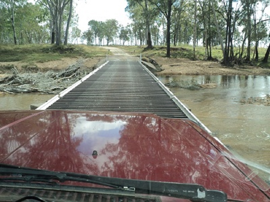
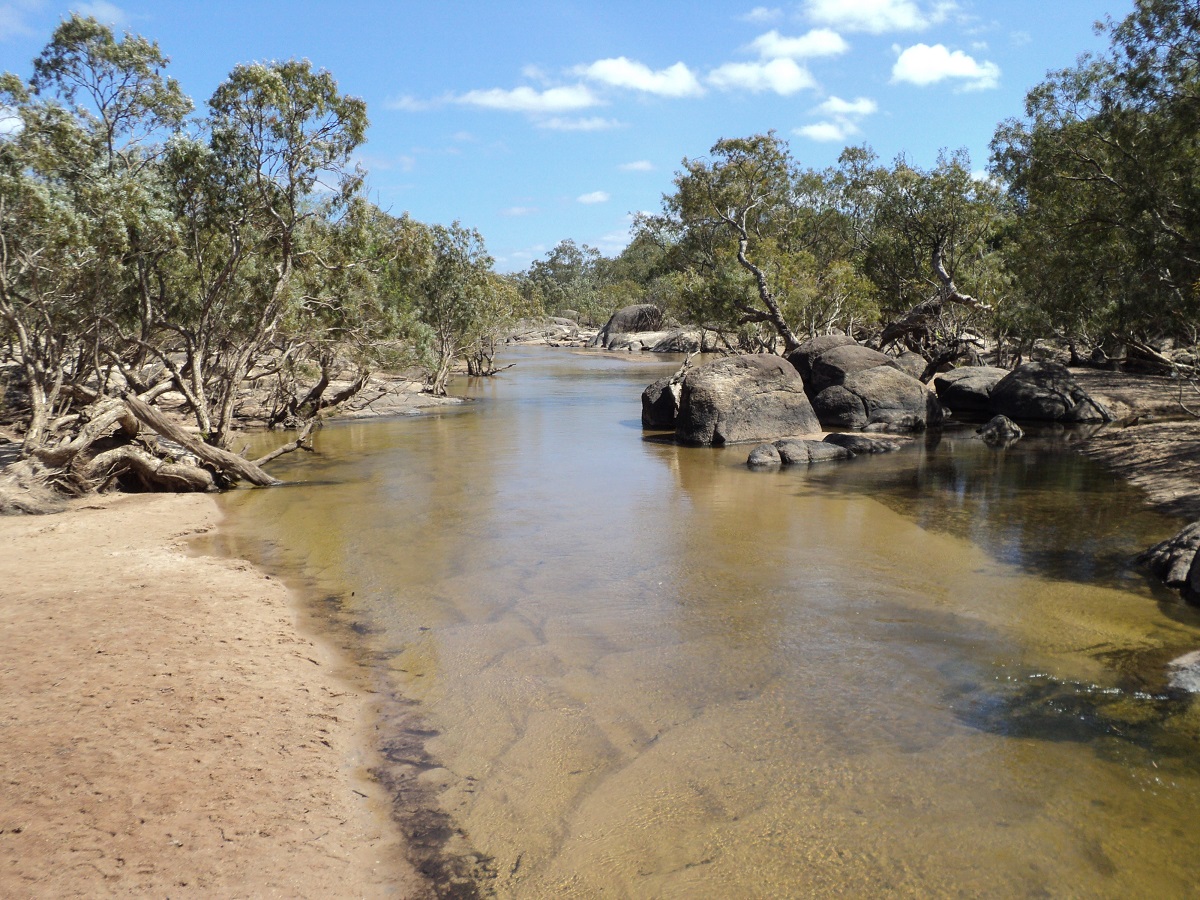
The road improved the next day and we made it to Noccundra by mid-morning. The Publican of the Noccundra Hotel kindly let us have 20 litres of water from his rainwater tank. We then made our way to Noccundra Waterhole on the Wilson River. Here we set up camp for two nights and threw the Yabby trap into the river and caught a few Yabbies. There were quite a number of water-birds as well as birds of prey around and we spent hours watching their antics of survival on the fringes of the waterhole. Judith found a pair of fancy fishing gloves in the crook of a tree which she gave to me. We started having problems with the charging of the batteries both in the engine and in the caravan with insufficient charge going in. On top of that we ran out of gas for our cooking as someone had forgotten to change the gas-bottles over before we left from home.
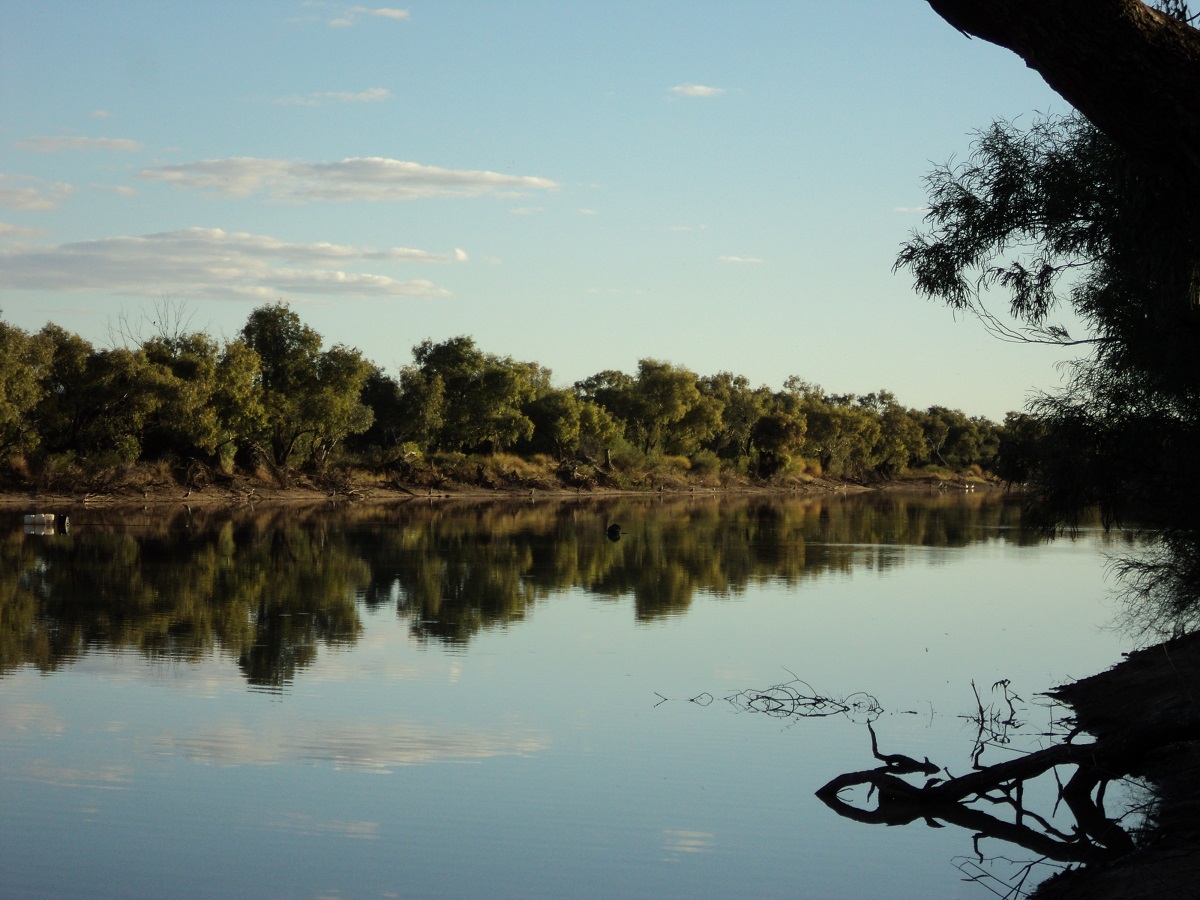
Noccundra waterhole
Our next place to visit was the town of Eromanga. The name was that of an inland sea which spanned the continent 300 million years ago and which supported many species of pre-historic life. We were looking forward to learning something at this place but the small museum was closed. We needed fuel and stopped at the BP oil installation to refuel. I had to follow red arrows along a long pathway to find a person to tell me that I can fuel up and then come and pay. I had just about refuelled when Judith walked over to go and pay. I was loading jerry-cans in to the back of the wagon when she returned stating that I have put in a lot of fuel. I looked at her receipt and the total fuel showed 150 litres while the pump had showed 115 litres. The trouble is that another vehicle had pulled up on the other side of the pump and my total had been reset automatically. We trundled back to the office following the arrows once again. A new person was behind the computer and acknowledged the mistake and refunded our overspent money. The original office worker hid in a backroom during the refund. We wondered if this ‘mistake’ process could have been a nice little scam. It is impossible to make such a mistake as all figures are digitally displayed and unless altered remain the same until the transaction is completed. Next we went to the local café where the occupants were warming themselves in the sun. We were sure there may have been cobwebs connecting them together. They were not very communicative or forthcoming so we bought a cold drink and went on our way.
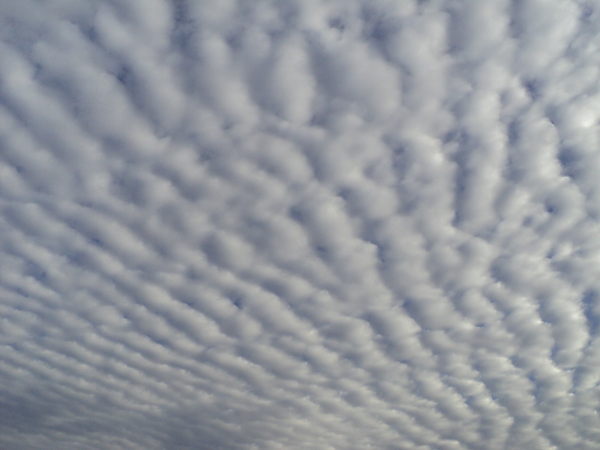
Striated clouds
At Quilpie we visited the Information Centre and the friendly assistant gave us directions for camping and where to get what. We had the gas-bottle filled and was staggered at the $42 it cost charged to fill the 9kg bottle. But that’s life and we moved on. Drove around the town to look at it and went out to Baldy Hill where Jeddah and I climbed the hill to experience the views.
Bald Hill
We camped on the Town Common where we cooked our tucker over a fire. Just on dusk we heard a vehicle coming down a bush track behind us. Suddenly a humungous dog came bounding through sand over the bushes narrowly missing the wagon. Jeddah did not have time to react! Soon after a ute stopped and bloke explained that he was taking his dog for a run! There had been a bit of traffic on the road about a kilometre away in distance but it went dead quiet after 9pm. The following morning we did some shopping and had a cuppa at a new Coffee Shop on Main street called Late on Brolga. Had a chat to some of the locals. Everyone in Quilpie is very friendly.
On our way north we stopped off at Houdrahan Lake before taking the back road to Adavale. There we chatted to the publican who said that if we gave her $250,000 she would walk out and hand the keys to us. We declined as there are too many prickles in Adavale, a very non inspiring town. Oh!, and there were grazing rights for 500 head of cattle included in the pub sale. But we pushed on along the gravel road which wasn’t too bad but having asked why only one side of the road had been graded we were told by the publican “Oh Bob will get around to it” Eventually we came to the Black Range Jump-down and a campsite sprang out at us right on top of the hill. As we sat around the fire that night we saw flashes of lightning a long way off to the south and I remarked that the rain, if any, would not come this way! How wrong I was, for at 2am, down came the soft rain for an hour or more.
Adavale Road
The run down the range was bitumen for around 800 metres and then we were on hard but wet gravel. We had hardly got into our rhythm for the day when I realised that we were now driving over wet Black-soil Plains! I immediately engaged four wheel drive after locking the hubs and we drove very carefully over the very slippery road with mud clumping up and around our mud and stone guards. A while later a local bloke in a ute passed us and I tried talking to the driver via my UHF radio but another person answered. It was a vehicle behind me towing a caravan as well. I eventually decided to stop for an hour while the dampness dried off and the travellers behind us stopped as well. We had a good chinwag and they happen to know good friends of ours when they mentioned where their home was. It is a small world.
We eventually lobbed onto Blackall and for $5 a night we were allowed to camp on a mowed grassed area down along the Barcoo River. This was very nice but we seem to attract other campers like a magnet and by nightfall they were camped in close proximity to us, but luckily, they were quiet. Blackall is a nice little town with most facilities and the town is made famous by Jack Howe the world record holder for shearing 321 sheep with hand shears in 7 hours and 40 minutes in 1892. We were still being dogged by electrical problems charging the fridges via the car or the solar panel. We stayed 2 nights.
Grey Nomads
At Tambo I found an Auto Electrician from Charleville doing business out of his 5th wheeler in the caravan park. He told me that the caravan battery was hungry for charge and that I needed a Ctek Charger and a Honda generator to run it. For only $1700 you can be assured of good battery management! Yeah OK, mate. We walked around town to the Info Centre, the Tambo Teddies and a non inspiring coffee shop. We gave the latter a miss and warmed our bellies with a Hot Chocolate from the Publican at the Criterion Hotel. We had set up camp at the free camp along the creek at Tambo but at 3pm some of the fishing fraternity descended upon us, parked close-by and lit a fire with green logs and smoked us out. So we packed up and left for a lovely quiet bush campsite along the road to Alpha.
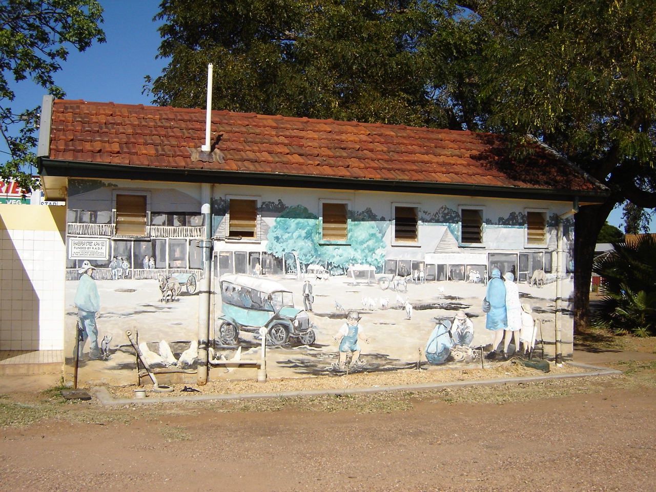
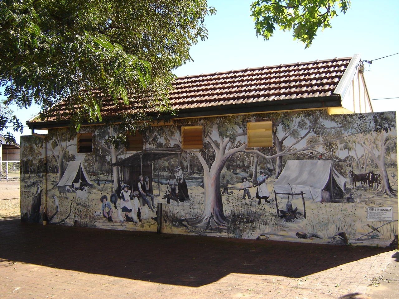
Alpha, is a town renowned for its Murals (or Muriels, as we call them). It is a lovely little community and a very friendly older lady at the Information Centre gave us tips on what to do and see around the place and opened the Museum for us at the back of the buildings.
Later in the day we drove on to Sapphire and Rubyvale. These are typical old world mining towns with higgledy piggledy houses and places of abode scattered around the place. Judith went in to Bob’s Place and bought a bucket of earth which she washed herself to find a whole handful of sapphires worth about 5 shillings…hahaha.
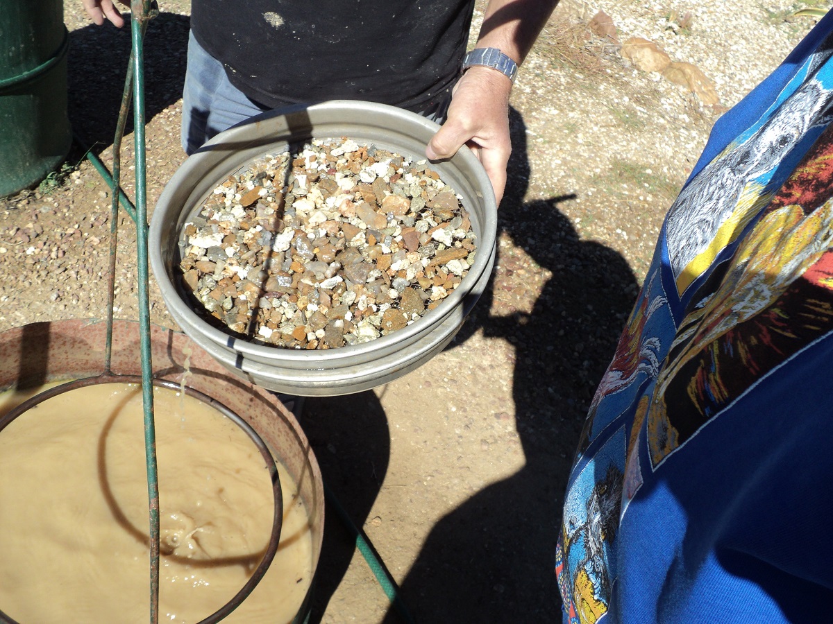
Washing Sapphires
We made for the free-camp at Sapphire which has now been reduced in size as a swimming-pool has been built on the front section of what was the large freecamp. We managed to get a good high site. Others pulled in but just on dusk some wetness appeared to be spreading down the hill towards the Big Rigs. The septic toilet system was overflowing and stank a bit. This caused some moving of camps. It did not affect us as we had prime position again out of harm’s way.
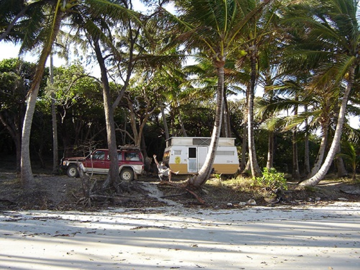
Emerald was still recovering from flood damage but the town was busy and the Information Centre was well set up and also had the RV Dump Point and water available at the front of the offices. We obtained the info we wanted and went on our way. The Woolies car-park was a tad cramped but I found a park in the shade for the rig. Coles was having its first opening day after the floods and it was bedlam in there. We drove to the Free Camp site at the Botanical Gardens. It sounded nice but the campsite was bituminised and situated between the vehicle and railway bridges. Not a very peaceful place. I swapped the Deep Cycle batteries over between the van and the wagon while Judith and Jeddah went for a walk in the gardens and amongst the many palm trees. We were soon heading north. At Clermont we went to the info centre and then drove 22km on to Theresa Creek Dam but upon arrival we found something akin to an unorganised caravan park with each caravan sporting a generator. This was not for us so we backtracked and camped on Douglas Creek next to the road. Later in the evening another vehicle pulled up and the people asked if they could camp behind us as they were dead tired.

Wolfang Peak

Clermont Coal Mine
On the way back into Clermont the following day we visited the South Copperfield Mine and its tall chimney. The mine closed down many years ago. After Clermont we took the road to Moranbah mining town. Apparently it is the most expensive town to reside in in Australia with astronomical rents and high priced everything else. I asked for possible access to Lake Elphinstone via some mining roads and a customer in the servo gave me directions. From here on we were on bumpy mining tracks. It is amazing just how the bush is being mined in Central Queensland. Eventually we came to a sign stating that there was NO ENTRY to a road. A vehicle approached and I flagged it down. The cheerful driver said not to worry about the sign as it means nothing and that everyone used that road.
Sunrise Lake Elphinstone
At Lake Elphinstone we found a good campsite on high ground as our old campsite had been flooded by recent rains. We spent a pleasant three nights there although generator noise was disturbing and annoying but luckily the noisy ones packed up and left the next day. The road too was noisy with mining vehicles and the only respite was between 11pm at night and 4am in the morning. We had brought our own wood as to find even kindling there, is difficult. There were about 20 camps over the 50 acre campsite. Our neighbours, Neil and Nevis below, had a boat and were avid Red Claw Yabby fishers and they gave us a dozen Yabbies over the time we were there. We were able to reciprocate by passing the fishing gloves on which we had ‘acquired’ at Noccundra waterhole. We did some campfire cooking for ourselves and to write up to our website. On the day we left the ablution block ran out of water and so we took it upon ourselves to drop in the town of Glenden to pass the message on to whoever was in charge.
Now our journey took us along a bitumen road towards Collinsville. Mining was intense. Collinsville area has been mined for a while but the town looked sad and run down and there were many vacant shops. At present there has been intense lobbying to the Mining Industry to rebuild towns with people and desist with the Fly-in Fly-out practices of managing their workforce. Although the mines are making huge profits, they are putting very little back into the communities around them.
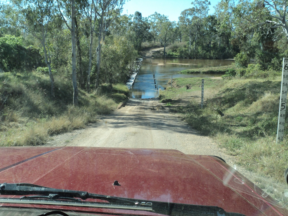
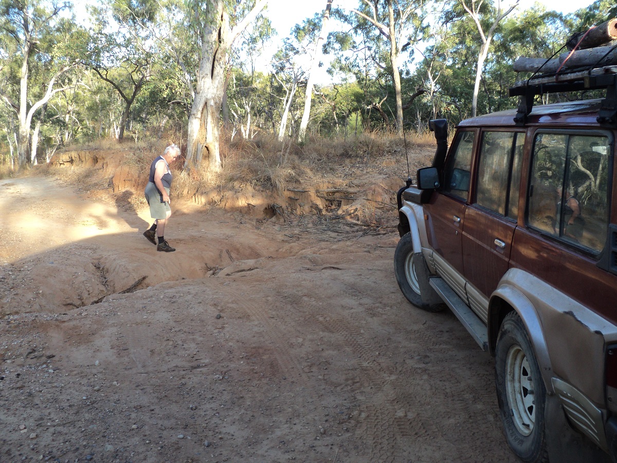
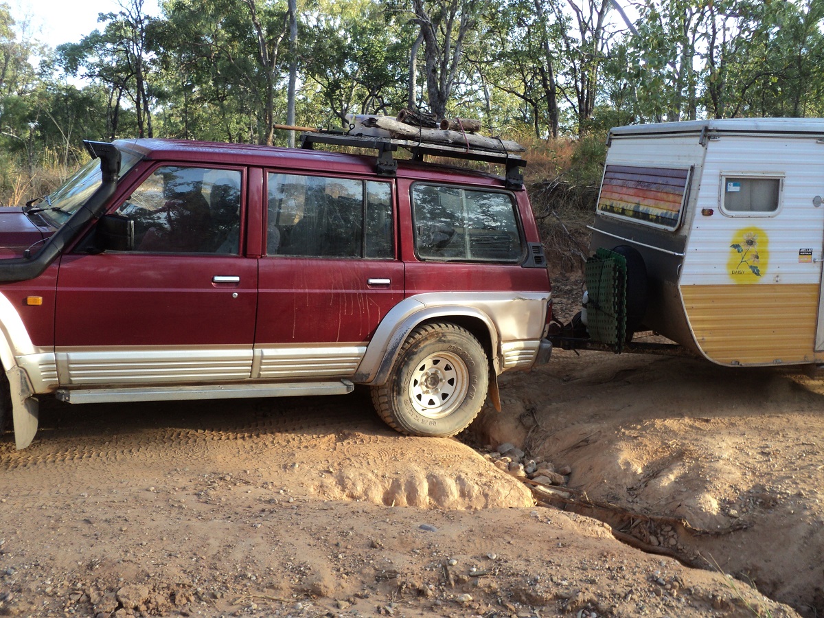
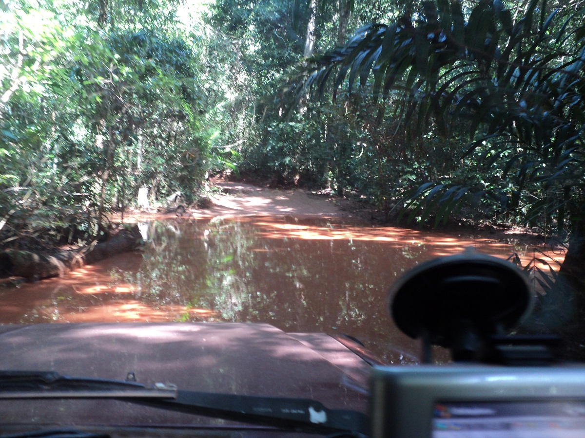
I saw what looked like a track on the map for a shortcut to Ravenswood as Judith had a desire to visit the place and stay for few days. We called in at the Info Centre but the lass there had no idea about anything. At the Servo I enquired and the girl working in the kitchen was called out. She told me that the road was good and that I could cross the Burdekin River at Strathalbyn Station after which we would be able to make our way to Ravenswood. With this info in hand we drove off and after some kilometres turned left on to a station road. The countryside was quite scenic but the going was slow with many sharp creeks and gullies to cross. Eventually we came to Strathbogie Station where a No Through Road sign confronted us. As it was another 28 kilometres to Strathalbyn Station I did not want to chance it so we did a quick detour into Strathbogie Station and found the owner at home. “Nah!” he said, “That crossing hasn’t been used for 20 years or more. You will have to cross the Bogie River to the south and head for Gumlo on the Bruce Highway”. So much for local information! The Bogie River crossing was concreted but water was running about 150mm deep over the causeway and the algae growing on it made it slippery. We made it across OK.
Bogie River Crossing
A while later we came to another creek crossing with crystal clear waters tumbling over the rocks and found a parking space on the banks for one rig. It was 2.30pm and that would do for the day’s travel. Only a few local vehicles passed. We had a good camp but decided against lighting a fire due to too much dry grass about. Dingoes howled their mournful songs during the night.

Sandy Creek Camp
At Home Hill the following morning we enquired about the back-road to Ravenswood. The ladies there were not sure but said that it could be rough and washed out and were non-committal to giving us any advice. We took off along the designated road though but soon found a sign that there was a very steep hill at the 78km mark and that the climb was unsuitable for buses, trucks, caravans and trailers. So with some doubt cast in our minds we turned around and took the ‘safe’ option via Woodstock and Mingela. We had a look at the ‘Very Steep’ hill from the other side and it would have been an easy climb for our rig. Oh well, next time!!! Had a look at the White Quartz Blow just out of town.
White Quartz Blow
Ravenswood is a quaint little town and there is camping allowed at the Showgrounds with water, toilets and hot showers provided. The town has a long mining history and some historic building still remain intact. We were told that the Coal Mine had closed down and that a new mine was started up about 20 kilometres from the town. With this in mind we decided to stay for a few days but only paid the $14 site fee for one night. Just as well because at 7pm that night the Crusher started operating again at the ‘Old Mine’ with the last of the coal ballast being crushed and transported to the new minesite. The load vehicle was constantly reversing and all we could hear was Beep Beep Beep Beep…………….arrrrggghhhh!!!! We left the next day and made for the Macrossan Campsite about 20km out from Charters Towers.
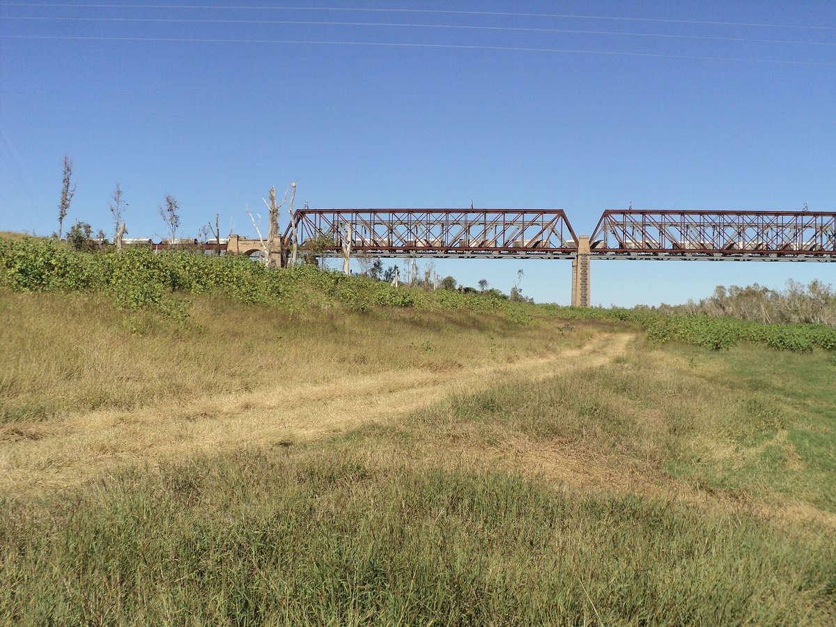
Burdekin Bridge
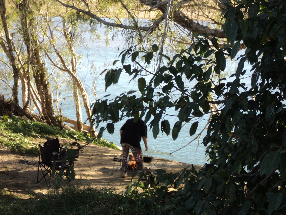
Macrossan Free-camp Site has an area of around 50 acres to camp on, between the Burdekin River Railway Bridge and the Flinders Highway. Most campers stay up high close to the toilets but as we are self-contained we are able to go further afield. We found a great camp right on the river with a landing for a place to cook our tucker. We went for a walk and scavenged discarded wood from old fireplaces and together with our own supply/ had a good fire.
Burdekin Campfire
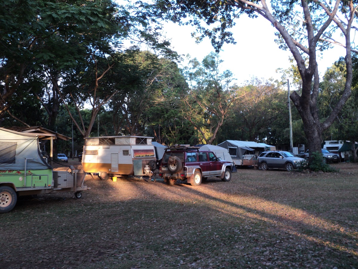
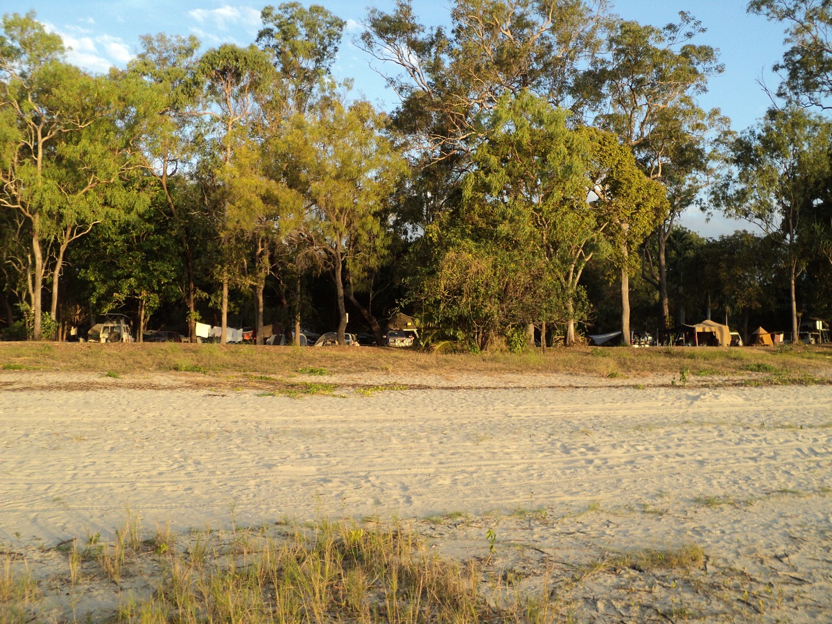
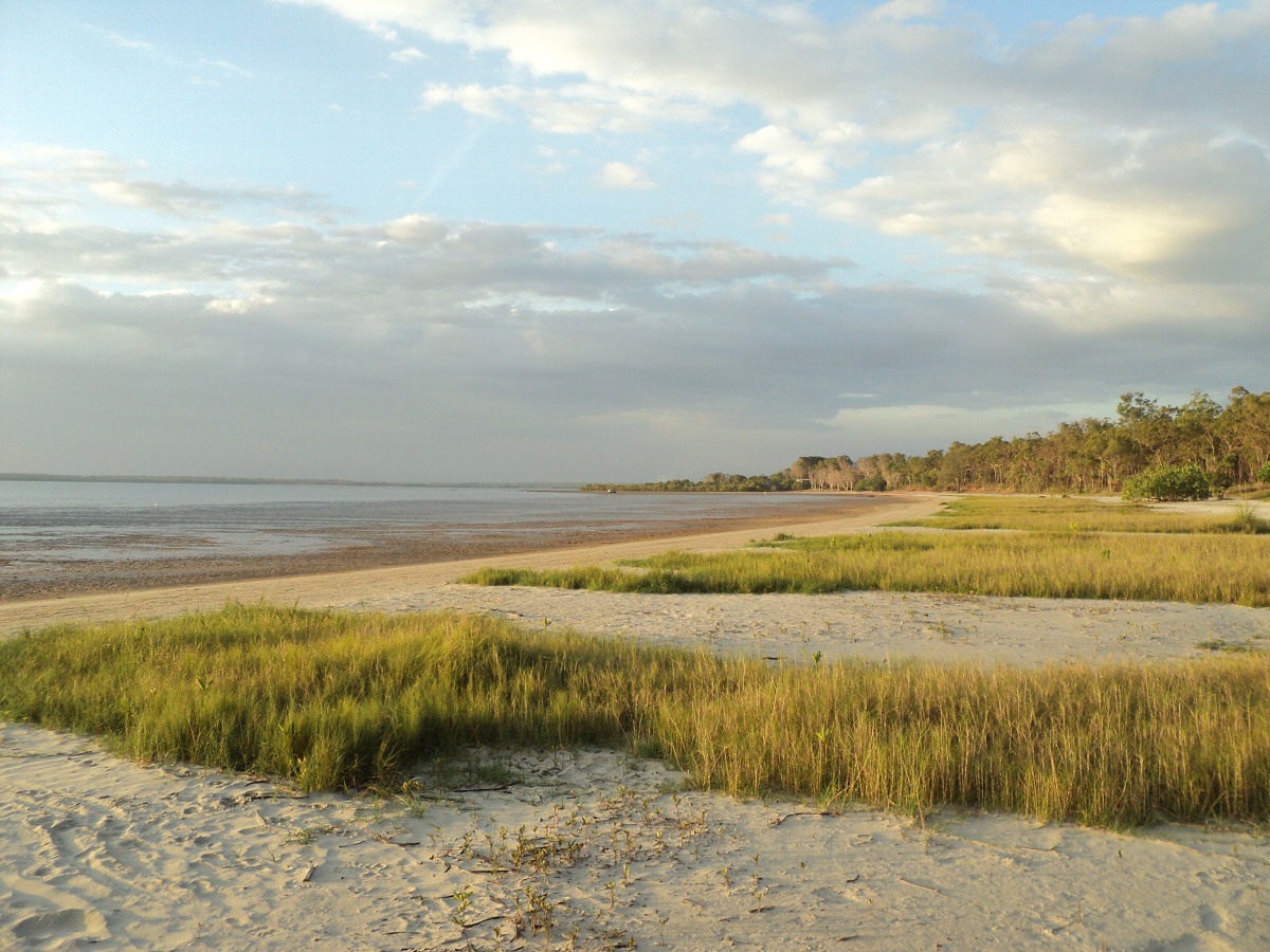
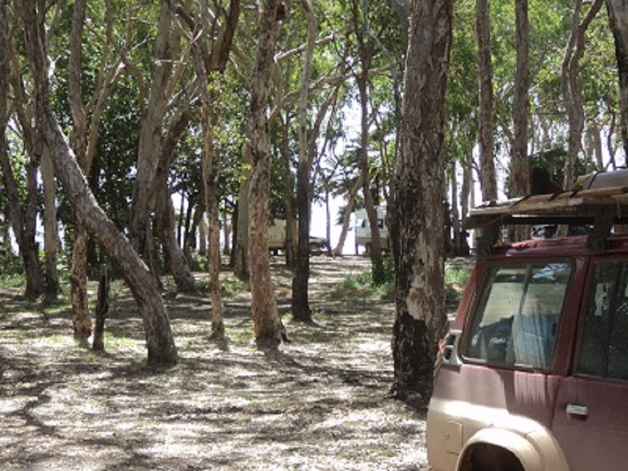
The next day we made for Charters Towers and after shopping and buying stuff we thought we needed, we had a convivial lunch at the Waverly Hotel with friends Colin and Renate who were on their way back south after visiting Darwin. The interesting thing about this hotel and others is that it has a real Bull Ring where live cattle buck-riding takes place. After lunch and after saying our goodbyes we made for Fletcher Creek Free-campsite, 42km north of Charters Towers on the Gregory Development Road. This site is run by the Charters Towers Council with toilets and cold showers provided. It is about 50 acres in size but used to be a lot larger. In peak tourist season you may find up to 100 vans and RVs parked there. This time around, there were only about 20 camps. Generator noise wasn’t too bad with most shutting down by 8pm. Truck noise, from the Gregory Road, depending on which direction the wind is blowing, can be severe with some using the exhaust brakes or foghorns just to annoy the campers. Someone had let four Bantam Roosters loose at the camp and they did the rounds finding kindly travellers to feed them.
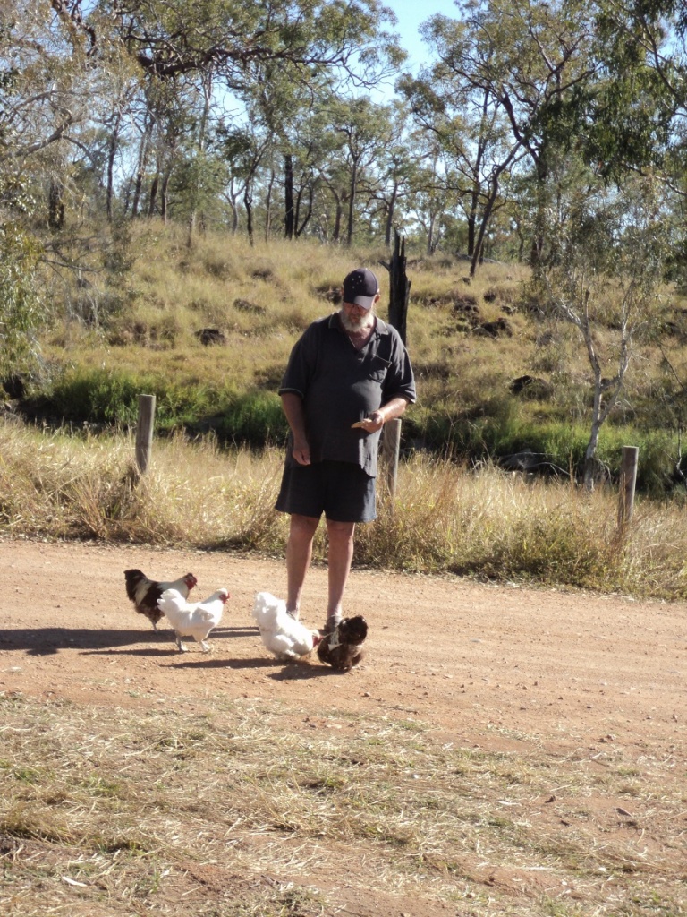
Feral chooks
They had been there a while apparently and were quite wily to threats such as dogs or kids who tried to catch them. They did a great job of eating all of our vegetable scraps
We spent a lazy six nights at Fletcher Creek. The weather however was not kind to us and it became increasingly overcast and cold. We drove into town on June 7th, my 68th birthday for lunch at the pub and some sightseeing. It rained softly for most of the morning. In the late afternoon things dried up a bit and so we packed up in readiness for our departure the following day.

Cold dip in Fletcher Creek
Fossils and Fords 2011
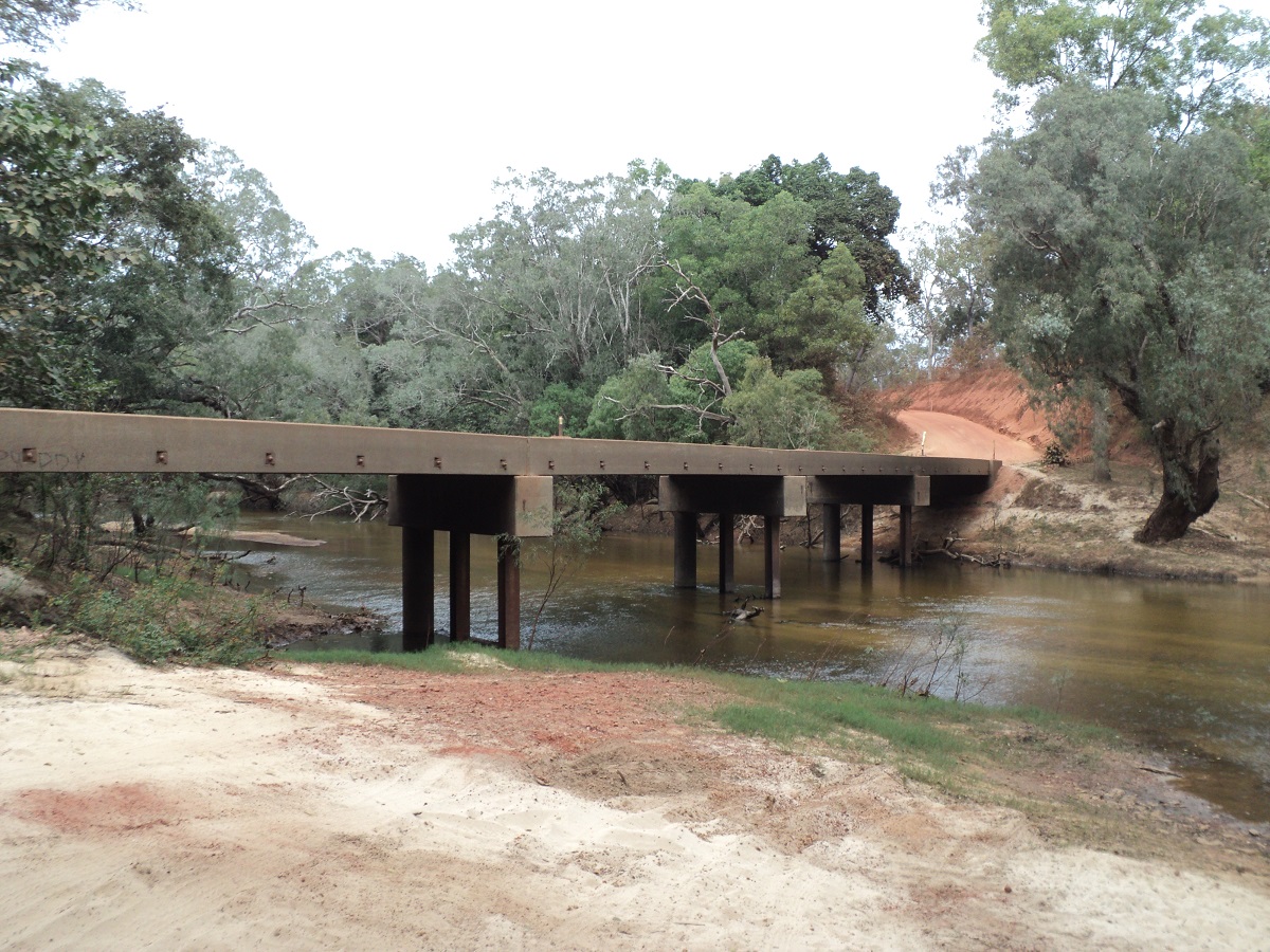
Lolworth Bridge
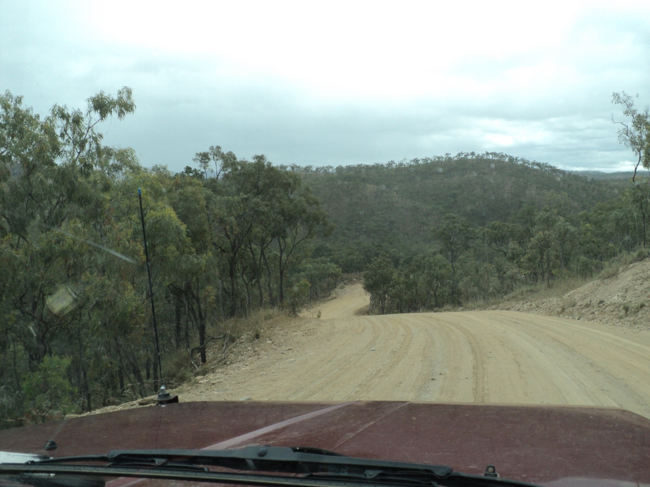
Twice before I had wanted to drive the road along the flank of the Great Basalt Wall and now we were going there. The road starts just before Fletcher Creek on the Charters Towers side via Lolworth Station and culminates in Pentland on the Flinders Highway. The distance is a shade over 200 kilometres and I was hoping to see some of the Great basalt Wall. Much of the latter is confined within a National Park with no public access which wrong as the parks belong to the people. We did see some Basalt but nothing spectacular. The drive however was very nice with the roads being in reasonable repair and with all the creeks running crystal clear waters.
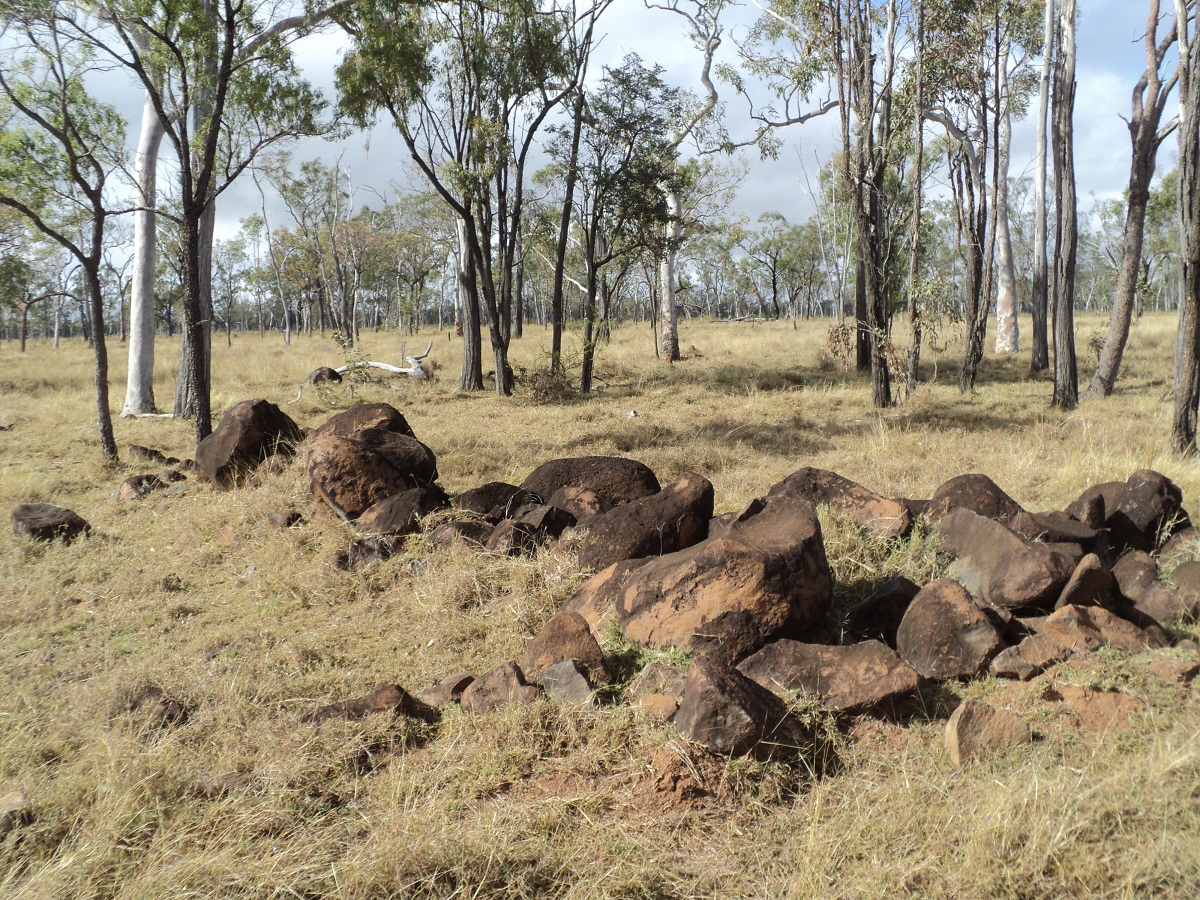
Basalt Rocks
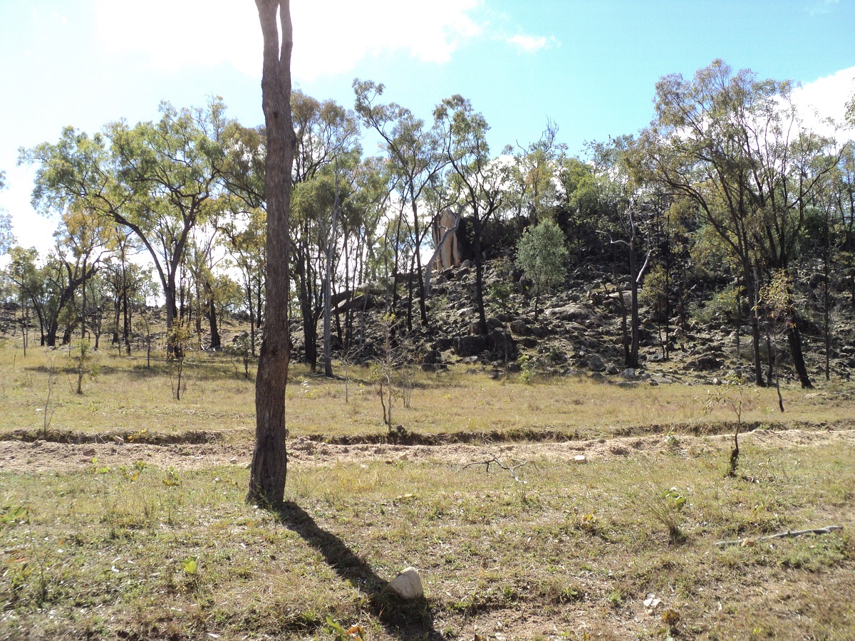
Basalt Wall
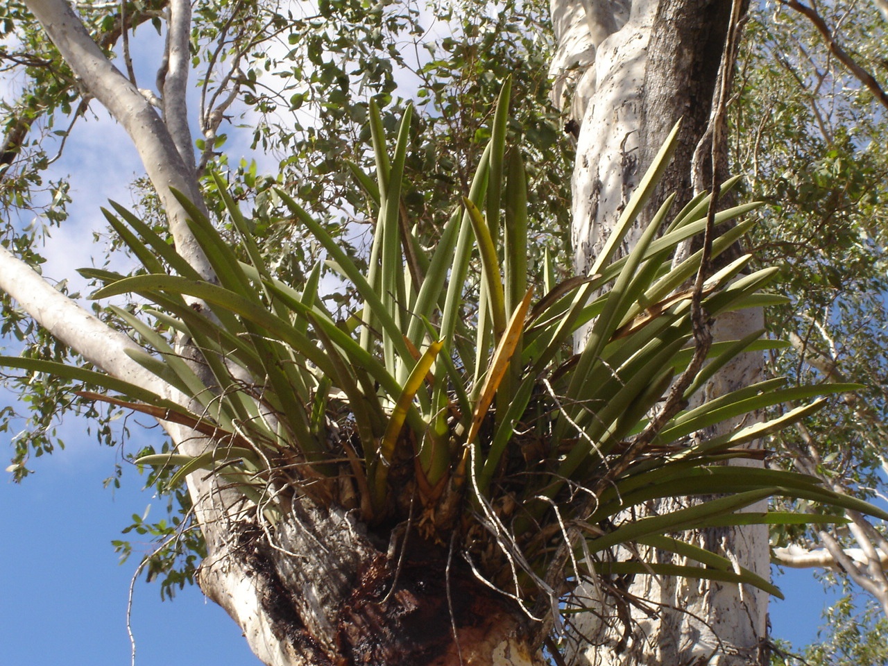
Orchids
We drove along at 60kmh in places. At various points many wild orchids could be seen growing in the nooks of trees. At lunchtime I wanted to do more work to the battery system for the caravan and pulled up at the upper end of a roadside quarry. By the time we had stopped, which was less than 100 metres the wheels were caked in a white, muddy goo. I did the repairs and we had lunch and then gingerly picked our way across some rocks to get back to the road. From here on the road was wet for around 50km. We were steadily climbing in altitude though as we were driving up the last hills of the Great Dividing Range. The altitude peaked at 745m above sea level and we began a steep descent down the other side.
Cape River
At the Cape River crossing we found a good campsite within the road reserve and stopped for the day. A handful of vehicles passed. I went for a walk in the river and tried out my Metal Detector and found a small piece of scrap iron. After dark a Ute towing a rattly old trailer stopped at our camp and the young station employee came to enquire about the fire. We said that we would extinguish it properly before we left the next morning. A small frog mimicked the sound of a generator down along the banks of the river. I went to look for it with the spotlight but had no luck.

Bustard
In the morning we set off again over a very rough road and after a short while I dropped the tyre pressures by 5psi to smooth the ride out a bit. We were in Pentland by mid-morning and bought some snacks for munchies and had a cuppa at the same time. Our journey now took us through the small townships of Torrens Creek and Prairie before arriving in Hughenden. There we did some shopping and lashed out and bought a digital radio for night time listening. We paid $6 for a permit to camp at the RV site which to my mind was a waste of money as only a vacant block of land was in offing for the money.

Pterodactyl
The Pterodactyl replica at Hughenden
It looked like rain was coming with the whole sky overcast again and so we decided, the next morning, to head for Richmond, even though we were a week early for our appointments for the Dig and Laboratory work. We also had to make sure that the bookings had been made as the last contact had been in October the previous year. On arrival at Richmond everything was in place and we paid in advance for our excursion at the end of the following week and were given special dispensation and allowed to camp at the free RV site for our time in Richmond.
The week in Richmond passed. We had a look at some real estate and found an old church hall that was for sale. We spent many hours discussing the merits of moving house and refurbishing this old building and how we would go about it. One thing that became very clear is, that although Richmond is a nice small town with a good community, it has limited retail outlets supplying necessary materials in the building, automotive or household lines and that the nearest major centres like Mount Isa or Charters Towers are both more than 400km from the town.
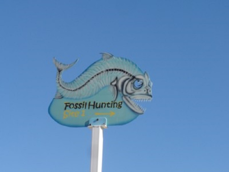
We spent a day fossicking in the mounds of gravel at the Fossicking Sites, twelve kilometres out from Richmond along the Cattle Byway to Croydon. We also had a good look around town at the native Herb Garden, Lake Tritton and other places of interest.

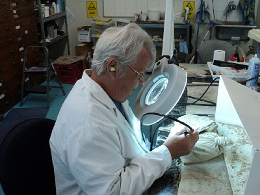
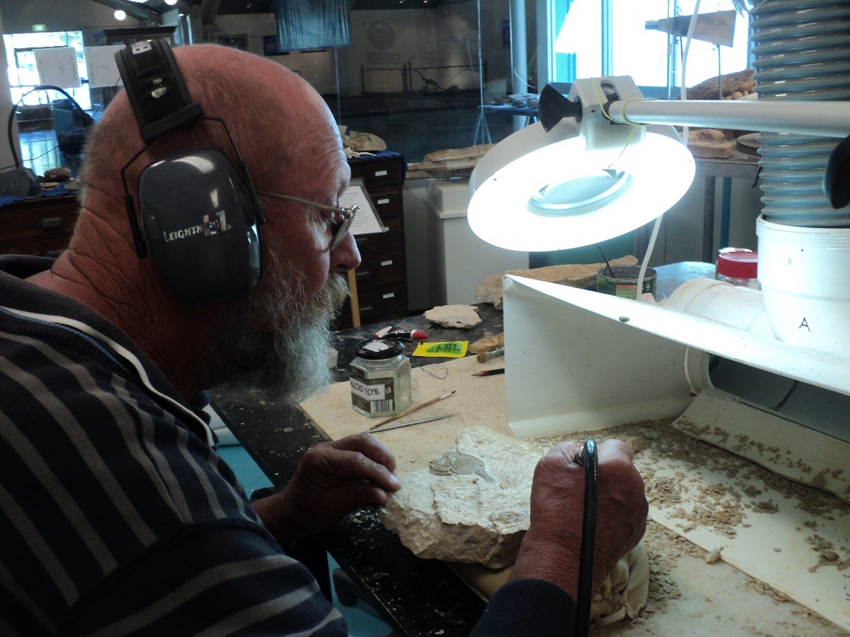
Our time finally arrived and we spent a whole day in the Laboratory of the resident Paleontologist, at Kronosaurus Korner Museum. Here we learnt how to use miniature compressed air jackhammers, the size of a dentists’ drill, to flake away rock to expose a fossilised animal or part thereof. I worked on a Turtle bone while Judith worked on the one of her own finds, a Richmondichtys Armoured fish plate. As one flakes away the rock you may find other fossilised life forms beneath the surface.
Copprolites
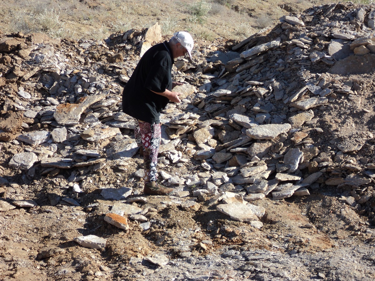
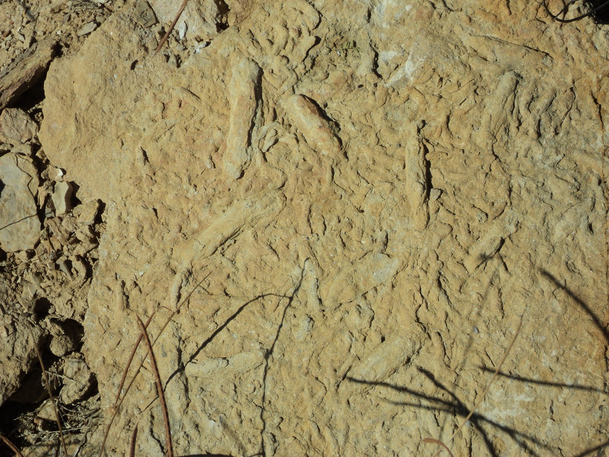
The following day a group of ten fossil hunters gathered and we were guided to a site on Cambridge Downs Station where we spent the day in a quarry, up-ending rocks to see what we could find. The find of the day was a Squid imprint. There are virtually millions of fish bones, jaws, teeth in these quarries which were once the sea bed of the Eromanga Sea some 100 million years ago. Ammonites( like Nautilis shells) Belmnites (like tubes) and Copprolites (fish poo) are found all over this area. There is also a great variety of shell imprints and Mother of Pearl as well as shell casings. Most of these are very fragile, and break up when touched. Dinosaur fossils have been found in the Richmond area and the museum displays a Kronosaurus and Ichtysaurus skeletal remains plus that of a number sea creatures of 100 million years in the past.
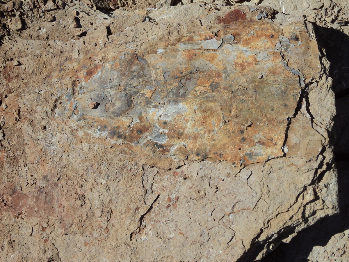
Fossilised Jellyfish
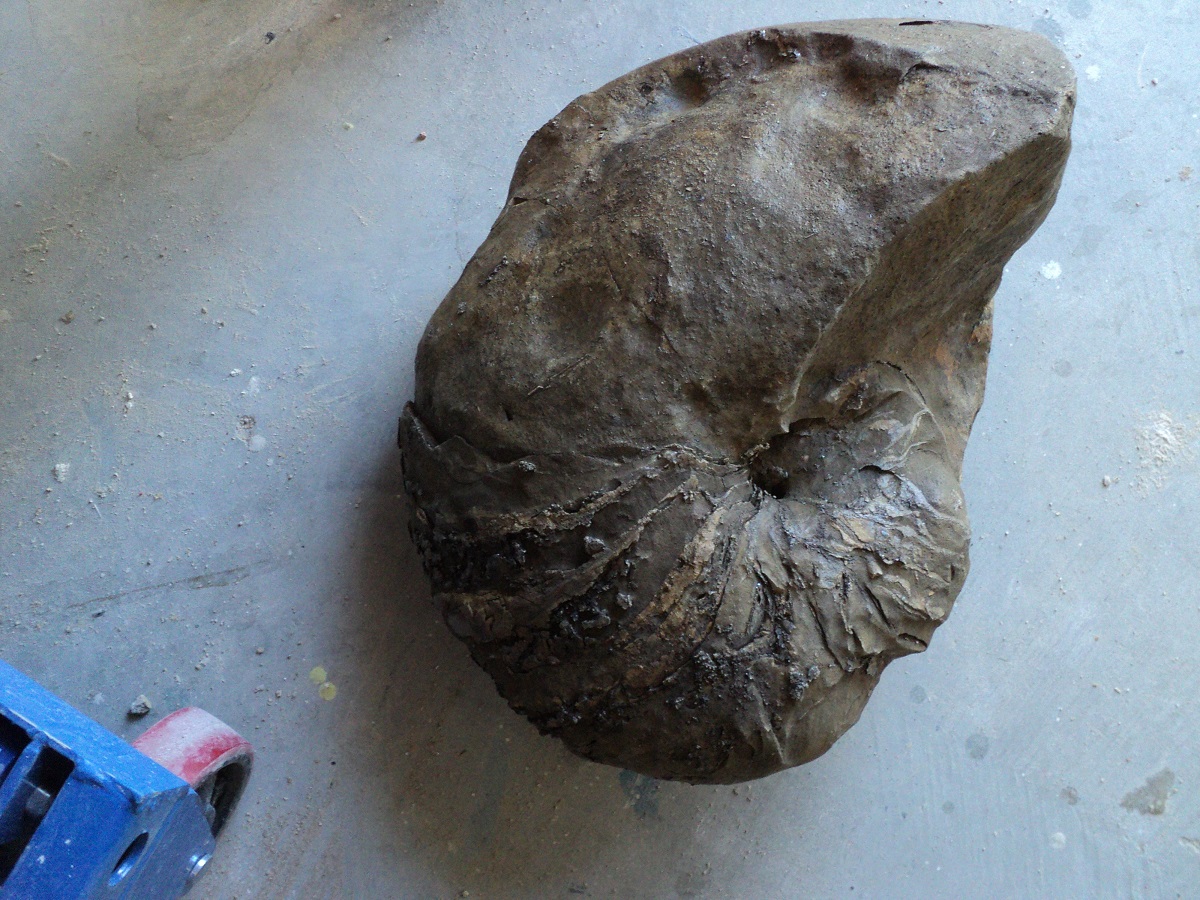
Nautilus shell fossil
Having completed our stay in Richmond we returned to Hughenden, refuelled and then went to drive the Basalt Byway, a circular loop through the ranges north of the town.
Just before the first jump-up along this Byway, we met a farmer and his wife driving a truck with cattle on board. They stopped for a chat and he enquired if we were Tourists. He reckoned that the road was closed up ahead or that it was very rough. I showed him our Byway pamphlet issued by the Information Centre but he remained unconvinced. Nevertheless we pushed on. Four wheel-drive was required as sections of the track were washed out and needed careful negotiation. There was one deep creek crossing and a rough jump-up over another range but by picking our way through the rough bits we made it and eventually arrived at Alderley Crossing on the Flinders River where we camped in 2010. It was still the same and we set up camp.
In the morning the School Bus out from Hughenden arrived at its terminus which is just beyond Alderley Crossing. A couple of utes arrived to drop the kids off and then we could hear a whirring sound. Someone was running late and brought their child to the bus stop by Helicopter! That made my day!
Chopper taxi
At Hughenden we bought stuff again and Jude has a short-short spikey haircut. We had morning tea under the trees next to the Flinders River which runs through Hughenden and we had company watching for scraps from the table.
Waiting for scraps
Then we drove north on the Kennedy Development Road and after 28km turned off on to the Prairie connector road. Much of this is a bush track.
More like a farm road to Prairie
Prairie road
At the Flinders River crossing there was no concrete causeway. There was no need for us to cross over as we were just looking for a campsite. I walked the track through the water however and found a number of very soft quicksand type places. Just the two utes arrived from the south. They were from the Yorke Peninsula in South Australia. I suggested lowering tyre pressures but said that they should be able to get across without too much trouble and they did just that after aI had suggested a course over hard sand. When they got through the one bloke told me that this was his first every water crossing by 4×4! Not much water in South Australia, methinks! After they had left we made a camp spot at the top of the embankment on the side of the road and stayed there for the night. Only two vehicles passed. One was the owner of the nearby New Glenorden Station and he stopped for a chat telling us about the number of people who get bogged at the crossing. Their property is also split in two by the river making management in the wet season very difficult as they have to access the other side by driving via Pentland and Hughenden!
The Kennedy Development Road runs from Boulia in South West Queensland to Atherton on the Tablelands west of Cairns. The section we drove from Hughenden to the Oasis Roadhouse at The Lynd is still under construction and after the heavy rain falls of the summer the road is in poor shape. It has wide bitumen sections, narrow bitumen sections, rough and potholes bitumen sections and many kilometres of smooth to rough gravel sections. The country side is quite interesting with woodland savannah traversing at first hilly areas and then plains country.
Inspecting grass trees along the way
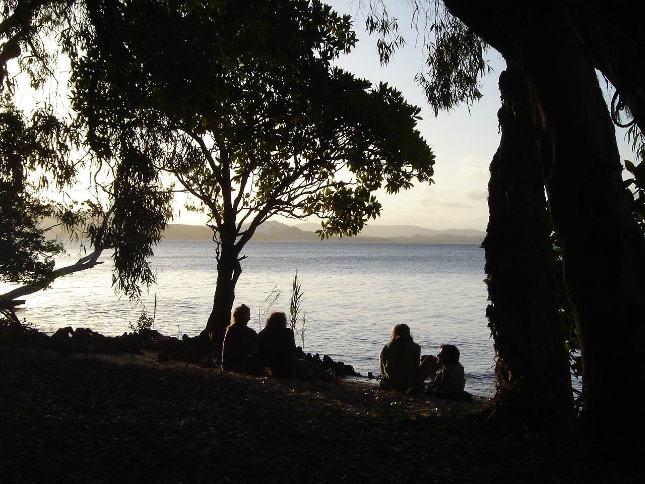
After crossing the Einasleigh River for the first time there is a large area of swampland around Lyndhurst Station and major road construction is underway as the old road had collapsed. We turned west 1km south of the Oasis Roadhouse which wasn’t a too exciting place and headed for Einasleigh along a gravel road. We crossed the Einasleigh River again just beyond Carpentaria Downs Station and found campsites on all sides of the river. There were only two other camps and we found a good spot to sit back and relax for a few days before heading further west and then north to Georgetown. The Einasleigh River spills over a layer of basalt Rocks to form rapids and to make a light roaring sound over the rocks
We always seem to find enough to do when camped and this time was no different. First up we found that the front right hand panel on the van had popped out of its beading. We figured this might be so because of the 35kg battery located in that area. So with some effort and Tek screws the job was done. I repaired my Multimeter which had a broken tip and was able to solder it back together. Washing clothes is another routine and an array of buckets, compliment this process. I tightened a slightly loose wheel-bearing on the van and made sure that the batteries were getting enough charge from the sun. We did a lunchtime cook-up form our Campfire Cooking page on our website making Strawberry and Cream Damper! One night we had a feed of Marshmallows and ate until we were sugar coated! The Yabby trap yielded enough Red Claw Yabbies for a feed. Judith sat and painted a scene from the river.

Einasleigh River
Even though we were now under the 19th parallel South, the mornings and evenings tended to be cold and we had to rug up in our winter woollies until after 9am in the morning. In the late afternoon we were dozing outside in the sun, when Jeddah suddenly jumped up and made for the long grass nearby. Next thing she had a feral cat by the scruff of the neck and a fight ensued. Soon after there was a standoff and I had to intervene to despatch of the cat.
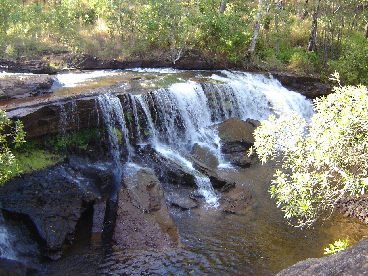
Out from Einasleigh River the road winds across the ranges and is in reasonable condition with some sections bitumenised. It is quite a scenic drive. At Einasleigh we found a small hamlet of a dozen or so houses and a pub where the sign stated that it was ‘Gulp’ Country. Close-by is Copperfield Gorge which comes as a surprise as it is not mentioned in any literature anywhere. A small waterfall pours over rocks into the gorge.
Copperfield Gorge
Forsayth is the next town of gold mining fame. It too is a small town with not many facilities but relies on Tourism to keep it alive. The Savannah Train runs on a weekly basis between Cairns and Forsayth as a mail run and tourist conveyance. The train is made up of two units only looking the same with an engine drive at both ends. I asked why the road was being bituminised and the answer was for servicing the cattle industry.
At Georgetown we did some shopping and internet activities and also found out that the road that we intended to take east of Mt Surprise towards Almaden was closed due to a bad crossing on the Lynd River at Lyndbrook Station. We were advised to take the road-train route 22 kilometres west of Mt Garnet to get to Almaden. We refuelled, had a quick look around and then headed for our destination via Mt Surprise. Once on the road-train route we used our UHF Radio to call ahead at Callpoints 1 to 27 and other names so as to advise oncoming traffic of our whereabouts. The road was slightly corrugated but not bad at all. I spoke with a Truckie about as to a possible campsite and he told us about a place further ahead. When we arrived at this spot there was another Truckie hosing his water-tanker down and he told us of a better place further ahead and so we looked for that spot. When we found it there was car and trailer parked near the entrance to the campsite which was obscured by trees. We drove in and then saw that the track either went through a very swampy area or over some high mounds near a railway bridge. I decided on tackling the latter as I thought that the swamp would pose a problem. The van followed along obligingly but the one back trainer wheel did touch on a rock in the manoeuvre. After this we found a beaut camp spot all to ourselves on the banks of the Sandy Tate River which was flowing nicely. We spent two nights there enduring the trucks going by 24/7 at about two hour intervals. The trucks haul tin ore for delivery to a crushing plant at Mount Garnet. On the way out we had a good look at the ‘wet’ crossing but decided again against it taking the more difficult route out without incident. Slow as you go in first gear Low Range.
Offroading
When we got to the Chillagoe Dimbulah Road we turned right and headed for Atherton via Herberton. The road veered off at Petford but when we arrived there we found a sign stating that No Caravans were to be taken on this road. This was disappointing and while we were contemplating our next move a dear old lady wandered out from a house nearby and started chatting to us. She repeated aspects of her life over and over a again and it took us a while to extract ourselves from the conversation without being rude. So we drove off back up the road and to Chillagoe where we camped at the Rodeo Grounds for three nights.
The following day we drove to Atherton to do some banking and shopping. Chillagoe was nice and warm but on arrival at Atherton in was cold and raining and I was in shorts and a T shirt! We did our jobs with some difficulty as the locals don’t seem to know where their other businesses are. Parking is also a problem as poor city planning has made parking bays smaller. Nevertheless we were out of there by lunch time heading for Herberton.
At Herberton the hotelier pulled the plastic sheets down at the outside dining area and lit the gas heater for us. I devoured a giant T bone steak and Jude a Seafood platter. From Herberton we climbed the range to close to a thousand metres before panning out and slowly dropping down to around five hundred metres. It was an interesting drive with some sections of the road only one car width wide. We passed Irvinebank and Emuford which are small hamlets nestled in the tropical forests. Some houses look decidedly derelict. There were roadworks in progress and we got stuck behind a truck and in its dust for about 15km before we were let through by the roadworks crew. We got back to the main Chillagoe Dimbulah Road at Petford and made for Chillagoe and our van.
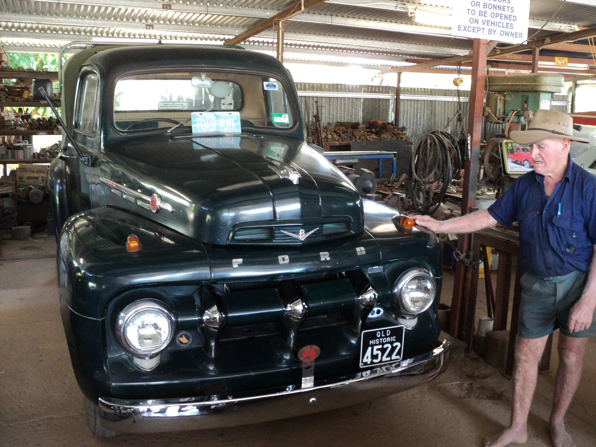
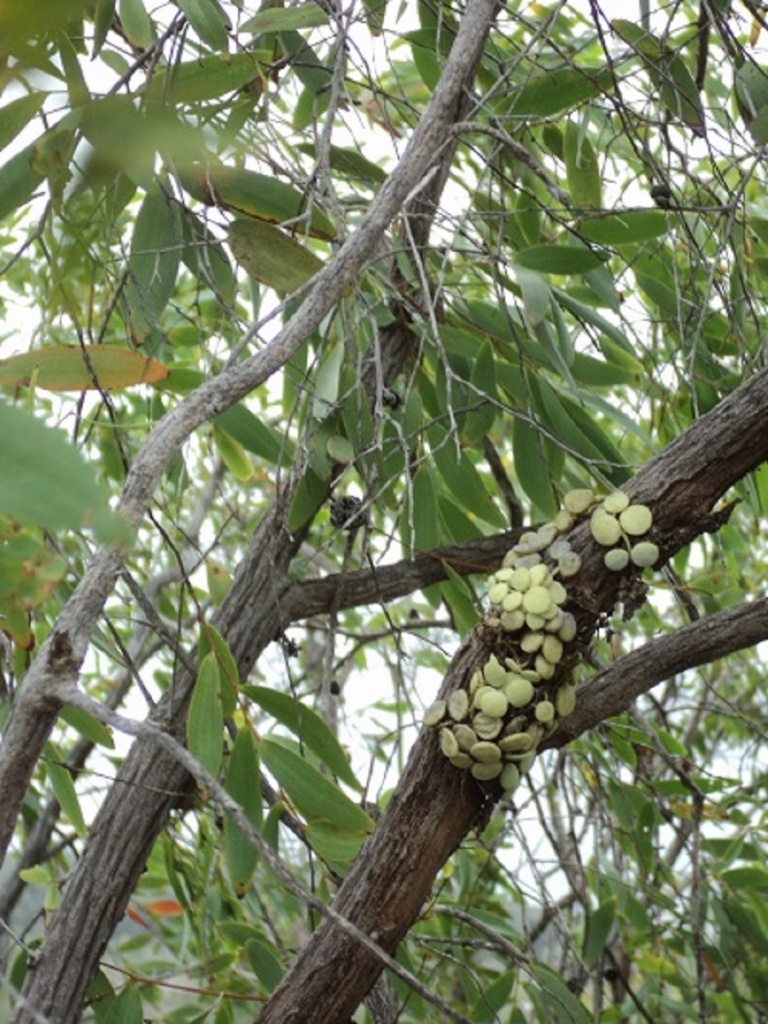
In Chillagoe, this time around, we made time to go and chat with Tom Prior and to have a look at his wonderful display of old Ford vehicles
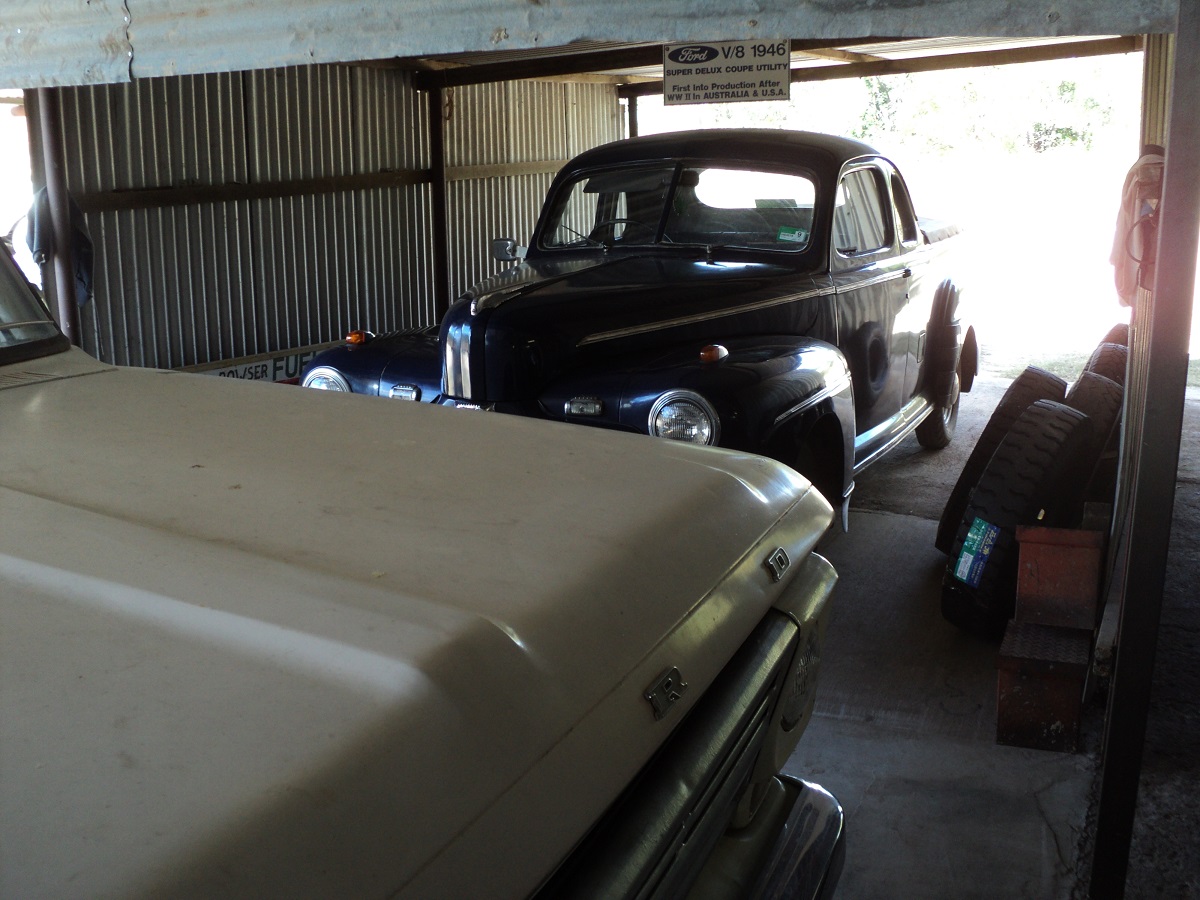
Fords
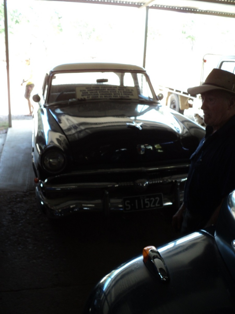
1953 Ford Customline
1936 Ford V8 Ute
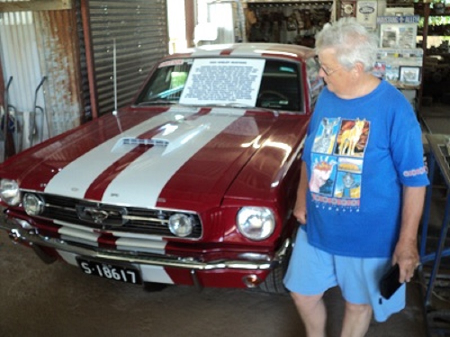
1966 Ford Shelby Cobra
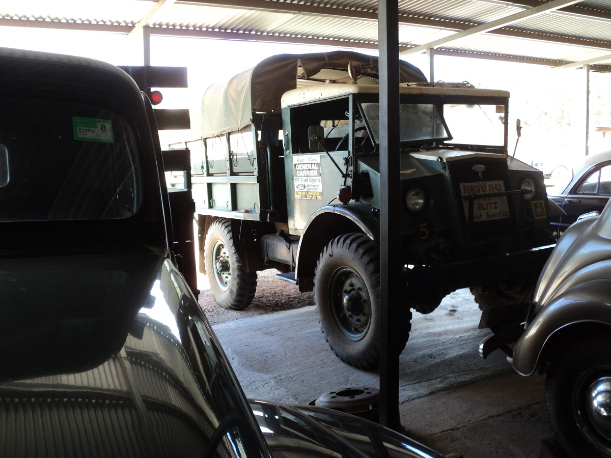
1942 Ford Blitz
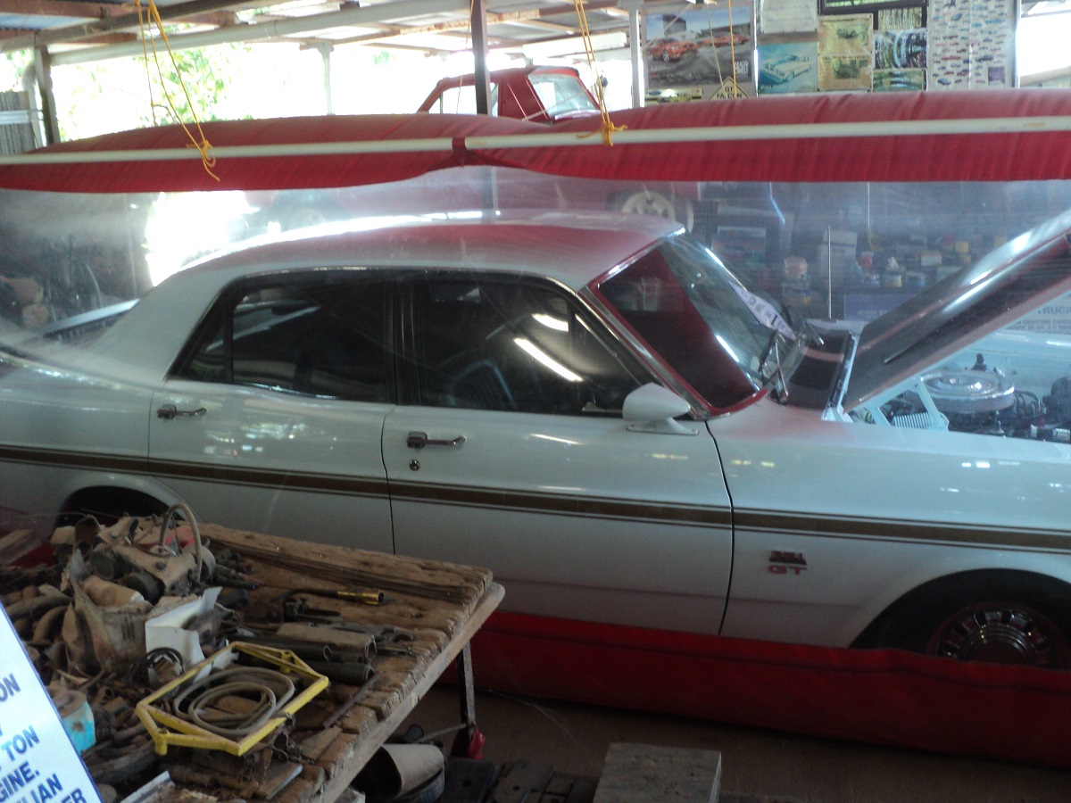
Ford Falcon GTHO Phase 4
We spent another day in Chillagoe doing exciting stuff such as washing and swimming in the local waterhole. It was our anniversary and we went to a hotel for lunch.
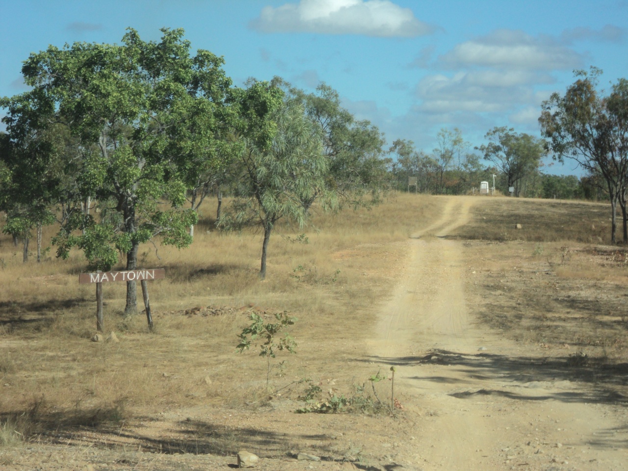
Maytown 2011
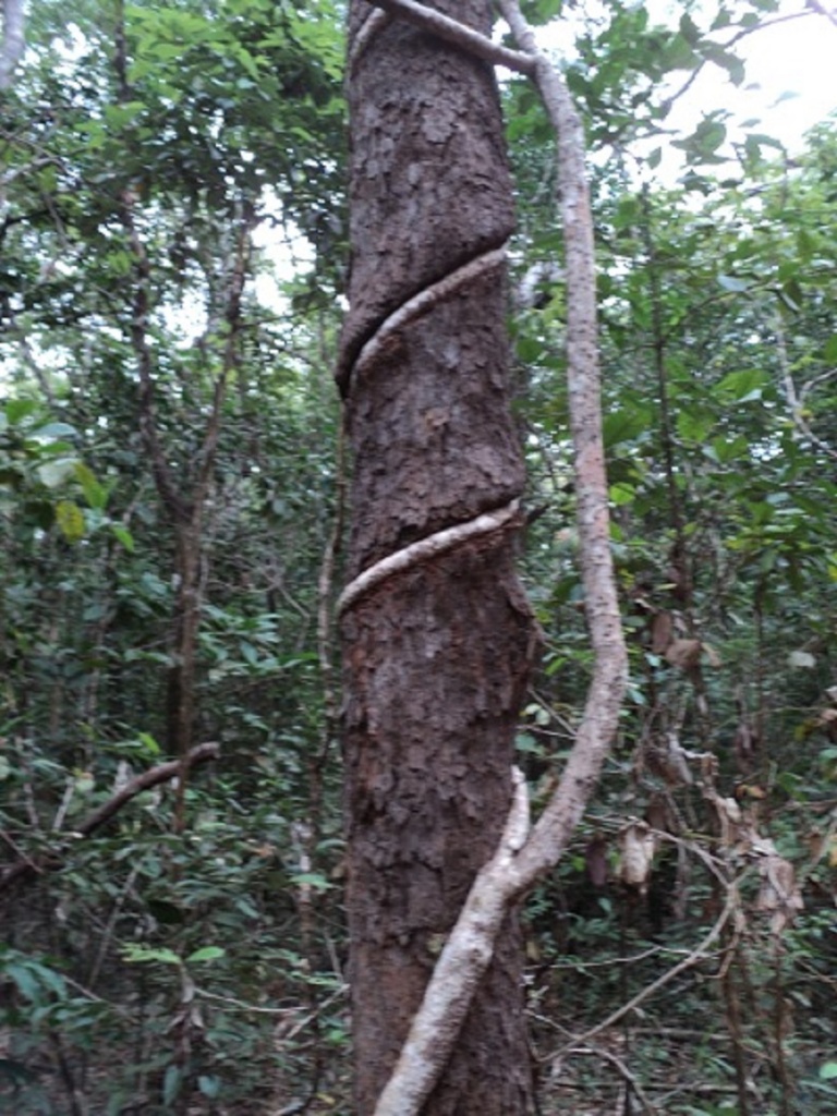
After doing more research about getting to Maytown in the Palmer River Goldfields Reserve the indications were that the way through Palmerville Station was closed due to road damage by the wet season. So we hitched up and made for the alternative route via Whites Creek Road. The turn off is 68km north of Mount Carbine Roadhouse on the Peninsula Developmental Road. But first we bought some munchies at Dimbulah Bakery and then made for the Walsh River where we camped last year. This spot needs 4×4 to access, and lies on a back-road between Dimbulah and Atherton. This is in the heart of mango plantations. Only after we had set up camp did we hear the repetitive bird gun going off in the distance and it did not let up for all the time we spent there. We gathered some firewood and had a roaring fire that night.
Approaching Mareeba we were surprised to see around one hundred camps at the Mareeba Rodeo Grounds and learnt afterwards that they had come for Christmas in July. Another visit to the local bakery and a gas bottle exchange saw us on the road north again. We took a side track to the Mareeba Wetlands and only when we were close did we see a sign stating No Dogs allowed. Bugger that we thought, and kept going. Jeddah sat quietly in the wagon while we went and had a look around. We actually found a good book there being Plants of Cape York and bought it. We also saw the small breeding colony of Gouldian Finches the Wetlands were engaged with. Every year they release around 25 pairs in to the wild. Next stop was Mount Molloy rest Area for smoko. This place was crowded too with overnighters running their generators to keep their satellite TV’s going. Further along the road we climbed a steep road over a pass to get back over the Great Dividing Ranges.
We turned west at Whites Creek Road which was unmarked and proceeded along a wide graded road which wound its way in and out of the hills. The ups and downs were extremely steep and I had to resort to using Low Range gearing to get up and down the hills. At the bottom of each dip there was either ponded water or a creek running and so the going was slow.
Whites Creek Road
There was plenty of bulldust too. The scenery was spectacular and the 68 kilometres to the Palmer River took us exactly three hours to negotiate. Then we had to cross the flowing river but after walking through to gauge the depth, we made it across without trouble. We set up camp along the river bank in a pleasant spot acquiring our space at just the right time though only two other camps came in after us. There is enough space along the kilometre stretch of area to space camps so that one is not intruding upon others and vice versa. Our little van had had no ingress of dust or water for the journey, which was very pleasing.
Palmer River Camp
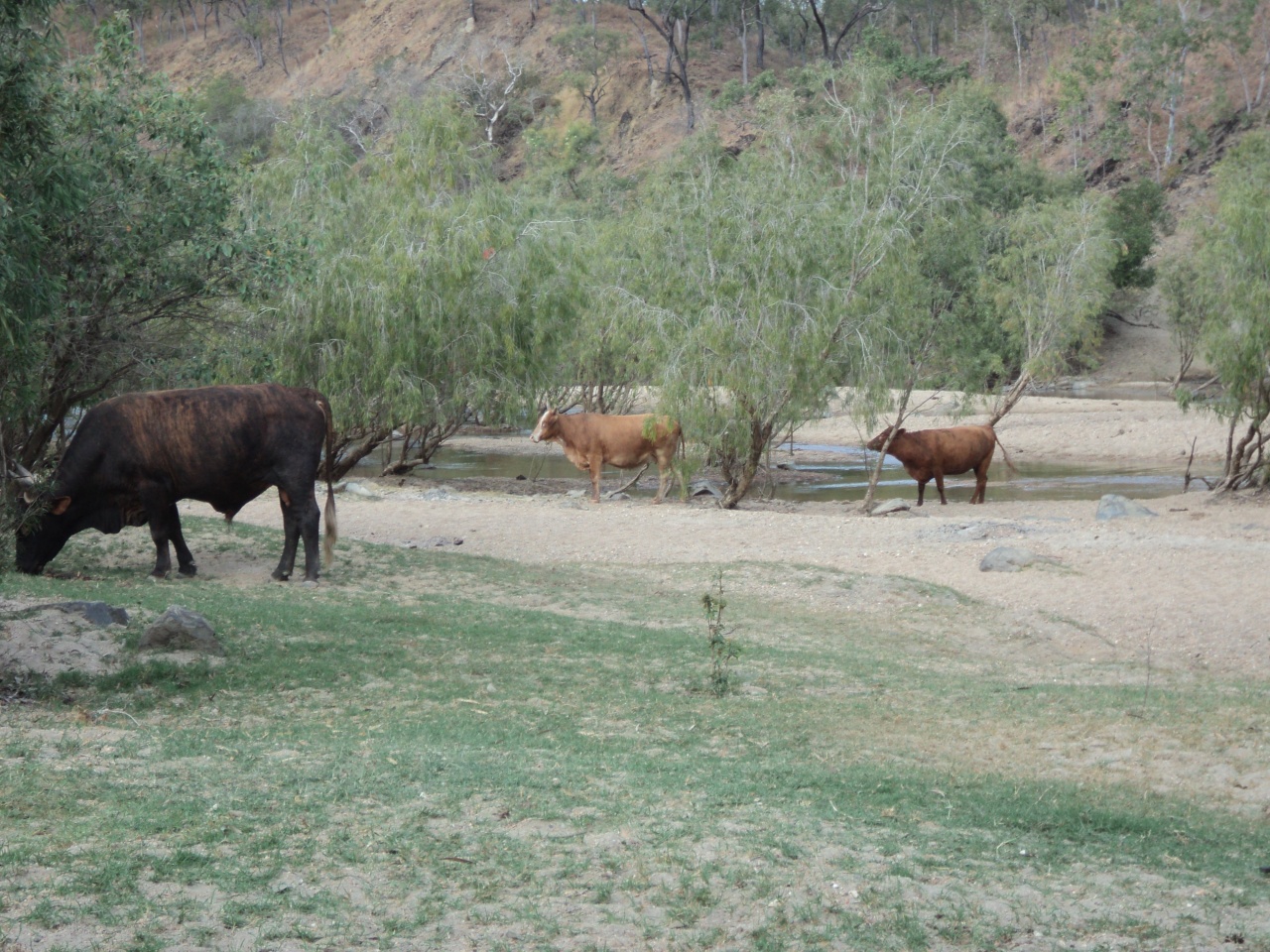
Bull and Cows
We shared our camp with a variety of birdlife, scrub cattle and wild horses. They all seemed unafraid of humans and invaded our camp on a regular basis. Jeddah got into the run of seeing the cattle off and she had them bluffed. The horses gave us a wide birth. Mornings were busy on the river fringes with Honeyeaters, Rainbow Birds, Rainbow Lorikeets, Bower Birds, Crows, Hawks, Brolgas and even a Jabiru keeping the pace going. Within 50 metres of our camp was a lovely deeper section of the now shallow-flowing Palmer River, where we could immerse ourselves for a refreshing dip. There was plenty of dead wood around so we kept our fire going of an evening and cooked over it most nights. We discovered the activities of a Greater Bowerbird who was building his nest less than five metres from our caravan. He seemed unperturbed by our presence and even less impressed with the blue clothes-peg we left for his nest.
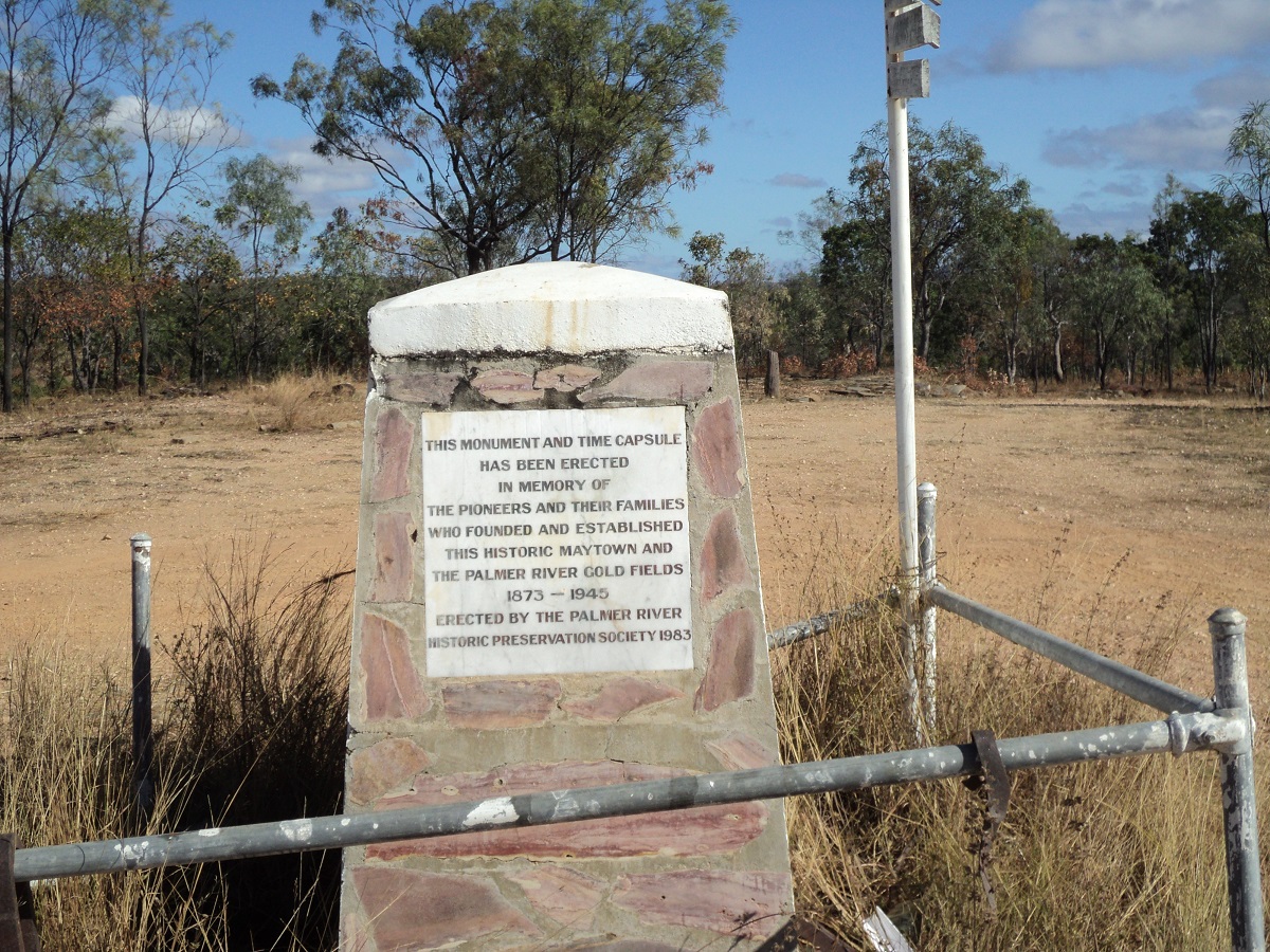
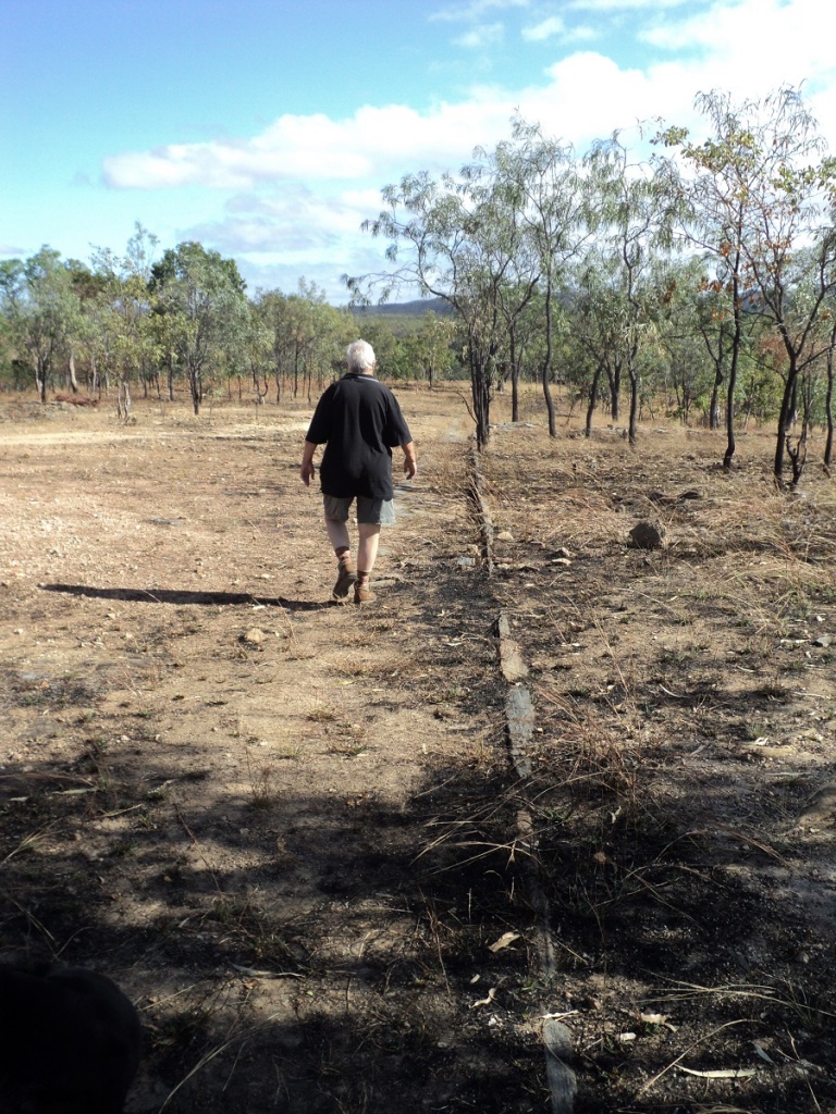
The now ghost town of Maytown, where businesses and a community flourished during the late 1800’s and up to 1945 lies 10km north of the Palmer River. Once again, the road in, is rough in places. We spent a morning looking at where the community thrived and at some of the old derelict mines in the area. It is a fascinating place and although all of the buildings, except one Replica Miners Hut, are gone from history, the paving stones still lie there to denote their tale of existence. It must have been a hard life for some as the gravestones give up dates of a number of persons departing this life before the age of 50. The Chinese Cemetery had no headstones and only an inscription written in Chinese letters over the walkway through the gate. We also had a good look at some of the abandoned mines and wondered at the sheer size of some of the mining equipment and just how they could have been transported to this remote locality. Here we were, driving in 4×4 mode, along these bush tracks. Back in the early days they only had drays, pulled by horses or oxen.
Track to Maytown
Maytown Memorial
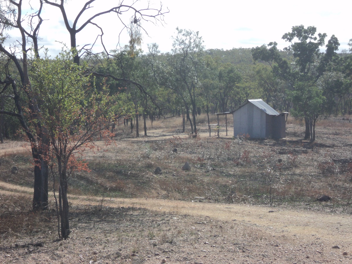
Typical Miners Hut
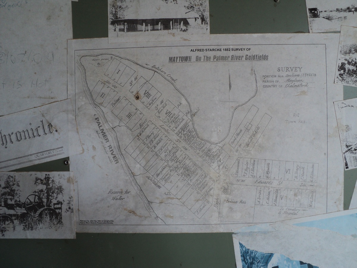
Maytown Streetmap
Maytown Main Street
The main thoroughfare of Maytown with its gutter stones
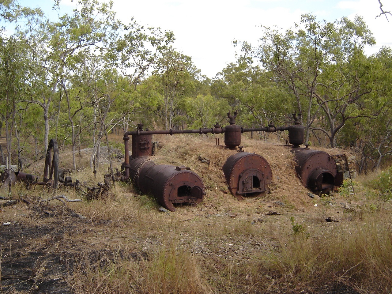
Queen Mill Boilers
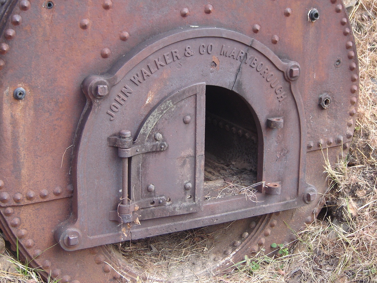
Made in Maryborough
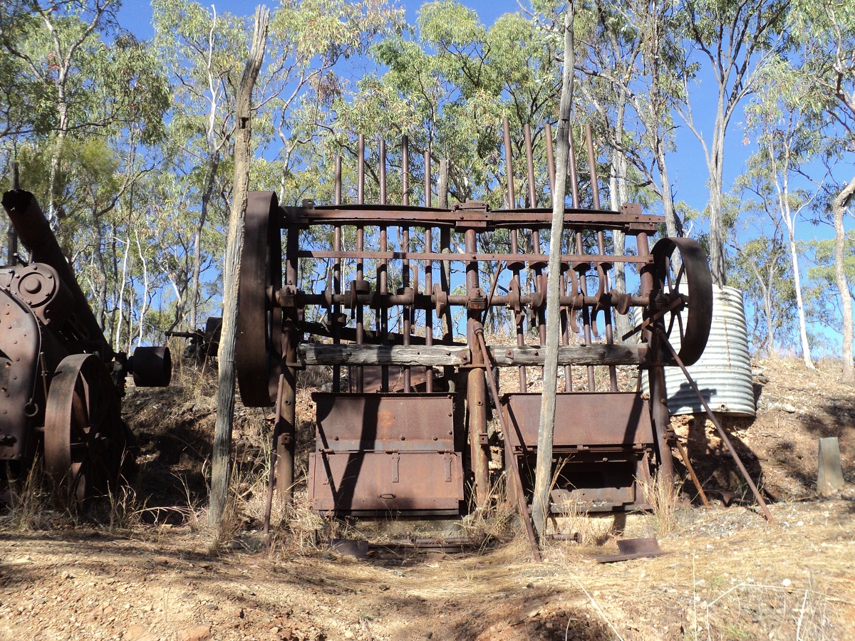
Louisa Mine Ten Stamp Battery
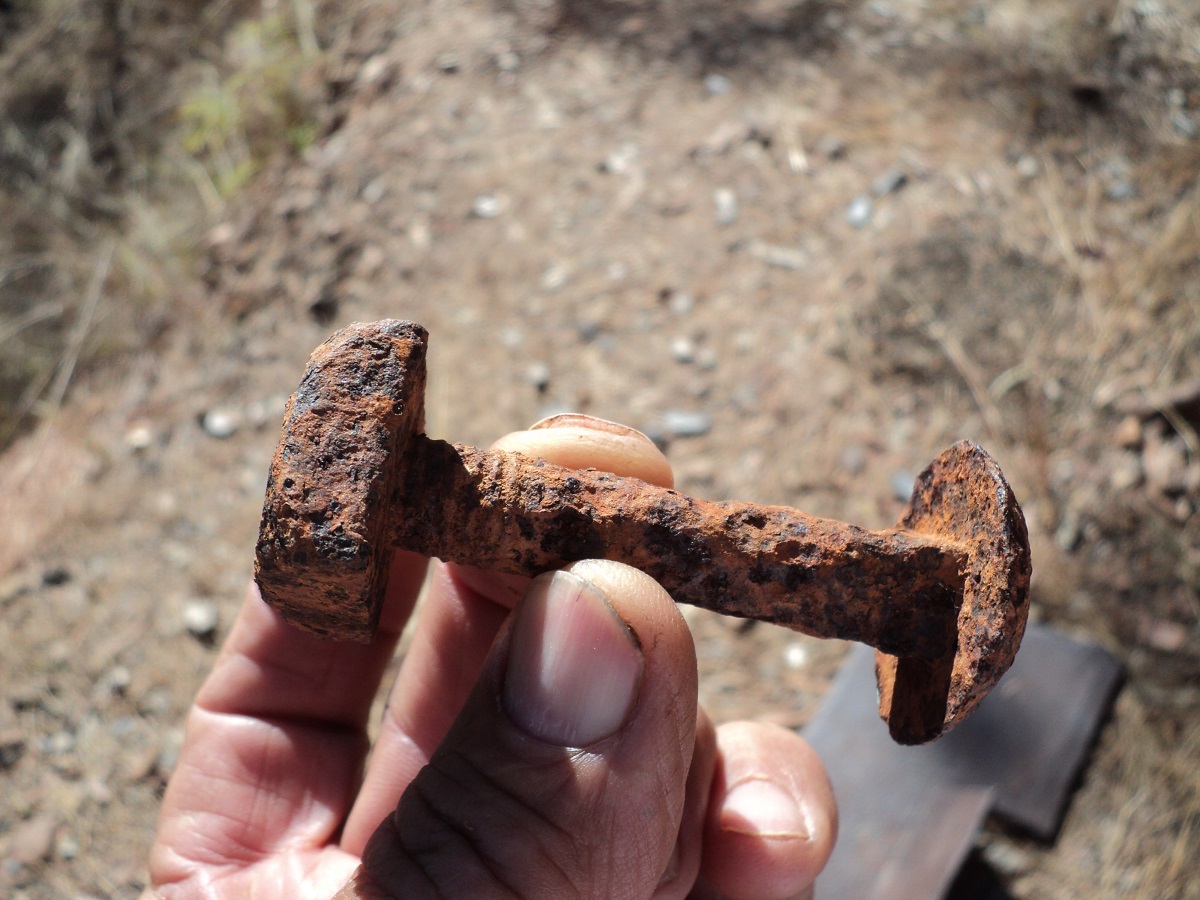
Rusted Coach Bolt
Forgotten
With the price of Gold being what it is today new mining ventures backed by big mining capital have sprung up again the Maytown area. It seems that they will continue to be looking for the shiny stuff.
After five nights out there it was time to move on and we made for Cooktown on the north east coast. The outward journey only took 2 hours with 23 major hills to crawl over.
Cape York 2011
The road up the Cape has over the years, caught the imagination of many travellers who may want to drive that distance to the very tip of Australia. In earlier times the access to the Cape has been along the now disused, Overland Telegraph Track, and, with many deep creek crossings, has been quite a challenge to negotiate. In recent years however, with tourism increasing during the winter months and the need for better access for local inhabitants, two Bypass Roads have been established giving easier access to the most northerly point of Australia. With the new roads in mind, and seeing as we had never been this way we decided that our little caravan should be towed along all the way to the top. Comments on our proposal varied but I do my research and take scant notice of ‘advice’ from armchair travellers.
Our journey starts in Cooktown where we arrived earlier than expected and needed to cool our heels, so to speak, to wait for pension day to come along so as to bolster our bank balance. So with some local knowledge in hand we made for Archer Point, about 27km south east of Cooktown. On arrival at our destination we took the first turn to the right and found, as related by our acquaintance, that there are some good camp spots situated right on the beach. It took a bit of manoeuvering to get the van in to an area amongst the coconut palms and about ten metres from the high tide mark. We set up camp in this idyllic setting.
Amongst the Palms
Archer Point
Well, idyllic it might have been, but the wind blew non-stop 24/7 and the crashing of the surf in the wee hours of the morning disturbed our sleep. But we went for long walks on the beach, shook coconuts to see if they contained milk, and even opened a few, albeit with my rudimentary method, of using a hammer and a screwdriver! But a day before our intended departure we called it quits and decided to leave, having been blown silly. I had gauged two possible exits from our camp. The problem was that the van does not track around corners with the 4×4 and so we had a devil of a time trying to get around trees without denting the van. It took half an hour and a 15 point turn to get free. Then we drove out to the Archer Point Lighthouse and took the little van with us along the steep winding road. Low Range third gear made it a breeze however. After that it was into Cooktown for laundry, shopping, and a refuel before taking the road to the Cape via Lakeland
Our friends Ron and Viv Moon, well known Adventure Writers and authors of many travel guide books, kindly sent us a copy of their Cape York Guide and we used this as our guide for our adventure to the north. We were making for a suggested bush camp site adjacent to the Split Rock Art Gallery about 12km south of the town of Laura. It was late when we found this slightly overgrown and washed out track but made it in as far we could go only to realise that turning was going to be a problem. Luckily there was a way out though the 4×4 and van got at acute angles! We camped on a flat site right near a lovely waterhole, lit a fire, and cooked our tucker. As we sat around the fire, bullfrogs and kookaburras serenaded us.
The next morning we found that the angle of a particular washout was too deep for the van to pass over and so we spent half an hour repairing the track damage before taking the van across without hindrance.
Packing the washout
Crossing the washout
Soon after our road-building exercise we were climbing the pathway up a hill to a series of rock art paintings at Split Rock. We were disappointed to see them not as spectacular as made out to be and that very little had been done to preserve the art from further erosion.
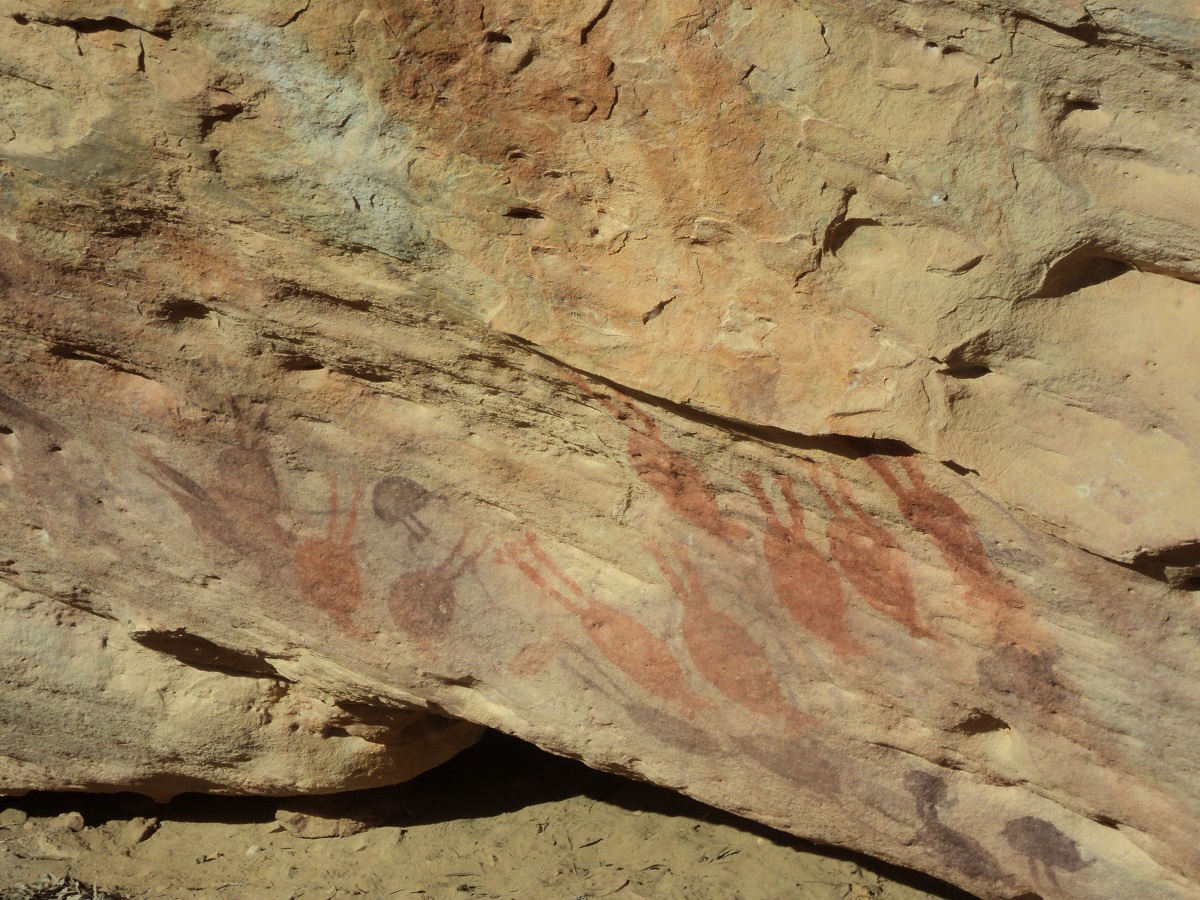
Split Rock art
At Laura we refuelled, did our internet banking and emails, dropped the tyre pressures to 24psi and set off to the north. The road was corrugated in places and every now and then there was some respite with a short stretch of sealed road thrown in. The road was busy with many holidaymakers travelling and some unfortunately throwing caution to the wind and driving in a manner dangerous to themselves and other travellers. We found an early camp in a disused road side quarry and stopped for the day.
Peninsula Development Road
The road up the Cape
Lotsa Dust
The following day the road was busy once again and people not used to driving in dusty conditions were taking silly chances. We were nearly involved in a head-on accident when a vehicle commenced as passing movement on us in the dust with a vehicle approaching from the other direction. It was a close call. After Musgrave Roadhouse the road deteriorated somewhat and I drove even slower. We found a nice camp site at The Bend on the Coen River and kept ourselves busy for the rest of the day.
Coen Main Street

The Bend Coen River
Coen River camp
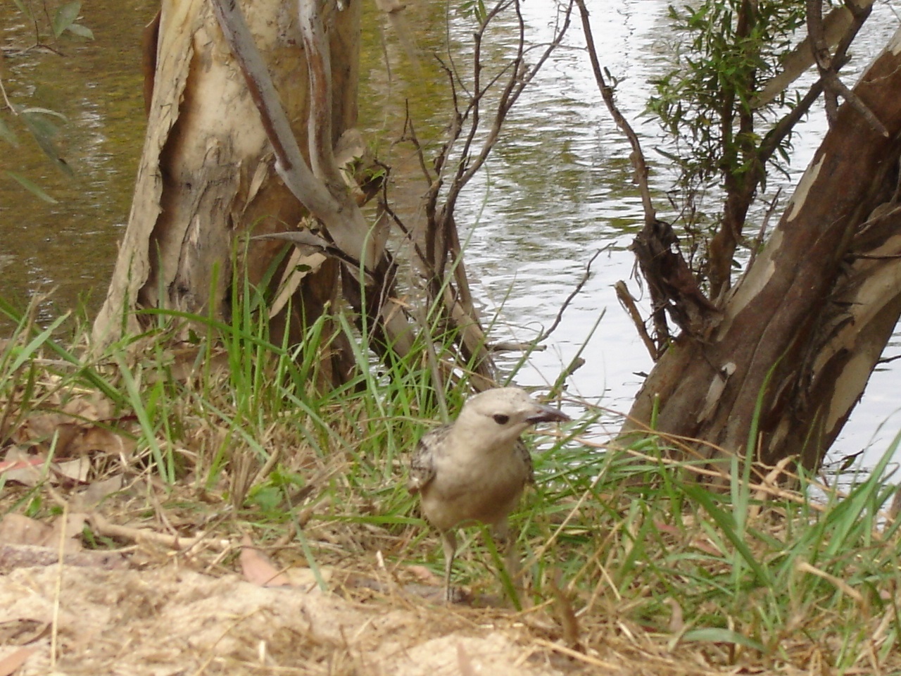
Friendly Bowerbird
We spoke with some other campers who came in later. Another traveller related a tale of an accident further back along the road in the afternoon. After our fire had died down we turned in for the night. A local generator not too far from our camp droned away until the wee hours of the night. At 5am I was awoken by voices close-by our van and on inspection found some fishermen camped less than three metres from us. Then they waved their torches around causing light flashes and we decided to have an early cuppa. Our noisy neighbours left soon after. We tried snoozing after that but to ni avail and then arose, did the morning chores, and were on the road by 8am.
The first 24km out of Coen was sealed. At the Quarantine Station we collected information for our return journey. From there the gravel road continued on to Archer River Roadhouse, Overland Telegraph Line Junction and Bramwell Junction Roadhouse. We refuelled at Bramwell Junction at $2 a litre of diesel. The day so far had been very pleasant with overcast conditions and very little traffic but they caught up with us eventually. The countryside along this route changes from Savannah Woodland to Heathlands and then sub-tropical jungle and then back to Heathlands. The road was relatively corrugated in places and one had to pick ones way through the bad bits. About half way along the road to the Jardine Ferry crossing, we found a road-works scrape atop the ridge and pulled up for the night. There was a strong breeze but dust made by passing vehicles was blowing away in the opposite direction and we could camp in peace. By 6pm the traffic had ceased.
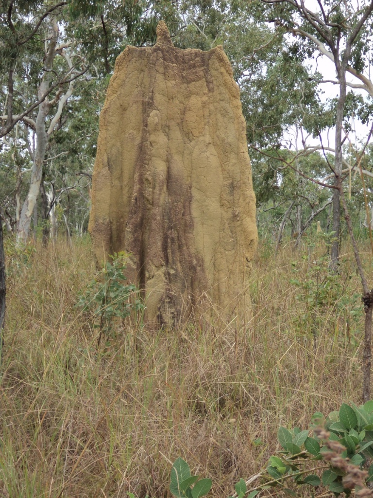
Cathedral Termite mound
Wenlock River
Jardine Ferry sign
Heathlands
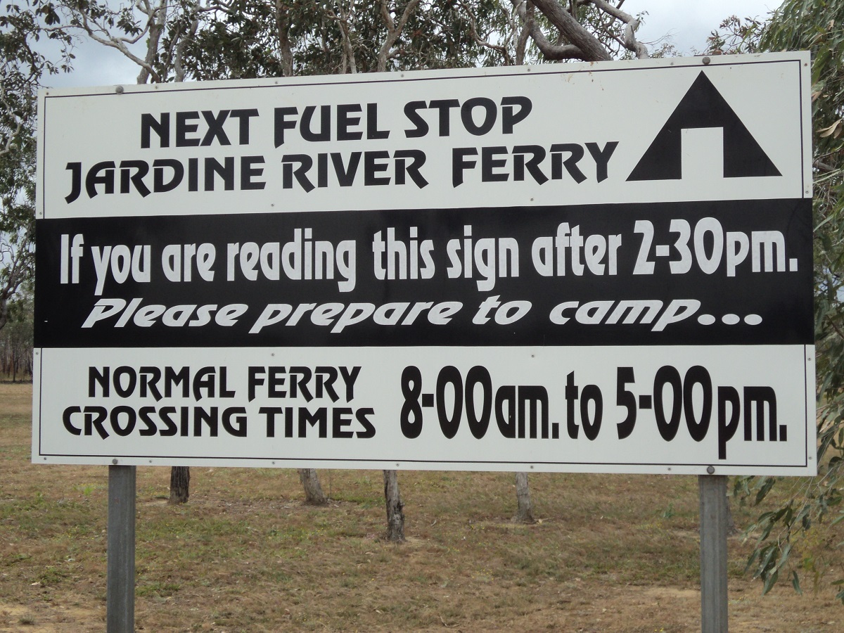
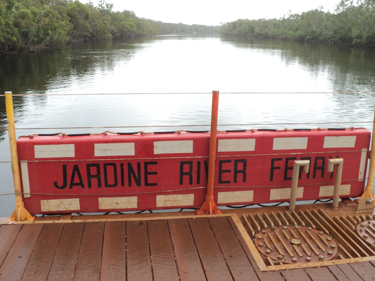
We passed by the signs to Fruitbat Falls and Eliot Falls with the intention of visiting there on the way back. At the Jardine Ferry we were surprised to receive a Seniors discount on the fare and camping permit which came to $70 return. The approach and departure angles are quite steep and one has to get on and off the ferry at an angle especially if towing.
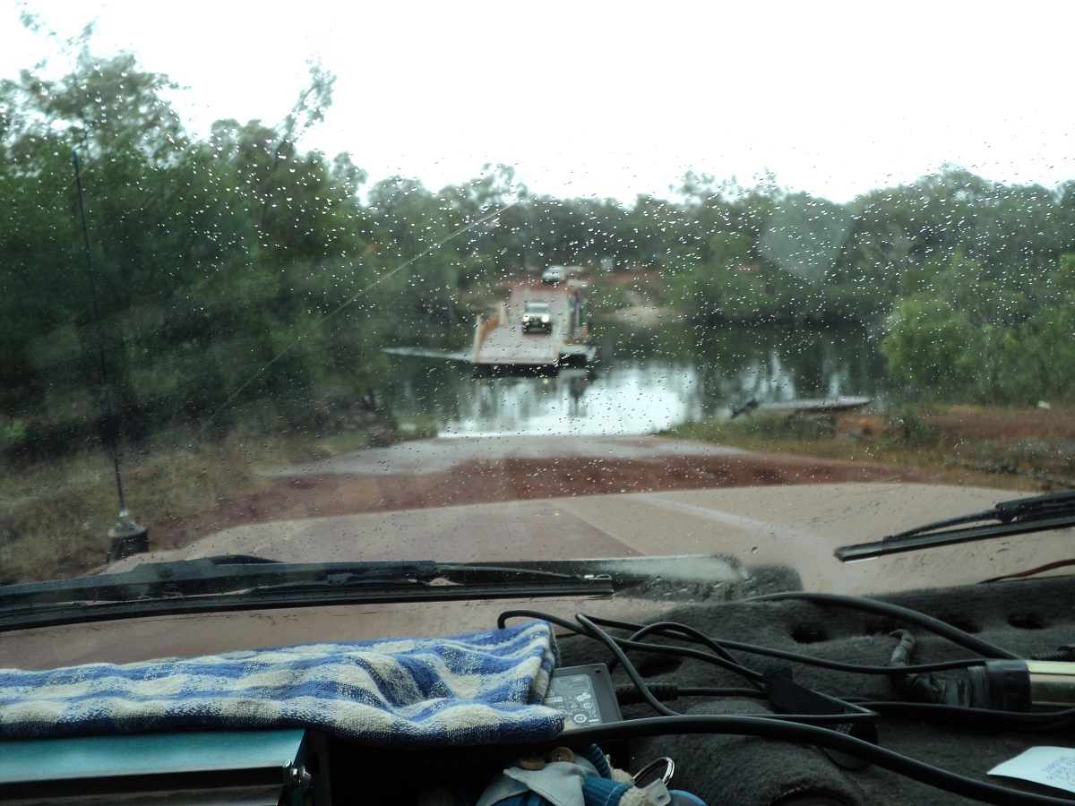
Jardine River Ferry
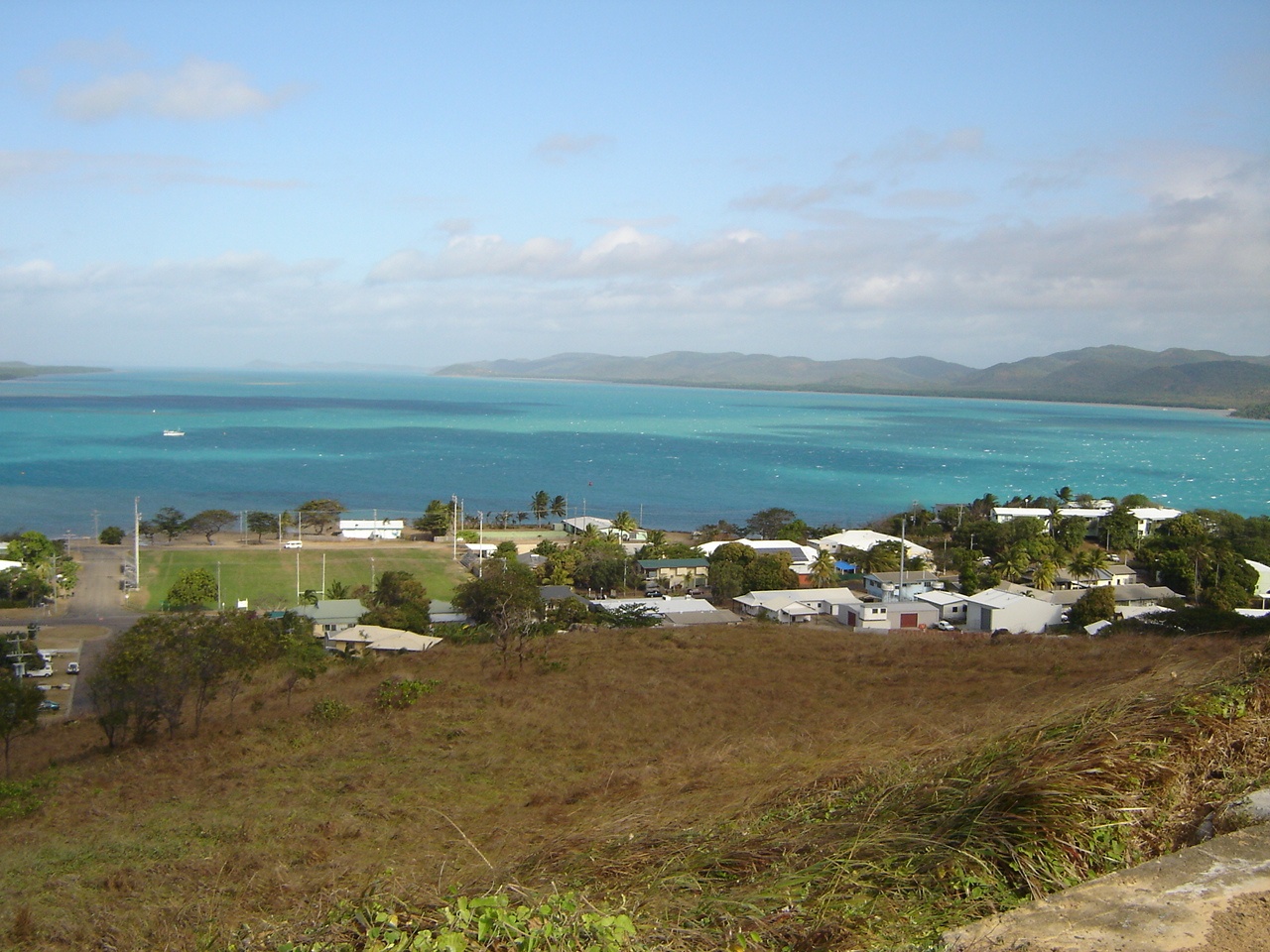
Once across, we made our way to Injinoo Community which is the most southerly of the four other communities of Umagico, Bamaga, New Mapoon and Seisia. We had picked up a brochure for the Campground at Alau Beach at the Umagico Community and headed that way.
The small communities of the Top End and all quite neat and tidy with mostly high set tropical houses.The usual dead cars are found in back yards and dogs roam freely on the streets. While the dogs all look well fed many of them have visible mange and are forever scratching and biting themselves. There are three supermarkets respectively at Umagico, Bamaga and Seisia. There is a Bakery, Butcher, 3 fuel outlets, and two vehicle recovery and maintenance workshops. All five communities are run by one Regional Council. The populace is made up of a rich mixture of Melanesian Islander and Aboriginal people. During WW2 a group of inhabitants from Thursday Island were evacuated to the mainland and never returned. Their first community was named Bamaga after the name of their Tribal Chief.

Umagico sunrise

Palau Island
Umagico Campground
Our camp
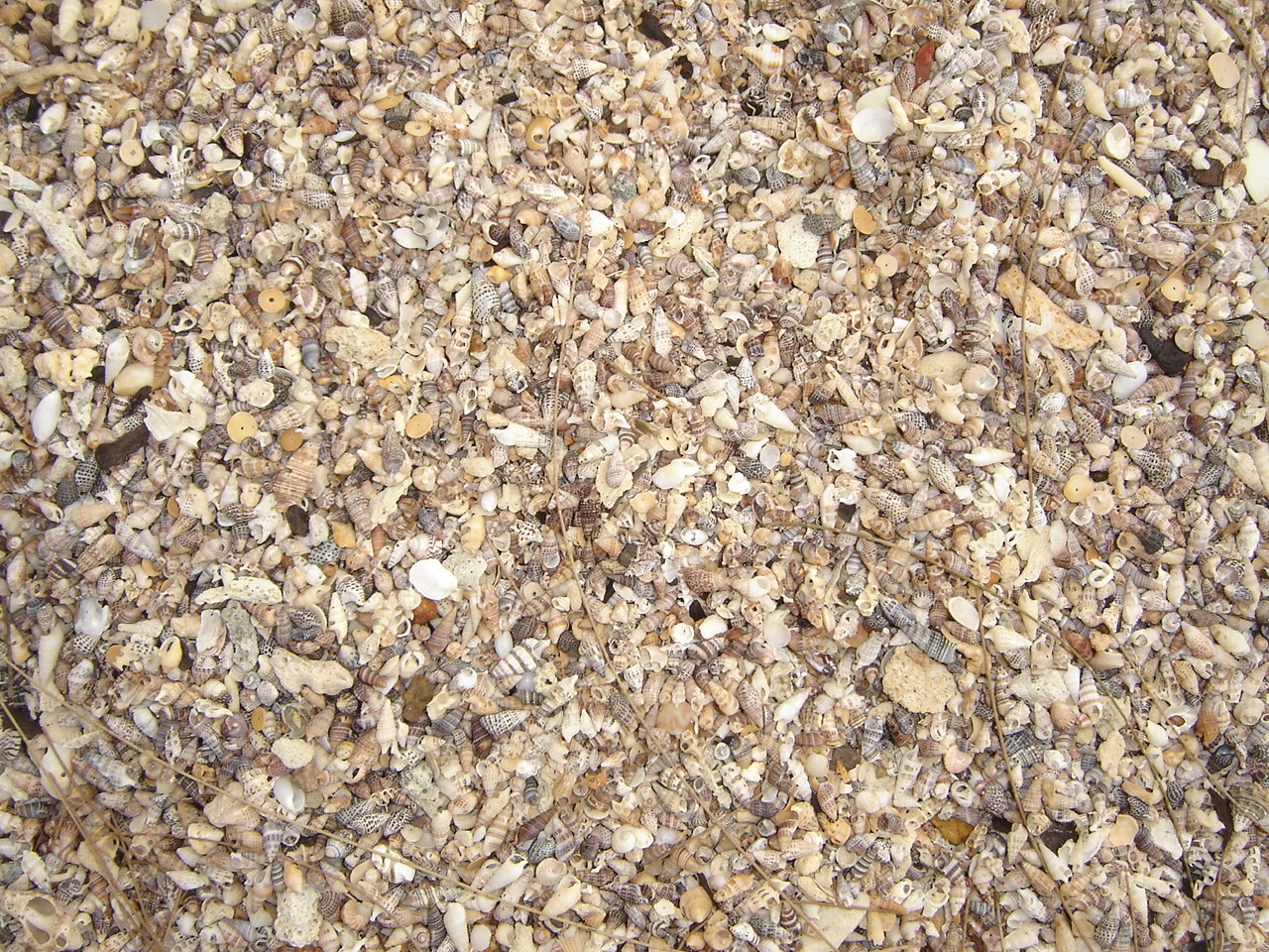
Alau Beach shells
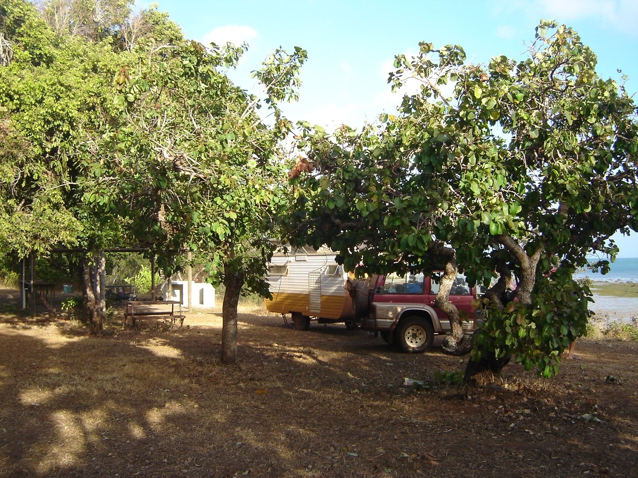
We had decided to base ourselves at Alau Beach campground at Umagico for a week and found a good spot with power at absolute beachfront. The facilities at Alau Beach were basic but they were clean and functional and we had a good time while we were there.
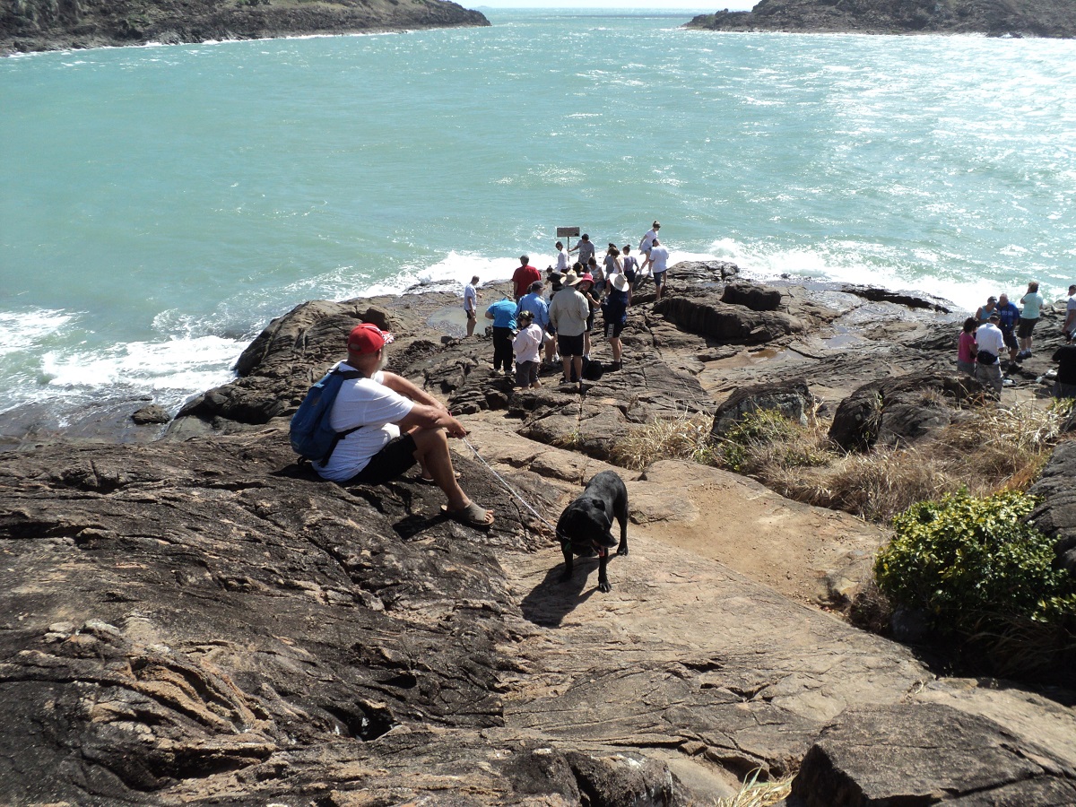
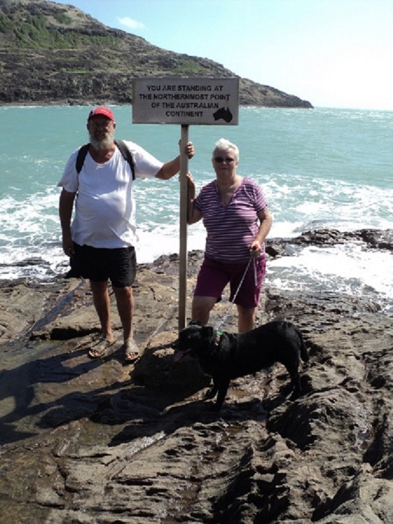
Our time at the Top End coincided with Queensland and Victoria school holidays and tourism was at its peak. When we arrived at the car-park at the penultimate destination we found a small area crammed with vehicles and tour buses. We made our way across the beach and up the rocks in our sandals winning the comments from more than one other traveller. At the signpost we had to wait our turn to have our photo taken by a kindly gentleman and then we spent some time there relaxing in the sun. Jeddah had walked with us and needed some fresh water we poured for her into small rock pool. After completing the return walk we drove down a wheel track on to the beach and had our lunch in the shade of the encroaching rainforest.


Roads to everywhere
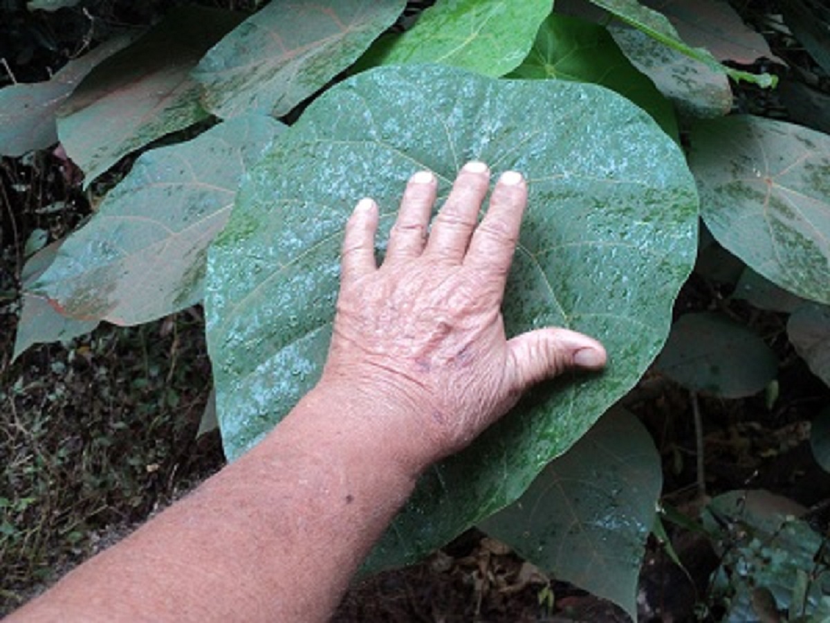
Our most delighted experience in reaching this point in our travels was driving through the rainforest which covers the last 25km to the Tip. We had purchased a Plants of Cape York book by John Beasley and we were able to identify a number of trees which caught our eye as being unusual. The rainforest is very dense in places and a number of poisonous shrubs and vines inhabit the place making it a relatively dangerous place walk in to.
Button Orchids
Strangler vine

Thursday Island
Prince of Wales Is from TI
Turtle Sculptures
I
Judith took a Ferry ride and Tour to Thursday Island whilst I minded Jeddah. By all accounts she had a great day.minded Jeddah for the day and opted for an art tour at a later date
Over the week we visited Punsand Bay Camp, Loyalty Beach Camp, Somerset Beach and ruins and drove the five beaches track via Fly Point, Vallack Point and Nanthau Headland. We also visited Lake Wicheura, which is a perched freshwater lake.
Pundsand Beach
We also drove out to Mutee Heads to have a look see and on the south side of the heads found that the beach sand was too soft and bogged the Nissan. This necessitated lowering the tyre pressures substantially and using our front heavy duty floor mats for traction. We managed to crawl out, albeit very slowly, from our predicament.

Deflating tyres
Then we took the track towards Van Spoult Head at the mouth of the Jardine River but after a few kilometres of bouncing along this two wheel track through a dry paperbark forest, we got sick of it and turned around to head back to our base at Umagico.
We had encountered cloudy weather from the time we had left Coen and overall did not see the stars at night for eleven days. This however did keep the temperatures at a steady 29 degrees and a fresh land breeze coming from the east coast of the Cape kept us cool for the time we spent in the Top End.
The day before our departure I noticed as scraping sound emanating from the left hand rear wheel of the Nissan. It turned out to be a fault with the Brake Callipers. I tried obtaining a replacement bolt from the local mechanical workshop but could not find anything suitable. So I used some of my Tie-wire and fastened the loose part, hoping that it would hold until I reached a more populated town.
Our journey south took us back along our track. At the junction of the Northern Bypass Road and Overland Telegraph Track, we made our way into Fruitbat Falls.
Fruitbat Falls
Expecting a road in, we found a one-vehicle-width track, and inevitably met others coming out. Some careful negotiating past one another was needed. The falls area is very scenic and offers a lovely, safe, swimming area. Our next destination was to be Eliot Falls but it is situated with the boundaries of Jardine River National Park, and domestic animals are not allowed in. So back at the junction we unhitched the van and set Jeddah up with sufficient water and air circulation in the van and set off for the falls area some 7km in distance. Other vehicles were on the track and we gauged the depth of one creek crossing as they were ahead of us. The falls were very spectacular and a boardwalk linked them. Swimming at Twin Falls was the order of the day for many.

Eliot Falls
Twin Falls
On our return to the van and Jeddah, I inspected the brake caliper only to find that the anchor bolt had worked its way loose and had fallen out.
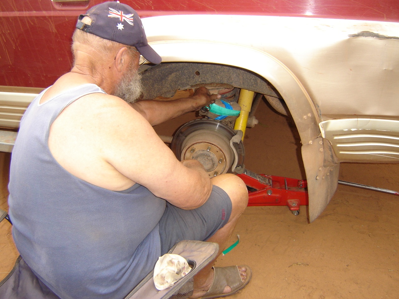
Breaking things
It was time to do remedial work. So I strapped and tied the brake caliper to the axle housing with tape and wire and after a while we were on the road again. We managed about 40 km before I noticed that the Emergency Brake Light had come on and upon further inspection found that the caliper had worked its way loose and somehow the brake hose had been damaged and that brake fluid had escaped. It was time to remove it. Now we had no brakes at all. We made for a quarry site I had seen on the way up and camped there for the night. I rang my mate George, in Darwin, via our Satellite phone and asked if he could source a replacement caliper.
Our next port of call was Moreton Telegraph Station where we decided to camp for the day. Moreton offered nice walks through the sub-tropical forest and along the banks of the Wenlock River. Their facilities however are only designed to cope with about 25 visitors and the night we were there at least 100 over-nighting. You had to queue for a toilet or shower. Luckily we showered early and have our own toilet in the van. We were going to stay two nights but the invasive noise of the diesel generator running during the day put paid to that. The generator did shut down at 9.30pm and after that it was very quiet apart from the odd Curlew call and the Kookaburras at around 6am.
We took the shortcut from Batavia Downs Station to the Peninsula Development Road. The road was good for the majority of the way except for one very big bulldust hole, just after the end of the airstrip. We were able to bypass it. Along the way we heard a scraping sound outside. Stopped and had a look under the Nissan but saw nothing untoward. Then proceeded for a short while and heard it again. At the top of the Embley Range there was a road-works clearing and we pulled up there to find that the brake activator pin at the wheel on the left hand side of the caravan had come adrift. So it was time for a roadside repair job. I removed the wheel, brake hub and bearings and repaired the damaged part. Then I discovered that I had left my grease at home. Just at that moment two young blokes from Darwin stopped to lend a hand and we were able to grab a couple of dollops of wheel-bearing grease from them
It was a smooth run into Weipa until we came to the Haul Road Crossing. Boom gates barred our way and would not budge although there was no traffic on the Haul Road. I rang the number shown on the sign and a very terse female voice told me that she could not help. I was to reverse all the way back to where we entered the divided road and try to activate the sensor. Did that with some difficulty and proceeded forward again but the boom-gate still would not rise. Just then a tour bus drove up from the opposite direction and the boom gates activated and we snuck across into Weipa. Technology does not always work!
We booked in for a week at the Weipa Campground. I rang George who advised that he had sent the parcel of parts that morning via Australia Post and E-post. The travel time for the parts would be 4 days. This was confirmed by the Weipa Post Office as well. The campground is a wide open space and shaded by Flaky Barked Satin-ash and Coral Bean Trees. It has direct access to the beach, good ablution facilities and a swimming pool. They also allow dogs. You pick your site at random and we found one in the shade of a tree with water and power handy. Weipa’s Woolworths Shopping Complex is only one hundred metres from the campground. Finding a place to camp is on an ad-hoc basis and as long as you have a long power lead you may pick your site at random. Our time was spent going on long walks on the beach, swimming in the pool, chatting to fellow travellers and watching DVD’s on the laptop at night!
Weipa Camprounds
Campground Beachfront
Weipa Beach
Weipa sunset
Red Beach
Midden
Ore Train

Turtle Beach
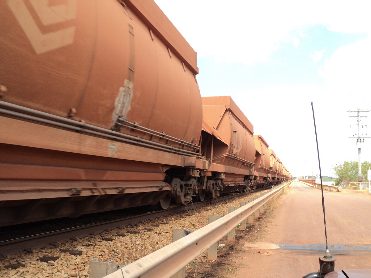
 We took a run up to Mapoon one day to experience crossing the Embly and Andoom Rivers which are spanned by a one-lane bridge and rail line. Camping is allowed by permit at Cullen Point at the mouth of the Wenlock River although the sites on the eastern side did not look too inviting. Along the open ocean beach there are some beaut spots under paperbark trees with access to Turtle Beach. On the way back we called in at Red Beach, so named as it is made up of pure bauxite granules. We crossed the bridges again together with an ore train bound for then stockpile at Lorim Point. Two ore carrying ships were being loaded and we saw this happen as a conveyor belt runs from the stockpile out to the ore wharves.

Loading bauxite
The brake parts arrived from Darwin after four days as promised, and I fitted them with Jude assisting when we had to bleed the air out of the brake hydraulic system. Jeddah looked on with a bored expression. On the Wednesday after, we set off again, heading south, or so we thought. I immediately noticed that the Nissan wasn’t accelerating quickly enough and mentioned that there was no power. After a few kilometres we stopped and found that the right hand rear brakes had seized on the brake rotor and that the wheel was red hot! After we let it cool down we returned to Weipa calling in at the RACQ workshop where we were quoted $110 per hour for labour! We returned to our spot at the campground and paid for another night. I rang George again for his opinion and he said that it was easy to repair and I would have no trouble doing just that! Oh yeah? Well we did just that but with some expert assistance from Garry Thompson, a fellow camper and qualified motor mechanic. Thanks Garry! That evening I broke my self-imposed alcohol abstinence, shouted a few beers and had a few myself!
On the Thursday we managed to get away from Weipa and made it to Coen by lunch time after stopping at Archer River for morning smoko.
Archer River
The road was good to start with but deteriorated after Archer River Roadhouse. We camped at The Bend on the Coen River and there were only a few other camps. The next morning I noticed that the right hand brake calliper retaining bolt was missing and so we drove into town to the only mechanical workshop and the owners were very helpful in giving us two bolts with the same thread as the lost one. We then went for a drive around Coen and at first came to a locked gate en route to where a waterfall supposedly was. The next track took us a long way through the scrub and ended at a deep water crossing on a small creek. I decided that it was not the time to cross and we went back to camp the way we came. On arrival back at camp we found an old couple parked right in front of our van. They were in their 70’s and stated that they always camped there under the trees and they were doing so for the next two weeks. They had a swag of bits and pieces and their camp looked more like a jumble sale. Later they moved their old Landrover so that we could hitch up again. Later in the day more camps settled in for the night and another bloke with a $200,000 Isuzu 4×4 tried to park us in but I said that I needed the space to get out in the morning and the fella reversed out in as huff.
We made it to Laura just after lunch having had it in the shade of the trees of Hann River Roadhouse. The road from Musgrave Roadhouse was quite good but the last 30km into Laura was very corrugated. Once there we refuelled and I booked to go on a Quinkan Rock Art tour the next day. Drove around looking for a campsite but found none. So we drove out to Split Rock Billabong and it was taken up already. So we turned around again along the washed out road and eventually found a sheltered place behind a quarry about 6km from Laura. Quiet night.
I went on the Quinkan Art Tour guided by Thomas Quinkan, a Traditional Custodian of the land. It was a long drive via a sandy track and only about 45 minutes of viewing three galleries. The art is good but not spectacular as I have seen far better art in other areas. But it was a worthwhile experience.
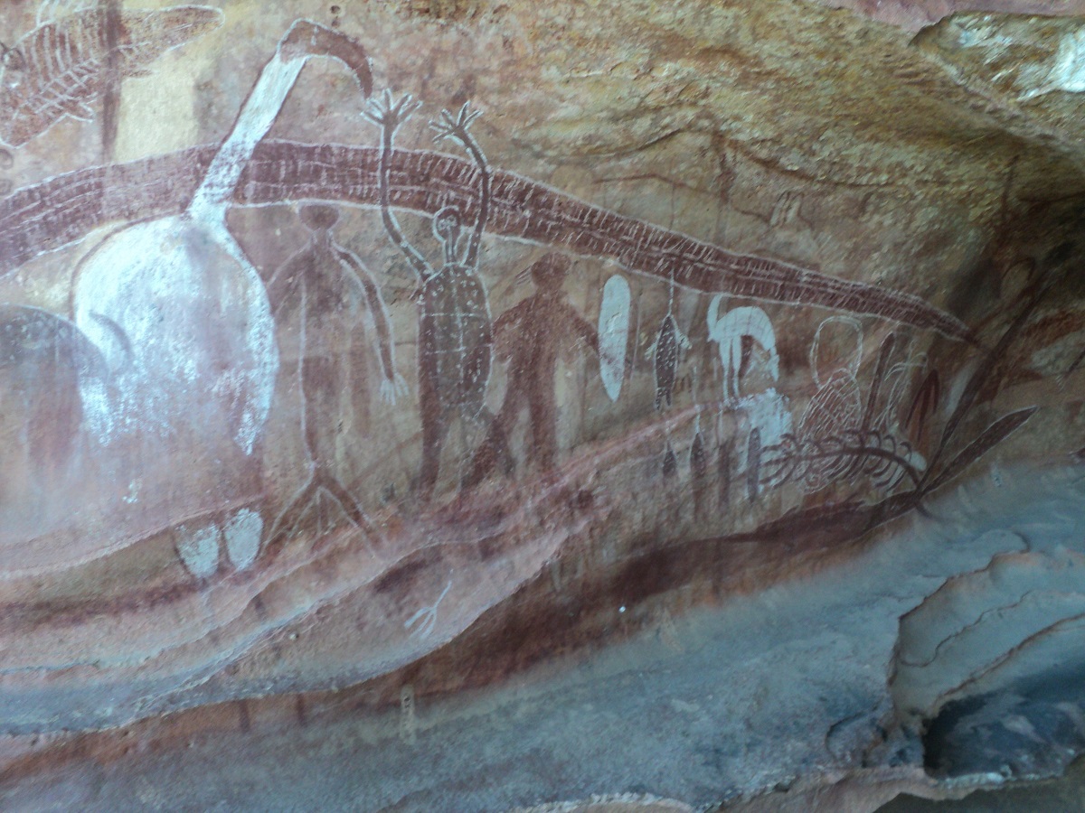
Quinkan Art
After the tour Judith presented lunch in the shade where she and Jeddah had been relaxing. Jude also visited the Cultural Centre presentation in my absence. Then we made our way along Battlecamp Road towards Cooktown. There were a number of rivers to cross but the waters were not too deep. Right after crossing the Normanby River, we spied a track leading off into the rainforest. We walked it first to see if we could fit the rig in. On the way in the track ran at a slant and the caravan leaned over onto a tree. I had to use all my driving skills to prevent further damage to Daisy, the van. We had a good camp but the Flying Foxes crapped all over our rig during the night.

Faces on a Bumpy Satinash

Normanby River camp
Isabella Falls
The last bit of road over the Great Dividing Range was good and sealed for a short way. We stopped at the delightful Isabella Falls and very soon after we were back in Cooktown where we did some shopping, replenished our water supply and washed the bad stuff off the Nissan and van.
And so our Cape York adventure came to a c
Elim Beach 2011
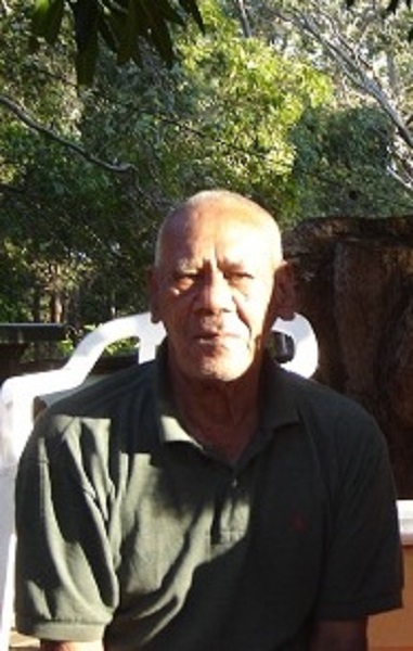
Eddy Deemal
Eddy Deemal is a sprightly 85 year old Aboriginal man. He told me he was descended from the Deedarr Tribal Clan of the Cape Bedford Area of Far North Queensland. The Deedarr Clan are known as the Fire-stick people and they traded fire sticks with neighbouring clans and some too with clans further south over time long ago. Today he still makes ceremonial Fire-sticks and Spears.
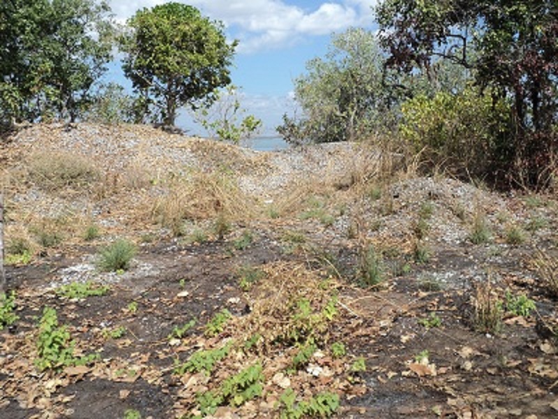
In 2001, nine years after the Mabo Deliberation by the High Court of Australia, Eddy moved back to his tribal country and started a tourist venture at Elim Beach. Word of mouth got around and many fishermen and sightseers visit Eddy’s Campground each year when the roads dry off after the Wet Season. Eddy has about an acre of land at his disposal at present and in the height of the tourist season anywhere between 15 and 20 vehicles may be camped there overnight. Flush toilets and cold showers are there for the convenience for visitors but power supplies have to be catered for by each individual traveller. This necessitates the running of generators by some which can be annoying to the ear at times. Eddy runs his power-plant to provide lighting from 6pm to 9.30pm and generally all generators are turned off by then. Water is pumped from an underground spring on the beach to a holding tank and there is enough for all the visitors.

Track to Elim Beach
The track to Elim Beach
The Cape Bedford was at first the focus of the Lutheran Church Missionaries who built a church and established a school at Happy Valley in the sandhills. They attempted many ventures over the 63 years that they were there. Later squatters invaded the area and built a number of beach shacks along the shores of Elim Beach. At present there is a dispute between Eddy’s Clan and the squatters and according to Eddy this may be resolved very soon.
Elim Beach Campground
Sunset on Elim Beach
A number of sandy bush-tracks follow the shoreline and cross over the saddle to Ocean Beach in the east or Coloured Sands in the west. The flora of the area is sand dune savannah with some heathlands and pockets of rainforest. Mangroves and wetland lie between the sand dunes and the sea and freshwater streams run from the dunes year round.
Coloured sands
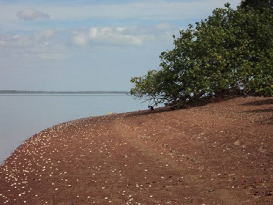
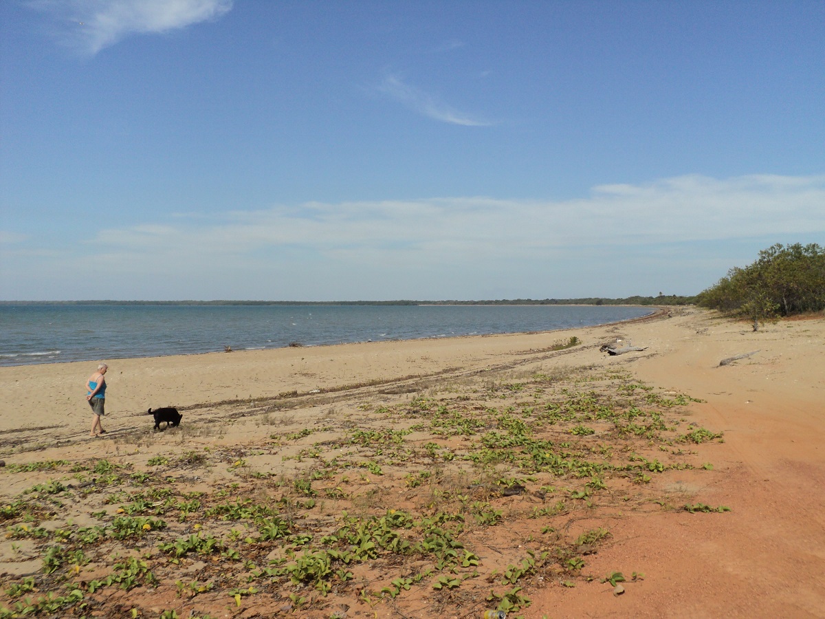
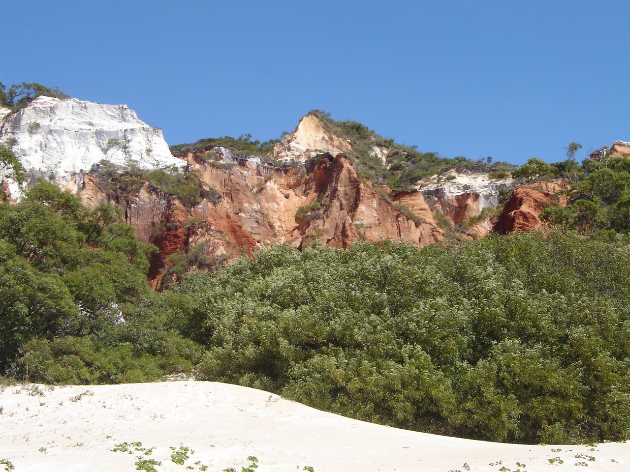
Ocean Beach, otherwise known as Cape Bedford Beach, lies about 6km to the east from Eddy’s Campground. It is an easy run along a track which is partly overgrown. One dune can present a problem to scale, so lower tyre pressures and a heavy foot is a must for this dune. The beach, which lies a short distance from the International Shipping Channel, is strew with flotsam and jetsam as the easterlies blow all discarded matter ashore, including wood and coconuts. It is a beach-combers paradise but is in a way, an environmental eyesore. The beach is flanked by Cape Bedford in the north and The Nob in the south
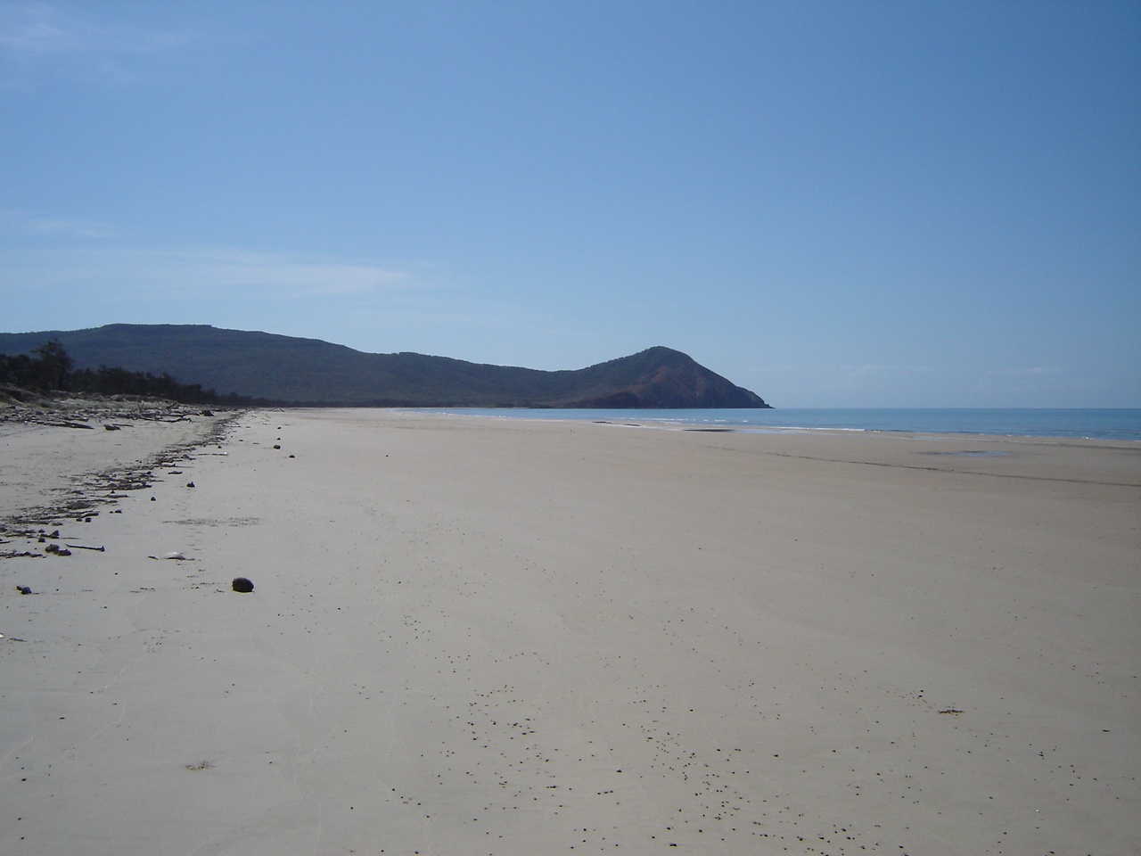
Ocean Beach
Washed up
In the Dreamtime a dinosaur was killed by a tropical cyclone and he came to rest at the north end of the beach where he expired. From a vantage point higher up one can see all of this clearly with his head and body visible to the naked eye using a bit of your own imagination.
To get to higher vantage point there are two set wheel tracks leading up the heath covered hills on the shores of the beach. Eddy had told me about them and I asked his permission to go there. I selected Low Range second gear and tackled the steepest track. I must say that my old Nissan made it in one go but right at the top I was conscious of the fact that we were going slower and slower and a swift change to first gear came to mind. After the initial climb the track follows a number of raised natural steps before tackling the final 100 metres to the top. Driving, with only the view of the bonnet in front of me, I was surprised, when at the top of the hill, there was only enough space for one vehicle. Over the other side was a sheer drop down a rocky slope. I had now climbed to 200 metres above sea-level. After gazing at the 360° vista around me and taking the photos I wanted, I executed a 7 point turn to get the Nissan pointing in the downward direction. The journey down, in first gear low range, with the engine using its compression braking, was breathtaking!
Cape Bedford vista

Coming down
Amongst our other activities we delighted in discovering plants we had not seen before and identifying them using our Cape York Plants book. Button Orchids hung in the paperbark trees in curtains and Ant Plants, a type of orchid, abounded. We took great pleasure showing these to other interested travellers.
Overgrown bush tracks
Button Orchids
Twisted paperbark roots
In our week of staying at Eddy’s Campround, I managed to help Eddy with some tasks around the yard and also repaired a rat trap for his brother David, who lives a short distance away. The rat trap repairs did the trick as a few days later David came to tell me of his success in trapping the rodent which had been raiding his pantry!
It was an enjoyable stay on our journey through Cape York.

Green Tree-frog
Oh leave me alone, will ya!
Beach-combing the Eyre 2011
Perlubie Beach sunset
Every year we make an effort to get down the beach for a few days. It is to see the sea and to paddle in the water. It has become a sort of a ritual. And every year we choose a different destination. We normally go in February after the school year commences. February however can have variable weather conditions. It may be extremely hot or rather cold depending on what’s happening in the Southern Ocean. For 2011 we chose to drive to Smoky Bay and start our beachcombing down the Eyre Peninsula Coastline
It was a slow journey, cruising at 80kmh through Horrocks Pass, and down the hill to Port Augusta, where the inevitable shopping took place. Lunch was had at the Eyre Highway intersection and although not a very exciting place one can always waste time by reading all the graffiti on the old disused concrete water tanks close by. From there we took the Eyre Highway heading due west. As usual the going was slow over the undulating hills through the wheat fields but it was a pleasant day and we were able to keep the windows open to keep fresh air circulating through the cabin. Close to the town of Kimba we took a side road to Lake Gilles to have a look at that salt lake.

Lake Gilles
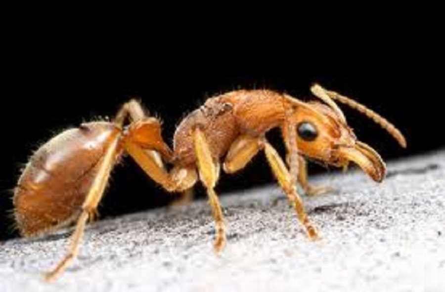
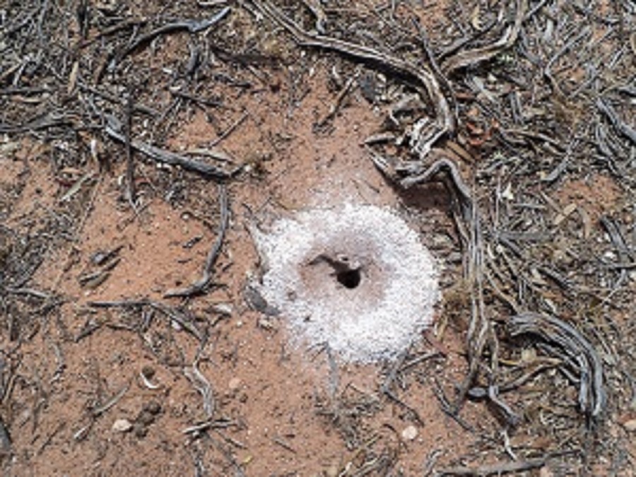
There were some puddles of water about. At Lake Gilles we learnt about the Dinosaur Ants whose nests burrow deep down through the desert sand to bring salt crystals to the top. Nothomyrmecia macrops, sometimes called the Dinosaur ant, is the only extant species of its genus. The primitive nature of the ant in behaviour and biology has resulted in the species often being considered a “living fossil. They are only found in old growth Mallee scrub and between Lake Gilles and Poochera, both places which are in South Australia.
Dinosaur Ant
Dinosaur Ant and Nest
Dinosaur Ant Dinosaur Ant and nest
On the way back to the highway I took a track running between the wheat fields by the name of Bungwalla. There is an old gate at the start of this track which was the original track to Lake Gilles. The track is lined with Mallee scrub. Numerous Ringneck Parrots, Currawongs, Happy Jacks and Crows lead the way as we trundled down this track trying not to get the caravan scratched. After a while we came to Aerodrome Road and thereafter the town of Kimba.

Bungwalla Track
By the time 5 pm came around I was feeling weary and the day had warmed up a bit. We looked at a camp spot off the highway but there were two vans already parked up with generators running. It was too close to the road anyway, and so we pushed on. A short way past Koongawa Locality we took the Wuddinna East Road, which took us to Mount Wuddinna and Turtle Rock, both granite formations, and found a good campsite near the Microwave tower. This site was a scrape, a short distance off the road. We had a very quiet evening apart from three local vehicles passing. We seemed to have parked near an ants nest though as there were plenty of small black ants on the ground. They lead us on a merry dance but we got around that by devious methods.
ANT CAMP: Jeddah the dog wanted to go for a walk at 6am the following morning. Then I made long coffees and a tad later we had breakfast. It was a cooler morning with some cloud creeping in from the coastal regions. We drove to Mt Wudinna, which is the largest exposed monolith in South Australia, for a photo opportunity, and then on to Pygery Rocks.
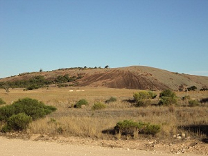
Mt Wuddina
The track off the main road into the viewing area for Pygery Rocks was interesting, as it was washed out and this took some careful wheel-placement with the little van following behind and then there was a very small turning circle right up against the rock at an angle. Once we started climbing the hilly road there was no turning back. I managed to turn the rig in a two point turn at the end of the track however. We went for a wander and to take some photos.
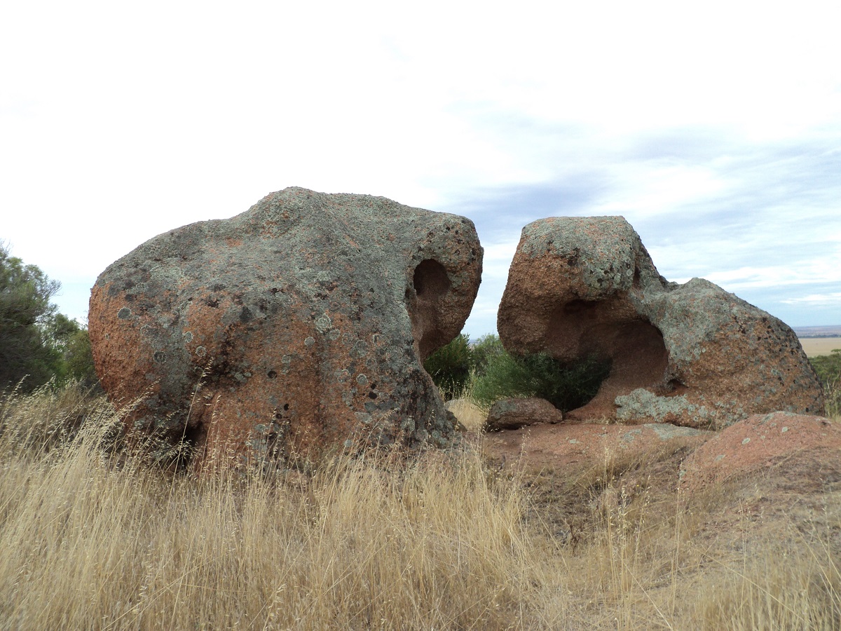
Pygery Rocks
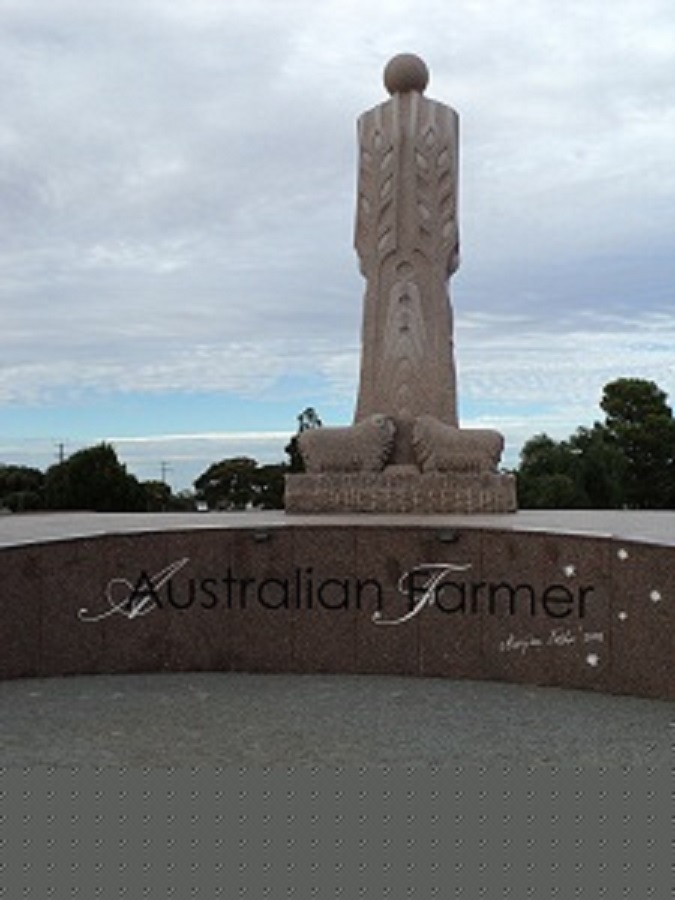
At Wudinna Judith had to buy a potato peeler as the regular one seemed lost. We also had a good look at the Australian Farmers Monument, which is very impressive.
Farmer Monument
The local wheat harvest was in and covered over, ready for transport to markets locally and overseas. Then we drove back on to the Eyre Highway past Minnipa, Poochera and Wirulla and shortly after Wirrula, we turned on to a gravel road again, which took us all the way to Smoky Bay. The bay was named by Matthew Flinders in 1802 because of the many native fires he saw on the mainland when he was sailing past. We had lunch there on the foreshore and then headed south. Smoky Bay is essentially a fishing village with holiday shacks and houses to rent for holiday makers. The day was very warm and we ran the old Nissan air-conditioning for short periods of time until the temperature gauge showed 90°. Then we would endure some warm air until the temp dropped to 75° and then on again with the cool air. We called in at Haslam Beach but it wasn’t very exciting. It is more of a fishing hamlet for those die-hard fishermen…which we are not. We had a look around Perlubie Hill Housing Estate. Farmers are subdividing their land and selling off to developers who in turn create rural living areas near the sea. The houses are mainly wooden or steel structures with modern exterior looks. What did strike me was the amount of rainwater tanks and solar panels adorning most roofs. This is so as there is little groundwater about and the cost to lay it on from Streaky Bay would be prohibitive. With solar panels you can either connect to the power grid or have a standalone battery system running all your household appliances on 12 volt. Then we saw a sign to the Wharf and following that road around we found Perlubie Beach, on Streaky Bay, where bush-camping is allowed. The parking area will only accommodate 4 or 5 camps however. But I walked down to the beach and decided that I would take the van there as the beach sand looked firm enough.
Perlubie Beach
There are a number of grass topped shade areas and we drove on to the beach behind one and spent the afternoon lazing around in the shade. Perlubie Beach is a popular beach and it is only 15km from Streaky bay. An annual News Years Sports Carnival is held there and by all accounts the place gets packed out. We went for a swim in a very warm sea. In fact I would guess that the water temperature would have been close to 40° Celsius. Jeddah came in at first but didn’t like the small waves and stood on the beach barking at us. Afterwards we had a shower at the ablution block on the sand hill to wash the salt away. That water was hot as well. Other travellers came by and chatted with us and a young fella travelling on his own set his tent up under one of the shaded areas. He spent the evening walking through the shallow waters of the outgoing tide looking for Blue-swimmer Crabs with his torch. At the beach we saw Pacific and Silver Gulls, Eastern Reef Heron, Pied Oystercatchers and Black fronted Dotterels.
HOT WATER CAMP: The weather cooled down rapidly during the night and we had a few showers of rain. The sand was quite hard packed the following morning but when I tried to reverse the van off the beach it turned sideways and bogged. I didn’t feel like airing the tyres down for better traction as we only needed to cross about 50 metres of sand and so I selected Low Range second gear and kicked the loud pedal hard to drag the van over the soft sand and seaweed to get off the beach.
We had a look at some more housing developments along the way to Streaky Bay. The well-appointed Information Centre gave out good local info. The young lady behind the counter was wearing a rather revealing garment and I did not know where to look! Later we visited some old friends from long ago for a chat and a cuppa and afterwards we went to the RV Dump point for obvious reasons and to replenish our water supply. There is a new Pay As You Go clean drinking water dispenser. Water costs 10cents for 40 litres and we thought that that was a really good idea. It is something that all towns should make available for travellers. We refuelled and bought a fridge magnet, shuck knife for oysters (left ours at home, didn’t we) and dim-sims for munchies. None of the Oyster Sheds were open for business near the boat ramp and we were a tad disappointed in that.

Blowholes
Next we travelled along a well maintained gravel road along the Cape Bauer Loop. We visited the Blow Holes and Whistling Holes along the seashore. A long boardwalk took us to these places Then we had lunch at Cape Bauer in the small car park. There I had to do a four point turn to get the rig turned around. The seaboard is very rugged and the rocks are of a brittle nature so that walking too close to the edge of the escarpment is fraught with danger.
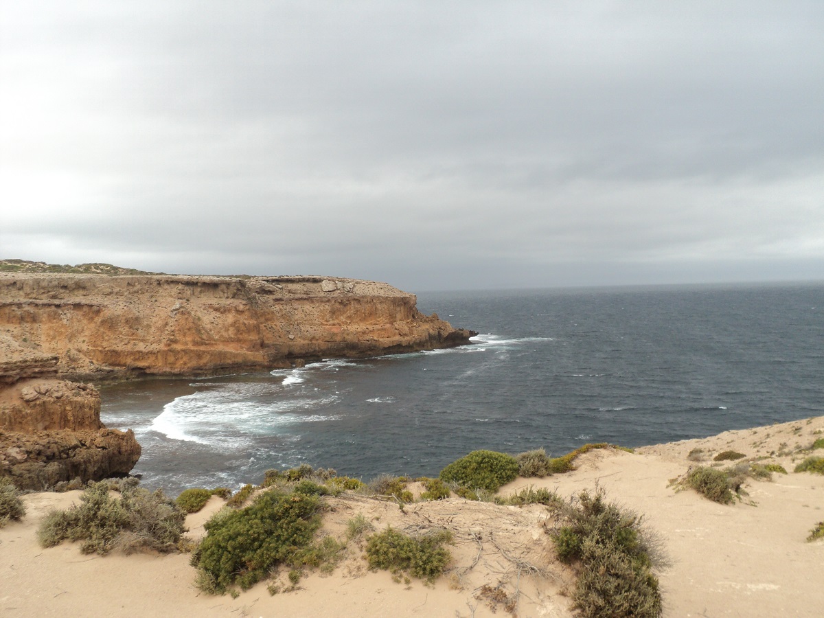
Cape Bauer
Once back at Streaky Bay we found an Oyster supplier and Jude bought 4 dozen. After that we did a leisurely trip to Tractor Beach, Point Westall and Smooth Pool. On the way back to the Sceale Bay road we encountered a very heavy rainstorm and plowed through a lot of water for about a kilometre. Then we had a look at Sceale Bay. Lots of new houses there too. At the top end of Baird Bay we stopped and found out that putting the top of the van up was extremely difficult. The answer was that we had tried to pop the top with the door closed as the wind was blowing a gale and so we beat a hasty retreat and made our way down to Baird Bay where there is a small camping area. A nominal charge of $10 per vehicle per night gives clean undercover BBQ facilities, fireplace and toilets. It works on the Honesty Box system. Just as well we paid as at dusk the Camp Keeper came to count the vehicles and collect the money! We met up with other travellers we had met at Perlubie Beach. They had been out fishing and had caught some Whiting. More travellers came in including some young Swedes, a bus and a 4by with a camper trailer. The wind was blowing a gale. Jeddah and I went to the beach for a walk. I reorganised the van and back of 4by so that our space is better utilised even with the gale in full pelt while Jude found something to munch. We had a dozen oysters between us and a good tea after. We were both tired and after listening to the radio for a short while, we dropped off into a deep sleep. The raindrops woke me at around 2.15am and then continued on for the rest of the night with squally gusts of rain being driven by the wind from time to time.
WINDY CAMP: It was wet and muddy outside but we were dry. We had a lie in and only broke camp at 9am. The road was not too wet though as we made our way to Murphys Haystacks. These are granite rocks called Inselbergs.
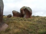
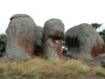
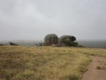
We three went for a walk in the drizzle and took lots of photos. Back on the sealed road the next port of call was Venus Bay. There are plenty of NO signs. We had a look around and decided that the place was going upmarket. After that we made for Talia Caves and Beach. These caves were impressive. First the Woolshed Cave is accessed via a long series of wooden steps and then The Tub Cave is a sinkhole with a cave at the bottom of it.

Talia Beach
The beach was also great and there is vehicle access to the beach through a gate for fishermen or campers even though the access is in to a Conservation Reserve. The usual warning signs about dog baits greeted us at the gate. However, dogs are allowed to the park a leash. This time however we did not go on to the beach. We had lunch at Woolshed car park.
-
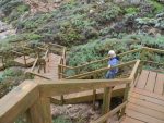
- Woolshed Walkway

-
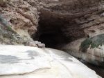
- Woolshed Cave

Then on to Elliston where there is The Great Ocean Drive with cliff-top sculptures.
-
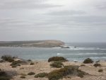
- Elliston Coast
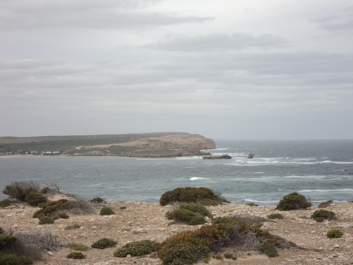
-

- Elliston Sculptures
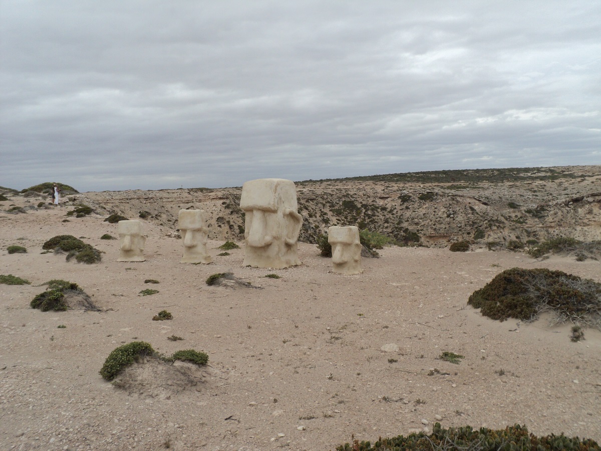
The number of NO signs increased around Elliston precinct.
Heading south along the bitumen we bought freshly baked bread in a wood-fire oven at a farm stall at Colton locality.
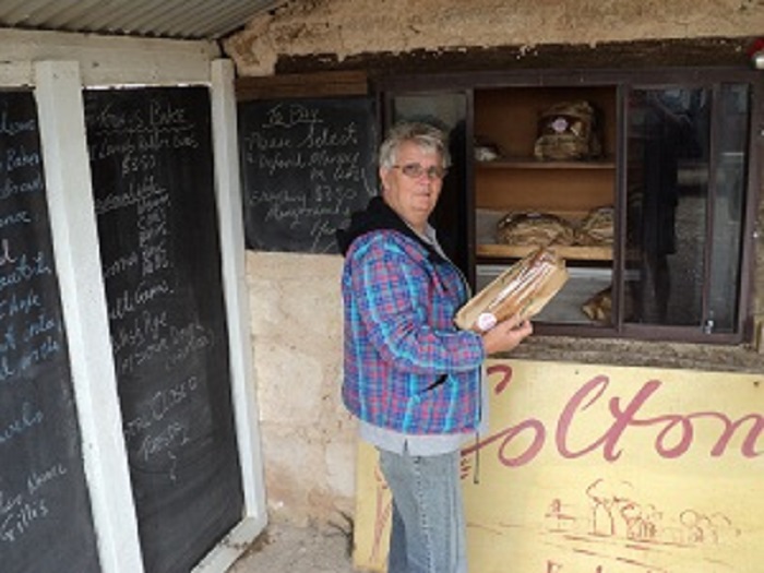
Fresh Farm Stall bread
After that we drove further along the Flinders Highway taking in the scenery. We stopped at the Dry-stone Wall rest stop and took photos.
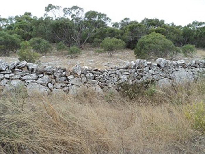
Dry-stone Wall
We turned off the highway at Mount Hope and found a sealed road to Cummins where we topped up with some diesel and then drove to Tumby Bay. Tumby Bay has expanded like mad but we did not drive in this time. Instead we drove on to Lipsom Cove where we managed to secure a good site. There were ten other camps. Not like the old days!! Went for a walk on the beach and had a feed of oysters early. We chatted to other travellers about nothing in particular. I had heard on the radio weather forecast that the wind would drop at midnight and told another traveller that. This person was complaining about the wind. The following morning the wind was still blowing.
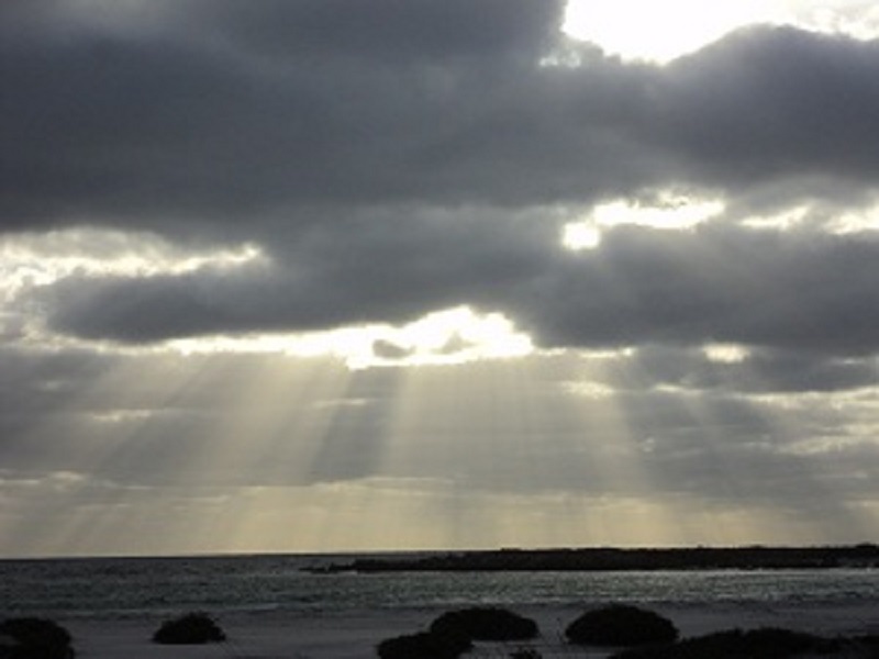
Rays of light at Lipsom Cove
SEAVIEW CAMP: The little van was rocked to and fro by wind gusts all night. Jeddah and I went for a paddle in the sea before sunrise and then we went back to the van and I made the early morning cuppa as Sleepy had only one eye open! We were on the road at our usual time of 8.30am. Had a drive around Port Neill and then bought some Quandong Jam from a dear old lady at Cowell. Added some diesel to the tank and then climbed our way steadily to Whyalla past the giant iron ore mine workings of Iron Duke. Did some shopping at Whyalla and topped up the fuel tank again. Heading the north the fuel price was dropping! Lunch was had at the Bird Hide Parking area at Port August and then we climbed the long climb up Horrocks Pass. The old oiler does not like those long climbs and I was down to second gear about one kilometre from the top of the range. By that time the engine had actually cooled down due to the high revs. Impatient drivers behind me overtook on solid double lines making a mockery of road rules. We were home by 4pm. We had had more rain in our absence and when I unhitched the van my swing-a-way jockey wheel dislodged itself as the van shifted it’s weight with the jockey wheel slipping in the soft soil, and the van came down on its drawbar. Lots of jacking with my trolley-jack saw the ‘accident’ remedied in no time.
Our five day excursion was a short but worthwhile sojourn along the west coast of South Australia and we visited places we had missed the last time we were that way.