Self ..Desert Rescue ..Going Walkabout .. Carson River Track – Kimberley ..Stock Routes, Strip Roads and Tracks ..Wandering the Eyre
Self
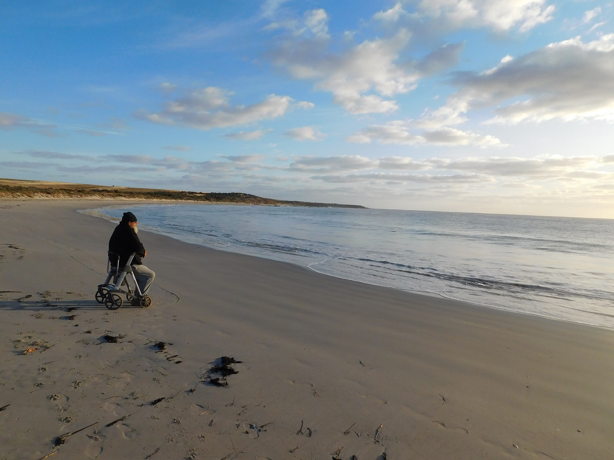
By January 2015 I had had enough and checked in at the Outpatients Unit and our local Hospital as I couldn’t trust going to the clinic only to wait for a month or so. A young doctor looked after me and over three months went where no other doctor had gone before with high increases of medicine intake and very soon I was on medication that relieved 90% of the discomfort. I still have my falls but I try hard not to. The Clinic has improved its practice since that time. My left leg has swelled up to twice its normal size. Deep vein scan produced nil result.
I am managing my condition but it isn’t easy. I use a 4 wheeled walker to get around.
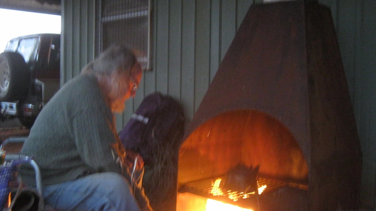
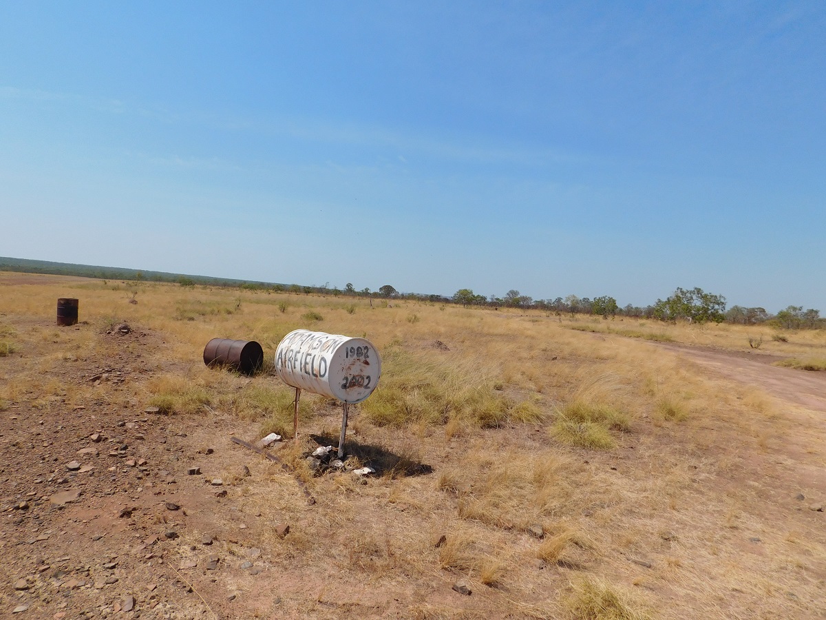
Desert Rescue 2015
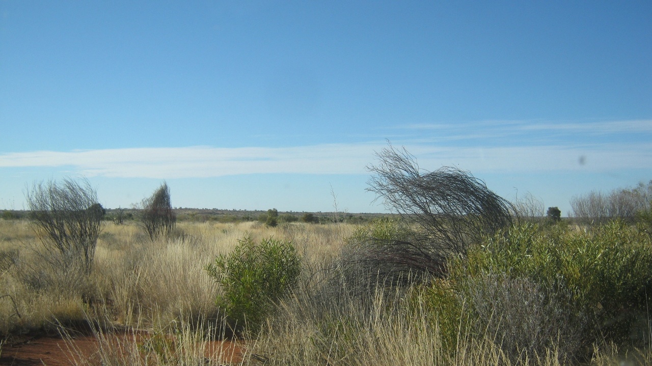
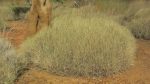
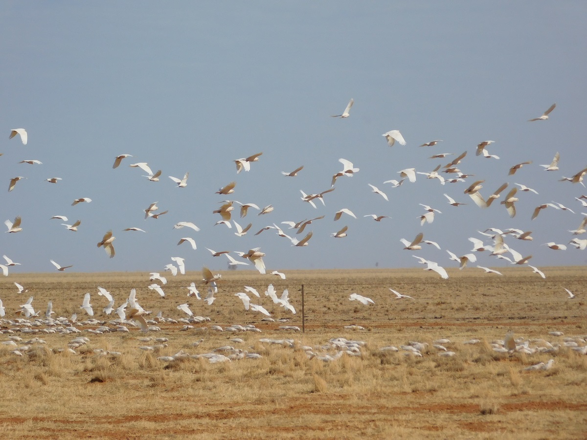
Dry Spinifex grass
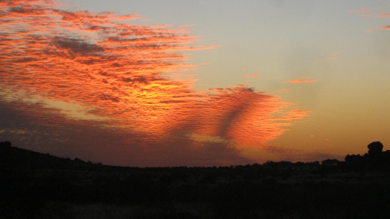
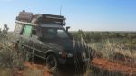
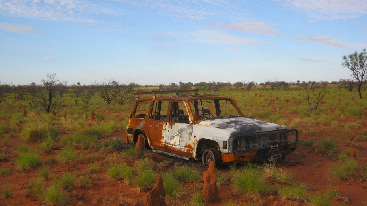
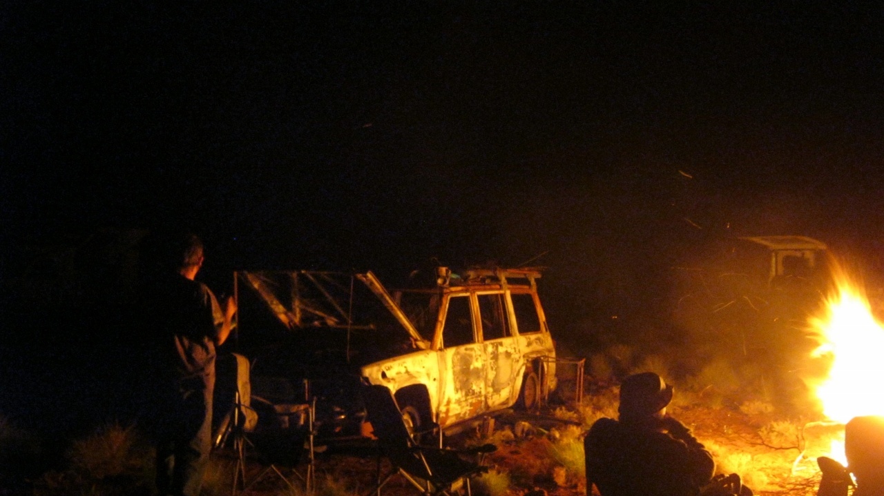
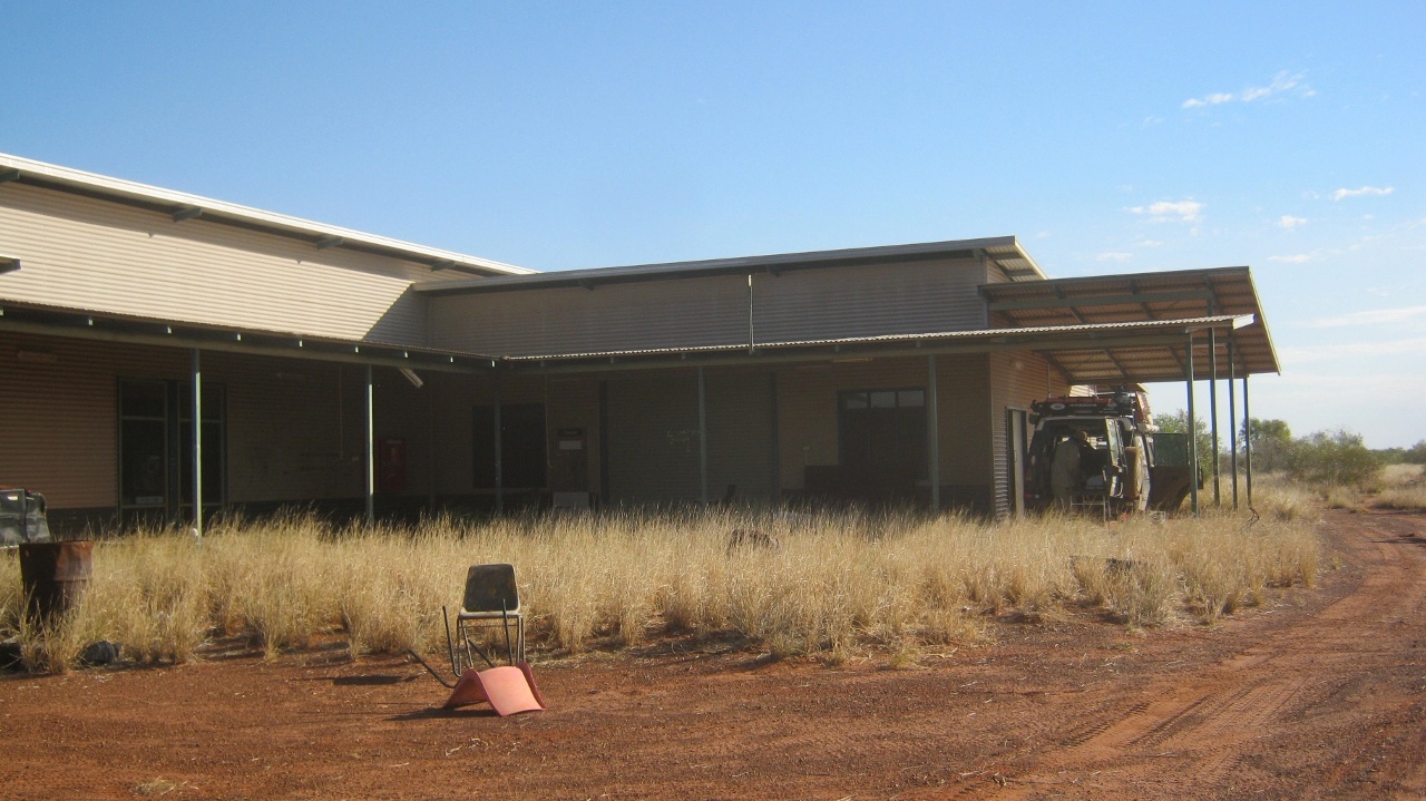
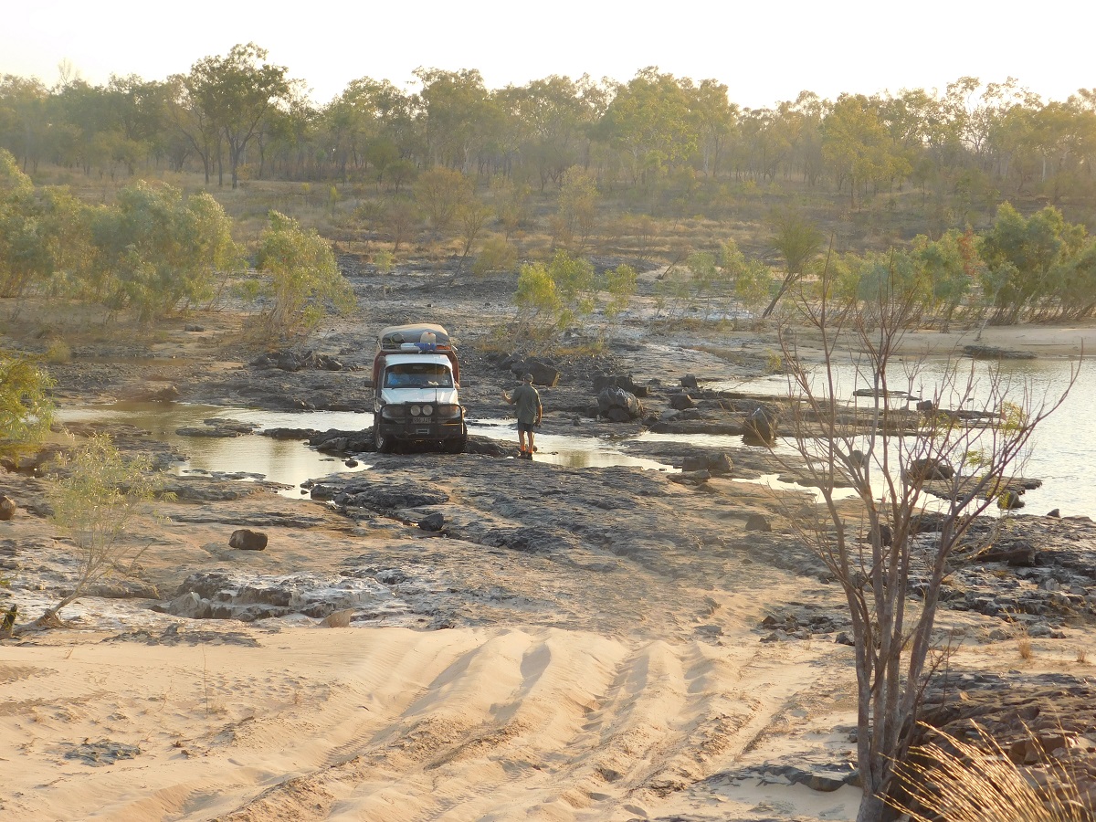
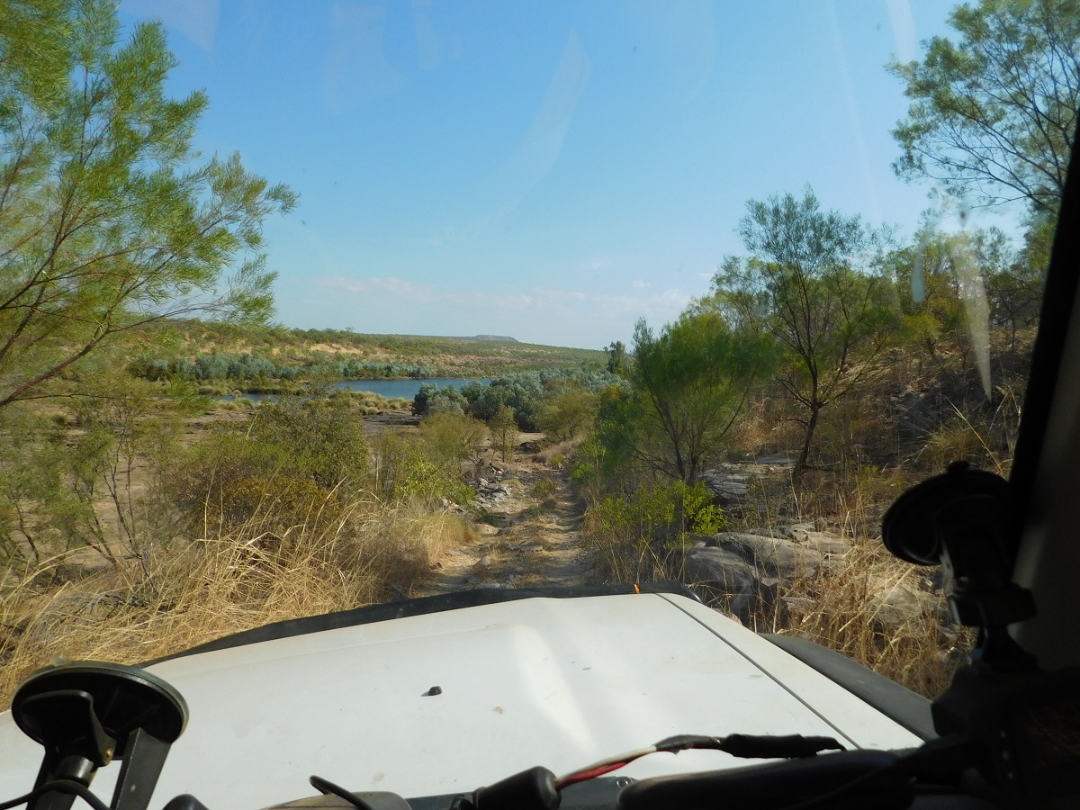
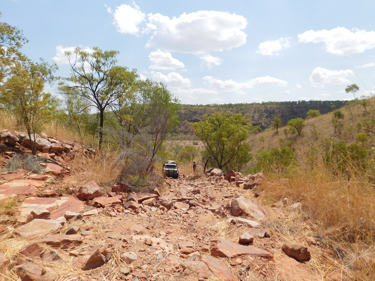
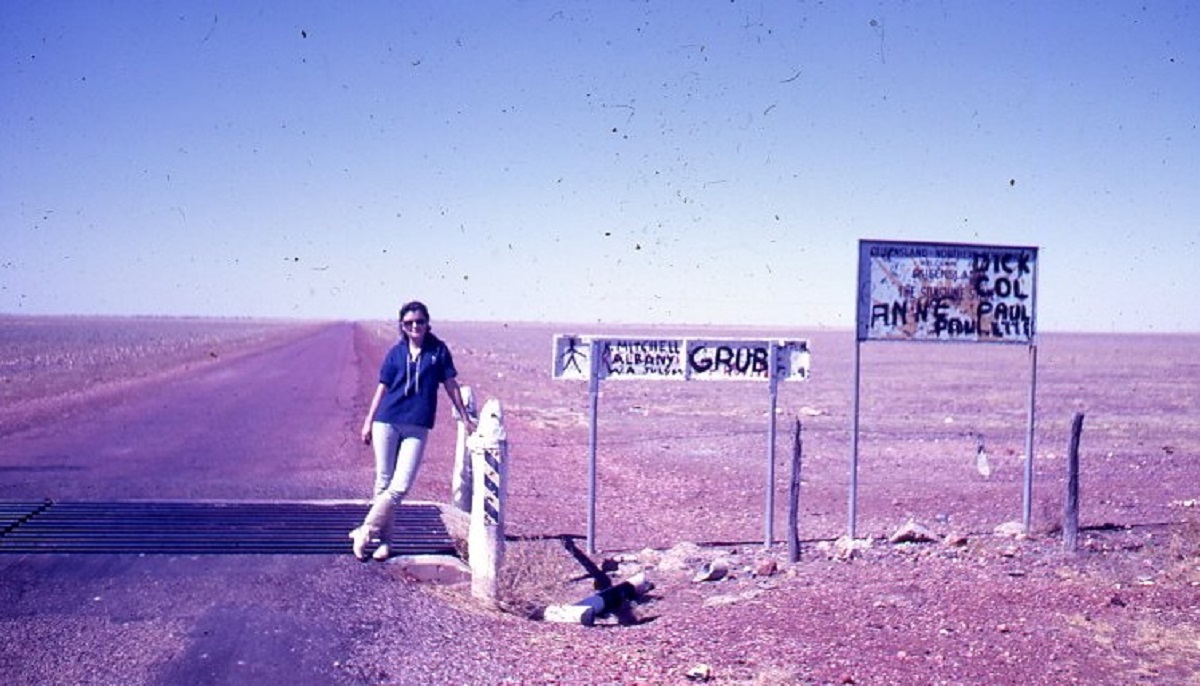
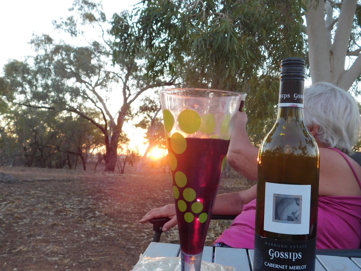
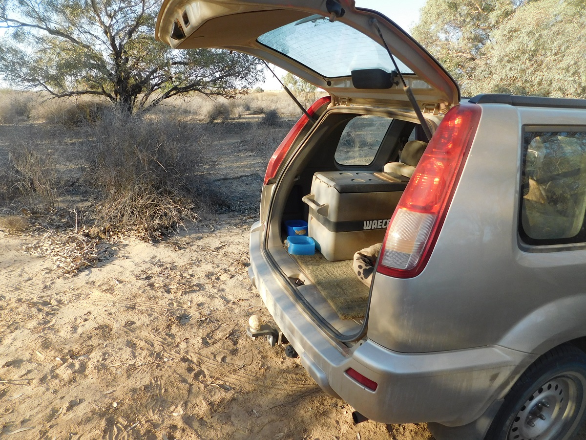
Hindsight is a wonderful thing. “If only” is a catchphrase often used after the event. But in the heat of the moment (and it was around 45C that afternoon), as Trip Leader, I decided to abandon my beloved Datto as we could find no remedy to repair the overheating engine. We were also running low on water supplies as we had been feeding all the radiators with this precious commodity. I asked Jeremy if he could give me a ride out as his passengers seat in the Landcruiser was available and he agreed. And so, as the sun dropped lower towards the horizon we shovelled Spinifex bushes out of the way to make a clearing in the sea of these bushes so that we could have a safe campfire for warmth and food preparation for the night. Marla and Neil, in the diminutive Mazda BT25 ute, offered to take some stuff for me and I managed to get essential items rescued but around $9k of gear in camping gear, accesories and parts added, still remained after we had left the site the following morning
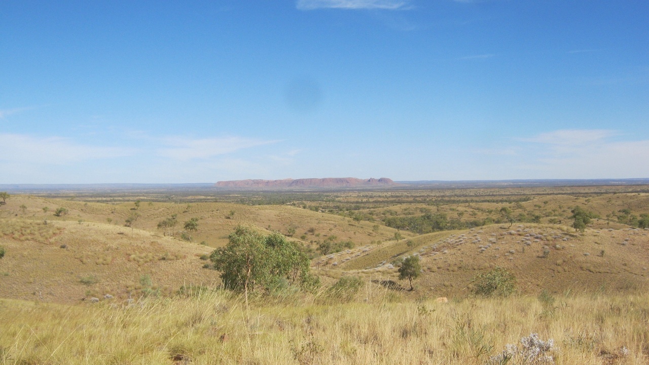
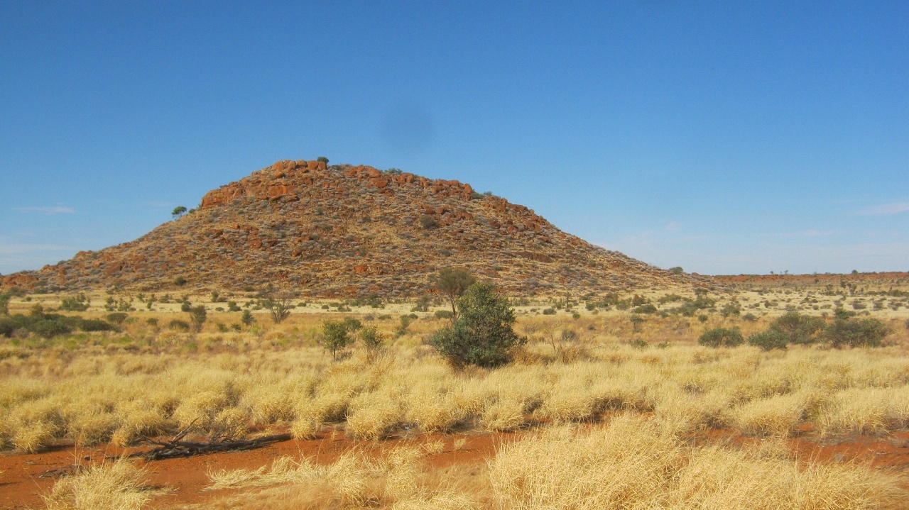
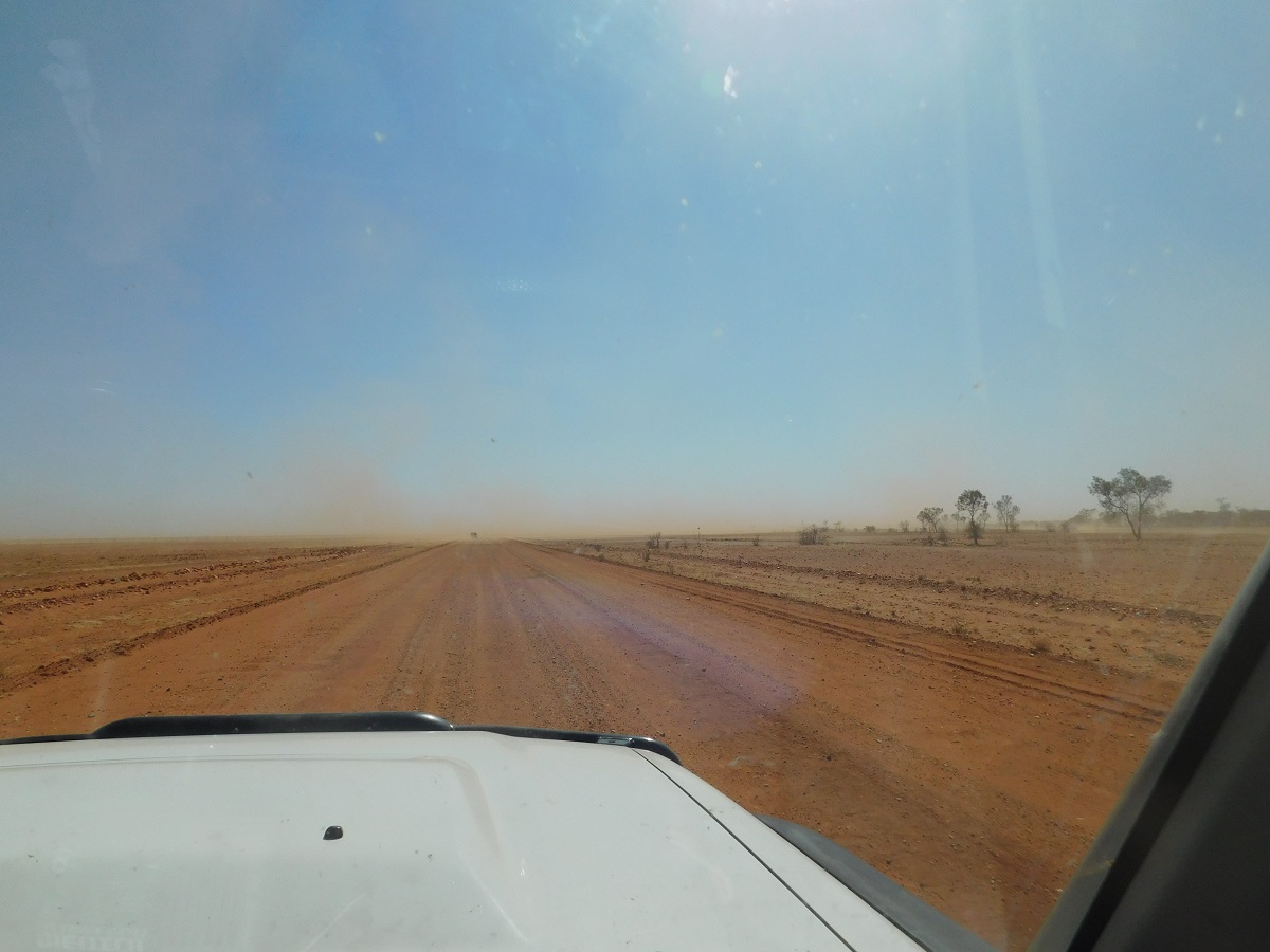
Hindsight suggested we should have towed the Datto out to where the bushtrack runs, north to south. That may have been possible but every vehicle had been overheating for the past two days and we were struggling to find a safe passage through the scrub. Our position was where the Tanami and Great Sandy Deserts meet, more or less.
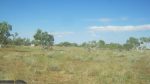
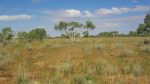
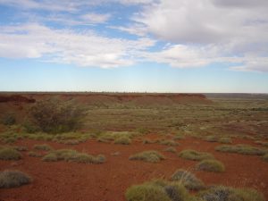
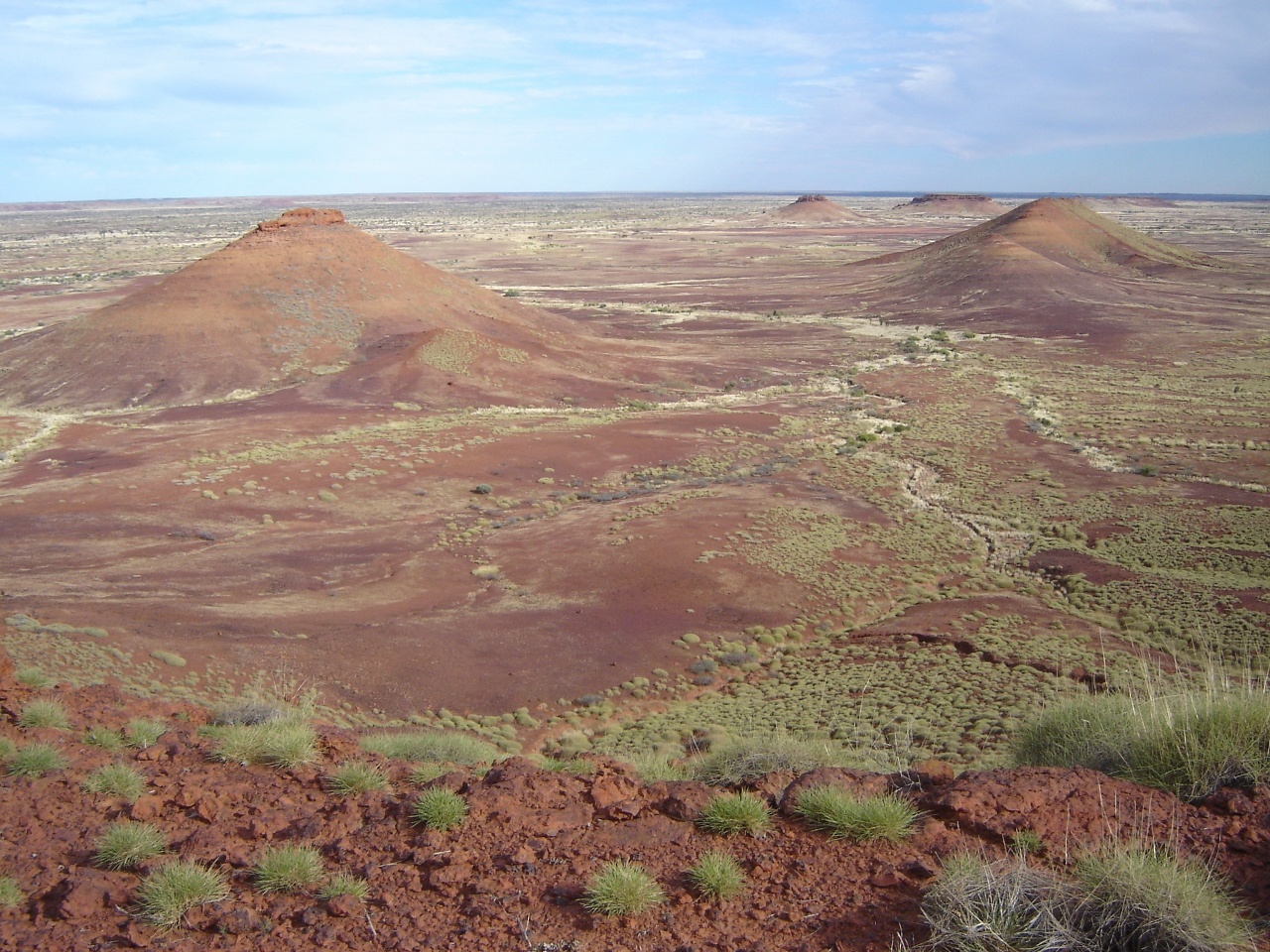
Desert is more a misnomer for these areas as one always relate deserts to sparse vegetation and open sand dunes.
Crashing through the Mulga
Here the desert vegetation can be extreme. The sand dunes are still there but all the growth had increased from 2009 to 2011 when exceptionally good rains fell over the whole country
And so here I was stranded in the desert.

Here I stay
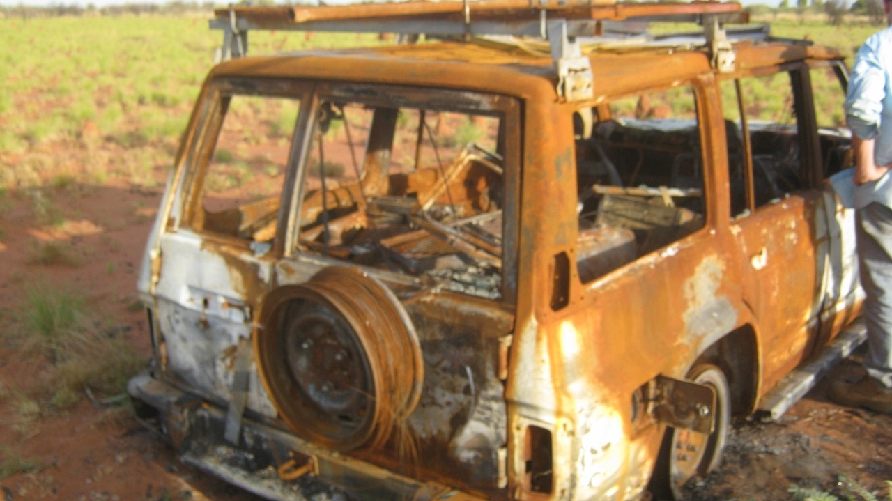
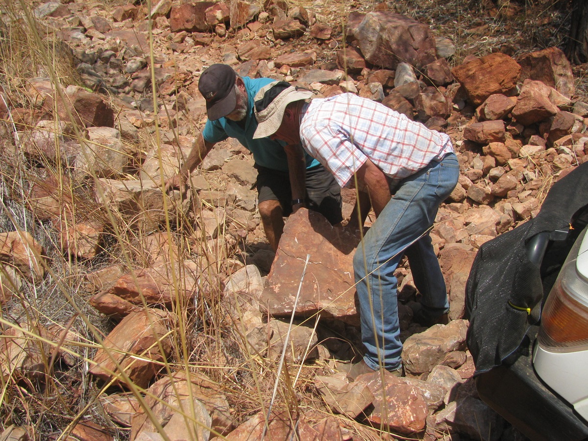
Hindsight suggested we should have dug the spinifex away from the Datto but at that moment I was not coming back and it did not cross my mind. I even removed the number plates off the Datto. It was only when I got home again and calculated all the stuff I had left behind that I decided to do a rescue mission….and another adventure, of course.
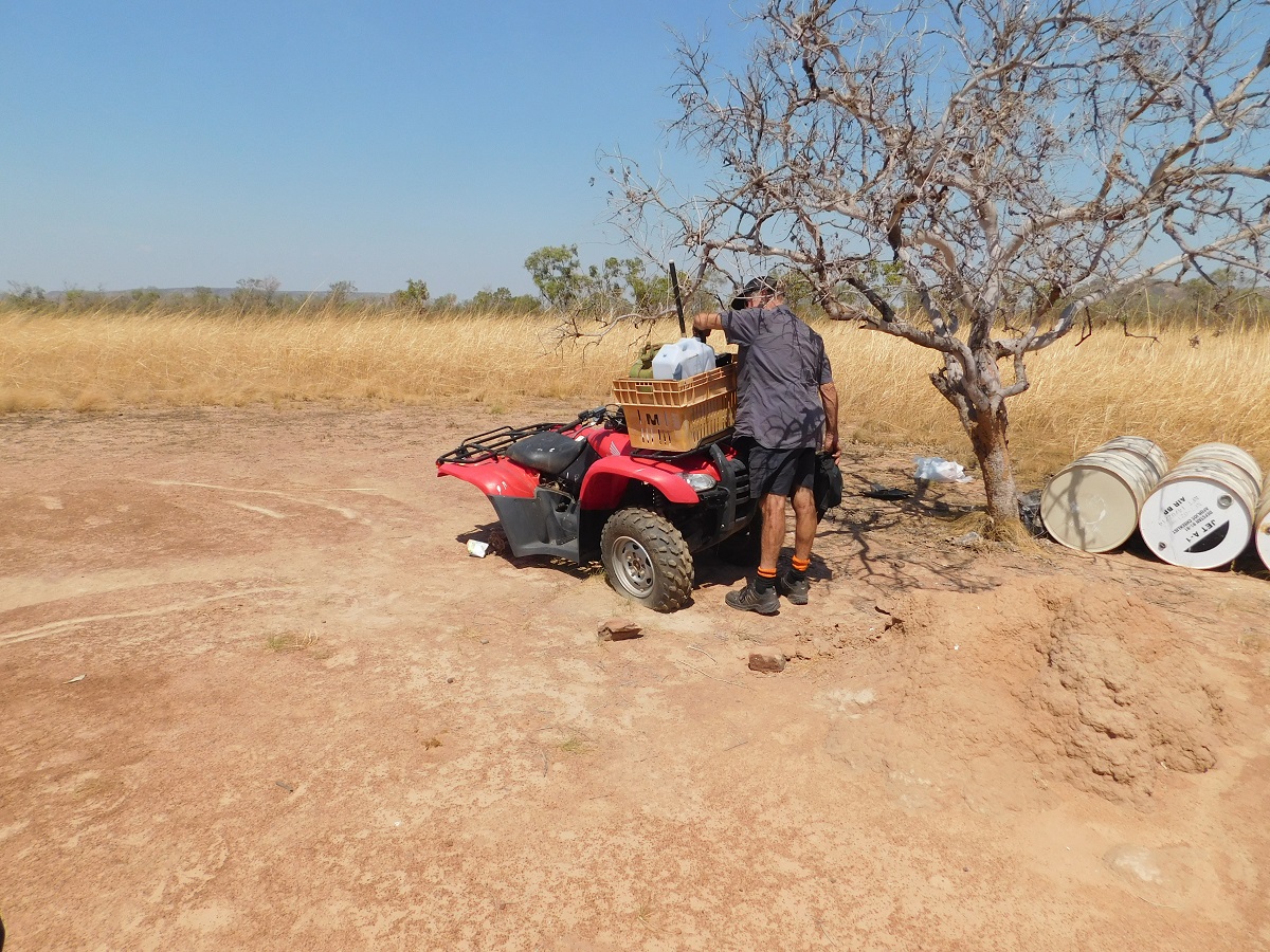
Over the past 8 months I have been scraping together the parts needed to retrieve the Datto. I now have a new water-pump, a reconditioned radiator, spare tubes for the tyres just in case they have gone flat and perished over the past 8 months, and a new battery just incase the solar panel has not been able to keep the charge up to the batteries in the Datto.
I have a new group coming along too
Andy (my mechanic) and Adam (his cousin) in a Ford Ranger, two young fellas who will keep us old fellas entertained, no doubt
Adam from Ironman 4×4 Melbourne in a Landcruiser twin-cab and Bryan from Top down under 4×4 TV from the Sunshine Coast.
Iain from The Blue Mountains in New South Wales in a highly modified Landrover Discovery and John from Peterborough
Myself, and Uncle Milton from Snowtown, in the Datto towing a trailer full of fuel, tucker, swags and parts. Uncle has featured in many of my travel tales as we used to go exploring around South Australia after the turn of the century
All Permits are in place (A Permit is a de-facto Visa to travel within this great land). As you are wondering what Permits may be, here is a short history lesson:
In 1770 Captain James Cook, on behalf of the British Navy, sailed around the Southern and Eastern Coasts of Australia. He saw some natives but as they were not wearing any clothes he considered them as sub-human and declared the Great Southern Land as Terra Nullius (uninhabited land). He planted the British Flag and annexed the Great Southern Land for the British King. In 1788 the British people invaded, what is now known as Australia, and set up camp in Sydney Cove without permission. At this point the fact was that the land was inhabited by the world’s oldest living culture and that around 260 tribal lands existed over the whole of the continent. The British Settlement expanded and after a few years the real invasion began and the Europeans spread like running water to take over all of the land. There were an estimated 720,000 indigenous peoples living here in 1788. By 1900 the indigenous population had been decimated down to under 100,000 souls. Then Federation of the States took place and the country of Australia was born. The indigenous peoples, having been forced to assimilate, found a voice and started petitioning the governments of the day to get their ancestral lands back. In 1976 the Northern Territory Land Rights Act came into being. Vast tracks of land were handed back to the indigenous landholders. To manage these lands, Land Councils were established and they, being corporations, funded by the Australian Government within the framework of Australian Law, manage the lands on behalf of the Traditional Owners. And so Permits were established for outsiders to comply with for visitation to these lands and they have become de-facto Visas in their own right. The indigenous peoples, having even more say in how their lives are managed, took the Australian Government to its own High Court and won its case. The High Court ruled in 1992 in the case of Mabo vs the Crown, that Terra Nullius did not exist. Since that time Native Title Claims have been settled giving the indigenous peoples more autonomy over their lands within the framework of the Australian Constitution.( Its more complicated than that as Europeans (whitefellas) have a tendency to do so)
And so : My Visas are approved and in order to show to anyone who cares to see them.
ETD is 8am on 15th May 2015.
We got away on time, the only difference being that the boys decided to tow the trailer for me as my Nissan Patrol has a petrol engine and uses a lot more fuel when towing.
Iain had come over from The Blue Mountains in New South Wales to join us driving his trusty early model Landrover Discovery. He had come a day early to get acquainted. Uncle arrived the evening before from Snowtown and John lived up the street a bit and joined us when we collected him from his home. The evening before we celebrated Judith’s birthday together, with a dinner.
About 70km out I saw the temperature gauge rise and fall quite rapidly and that only meant one thing, a water leak somewhere. Sure enough, that heater bypass-hose we were talking about the other day, let go. After the engine had cooled down a bit Andy used some heater hose that Adam kept in his ute and soon we were on our way again with the temperature needle showing cool running. And it stayed that way for the whole trip.
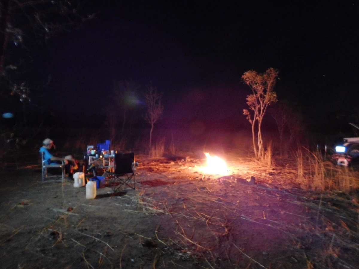
The transit stage is always a bit boring and a long drive and with Iain saying we were going too fast for him to keep up while he plodded along at 90kmh. I rang Adam, my mate from Melbourne who was about 8 hours behind us, to see where he and his mate Bryan were, and they replied that they were in the Adelaide region. Adam had flown in from Thailand the night before just saying Hello and Goodbye to his understanding wife, before jumping in to the Landcruiser and heading out. We got to my favourite campsite a few hundred metres past the Pootnoura Siding and Telstra Tower just before sunset. The boys soon found some dead wood and we had a roaring fire.

Roaring fire
Getting us oldies up and going is always going to take time and those availing their goods and chattels to the trailer seemed to bring a lot of stuff with them. We managed to get going at 8.30am and just as we reached the bitumen again Adam’s Landcruiser came thundering towards us with all the lights on. They had made good time and had still had 6 hours sleep at a roadside stop. Now that we had two Adams in the group we had to refer to them as Big Adam and Young Adam.
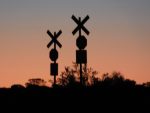
Once we crossed in to the Northern Territory where the 130kmh sign stood big, we invariably put the foot down without thinking, leaving Iain floundering in our wake. As we passed the turn off to Rainbow Valley I mentioned over the two-way radio that there was a unique sundial carving in the cave about 300metres from the road. Big Adam did a U-turn and said that he would catch up as he wanted to see the sundial. He and Bryan did just that and still caught up with us in Alice Springs.
Sundial
After refuelling and some shopping for necessary items we drove through the West McDonnel Ranges Valley into the sunset. It was time to camp and I found a reasonable campsite in some old stockyards on Owen Springs Reserve.
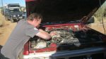
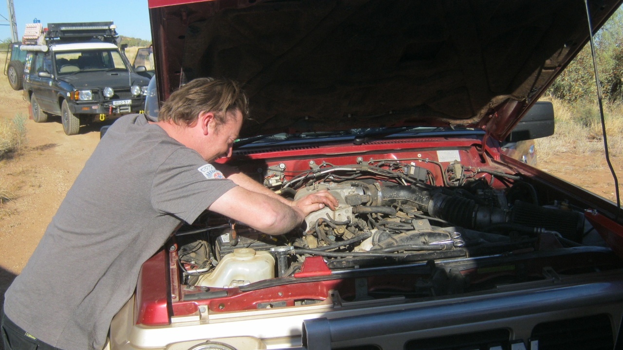
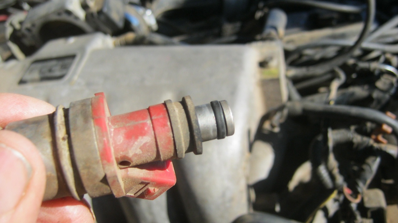
The following morning I had only driven about 100 metres when I smelled petrol fumes. I stopped immediately and hoisted the bonnet. Andy soon found that an injector seal had given in. Of course no one had a spare seal. Big Adam very kindly offered to drive the 45km in to town on the Sunday morning to search for the necessary part. And he and Bryan did just that and came back with the right part which cost all of 20cents. Andy, assisted by Bryan soon had the engine up and running again and we were off once more.
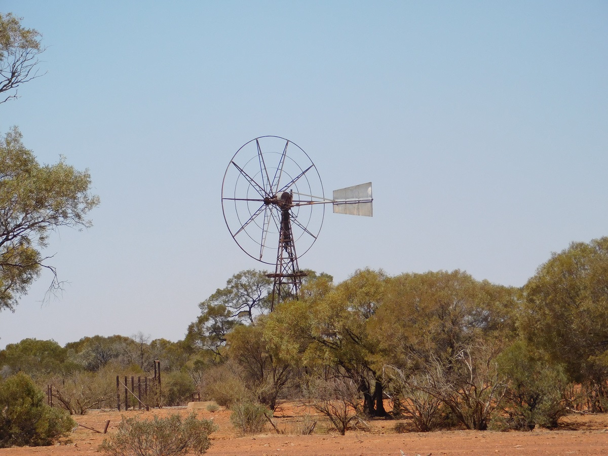
-
- The Windmill

-
- Andy hard at it
-

- Injector
-

- Bryan winching down to the cave
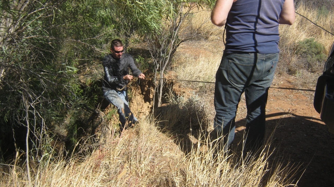
While we were waiting for the parts the youngsters climbed the windmill nearby and I pointed out a cave I went down in my younger days and the young fellas climbed down to have a look. When Big Adam and Bryan came back they also wanted to have a look but used the winch of the Landcruiser to lower themselves down and up again. In the mean time someone spotted a Dingo lurking nearby, but it ran off when the cameras came out..
Tnorala / Gosse Bluff
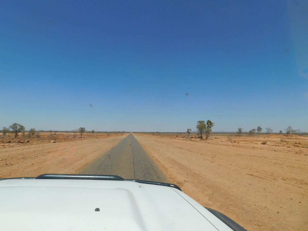
A short sojourn atop the lookout at Tylers Pass gave a great view of Tnorala/Gosse Bluff, the meteorite crater. Soon thereafter the luxury of driving on sealed roads ended and we were thrown back to the reality of severely corrugated roads.
Round Hill near Haasts Bluff
Haasts Bluff
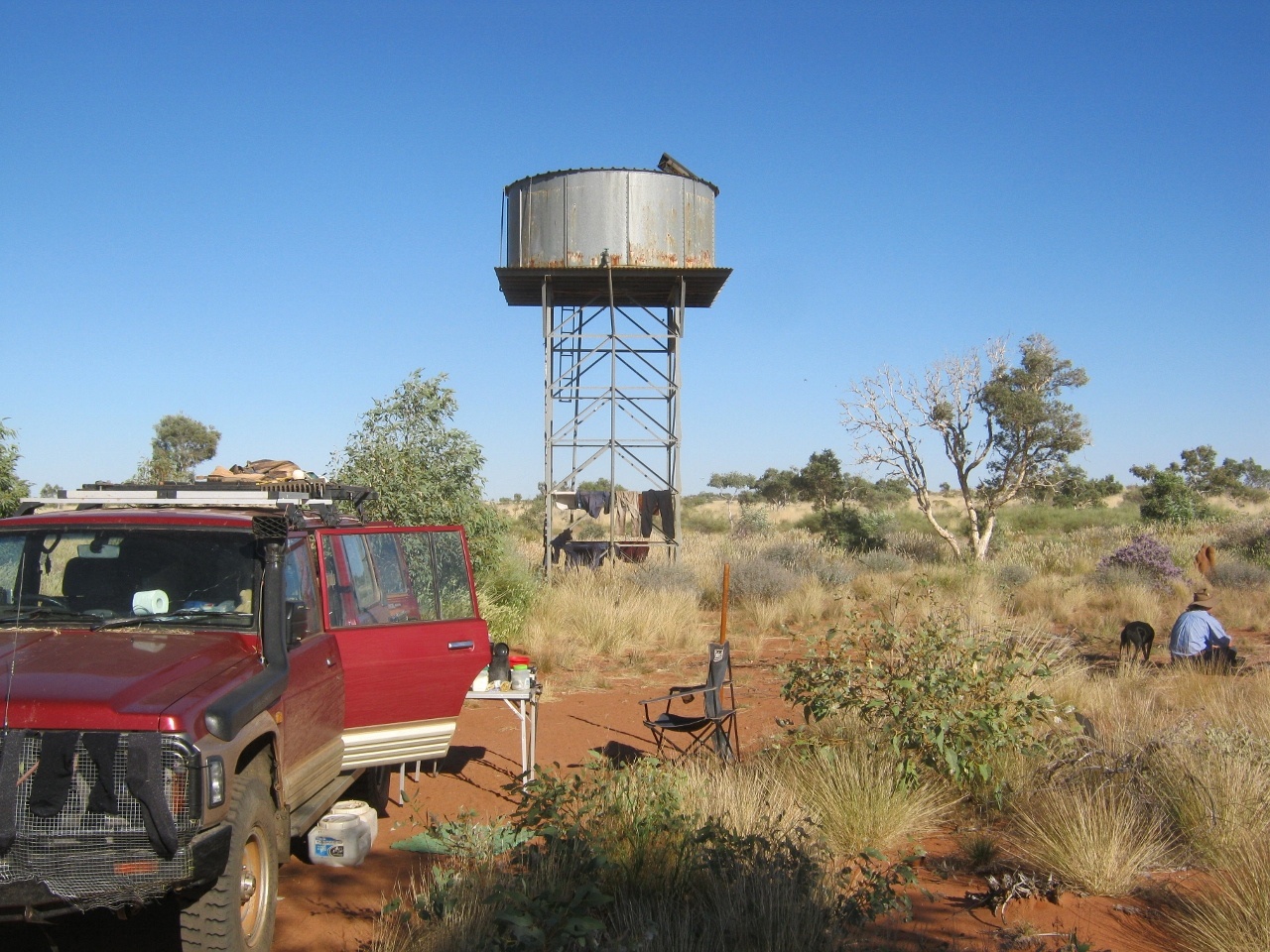
We slowly made our way towards the Kintore road and then once there drove through the outskirts of Papunya Community and then continued along the Kintore Road. About 15km west of Papunya I found an open area near an old abandoned bore and we made camp for the night
Gnamma Hole
Ron Moon had told me about some Gnamma Holes just off the road on the way to Kintore and he had given me the co-ordinates
‘Rainfall is low and unpredictable in Australia’s arid regions, but water can be found if you know where to look. The traditional owners of the lands depended on and protected such seemingly hidden water sources for many thousands of years. When Europeans arrived, they relied upon, and often forced, this ancient knowledge from the Aboriginal people to help them locate a variety of water sources, that included wells, claypans, soaks and springs. One of the main sources of water for the Aboriginal people were ‘gnamma’ holes. These natural cavities are commonly found in hard rock, particularly granite outcrops, and as such act as natural water tanks, which are replenished from underground stores and rainwater run-off. Gnamma holes vary in shape and depth, and the small surface area of the hole helps to minimise evaporation’(Source WA Museum)
Whilst there the young blokes were bursting with energy and virtually ran up a hill nearby to get a better look.
-

- Lookout hill along the Kintore Road
-
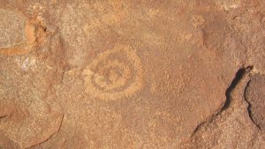
- Water symbol petroglyph
We old blokes pottered around below trying to stay upright and found some ancient rock engravings nearby.
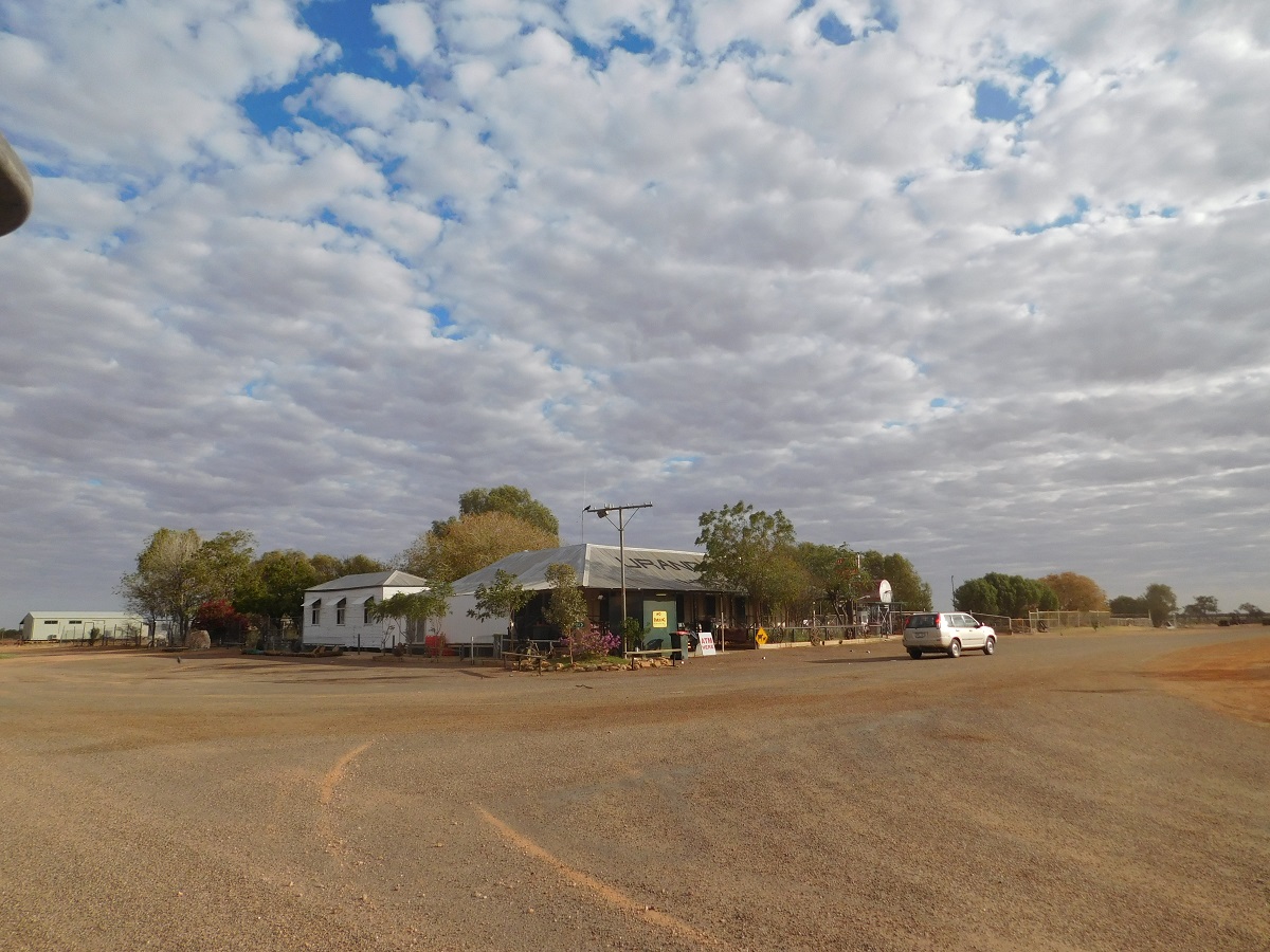
We arrived at Walungurru / Kintore during the lunch hour and had to wait for the fuel bowser to open at 2pm. A lonely Tea Tree provided shade just out of town and we crammed all cars in to get cool. The local Police came by to say G’day and Noel (from last year) came by to invite us for a coffee. We politely declined as we were having lunch already. Whitefella’s who work in the communities are starved for conversation.
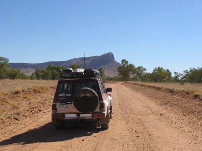
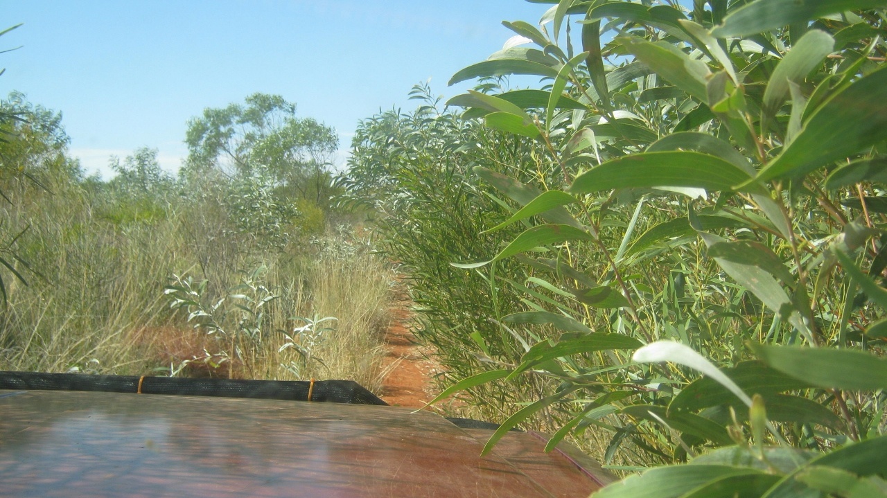
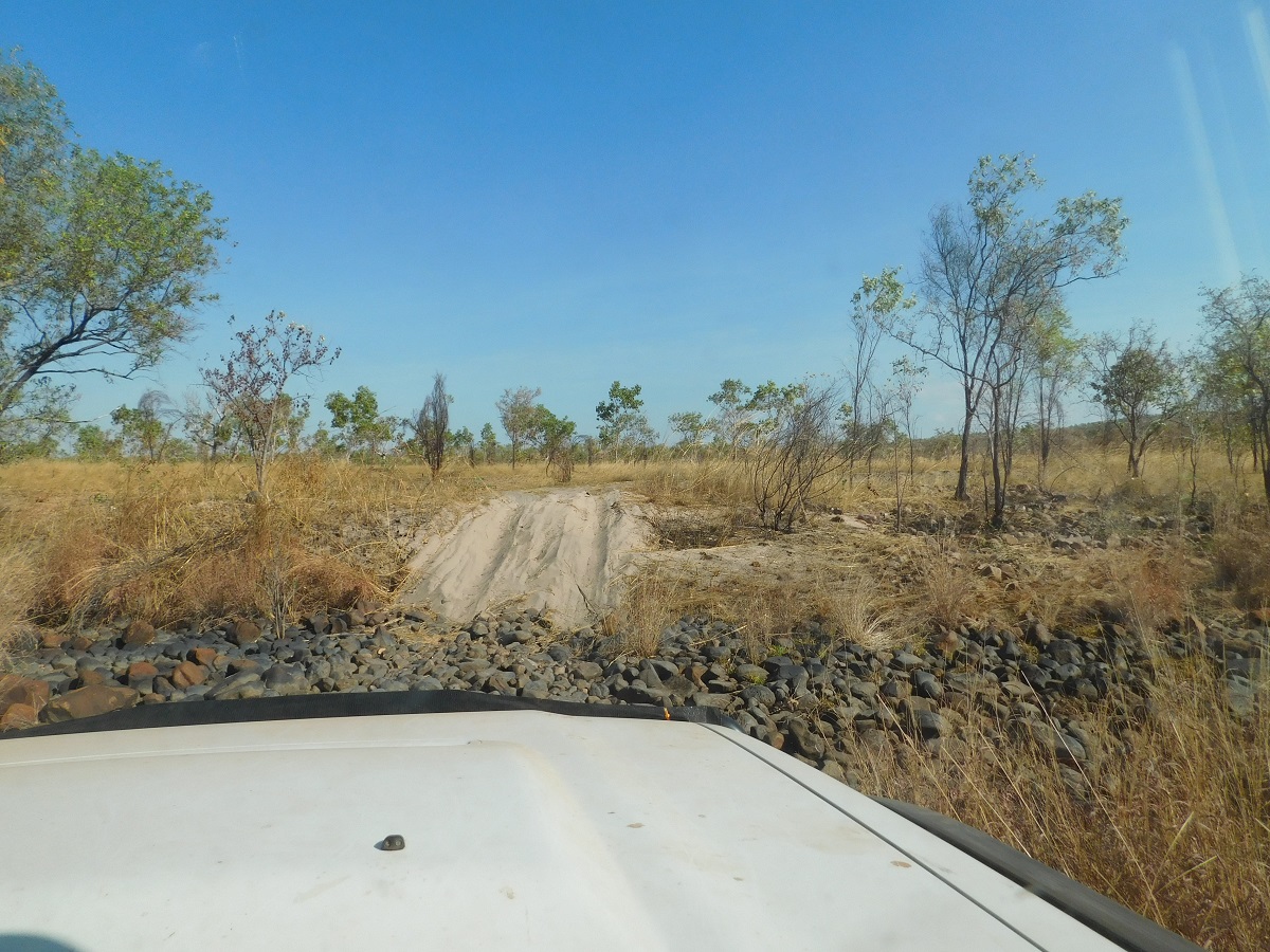
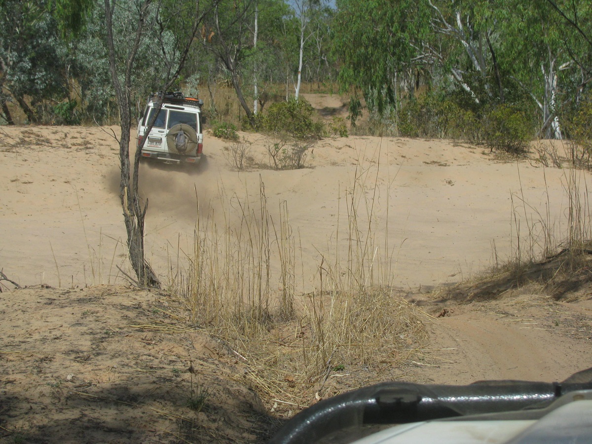
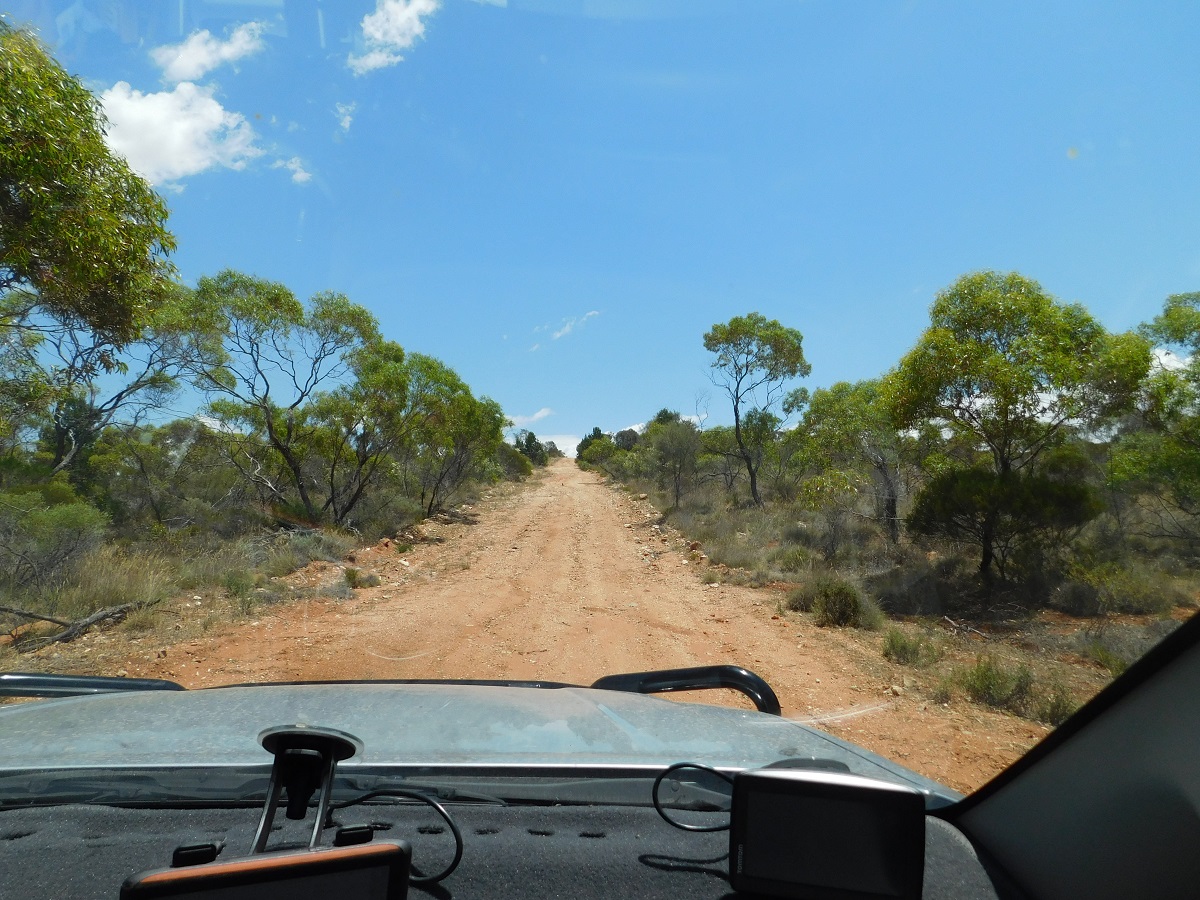
After refuelling and buying last minute supples and around 2 hours and 150km later, we turned off the Gary Junction Road in Western Australia along a seldom used track which skirts the western slopes of Mount Webb.
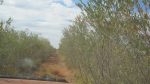
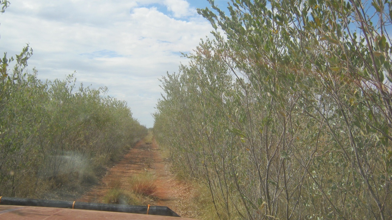
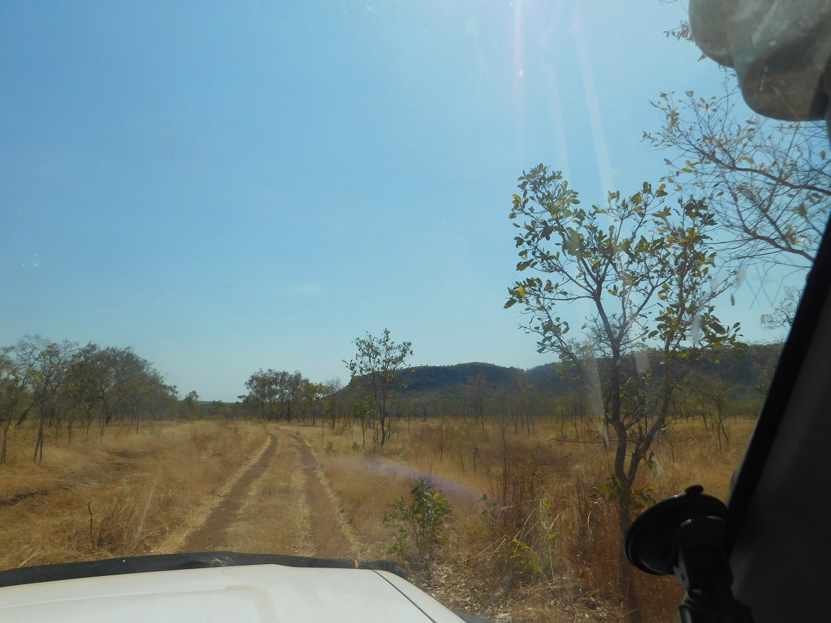
It was time to fix the seed screens to the bull bars and radiator grilles to help minimise seed collection in the radiators. I had my mapping running on the dashboard via a USB GPS and 10 inch computer screen and seeing as I had been that way the previous year it was relatively easy to follow the overgrown track loaded into my map. But I did lose the track once or twice in the real world until we had cleared the range.
Where’s the track?
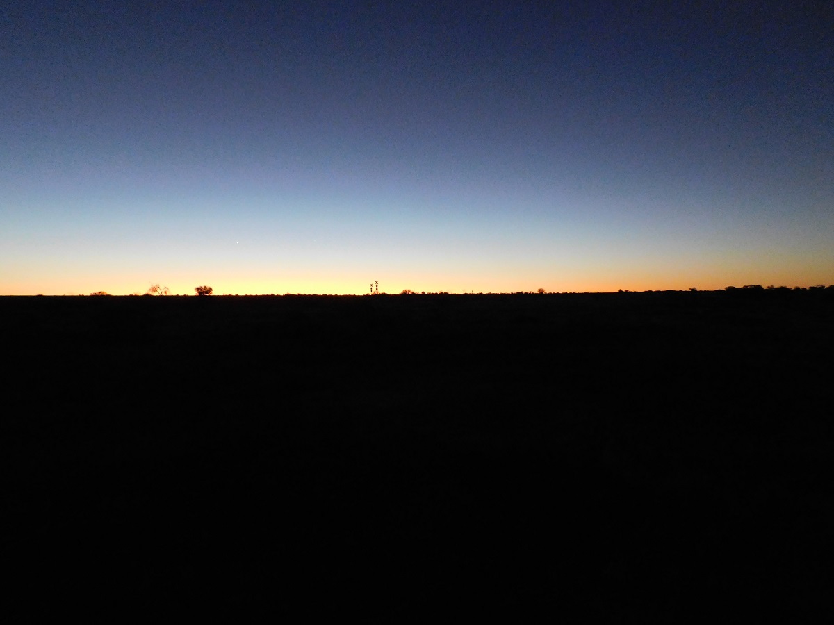
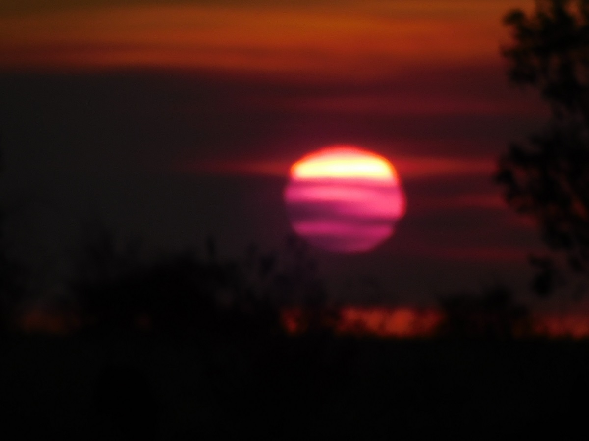
I found a campsite between two hills and we settled down after a brilliant desert sunset.
Spekky Sunset
Around 2am a light breeze sprung up. I drifted back to sleep. Then at about 5am I heard a clanking as if someone was messing about with a saucepan. We all heard it but no one cared to investigate. At sunrise, around 7am, we found our billy missing from the campfire. John went looking for it and found it about 50 metres from our camp. We can only surmise that a Dingo was responsible for the attempted theft! “A Dingo took my Billy!!!”
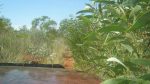
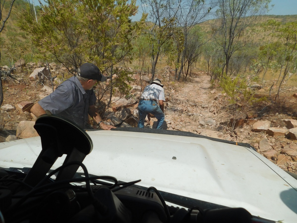
After leaving, we struck an obstacle within 100 metres from the camp. The track slewed sideways over a dune and some drivers had to have more than one attempt to get over.
Traction troubles
Now we were on the Yagga Yagga Aboriginal Business Road (as it is known by). This two wheeled track, which connects Wirrumun/Balgo Community with Kiwirrkurra Community, via Lake Mackay, was bulldozed in the early 1980’s when there was a lot of mining activity in the area. It also connects with Yagga Yagga, Lamanbundah, Mangkala and Bilbarrd Outstations, all abandoned at present, but there if the traditional owners want to return.
Wilkinkarra/Lake Mackay once again dazzled us with its brilliance of whiteness
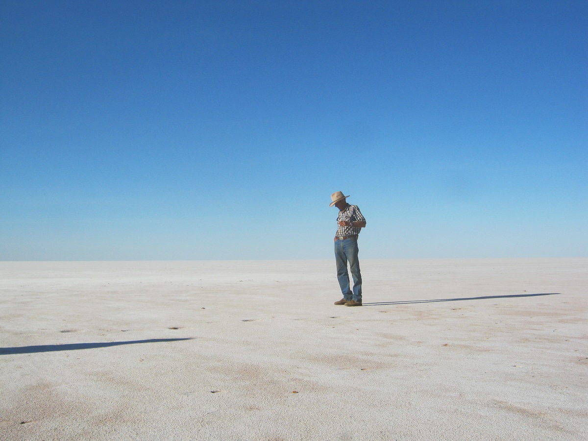
Contemplating Lake Mackay
Leaving Lake Mackay behind, we had a brief sojourn discussing two vehicle wrecks along the track, before arriving at Maruwa Well also know to other travellers as Dwarf Well. Here a tank on a high frame with solar panels to power the pump, was installed some years ago to facilitate an Outstation, but this did not happen, and it all fell in to disrepair. Then a hand-pump was installed. After only eight pumps this hand pump delivers the softest, sweetest water of the Great Sandy Desert. And some wag left an old enamel bath there for all passers-by to use. Andy kept on telling me that he thought I was telling porkies about this bath in the desert. He could not believe his eyes!
Maruwa
After spending some time having baths and washing clothes we pressed on along the track. At one stage we were behind schedule, if there was a schedule, but now we were in a better position.
We had stopped for one reason or another and as I could not raise the either of the two Adam’s on the radio, I decided to turn back to look for them. They weren’t far away. It turns out that they had stopped to have a look at some camels and then smelled smoke and soon after realised that they had a spinifex fire on board. If it wasn’t for the quick actions of Big Adam and Bryan, who knew just what to do, they may have had the Ford Ranger burnt out totally. Two fire-extinguishers were expended within minutes. Spinifex seed build up in cavities of the chassis can cause these seeds and dry foliage to rub up against the hot exhaust causing a fire.
As the day took us, it was slow going over the washed out track. The sun was just above the horizon in the west and I found an open space in the sea of spinifex and we made camp. There was seemingly little wood in sight but after scratching around the boys came up with enough wood for the night and we settled down.
We had only started for the day when we came to Bilbarrd Outstation. This Outstation has been abandoned for some years though it would seem that there has been recent activity as a new water holding tank has been installed below one of the tankstands. The hand water pump does not work. We continued to drive on over the rough track having only a Willy Wags fly in front of us for some of the way. At the Intersection of old seismic lines and the Yagga Yagga Track, there was a Helicopter parked together with a number of Avgas fuel drums. We wondered what was happening out here. Maybe they were shooting camels? There was all kinds of conjecture brought to the fore, but we were later to learn that aerial survey work was being done on behalf of the Commonwealth Government.
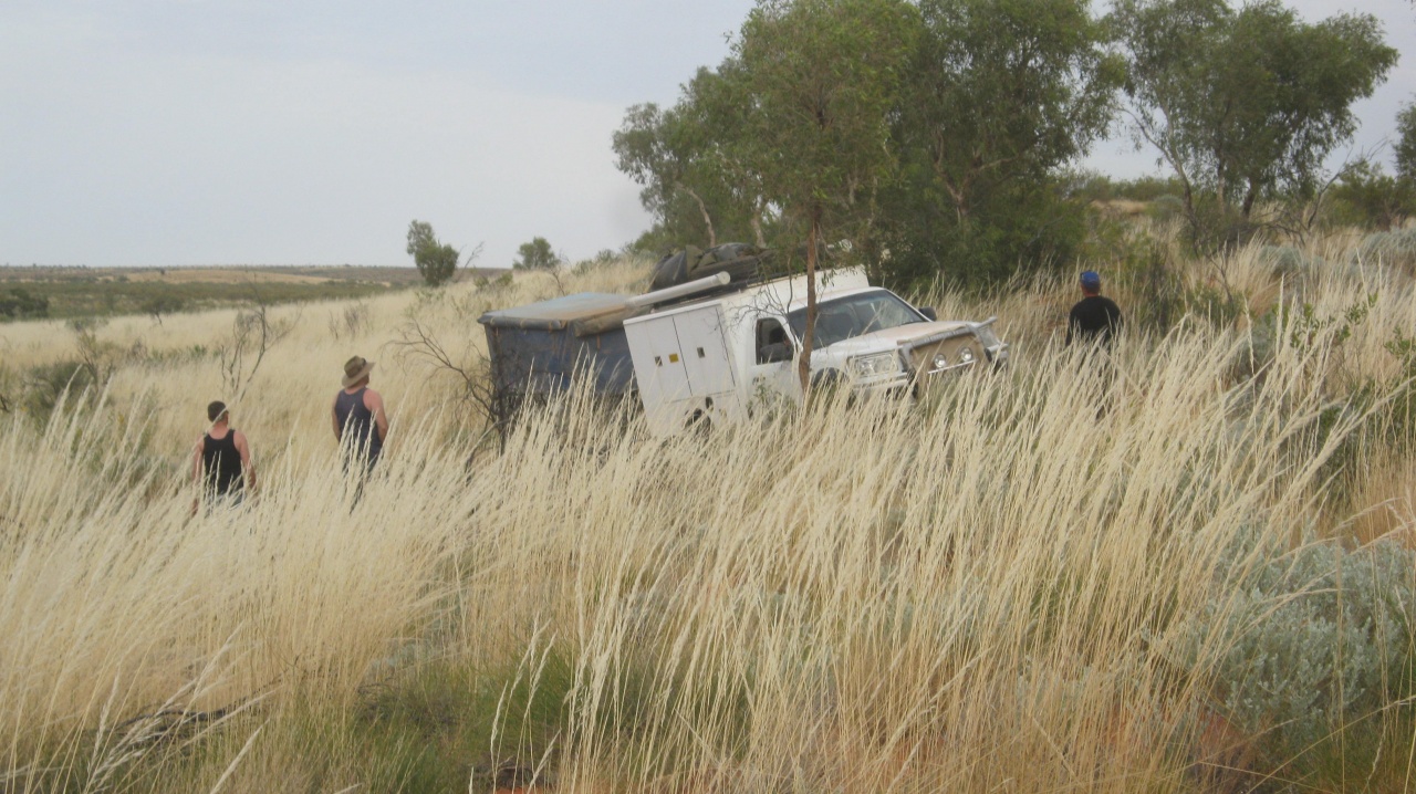
This was the place where I had intended to turn south east towards where the Datto lay. However the track from here was still very overgrown and Big Adam came up with an idea to forge another route to our destination over some open country he had seen about 10km back along the track. I went along with that idea and turned the lead over to him and off we went.
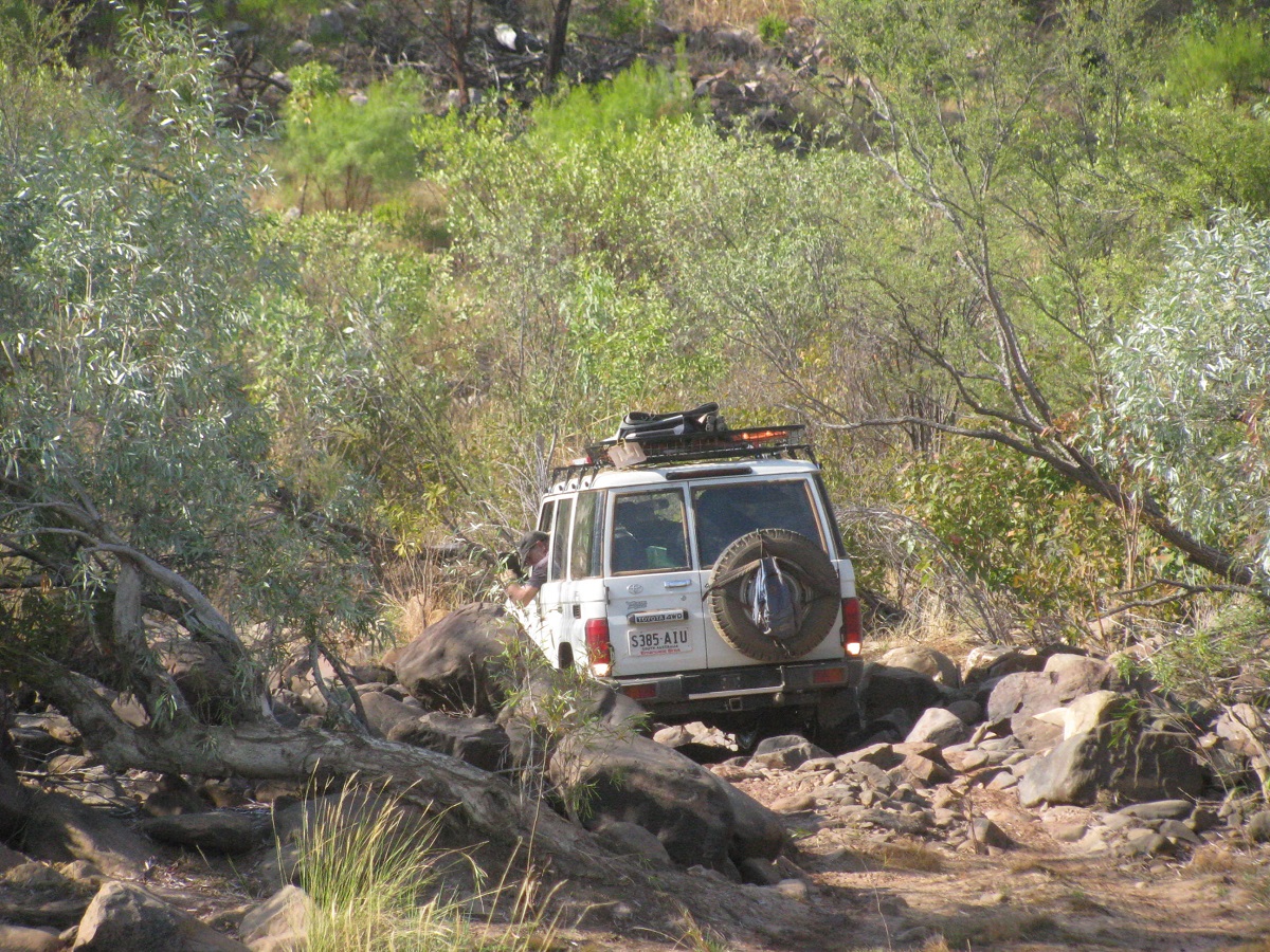
Initially the going was reasonable but then we had to cross some dunes and I suggested that we leave the trailer behind just taking necessary stuff with us. Some of the steeper dunes were a challenge but we lowered our tyre pressures and got over OK. Andy thought it was a lot of fun.
We were getting into some open country when Big Adam asked me if the country was as clear before with only fresh stubble Spinifex. I said no as we had to battle overgrown conditions and heavy foliage last year. It was evident that a bush fire had burnt a large area of scrub in the intervening eight months.
-
- Open country

-
- Ghost gum

-
- Cresting a dune

-
- Porcupine grass

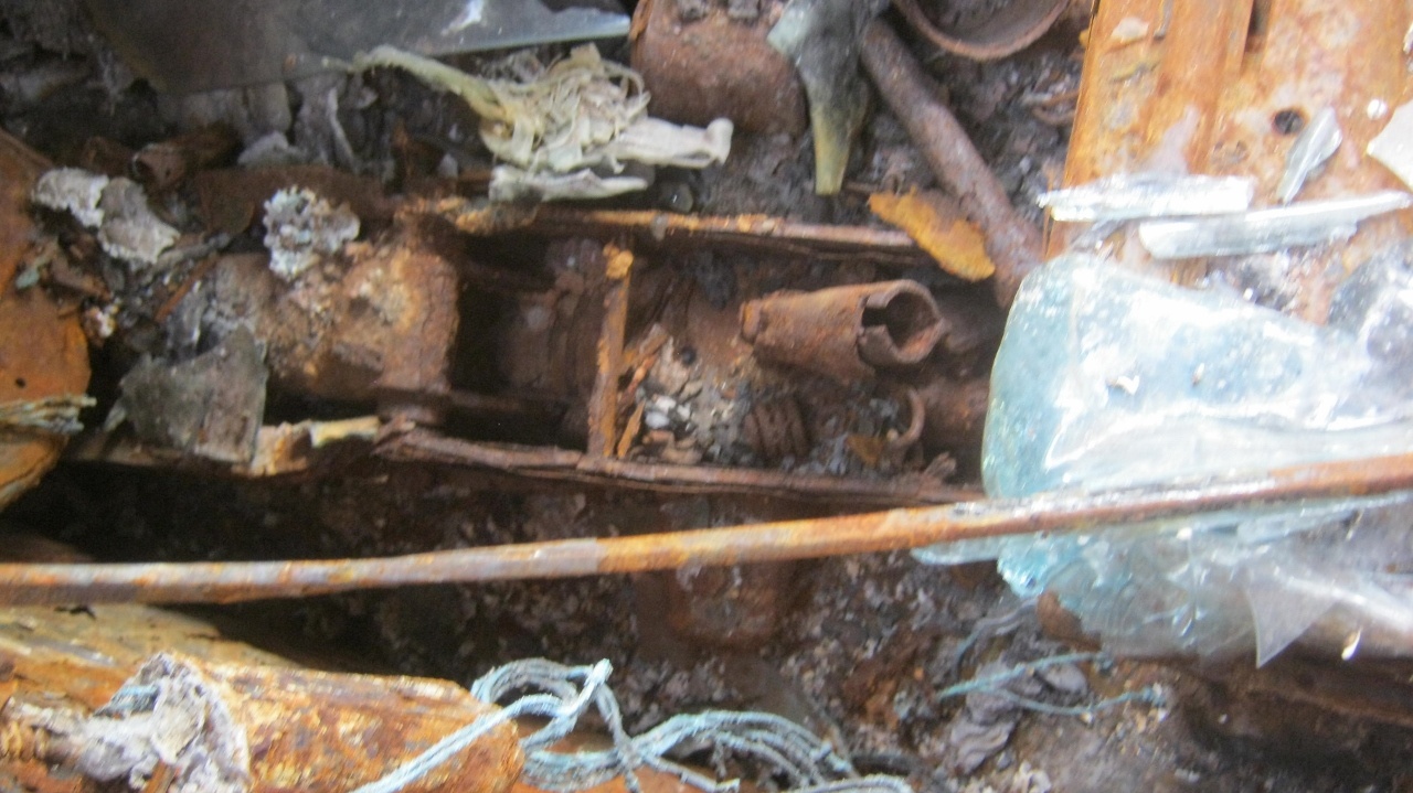
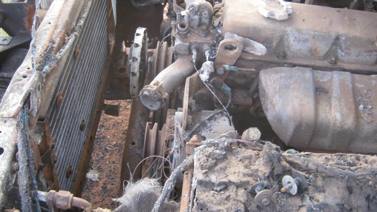
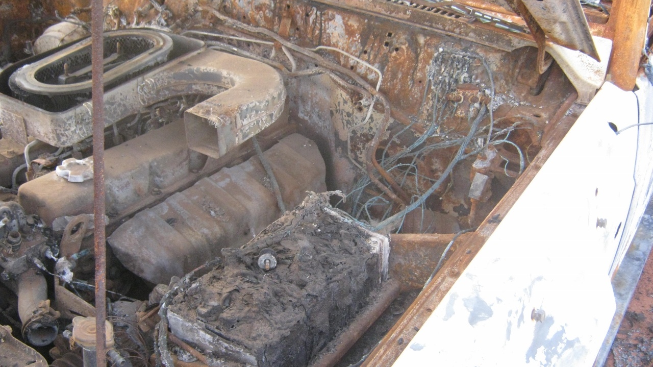
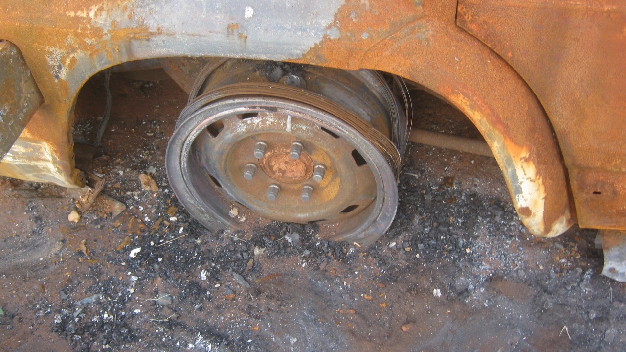
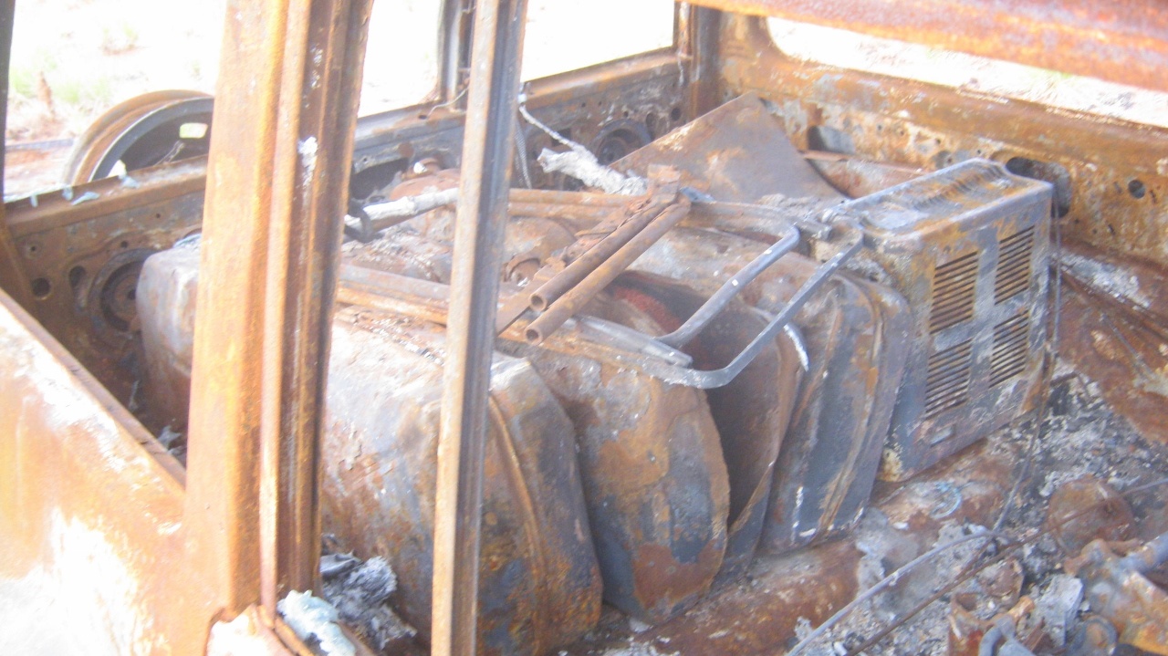
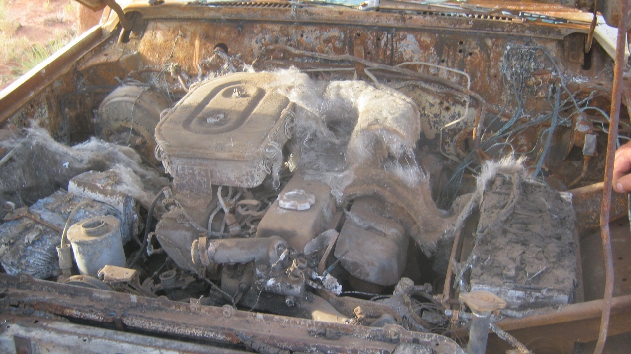
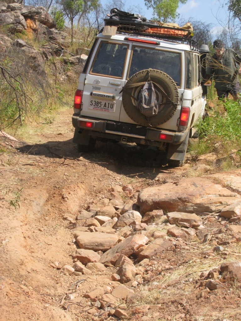
And so, after 26 kilometres cross country from the track we came upon the burnt out wreck of my beloved Datto. It was hardly unexpected but hoping against hope I had tried to rescue the old car which had taken me to many places. I think that maybe a lightning strike in summer had caused the fire as about 10 square kilometres of scrub had been burnt and raging through and over the Datto, had burnt it and everything in it to a crisp. (I have since learned that Government contractors were doing aerial burnoffs by throwing incendiary fire bombs out of a helicopter to clear the country for survey work during the winter months. So there was anopther possibility). There was nothing recoverable but John thought that the radiator looked OK and removed it from the wreck for restoration later on. It was a disappointing end to a lot of expectations, but there you go. That’s life.


The Wake
We held a Wake that night and some were feeling seedy in the morning. As the objective had been reached Big Adam and Bryan decided to to leave early as they had business commitments back in the south and Young Adam and Andy decided to tag along with them. This left the old blokes in the group to their own devices to amuse themselves. We followed our track out and even tackled the big dune from the steep side and won. Once back on the track we swapped the trailer to my Datto and the young ones departed.
I had intended to visit an area about 30 kilometres to the west of the Mangkala airtstrip, but now, with diminished numbers I wasn’t so confident driving the petrol powered Dattoo out there into the wilderness. The area I intended to visit, was where two young Jackeroos, Simon Amos and James Annetts perished under suspicious circumstances, in 1986. The track was totally overgrown and I decided that I would come back when I have another bush-ready diesel vehicle in my possession and maybe also invite some interested participants along. Here is their story http://deathinthesand.weebly.com/
We drove on to Lamanbundah Outstation. There we replenished our water containers from the hand pump. The water looked a bit murky but tasted OK. We went looking around this Outstation with its 7 houses and other outbuildings and came to the conclusion that it had never been occupied. By this time it was mid afternoon and we were feeling lazy and so decided to camp around the back of one of the houses. . This particular house had two carports and a fireplace along the back wall. We parked in the carports and then we found some dead wood lying around and got the fire going.
-
- Uncle getting some exercise

-
- Boiling the billy
-
- House to let
-
- Under cover

In the meantime, John was playing with his motorised bicycle, which he had, unbeknownst to me, smuggled into the trailer load. I only realised that there was this contraption in the trailer two days into the trip when I saw a bicycle wheel in the back of the trailer which had an array of tarps and bags which I thought just contained clothes. It was carefully hidden. And I had no reason to get anything from the trailer for the first few days. I was a bit annoyed that not enough thought had gone into this and not enough discussion with me. I asked why he had brought the bicycle but he could not give me a straight answer. One cannot be too careful out there in the Never Never as things can go horribly wrong if you aren’t watchful. I have come to realise that many people have no real concept of the vastness of the Australian Continent and the survival risks. The bike was put together and for the next two stops John rode his bike every afternoon giving the engine a run too. The bike was also used in Alice Springs to get around on.
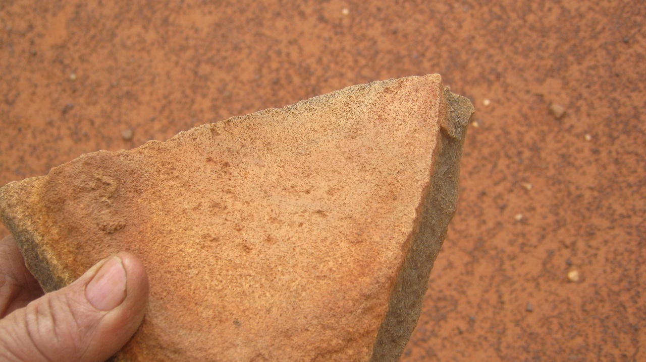
The track to Yagga Yagga is overgrown in places, due to the water collecting in what has now become a man made dry creek bed. When it rains the water feeds the saplings in the creek (track) in an otherwise flat terrain. On a claypan near the Point Moodie track turn-off I found a broken Stone Age Grinder and so flint shards. These were the survival tools of the ancient peoples who roamed this land. I explained this to my travelling companions but they weren’t interested.
-
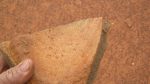
- Grinder remnant
-
- Open country
-
- Creekbed avenue
-
- Pushing through
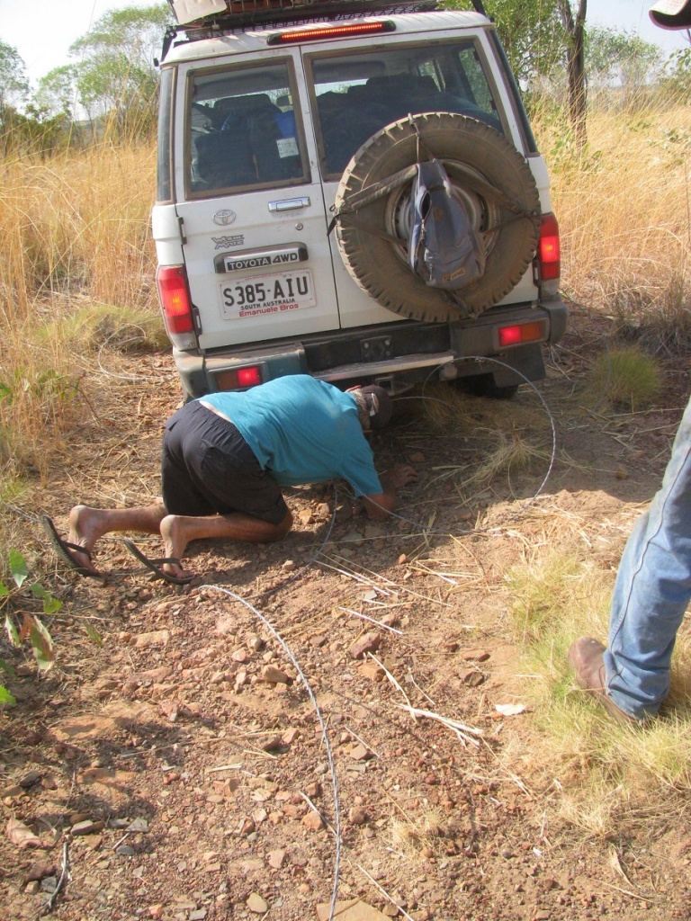
Negotiating a rather washed out section of the track I heard the scraping sound of metal to rock but did not investigate. Later I found out that the fuel tank had a small dent in it where it had hit a rock and that a weld on the tank had cracked making a small rupture, enough to let petrol weep out. We applied soap for the interim.
At Yagga Yagga there is another prime example of government wastage of taxpayers money. The town was built as an Outstation in the late 1980’s at a considerable cost judging by the infrastructure. I had heard that there were a number of youth suicides in the town which led the Elders to believe that the place was cursed. So in 1996 they just abandoned the place. The town was still being maintained by a skeleton crew by 2002 but then abandoned all together. The Outstation movement was an initiative of the Hawke Government era. There are many small villages like this one, abandoned, throughout Western Australia.
-
- Abandoned Community Store
-
- Yagga Yagga
The next 50kmh of track wends its way through dune country and where gaping expanses had been bulldozed through the dunes cutting them in half. The sand has reclaimed some of of the lost area through the winds of time. It makes for a rather pleasant drive. The last 50 kilometres shatteresd ones perceived illusion of nirvana as the track deteriorates to the wort corrugations imagineable and there doies not seem a good speed to get on top of them. Close to Wirrumun/Balgo the track skirts close to the Palotine Escarpment and Hills to give a grand view of the lands to the south
-
- Palotine Escarpment

-

- Palotine Hills
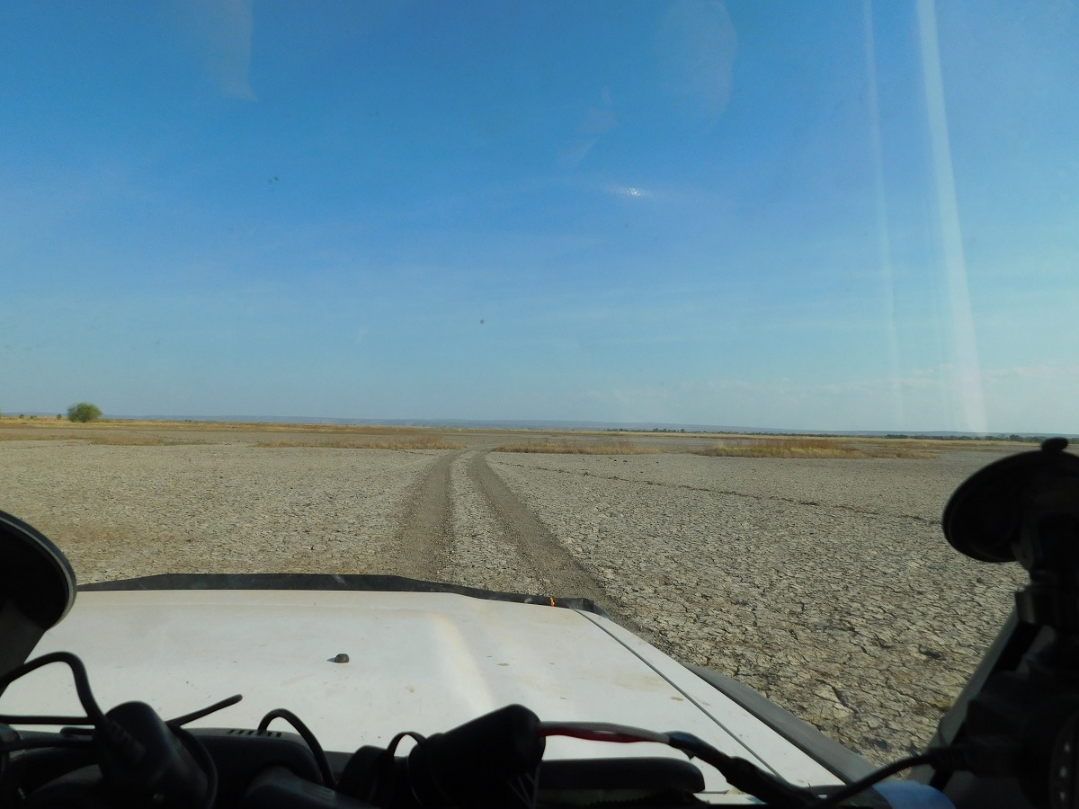
After some light shopping at the Balgo Community Store we pressed on to Mulan where I caught up with an acquaintance and some local knowledge. I refuelled at the Community Store injecting a nice bit of cash into their coffers with a bowser pump price of $2.40l. I also paid for a nights camp out at Handover Camp on the shores of Lake Gregory and we set off for the last 10km of the days run with me taking the wrong track and having to do some cross country driving to eventually arrive at the correct destination

Lake Gregory
Apart from more horrendous corrugations, a lost suitcase on the road, a wad of money found therein, and 9.3kilometres of bitumen road surface in the middle of nowhere on the Tanami Road, we made it back to Alice Springs in two and a half days and after some R & R there, a 19 hour drive home in continuous light rain.
Tanami Road
Going Walkabout 2015
The cold weather of the the southern climes gets to us every year and so we are preparing for another sojourn out in the tropical bush.
Having lost some camping gear in the Datto fire we are embarking on a ‘replacement’ drive for essential items such as a Tripod for the Billy, an Eco-billy for quick hot water, a fire pot handle and other stuff as we think of it.
We are going back to basics and we were not going to take our car fridge along, but on second thoughts, I will fit it in the trailer and make a special charging attach ment to the Dattoo’s electrical circuit.
Having broken a main leaf spring on the trailer we are replacing both spring-sets, u-bolts and plates and also fitting new wheel bearings plus a new Tilt Jockey Wheel. The trailer has had a hard life bouncing over spinifex clumps and rocks. We bought it new 10 years ago and it has done around 80,000 kilometres carrying heavy loads at times. Nothing has broken on the body though….so it is a pretty tough build by Modern Trailers in Adelaide.
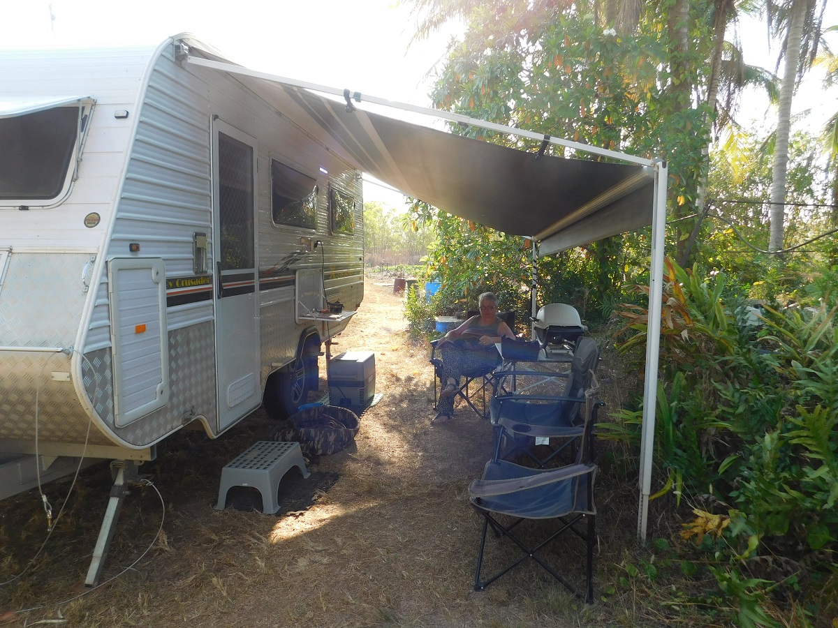
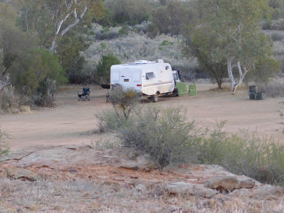
Then everything changed. After much searching on the internet we found the right caravan for us. Then the wait came along as we waited for an investment to mature. It was still there when we got to the sales yard and bought after a brief inspection. It took two days to get various towing aspects organised and the money we paid for it to clear.
On the road home and only 67km from our destination the Datto blew a headgasket. We had to be rescued by an RAA operative with a Tilt Tray truck. Another two weeks went by for the engine to be reconstructed and repaired and we were on our way once again. This time we only made it for 45km before the engine blew the head gasket again. The RAA to the rescue again. It was time for a rethink.
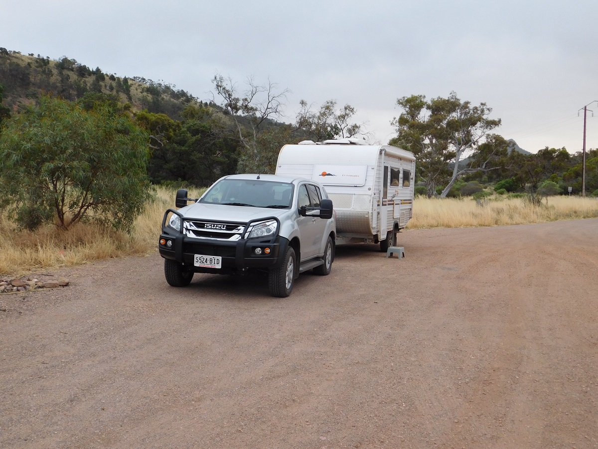
We spent the weekend driving around the mid north towns looking for possible 4×4’s and on the Monday we bought a Toyota V8 Turbocharged Station wagon in Port Augusta. When we picked it up we were told that the Owners Manual and service books were in Adelaide and that they would be posted to us. We took this in good faith but a month later were still waiting for the books to arrive.
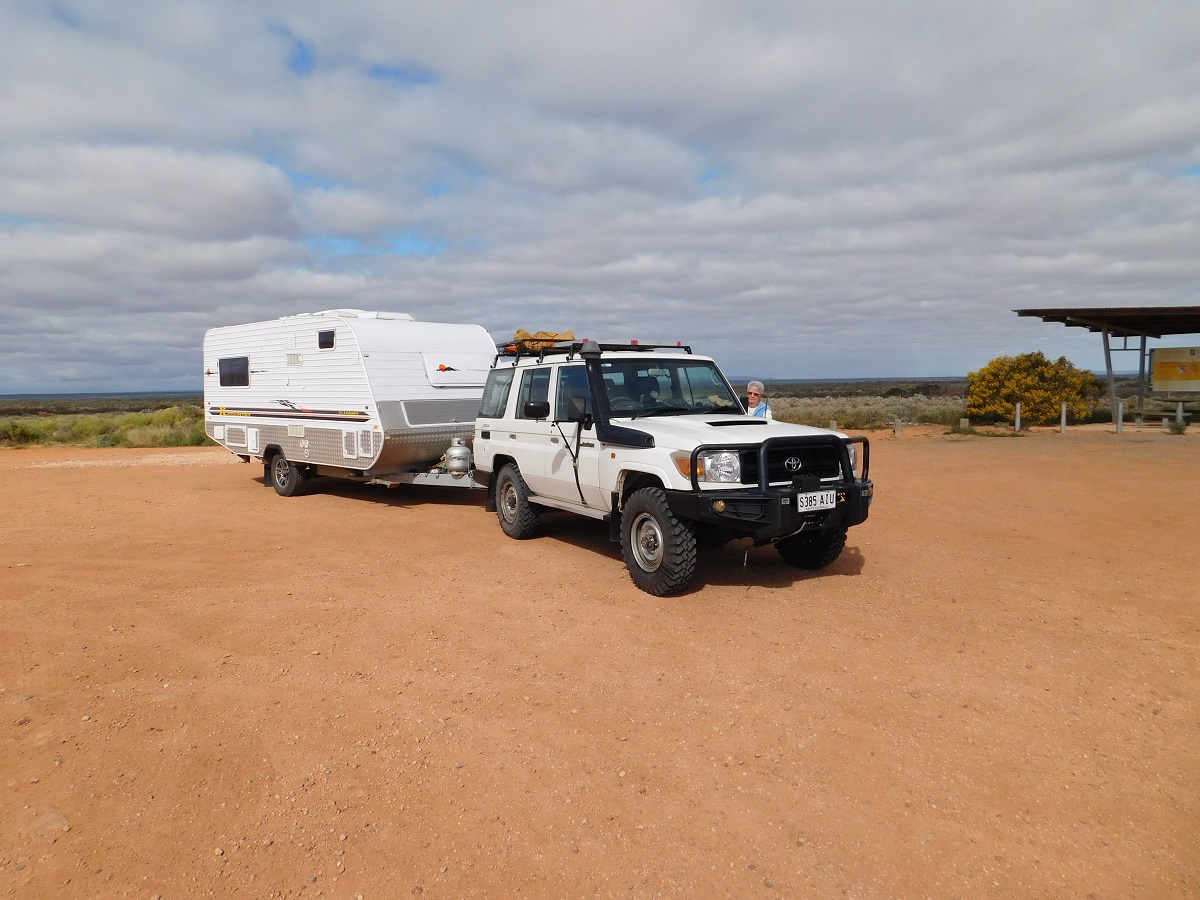
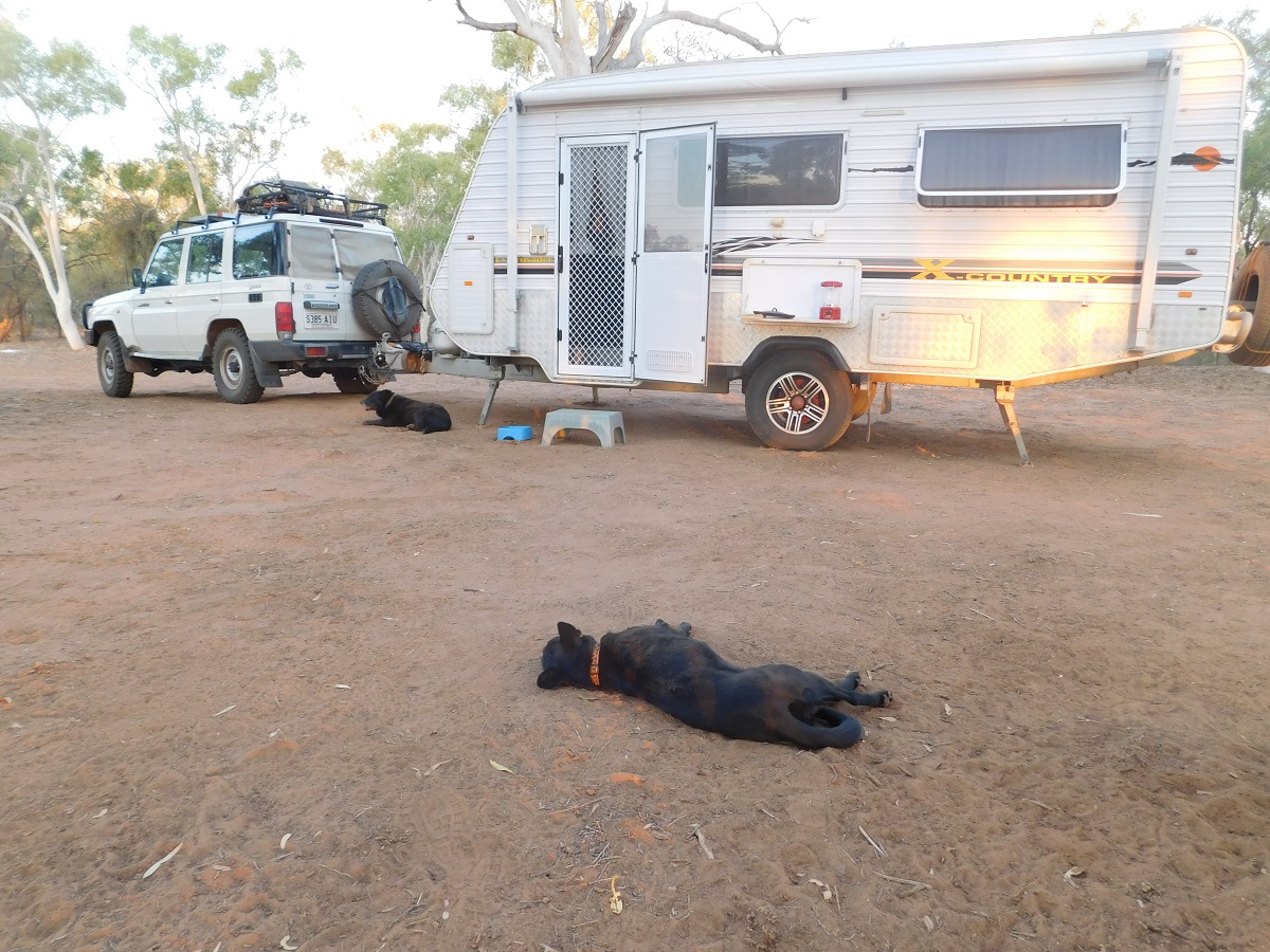
Back home I had 4 new tyres fitted and two days later we were on our way again. Judith had decided to take her car as she had some projects in mind in Alice Springs and Darwin and that this would be good for her to be mobile while I was away on an expedition in the Kimberley
-
- Toyota and caravan
-
- Travel group

Our first night’s camp was at Lake Hart on the Stuart Highway and we managed to get off the road about 100 metres on the lee side of a dune and camped there for the night. The traffic slowed down after 10pm and we managed to get some sleep.
Poached-egg daisies and Lake Hart
The next day our troubles began again. At Ingoman Wayside Stop on the Stuart Highway Judith had starter problems with the Xtrail. We got the car going again and in the end we managed to get it to Alice Springs and had the starter motor replaced by the Autosparky Company who gave us excellent service.
Turning in to Coober Pedy to refuel an engine warning light came on. Not having service books to refer to we visited three different mechanics at a cost of $20 each. The upshot of it was that the Turbocharger had a low boost and that it was not working and functioning properly. As I was going on an expedition and that the Toyota would be well out of the warranty period, Judith arranged with the Managing Director of the Sales Yard that they would extend the warranty on the Turbocharger until we returned from our holiday.
-
- Pootnoura sunset
-
- Blurred lines

-
- Fire coals
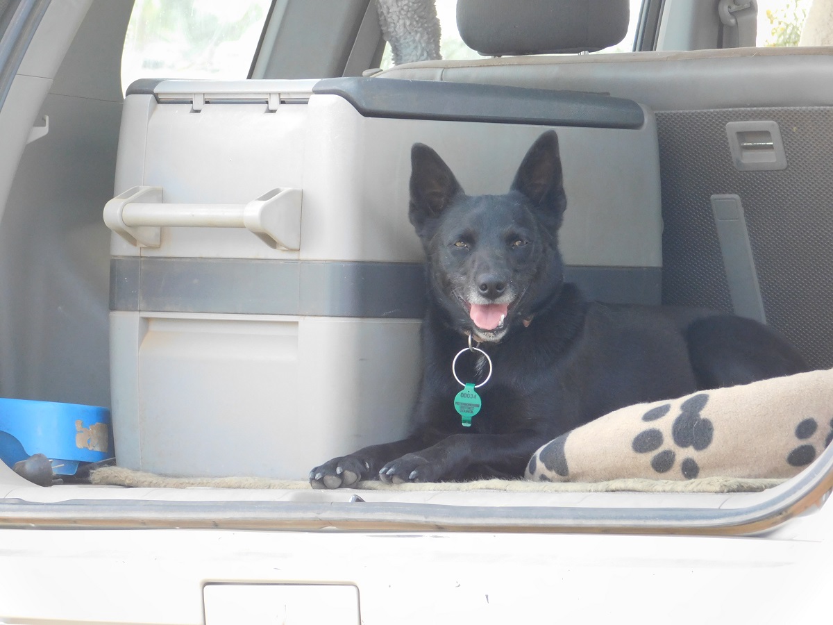
My mate George accompanied me back from our Kimberley adventure to Alice Springs where we collected Judith and the furry children from the caravan park and headed north. At Tennant Creek we caught up with our friends, the Wright Family and then pushed on to camp at the Pebbles and found the only possible site left. Then on to Longreach Waterhole 14 kilometres west of Elliot.
-
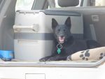
- Blaise in her favourite spot
-
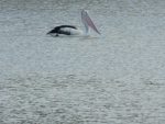
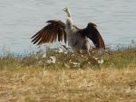
- Mr Percival
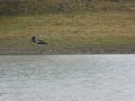
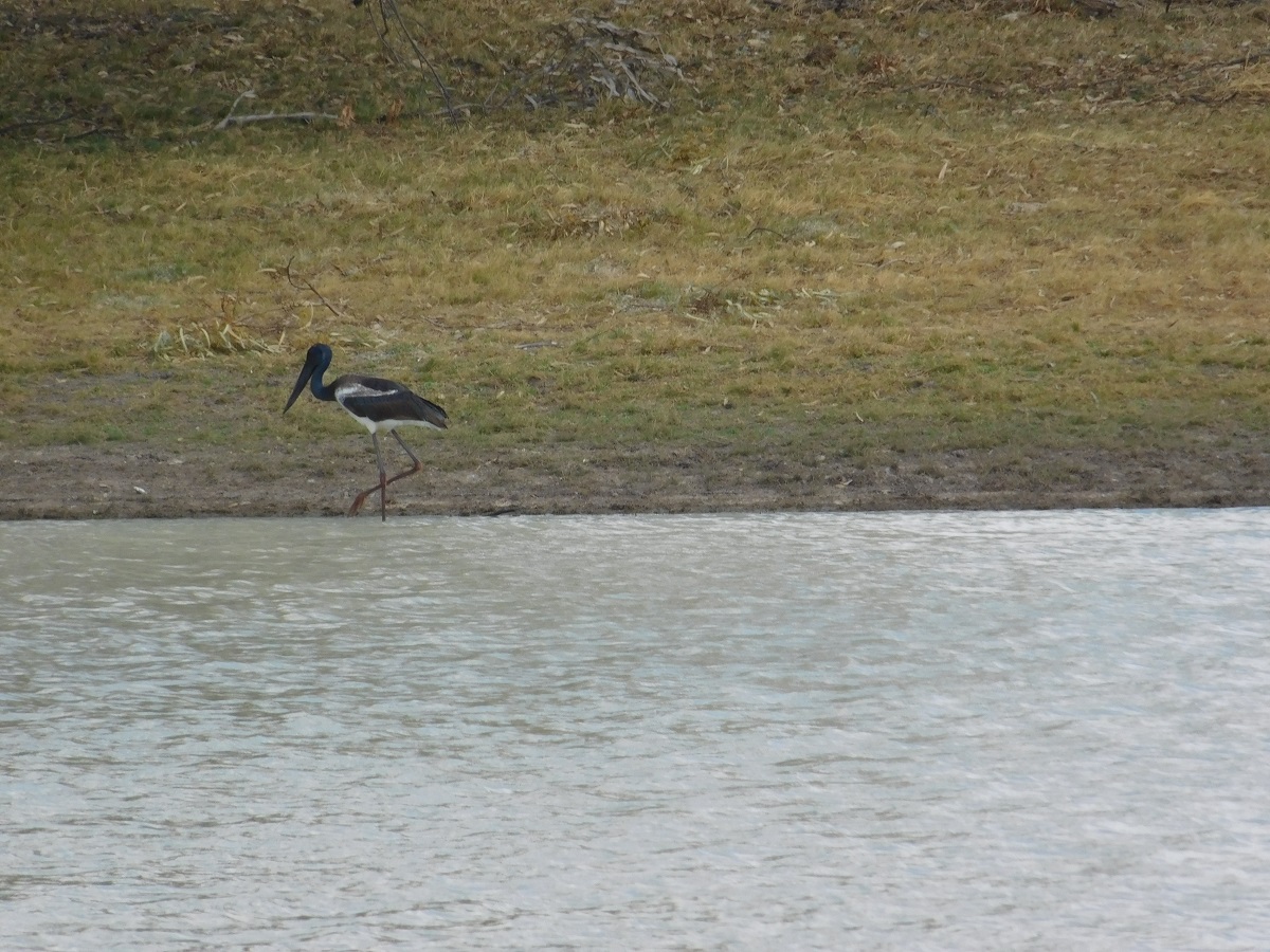
-
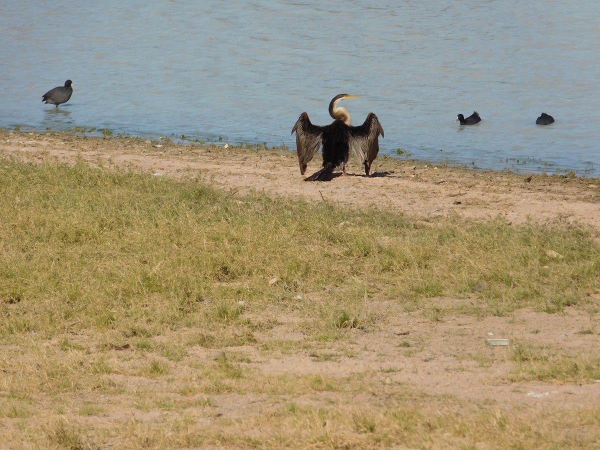
- Jabiru
-
- Snake Bird

-
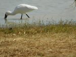
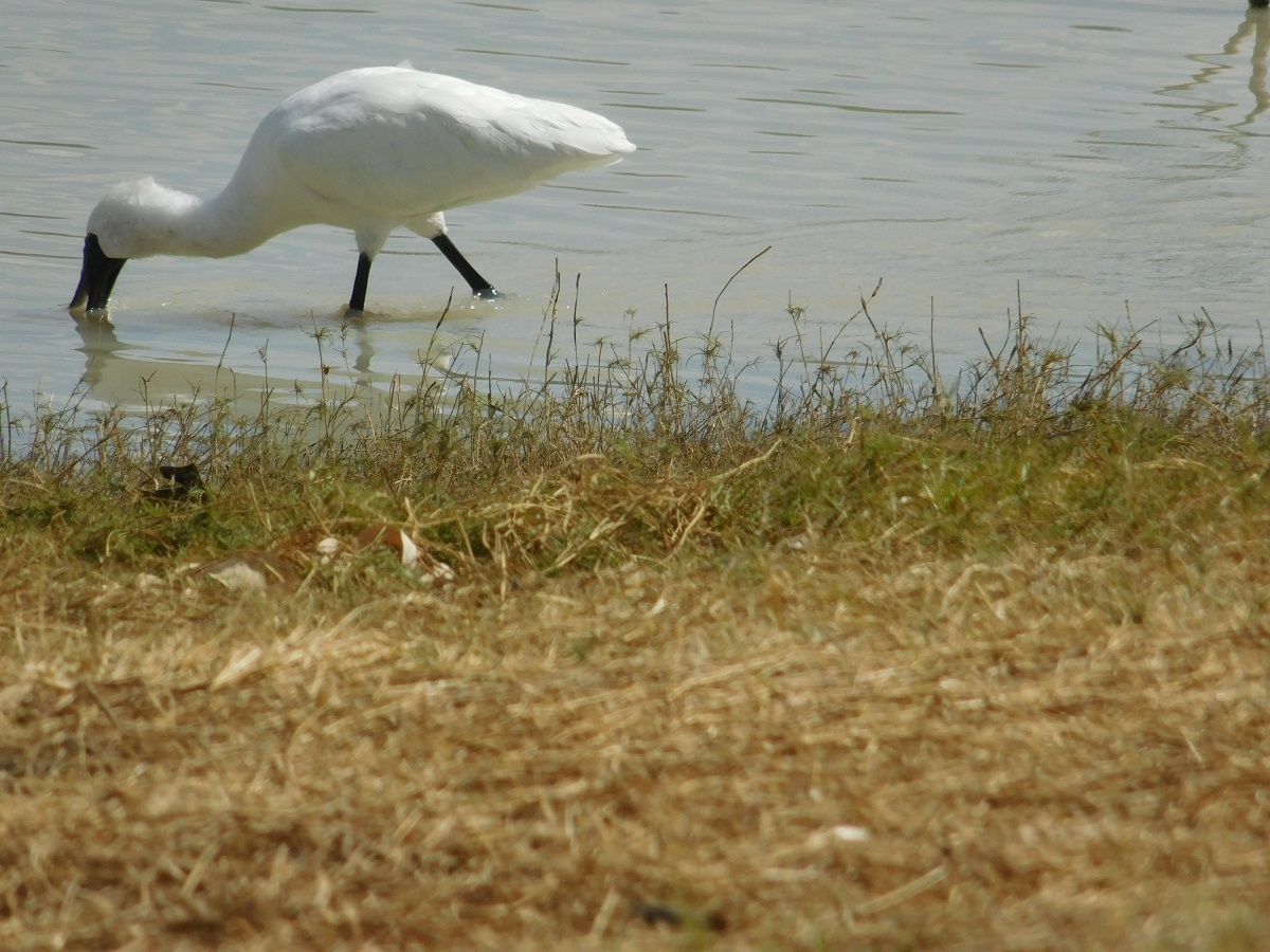
- Spoonbill
-

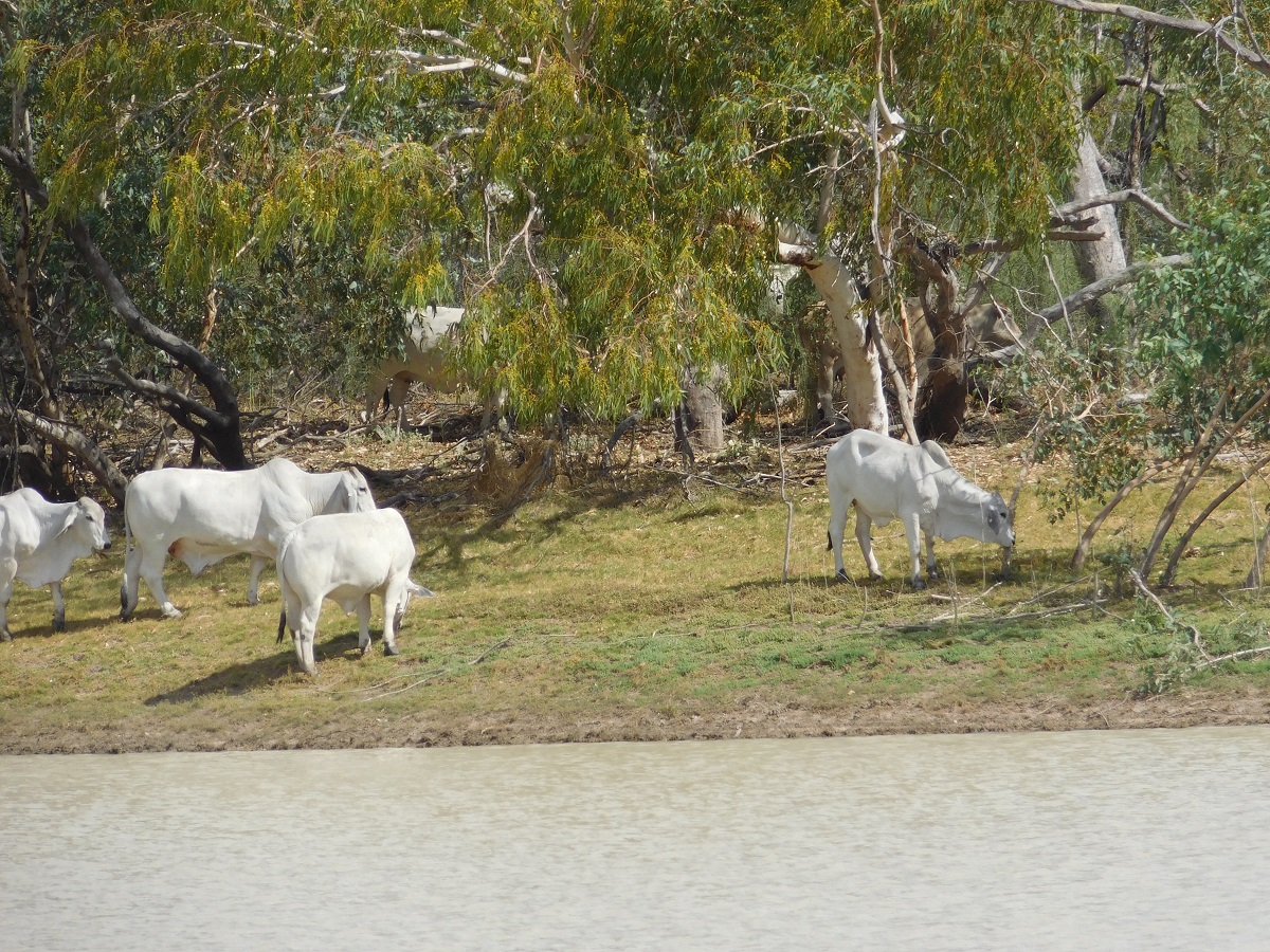
- Stud Cattle
-
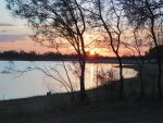
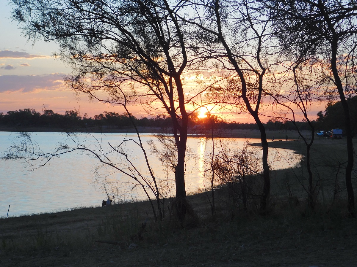
- Longreach Waterhole Sunset

Up the tree
Our last camp was what I call the Pan Que Quarry, west of Pine Creek where we were able to get close to one kilometre off the highway. We made it to our friend’s 5 acre block at Virginia the next morning and from there it is about 30km from the city of Darwin. Our friends are market gardeners and have a tropical oasis and a great variety of plants.
Tropical camp
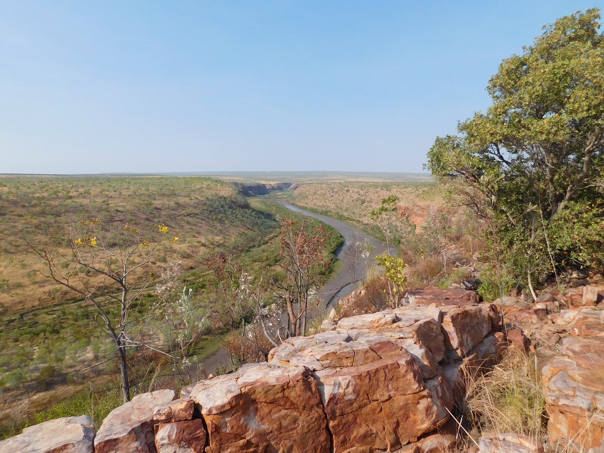
Carson River Track – Kimberley 2015
Carson River Track
Some photos by Marla Nightingale(MN)
( Click on thumbnail photos to enlarge them )
Please Note: The Department of Aboriginal Affairs is no longer issuing permits for access to Oombulgurri Lands. This includes all of the eastern section of the Carson River Track. Permits are still being issued for access to the Carson River Escarpment and King George Falls. Tag-a-long Tours are run by the Traditional Owners of the Oombulgurri Lands out of Wyndham for the whole of the Carson River Track. Contact: www.wundargoodie.com.au
Having had this exploration curse my whole life, I have been extremely lucky to visit many remote places on the Australian mainland over my time here. Not that I have made any critical discoveries or cut virgin ground, but that I have seen some fantastic places where few others have been and have enjoyed the ambience of the wilds. As per usual I have initiated the course, gathered willing participants, set the route and experienced the outcome.
Carson River Homestead
Now in my 73rd year, the Carson River Track is the last wild track to drive that looms big on my Bucket List. My health is starting to fail and I have decided that while I am still physically capable, even in a handicapped way, I should attempt this last bastion of utter remoteness.
The Carson River Track runs from Carson River Station in the Kimberley Region of Australia in a south westerly direction, culminating at Home Valley Station near the Gibb River Road. The distance is a mere 421 kilometres but it could take a minimum of 8 days to drive it. An owner of Carson River Station used to drive his cattle to the Wyndham Sale Yards via this track which he initiated himself. At first it was just a cattle and horse run but over time he made a rough track fit for a vehicle to negotiate. A bulldozer was used to push this track through to the Pentecost River. Carson River Station and the Oombulgurri land area passed back into hands of the Balanggarra Traditional Owners in 2013 under Native Title Settlement.
Internet research on Oombulgurri brought this reference
The Anglican Forrest River Mission for Aborigines was founded in 1896–97 by Harold Hale but was abandoned after a few months. A permanent mission, known as the Forrest River Mission, was established on the site in 1913 by the bishop of the north west, the Rt. Rev. Gerard Trower. In December 1913, Anglican priest Ernest Gribble took charge, three years after he was forced to resign as superintendent at Yarrabah. Gribble remained as superintendent until the early 1930s.
In 1926 the mission was plagued by an influenza epidemic and impacted by the Forrest River massacre where police killed a number of Aboriginal people. This event remains controversial.
The mission was closed in 1969, after the 1967 Aboriginal referendum.
In 1973, fifty Aboriginal people decided to resettle their abandoned tribal land and rename it Oombulgurri. Within a year, the population had grown to 200. Infrastructure and welfare programs were set up in the 1970s and 1980s to provide the residents with basic amenities and to allow the town to become self-sufficient.
Closure
In October 2010, the government of Western Australia announced plans to close the community of Oombulgurri, as its population had decreased from 150 to less than 50. In February 2011, the government was reportedly considering a number of proposals about the community’s future once all the residents had moved out, including converting it into a tourism retreat or a juvenile justice facility. On 1 March 2011, the community’s only store was dismantled and removed by boat. As of 2 March 2011, only seven residents still remained in Oombulgurri. Shortly before Christmas of 2011, the remaining residents were relocated to Wyndham. In 2014 the state government’s plan to demolish most of the buildings at the site was opposed by former residents
Source Wikipedia
Only recently, and to promote tourism to the area, have permits to traverse this remote track been given out. I had heard of this track in the 1970’s whilst chatting to other adventurers who told me that it was doable but that they had heard of travellers driving the track and having to spend many hours winching their way up the escarpments. Now, having driven the track at last, I wonder if they were talking about another track out there. This track had been bulldozed once in the 1950’s and by all accounts very little maintenance had been done over the years.
This time around my old mate, George, from Darwin, accompanied me on the trek. And I had friends, Marla and Neil, from Queensland, along for another adventure with me, driving their well-stocked and almost overloaded Toyota Landcruiser 6 cylinder Turbocharged Ute.
Our recent purchase of a Toyota Landcruiser 70 series wagon has proved problematical. We purchased the 4×4, added some accessories, hooked our van up and left for the north. At Coober Pedy, on the Stuart Highway, an engine warning light came on and various mechanics in the town diagnosed that the Turbocharger was low on boost pressure.
At Alice Springs it was decided that Judith and our dogs would stay there in a caravan park whilst I go on to Darwin to collect George and then go to the Kimberley. Once in Darwin, a good friend from long ago, Malcolm, very kindly did extensive testing on the Turbocharger to discover that certain parts of the Turbo were rusted and it appears that the 70 has had contact with salt water and has various points showing serious rust. Some of this will be attended to when we return down south as the vehicle’s warranty has been extended to cover the turbo. The engine goes well enough without the Turbo but fuel consumption is all over the place, especially when towing.
In Darwin, George added more gear than I thought was necessary and I baulked at the gas stove (it proved to be very handy at times, much to George’s glee) and then we left for our rendezvous with the others in Kununurra on Sunday 16th August. I was going to camp along the way but as things turned out we drove the 880km distance with ease and stopped in motel in Kununurra after clearing the fruit fly inspection point into Western Australia. Marla and Neil were already there and we booked into the same motel. In the motel, in the room splitting our rooms, an aboriginal elder was staying and at around 10pm he became very unruly and noisy and we complained to the hotel management and the police eventually removed him and we all got some sleep. The following day we bought fruit end veg and fuelled up and then drove around Kununurra and out to the rural area where we got lost and then bogged twice, looking for landmarks I knew long ago. We then drove out to look for some waterfalls and eventually found Black Rock Falls. Then on along the dusty road and just before dark I found a camp spot amongst the Boab trees on Parry Creek(dry), and we stopped for the night.
By accident I have discovered that sleeping on my Toyota’s driver’s seat, is very relaxing and beneficial to me, and so that is where I slept for the duration of the trip. It was warm enough at night to sleep with only a light covering and a spray of aerosol to keep the mozzies at bay.
The following day we drove to Wyndham and Five Rivers Lookout, the Old Wyndham and then we took the road to Diggers Rest Station and then on to the Old Karunjie Track (King River Road) which brought us out on the Pentecost River crossing on the Gibb River Road. Along the way we visited an Aboriginal art site and a Prison Boab Tree.
A few kilometres on past the Home Valley Station turn-off, I found a good quarry and we camped there for the night. There was no wood in sight but Marla and Neil managed to find a burnable lot and George went to help them. Neil brought out his trusty long handle axe and chopped the wood into pieces, as he did almost every other evening . He likes chopping wood.
The Gibb River Road was in very good condition with some of the jump-ups over the ranges being sealed. We stopped at the Durack River to replenish some of our water and then kept a steady 70kmh pace to Drysdale River Station, where we refuelled. Burgers and pies could be bought at a king’s ransom and so we found a shady spot and made our own sandwiches for lunch.
The road north from Drysdale River Station was graded for the first 10km and then it deteriorated into severe corrugations. Once again I found a quarry-like open space along the way and we made an early camp.
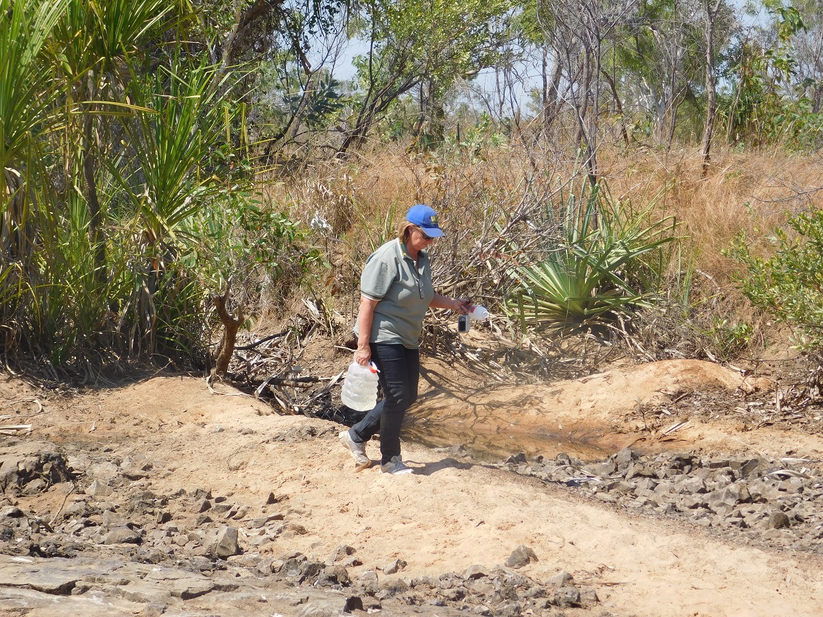
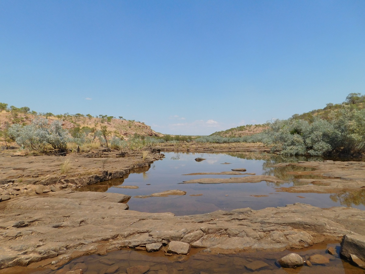
The road to Kalumburu winds its way over some low hills interspersed with a severely corrugated flat road sections at times. We made it to Kalumburu only to arrive at 10.59am and the fuel depot closed at 11am for lunch. But the lady running the store relented on closing and refuelled us at $2.47/l. We then went to the Caravan Park and replenished our water and had lunch and later went for a drive looking for the King Edward River. We eventually found it down a back track but I didn’t find the nice cool spot we had seen way back on our visit here in 1987.
At 1.30pm we went back to the store for supplies only to find that the Take Away shop had been open all of the time and that it had the necessary supplies. No one passes on information here in the tropics. Maybe tourists are only just tolerated.
The Carson River Road, as described on our Permit to Enter an Aboriginal Reserve, turns off the Kalumburu Road to the east, a very short distance after crossing the Carson River when northward bound. Carson River Station was an operational entity in 1987 when we first visited this area but now it is lying in ruins. The Manager at that time gave us permission to access King George River Falls, a spectacular geological phenomenon. It lay 117km from where we were camped on the Drysdale River and we made it there and back in a day despite multiple punctures to our tyres. But times change, and those people who populated the area back then, are gone to other pastures or endeavours.
I took the wrong track to the Drysdale River and we had to back-track a number of kilometres before making it to the ‘Ford’ at Drysdale River as shown on the map. This time of the year the river levels are very low and the crossing was visible. A steady, small stream, flowed through a crack in the rock-formation, and we all bounced across this on our way to the other side. With the sun low in the sky, and fading in the late afternoon ozone, I found an open space in the spear grass and we camped for the night
Carson River Escarpment
Not having any idea of the condition of the track or what we might expect we set off in anticipation of tough hard conditions. As my digital mapping system would now not fit the new vehicle, Marla lent me her Hema 7 Digital Mapping unit and it became an invaluable tool for finding our way through a maze of tracks which have been made by others during the dry season. The Hema however kept on turning the map upside down so that the writing was unreadable. There was obviously a way to reset this but both of us were too challenged to find it.
Drysdale River ford

Drysdale River
We had a pleasant drive the next day with some good surface and some bad washouts. Various vehicles lay abandoned along the track including a large truck, a backhoe and a forklift.

40 series Toyota

Backhoe
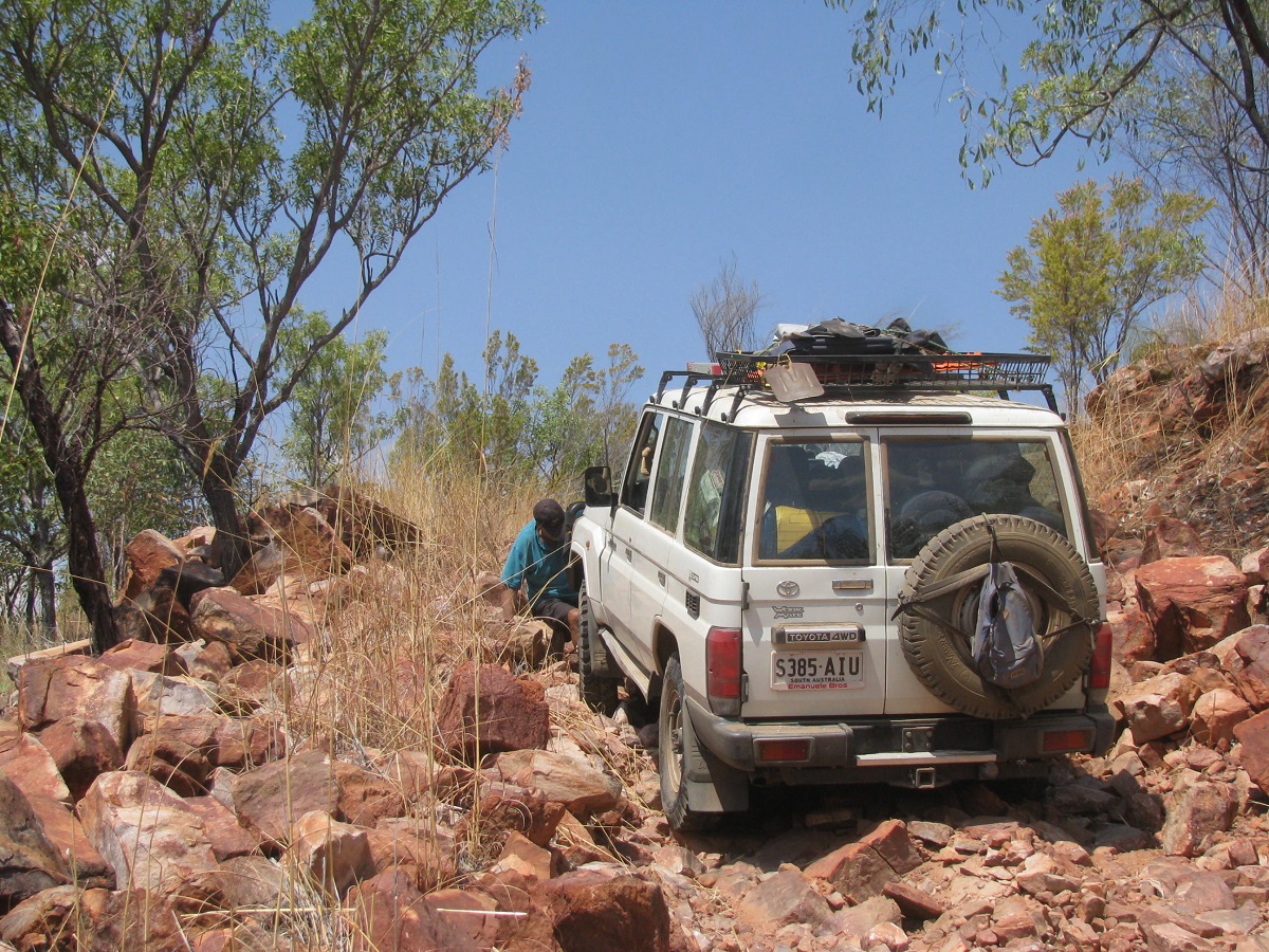
We crossed the King George River twice and climbed a steep washed out jump up. Here I had a nervous moment when I was negotiating the washout halfway up the slope, when my vehicle lent over at an acute angle and I feared that I might tip over. I steered to the right as the lean was going that way and the heart rate went up a few notches! Some manoeuvering with the steering-wheel brought the vehicle back on the level again and I was able to drive out of trouble

Rough Jump-up
The lean seemed worse(MN)
At the apex of this jump-up we found a huge quarried area. The mapping declares it the Beta Creek Mine. Various mullock heaps of different aggregate have been deposited by an equally large crusher (now non-existent). As to why this mine was ever started is a moot question. An internet search of this mine, with the correct spelling, shows that it was an exploration site for diamonds. Judging by the equipment left behind they may come back!
Topping up water
Wild cattle now roam and breed freely in the East Kimberley and there must be thousands of these cattle out there. Mustering in this hard country though would need a special kind of operation.
Walking first just in case(MN)
Not deep at all(MN)
I I
I found a good campsite after the third King George River crossing.
Camp activities
After we had eaten, George and Marla got stuck into the Port and covered a range of subjects, some of which I had heard before so I busied myself in other pursuits.
The following day was a long and hot day and we covered 61km for the seven hours of driving, crossing ruts and gullies, swamps, serious washouts and sharp rocks. At mid morning smoko my self-put-together roof-rack was dangerously loose and I had the idea to abandon it. Then I decided to fix some Tek screws where the movement of the parts were. Everyone pitched in with ideas. It seemed to work and the roof-rack is now as strong as ever. We stopped for lunch in the shade of some Ti-trees and a group of five vehicles sped past with nary a wave. Later in the day we could not see the tracks of the vehicles we had seen and wondered if we hadn’t stumbled upon an anomaly in the fifth dimension.
One of a thousand ruts

Campbell Range
Berkeley Hills
The countryside around the Berkeley River opens up as we dropped down towards the river with conical hills and flat top mesas to be seen in the near distance.
The track down to where the crossing is, is strewn with loose rocks and we gingerly picked our way down.
Down to the Berkeley River

Loose stones
This way
Early morning Blue-wing Kookaburras greeted us with their raucous calls every day at around 5am. They were elusive though and camera shy
No shade was to be had on the Berkeley but we were able to extend and unfold more or Marla and Neil’s roof top tent, and had enough shade for the four of us to shelter under for the day. Neil walked upstream to some billabongs to throw a lure but came back empty handed.
Berkeley Camp

This is the life(MN)
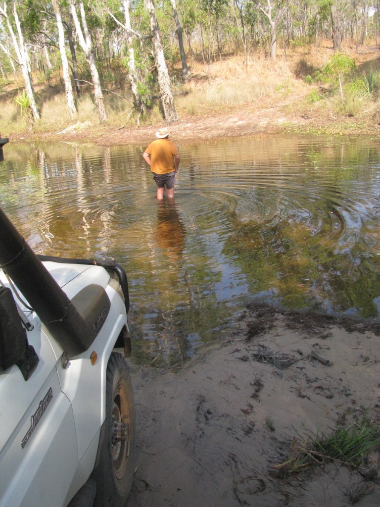
Monday morning and we tackled the Berkeley River crossing. Low range first gear all the way. Neil had laid out tree branches to show us the easiest way across the rock slabs to the other side.
Rocky Road(MN)
Today we did hard four wheel driving with lots of gullies and creeks and washouts to contend with. At Adamson Airfield on top of this range we found an abandoned Honda 4×4 quad bike and later an International tip truck which reminded us of days in the past when we worked with a similar truck.
Adamson Airfield
Abandoned Quad bike
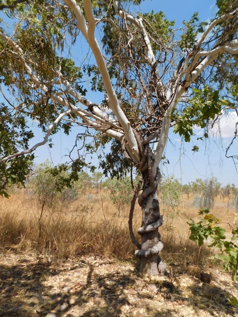
A burnt out Boab Tree was of great interest as none of us had seen one burnt like that before.

George took the wheel after lunch and drove for a while until he scrunched the side step of the Landcruiser on an ant hill. He gave me back the wheel as he had lost his appetite for driving after that.
The next day the track started to move in the direction of some hills as we followed the Delancourt River which we crossed a number of times and it looked like we would need to get up through a saddle in the ranges. We were soon to find out just how taxing this range would be with lots of road building to make it easy for access across for the vehicles. Just getting out of camp was an exercise in swinging the steering wheel the next morning as the track took off up a series of gullies running in to the river. We stopped for smoko in a cleared area after a long hard climb up and on to the top of the range. A small gas bottle stood in the clearing by its lonely self, obviously forgotten by campers in their haste to pack up and go. It still had some gas in it and we boiled the billy.
Roadbuilding
Whilst admiring a strangler vine with a firm grip of its host tree, Marla discovered that some of their bags had slipped out from beneath the skirt of the canopy of the ute and one of them being the computer bag. They turned around to go and find the lost items while George and I lazed in the shade of a tree nearby the strangler vine. Two hours elapsed before they returned having found all of the gear. They had traversed 15km in that time
Strangler Vine
The countryside now dropped down gently from the ridge and we ended up driving over a long, wide, clay-pan towards the abandoned settlement of Oombulgurri. The thought came to mind that this would be a no go area when it rained.
Rocks and sand
The Claypan
Our first bit of ‘civilisation’ was encountered when we stopped at the Oombulgurri Airport Shed. We drove to the outskirts of the abandoned town as our permit did not allow us to enter the town. We camped nearby and managed to find enough fire wood to rustle up some tucker. It was a warm night.
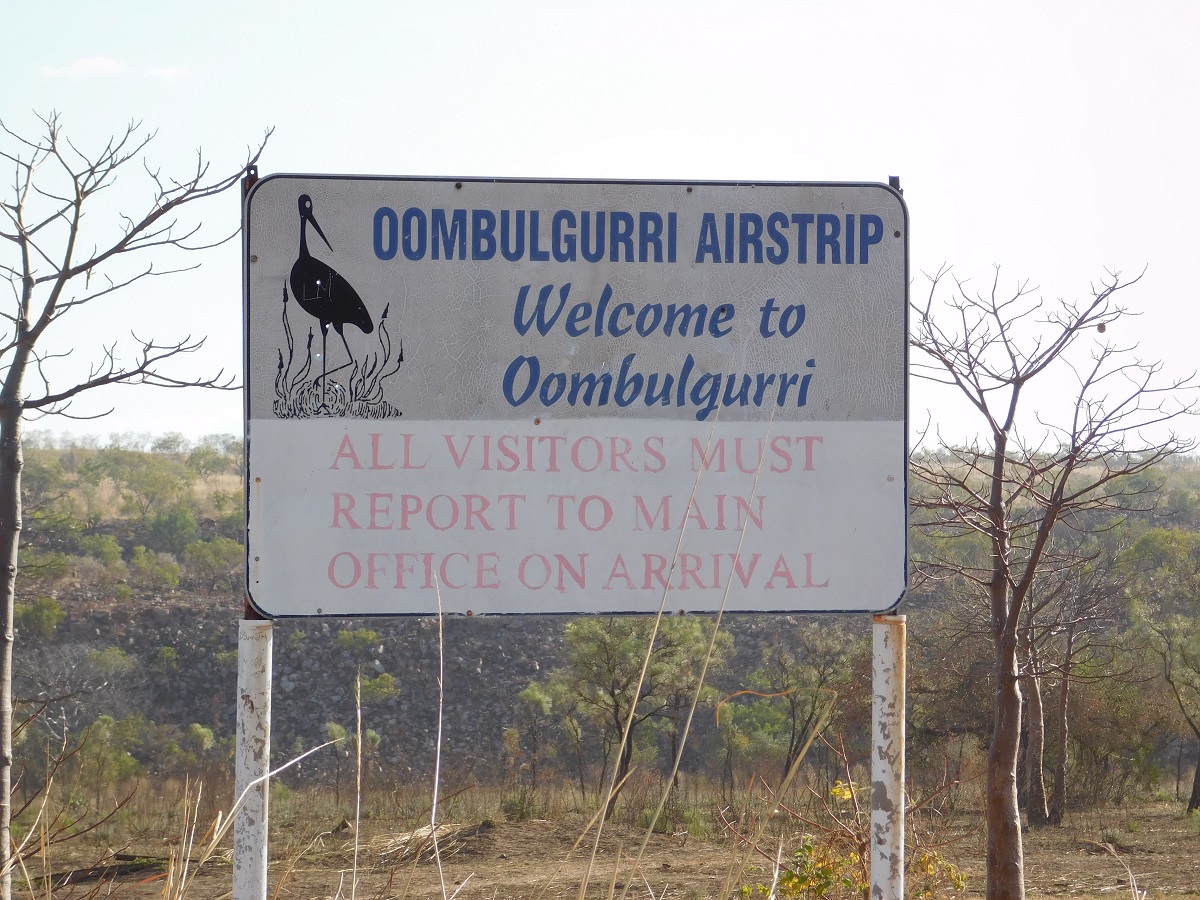
Oombulgurri Airport
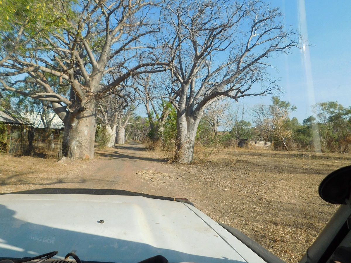
Avenue of Boabs
Forrest River

George guiding the way
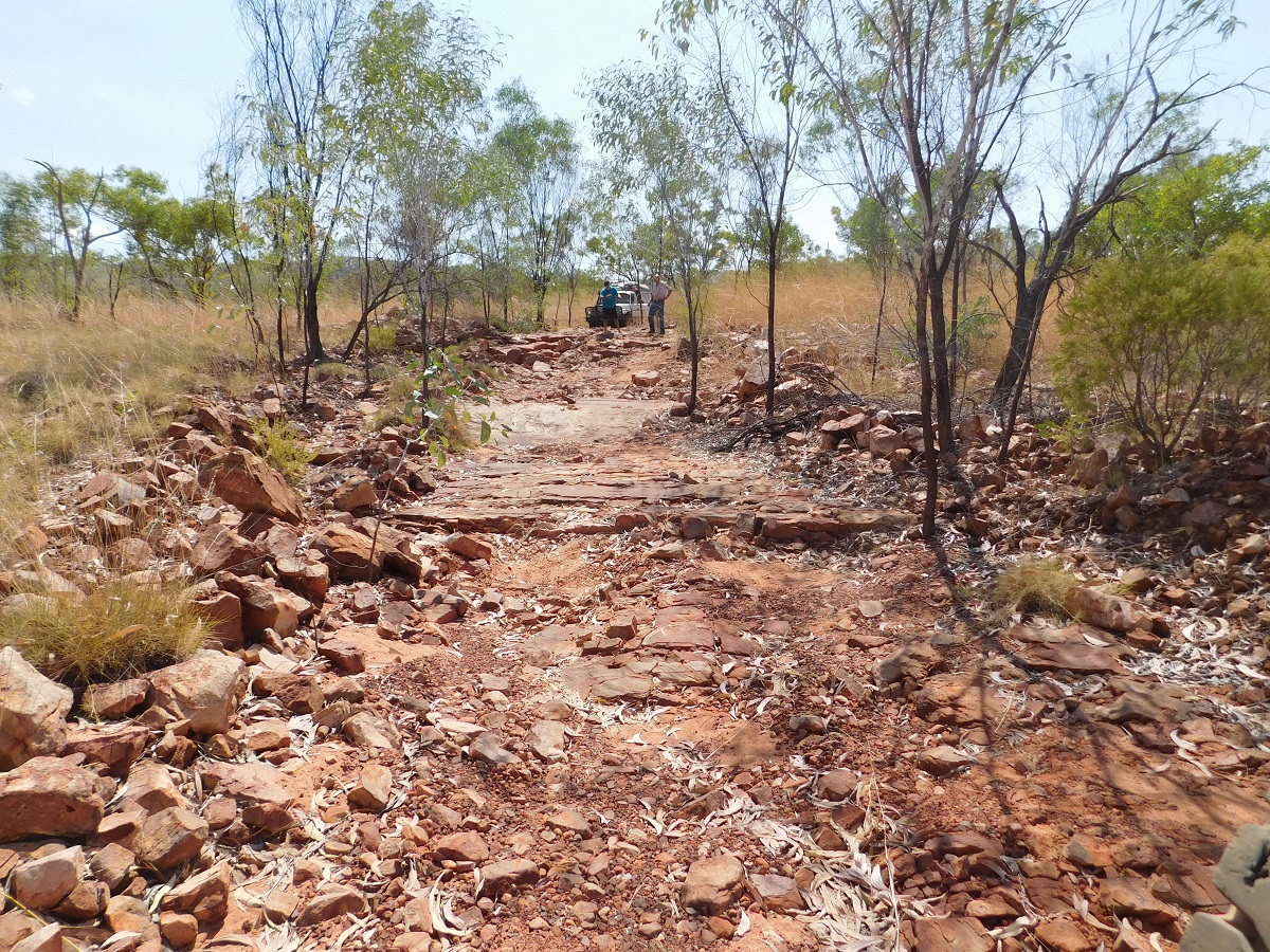
The following morning it took us a while to find our way out from where we had had camped but a faint clearing in the never-ending rocks showed a way across the Milligan Ranges. Our curiosity found us going down a track to see the old Pumping Station at Camera Pool on Warringali Creek just short of the junction with the Forrest River, where clean water was pumped for Oombulgurri Town. The infrastructure was quite something to see to keep such a small population of inhabitants in water. Now this infrastructure is all lying in ruin.
Down the range we went crossing the Warringali Creek and the baptism of fire started on the Carson River Track. We were now into the extreme stuff. Rocks, rocks and more rocks and when not rocks then stones! Today was the day for low range driving. We managed 52km for the day.
Pushing hard through the sand(MN)
Delancourt River
Rough as
Diff clangers
We camped in small burnt clearing on side of road 31km from Home Valley Station as per our mapping. This was to be our last camp on the track after seven days of driving. Now, being on a smooth level surface, we had the wrong sense of ease thinking that the end of the endless rocks was behind us. Not so!
More grunt needed
Forrest River
Last camp fire
Rough track(MN)
As we were doing a radio check the next morning upon leaving camp someone else spoke on our channel. I thought that we may have picked up someone across the bay on the Old Karunjie Road. We were soon to find out who it was as a convoy of vehicles came up the track towards us. The lead vehicle had a large bug deflector with EVIL emblazoned on it. An aboriginal man alighted from the cabin and strode over to us in a firm but friendly manner and asked to see our permit after introducing himself as Colin Morgan, Traditional Owner of these lands. I duly produced the permit which Colin took back to his crew with him. They all pored over it with interest. The next thing a fella came towards me taking photos of our vehicles and especially my number-plate and so I took photos of them in retaliation. Colin stated that the permit did not include the track from the King George Falls area to Home Valley Station to which I countered that if that was the case why mention Oombulgurri Township in the permit at all. The Carson River Track is also the Carson River Road and the permit allows the bearer to traverse the lands under certain conditions as laid out in the paper. Colin then agreed that the permit was in order and asked if he could take a photo of it. I had no issue with that. Amongst other things Colin stated that it was his intention to manage these lands, away from the control of the Department of Indigenous Affairs, in the near future and that access to them by way of his own permit approval and fees, should be in order by next year to stop people from driving everywhere, as he put it. Subsequent research shows that Colin and his family take Tag A Long tours (Kimberley Outback Tours) on a ten day slow trip along the Carson River Track, at a cost of $3000 per vehicle.
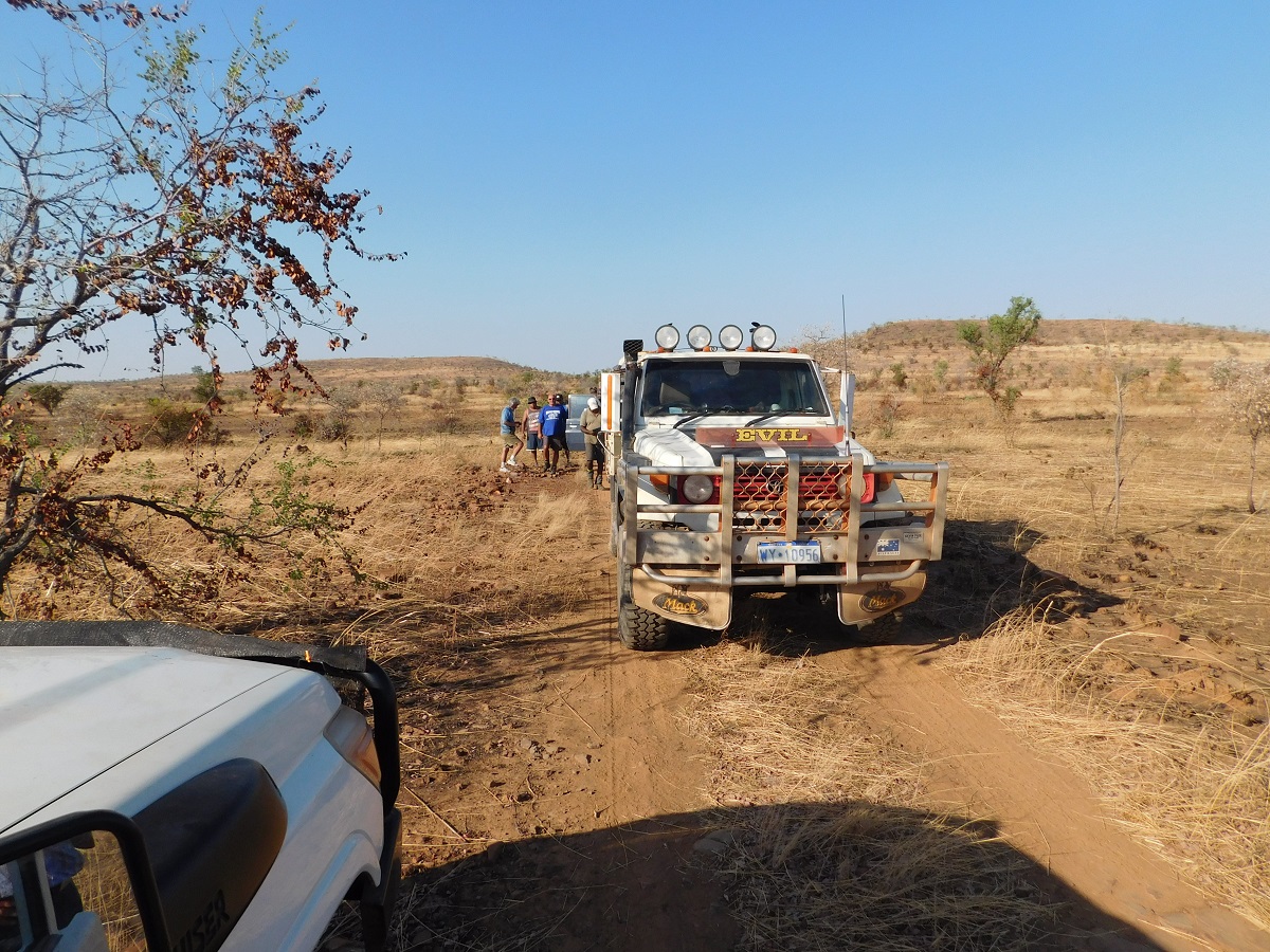
Encounter

Colin Morgan and me
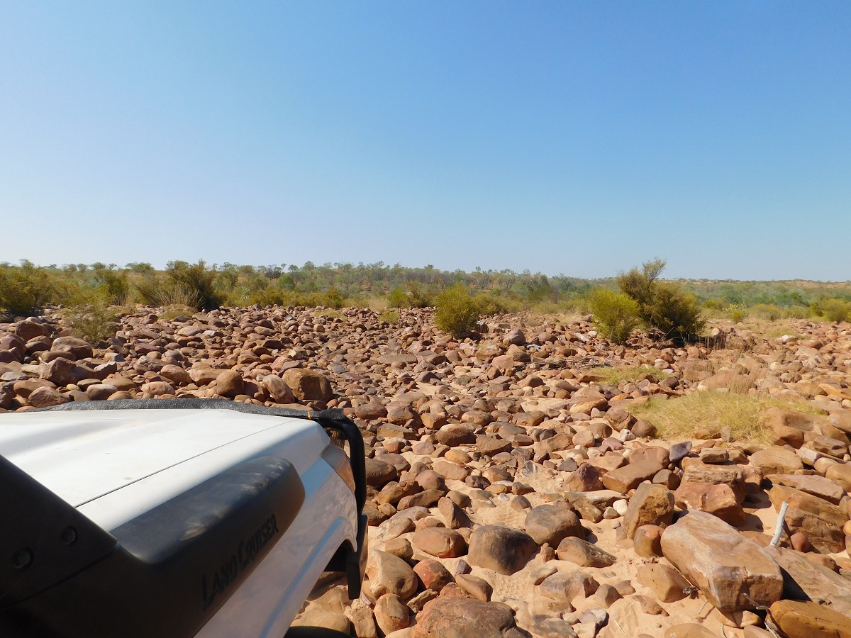
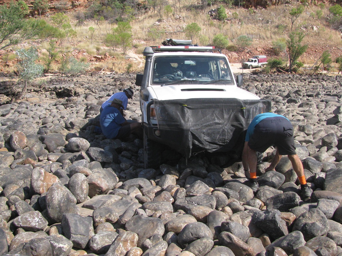
So now it would only be a short distance to drive to Home Valley. Right? Wrong!! We had to cross the Durack River and the range beyond that. The track meandered down the headland cut by the river over the millennia. At the crossing lay thousands of boulders all the size of a football or bigger, rounded by the flow of the river over time. Even running low tyre pressures didn’t help as I crossed as I dislodge a rather large rock which wedged itself in under the Landcruiser and it took quite a bit of road work by George and Neil to extract me from my predicament. Then we had to clear another very rock-strewn jump-up and this time a scrunched the side step and put a small dent in the wheel-arch panel. The rough travel continued on for another eight kilometres before we dropped down on to the Cambridge Gulf floodplain and smooth travel to Home Valley Station. This last bit had taken eight hours to negotiate at a steady pace of around 4kmh! The Pentecost River was the last rocky riverbed to negotiate.

Way out(MN)
Hmmmm looks suspicious(MN)
Bush discussion(MN)
More road building(MN)
Bogged in rocks(MN)

Checking out the route

Floodplain
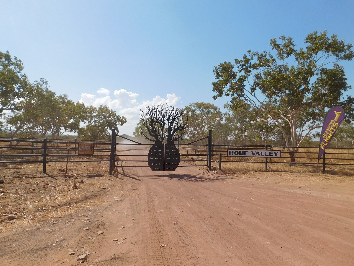
Home Valley gate
We were thirsty when we arrived at Home Valley Station and bought beers ignoring the price of $9 each! Nice earner there.
Driving the Carson River Track had been a worthwhile experience. We did not manage to see lush water holes or magnificent rock art as we did not have the knowledge of where these places were. The track was very rough to extremely rough in places but we took it easy and sustained no punctures over the eight days of venturing on this 421km track in the Northeast of the Kimberley Region in Western Australia. I sustained a small amount of panel damage to the Landcruiser but not much to worry about.
Stock Routes, Strip Roads and Tracks 2015
Longreach Waterhole
Cuddles
Drying off
Human activities
I am watching
Hanging in there
Early morning fish hunt
We had spent a few lazy days at Longreach Waterhole on Newcastle Waters Creek, which lies twelve kilometres west of the Community of Elliott on the Stuart Highway. It is a popular spot for tourists who travel in Self Contained vehicles. Bush toilets have been provided but apart from that you are on your own
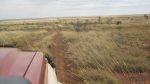
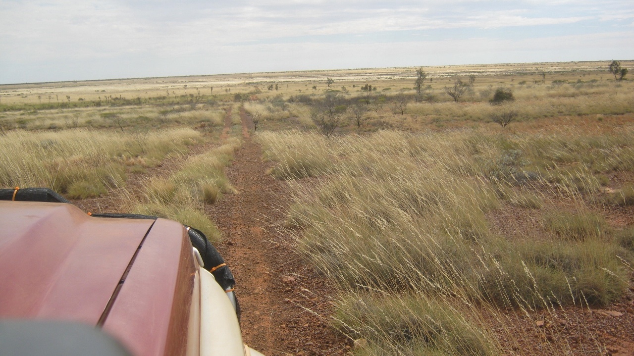
On the morning of our departure an east wind sprang up and by the time we turned off on to the Barkly Stock Route the wind was building up velocity.
The sign at the start of the Stock Route across the vast Barkly Tableland states
NO FUEL FOR 500km.
Barkly Stock Route
As far as the eye can see
I had driven the Barkly Stock Route in 2007 and I wanted to show Judith the wonderful plains of Mitchell Grasslands. This was also going to be a day that Judith would be learning to tow the van.
And so we set off, the dogs and I out front in the Xtrail, and Jude coming on behind with the Toyota and Van. I had bought two UHF radios and we were able to communicate while driving, which helped a lot
Driving the Barkly
Day camp
After about 20 kilometres Jude said that she was having difficulty in driving on the rough track and I took over again from there. By now the wind was becoming a blast and we struggled on into the east over some country which could also be named Nullarbor (Null Arbor = No Trees) as it looked just like it.
I was down to 2nd gear and 50 kilometres per hour into the wind and I called Jude up and asked her to look for an open space so that we could pull over and stop for a while. She found a space near a cattle grid and we stayed there for six hours waiting for the wind to abate. No other traffic passed by in that time.
Lying there dozing with the wind curling around the open windows of the caravan and we could distinctly make out human voices, dogs barking and cattle lowing as every gust of wind was different. We called them the ghosts of the Barkly remembering the European pioneers who drove cattle across these plains to other fertile lands in Western Australia. Aboriginal people may have walked this way too, knowing where the gnamma-holes were that held precious life-giving water. Today the land is managed by vast cattle empires that make their profits for shareholders this way. From Elliott in the north and in a south-westerly direction, one cattle enterprise, AACO, owns the land for 700 kilometres as far Boulia in Western Queensland. The cattle stations employ any number of Jackeroos, Gardeners, Cooks, General Hands and Stockmen and station life is a way of life and many would say, it’s a good one.
Government Bore
We trundled on again at around 4pm waiting for the wind to drop at sunset, as it usually does. We passed by dead windmills aplenty and one wonders what ever happened to the windmill mechanics who used to ply their trade, upgrading and repairing windmills on stations. These days many stations have diesel pumps on their bores and some are monitored and controlled via Satellite Internet. Human hands still have to do repairs though but they are not required to ride the boundary any longer. Technology is changing how things are done, even in very remote locations.
Crows nest
There had been no wildlife as such around except for the ubiquitous Crow. Then I saw a wave of Australian Pratincoles crossing the path in front of me. They are such graceful birds flying in their distinct manner.
Barkly sunset
I found a clearing near a Turkey Nest Dam and we pulled up for the night. As the sun dipped below the horizon the wind dropped and it was deadly quiet except for cattle lowing in the distance. We dared not light a fire due to the dry grass conditions but we sat outside after feeding ourselves and counted satellites as they crossed the expanse of the Milky Way on such a clear night. At 5am a station vehicle rattled past the van and woke me up with a start. We had parked on a station track which had looked like it had not been used in a long time. But, there you go.
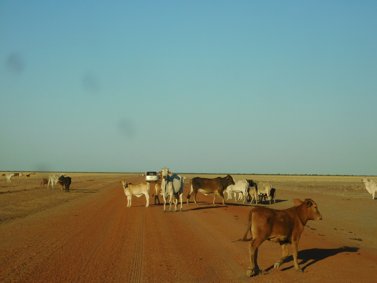
Brahman road block
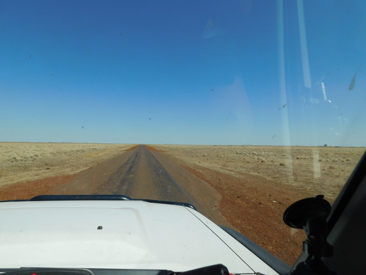
Tablelands Highway
By mid-morning we had reached the Tablelands Highway and it was time to refuel with the jerry cans of petrol and diesel I had carried in the Toyota. The flies were annoying and the wind was starting to blow again. An hour later we pulled in to a wayside stop and hid on the van once again but only for two hours this time before moving on.
I try to stay clear of negativity when writing of our travels but I have to say that the Tableland Highway strip bitumen road, is the worst road I have driven in many years. It was constructed in the late 1960’s and completed in the early 1970’s. Built for the primary use of road trains to ship cattle out to markets it has suffered the consequences of little maintenance over the years and increasing heavy haulage. It was the most uncomfortable ride we have had in many years. We were more or less exhausted when we arrived at the end of the road and the Barkly Roadhouse, and despite the signs portraying a friendly atmosphere we were confronted by Backpacker Staff who knew nothing about the local environment and were just there to take the money for the roadhouse owners.
The drought is setting in and waterholes are drying up
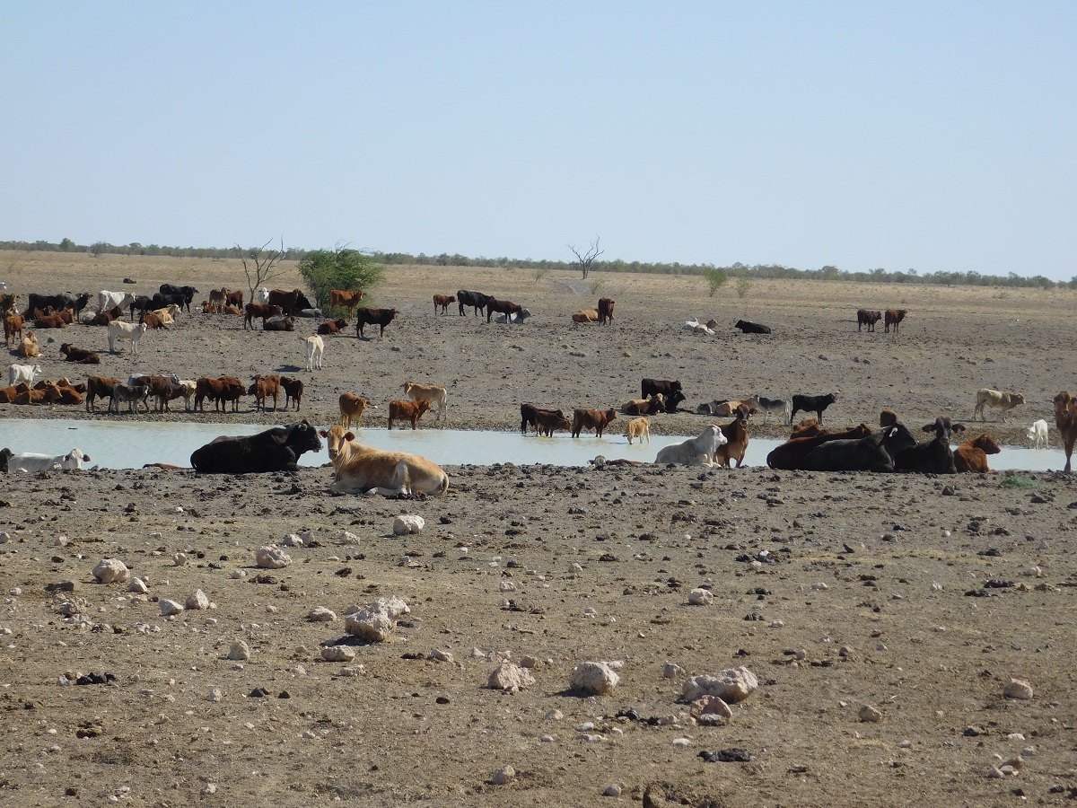
Last of the water
We didn’t waste too much time in getting back on the road heading towards the Queensland Border. The shadows were casting long shapes and I started looking around for a place to camp. Just before sunset I found a Telstra Tower about 600 metres from the road and we pulled in to stay the night. Later another vehicle came in after dark and parked on the other side of the tower and kept to themselves.
Early morning heading east and we were back into the wind again. Luckily the road was not too busy. I kept on looking for old landmarks we used to visit back in the 1970’s but much of it has been overgrown and is now out of sight.
We stopped for a break at Avon Downs Rest Stop and had a look and the great big cooking pots outside the Police Station. The coppers dog came over to visit our two and even hopped into the Xtrail much to Blaise’s disgust!
Nothing much has changed at the Northern Territory/Queensland Border
1969
2015
Even though it was Saturday the Queensland Roadworks Department was resurfacing the Main Street of Camooweal and it was all pretty messy. But we managed to refuel at the roadhouse which still looks the same as it did in 1971. We had our lunch in the parking area and as there were water taps at hand we filled our caravan tanks feeling justified in doing so after spending more than $200 in the town.

Camooweal

Commemorating Outback Drovers
Now we tackled the Urandangie Stock Route. Exiting the town over a cattle grid and heading due south, we enjoyed a relatively good gravel road up to the Camooweal Caves National Park, after which the condition deteriorated rapidly. The wind was still blowing but now either from the side or from the back. The track became sandy and we both had to revert to 4×4 mode. We were like this for about one hundred kilometres after which the track improved again. With the wind still blowing a gale I found a huge quarry on the side of the road and we ducked in there to get away from the blast.
Having been along the track before, I recall visiting a sinkhole a short way out from Urandangie. Now I think that, Douglas Hole, has been opened up by the quarrying.

Douglas Hole camp
We were able to light a fire to cook our tea after the wind died down at sunset and we sat out and counted the stars and watched the coals of the fire glow in the dark. Far off in the distance to the east we saw faint lightning.
I woke up at 3am and there was think cloud cover and fearing rain we got up and stored all our outdoor gear such as the chairs and tables and campfire utensils. Then we went back to sleep. By sunrise however the cloud had thinned and was dissipating so that I was able to take a beaut photo of it.
Driving into Urandangie we saw some campers who were sleeping rough on the outskirts of the town. Apart from the pub and historical Post Office building there wasn’t much else to the town.

Urandangie Post Office
Urandangie Pub
Jude was in front and took the short-cut to Dajarra. This meant more gravel road but it took 18 kilometres off the distance. The first 20 kilometres was a well-made road but then it reverted to sandy stretches and we were back in 4×4 mode.
Then the wind sprang up again. Whereas the northern half of the Barkly Tableland was covered with lush Mitchell Grass the southern part is in serious drought condition. Western Queensland has seen little rain in the past four years and communities are struggling, surviving only on the passing tourist trade.
Windmill in decay
The short-cut from Urandangie to Dajarra follows in a loop position so that you start off heading south, then east and then due north. By the time we were past the Kallala Station turn-off the wind was blasting gusts and clouds of dust started rising into the air. Even the Corellas were making hard work of the wind
Corella frenzy
After a while visibility was down to a 100 metres and we motored along the stony, then sandy road trying miss large bulldust patches which dotted the surface in no particular pattern. It was a relief to reach the bitumen road again just past Ardmore Station.
Swallowed by dust
At Dajarra we refuelled, had a bite to eat and I asked a local about Mrs Johnston, who had owned the Dajarra Hotel back in the 1960’s. She gave me a job cleaning the hotel back then when I landed in Dajarra with little money and no prospects. Then her husband found me a job with Zanen Roadbuilders as the strip road was being built between Mount Isa and Dajarra. I was told that as far as the local knew she was still alive and living in another part of Queensland. Soon after we set off down the road, now with a tailwind, to Bedourie.

Dajarra Hotel
Strip road out of Dajarra
At Boulia we found a good campsite down on the Burke River where we camped for two nights. We were able to light a fire and do our cooking outside despite the wind still persisting to blow.

The Cook
A dogs life
Toasting the end of the day

Last gasp
We continued on our journey south and the road improved somewhat south of Boulia. Just past Marion Downs Station turn off we crossed the Tropic of Capricorn again.
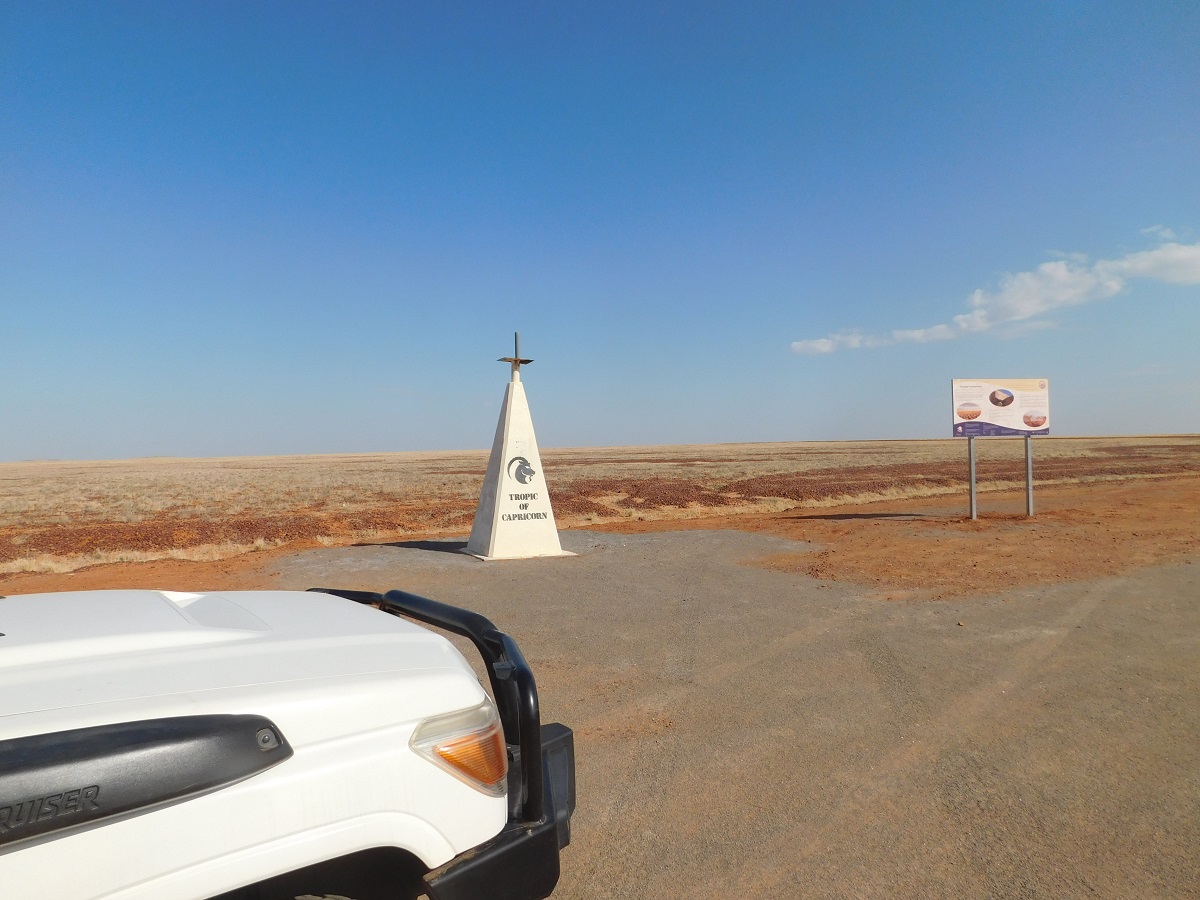
Tropic of Capricorn
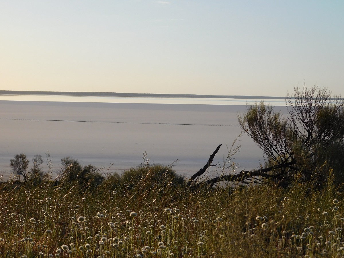
Further along on the way to Bedourie we stopped at Johnsons Lookout, right on the shire boundary of Boulia and Bedourie. There is a steep bitumenised climb to the top of the mesa and toilet facilities and information boards about the area are very new. The lookout gives an impressive vista over Lake Machattie.
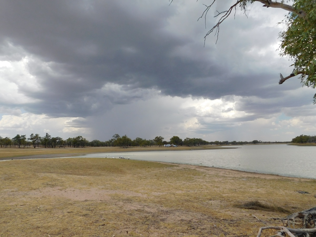
Lake Machattie(dry)
The Lake Machattie Area is a large tract of land in the order of nine hundred square kilometres comprising Lakes Machattie, Mipia and Koolivoo, with the surrounding Georgina River and Eyre Creek floodplains, in the arid Channel Country. The area is important as a breeding site for water birds when it rains. Freckled and Pink eared ducks use the waters as their home base whilst other birds such as Pelicans, Ibises, Spoonbils, Cormorants, Avocets and Sandpipers also visit on their migratory journeyss. Lake Koolivoo and Mipia are flooded annually and Lake Machattie seasonally. Annual rainfall out here is less than 170mm.
We stayed two nights in Bedourie and enjoyed our visits to the artesian spas in the swimming-pool complex.
As we made our way south to Birdsville the country was drying out rapidly as the grasslands had disappeared and all that was left was red Gibber stones. Farming out here is a precarious occupation.

Dry as
We visited the Birdsville Clinic where Jude had participated in building a story of stone in 2005 and she had not seen it in its completed form.
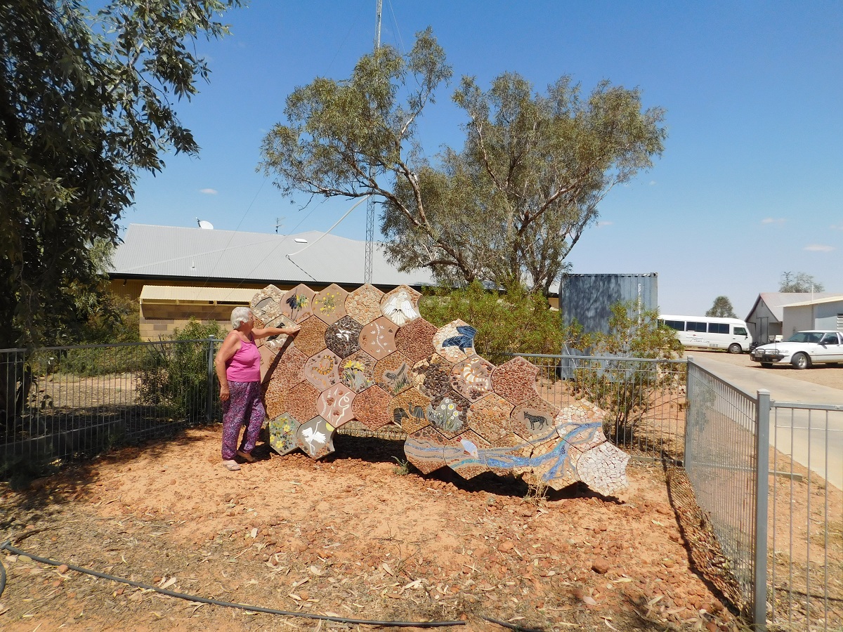
Birdsville stone art
Then we caught up with a friend over a cup of coffee, and after that we refuelled and drove down the Inside Track which skirts the western edge of the Diamantina River Floodplain and across part of Goyders Lagoon. I found a sheltered campsite and managed get the van in to the cramped area.
It was just about feeding time for the dogs and they were hanging around the caravan door, when a two metre long King Brown snake came sliding past the van less than three metres from me. I quickly bundled the dogs into the van and then stamped my feet on the ground as snakes pick up the vibrations and move away.
Close encounter with a King Brown
The snake slithered off into the scrub and we tracked it for a short distance to make sure it was out of harms way before we let the dogs out again.
That night I managed to get a half decent photo of Jupiter aligning with the Moon, without the aid of a tripod.
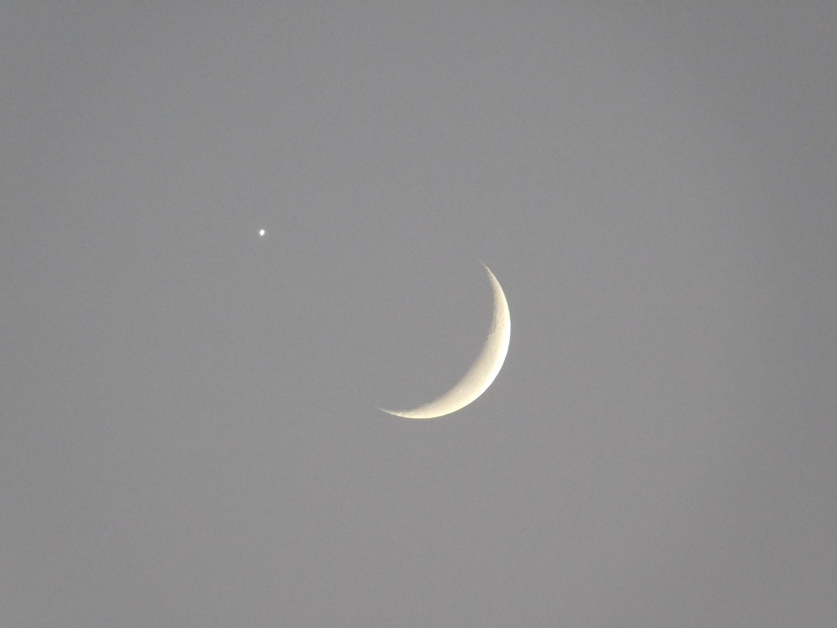
Jupiter and the Moon
The following day we drove the Birdsville Track, which today, is a modern wide road linking Birdsville with Marree and a a steady pace saw us reach Claytons Wetlands Campground in the late afternoon. Along the way we stopped at Mungerannie Hotel and bought some food and drinks which we ate down at the artesian waterhole whilst chasing flies.
Mungerannie humour
In the quiet afternoon and sitting in the shade of the van at Claytons Artesian Bore, we saw a male Emu and seven striped chicks grazing and slowly coming towards us. Our Kelpie, Blaise, barked a warning, which got the attention of the male Emu.

I’d like to chase ’em
He steadily worked his way towards us possibly thinking that Blaise was a black fox coming to eat his offspring. Emus can dismember a dog in one swift kick. The Emu was concentrating on Blaise when I intervened by throwing s rock at it. This broke its stare and it took off in a hurry. Blaise, in the mean time, stood her ground but obeyed commands not to chase. The Emus moved on and shortly after followed by a small herd of Angas Black Cattle, grazing peacefully as they made their way to the wetlands to quench their thirst. We filled the open tub with hot artesian water and went for a dip. It was a quiet night with no traffic and we slept well
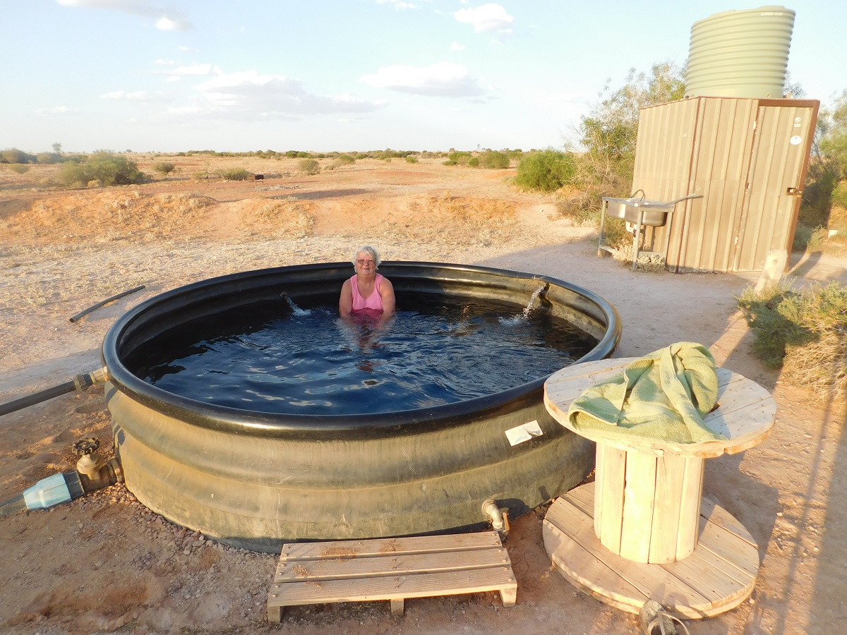
Clayton Wetlands spa
In the morning we had another soaking in the hot waters and then drove on to Marree for fuel and some take-away from the Bakery. We ate our munchies in the rotunda at the railway station where there was shaded seating.
From there we drove to Farina Ruins Campground and arrived around lunch time.
Farina camp
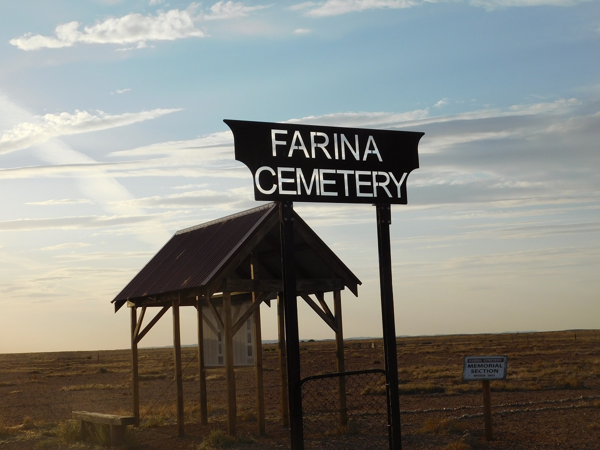
Desolate resting place
I wanted a short drive for the day before the last leg home. We spent the afternoon reading and then just before sunset we visited the cemetery upon a hill nearby. The cemetery has been restored by volunteers and the history of some of the people there has been noted on an information board.
The drive along the flank of the Flinders Ranges is always nice. We stopped at Copley for a rest and did the same at Hawker before pushing on for home. The countryside here was distinctly greener due to winter rains

Flinders Ranges
And so we came to the end of our northern escape. Now a big cleanup and and rethink of what we carry in the van to get ready for the next trip, which hopefully, will be soon.
Home run
The wash up:
We had travelled 19,000km in two cars for the duration of our two and a half month holiday over a variety of road and track surfaces and had had no punctures. However, I managed to dent some of the bodywork of the Toyota on my trek along the Carson River Track in the Kimberley. Due to issues with the Toyota we traded it in on a new Isuzu MU-X which will now become the tow car. I found an old diesel Nissan Patrol on Gumtree and it is being prepared for more off-road adventures.
Wandering the Eyre 2015
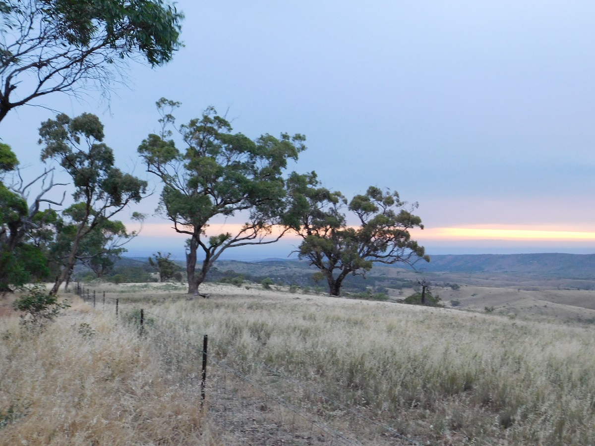
On top of the Southern Flinders Ranges
We set off from home earlier than expected on our weekend away. The fierce west wind had been blowing all day and now at 6pm it had started to dissipate as we headed into it.
Our destination for the first night was Hancock’s Lookout in the Southern Flinders Ranges. We had not visited there in at least ten years and our newly acquired Camps 8 book stated that it was still a Free Camp. Arriving at the foot of Horrocks Pass we turned left to take the gravel road to the lookout when we were met by a sign stating that there were no camp fires, no caravans and no camping allowed. Stunned by this sign we decided to drive on regardless for the seven kilometre distance, and to go and take some late photos and then return and look for a place to camp for the night.
The road climbs up over some low hills and it is quite scenic as you pass by and under the shade a giant old gum trees clinging to the meagre topsoil and sending their roots down and along granite veins to precariously cling to their environment.
About halfway up the drive we met a sheep farmer herding a mob of sheep down towards his farmyard. I switched lights off so as not to blind the sheep and waved to the farmer as we passed by slowly while waiting for the sheep to mill out of the way. I got a dirty look from the farmer. It only occurred to me later that the sign meant no caravan access. He probably got sick of rescuing caravans that got stuck in the creek crossings.
I took some sunset photos up on the ridge at Hancock’s Lookout and then we made our way back down the hill. It wasn’t long before we caught up with the moving sheep brigade and we held back with our lights off until they had reached their destination.
Hancock’s Lookout
By this time it was dark. Now the question was where to camp for the night. We decided on Woolshed Flat Rest Area in Pichi Richi Pass about half way between Quorn and Port Augusta. The road was quiet from Wilmington to Quorn but livened up a bit heading in the direction of Port Augusta. It is quite a long hill coming out if Quorn and it did not seem to want to let up. Eventually we were heading downhill again and we were at our destination. Now we were hungry as it was 10 at night and we hadn’t had a bite since lunch time and so we rustled up some quick spaghetti and fell into bed. Although we were parked close to the road what traffic there was, was unobtrusive. I woke with a fright from a noise which I thought I had heard but then dropped off to sleep again. In the morning I saw that some idiot had buzzed us in the dead of night as tyre skid marks could be seen close to the caravan.

Morning mist in Pichi Richi Pass
Camp at Woolshed Flat
The raucous call of the Kookaburras woke us early and I for one could not recall that I had ever heard then in the Southern Flinders Ranges. Subsequently I have been told that in earlier years they had inhabited the whole of the Flinders Valley but for some reason were now contracting southward.
The morning had misty clouds hanging about but by the time we reached Port Augusta the sun was out and clear day was looming. We did some shopping (shopping is never-ending, it seems) and then took the main road out of the town, which, if driven in a westerly direct, will bring you out at Norseman, in Western Australia. However, we turned south on to the Lincoln Highway and made our way along Long Sleep Plain to the iron city of Whyalla. Then we drove on to Cowell where we refuelled and bought some Cowell Oysters from the Roadhouse. The countryside has some ranges between Whyalla and Cowell and active iron ore mining has taken pace there. Then the undulating hills and flats coastal plains take over and this is one to the prime areas for growing wheat and to a lesser degree, sheep.
The small coastal towns and villages, once a hive of local activity, have decreased in size. People have drifted away as farming land has been going to the highest bidder and the workforce is there no more as farming is now very highly mechanised. Now the townsfolk vie for the tourist dollar and try to attract visitors to stay longer in the region.
We passed Arno Bay and then turned off the highway at Port Neill. Then we took the gravel roads from there meandering along roads that cut through the wheat fields to various destinations.
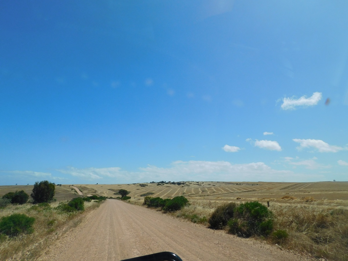
Wheat fields
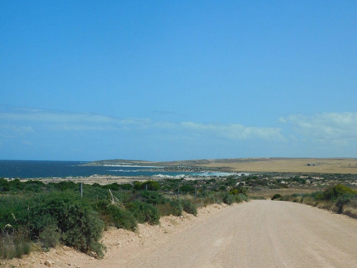
The coast

Lipson Cove
At Lipson Cove, a preferred spot for us in days gone by, we saw the commercialisation of the place with long drop toilets and a Honesty (Dishonesty) Box and camping sites for two camps but the whole camping area taken up by one camper. Disappointed we turned around and drove back to Cowley’s Beach where we had a wonderful two night camp with no one else around except for a few Seagulls and a Willie Wagtail family. I parked the van sideways as there was still some remnants of the westerly wind about and we settled down to a feed of oysters and some chilled wine followed by a long sleep listening to the crashing waves on the beach in our subconcious mind.
Jude was up at daybreak to let the dogs out of the car when I heard her talking to someone. Peeping out through the curtain I could see a male figure sit down and light a small fire. When Jude came back into the van she said that the young bloke had been curled up asleep in the bushes nearby. So much for our watch dogs. I thought that he may have been a beachcomber and later, when he appeared walking back from the beach, asked him that. He gave me a vague answer and said that he couldn’t get enough heat going to warm his baked beans. Then he sauntered off in the direction of Port Neill.
A short while after breakfast another male voice caught our attention asking if our dogs were friendly. This time it turned out to be the Landowner of Cowley’s Beach who had just come to to see who we were. He lived behind the hill and one could narrowly discern his TV antenna sticking out from behind it. He told us that he had development plans but that they were on hold due to the suggested deep water port that a mining company wanted to build there. This issue had been running for eight years now with no resolve. It would be a pity to desecrate this pristine foreshore with any kind of development be it for mining or for tourism. After those two encounters our only other visitors were seagulls and other small birds.

Cowley’s Beach
Up at sunrise
Early morning serenity
On the way out on Saturday morning we visited Carrow Wells campsite but it wasn’t too exciting with a dusty walk to the beach and therefor not for us. Next was a sojourn at the Port Neill foreshore and soon again we were back on the Lincoln Highway heading north. At Arno Bay we called in for something we needed from the local shop and then stopped off to view an art exhibition which was on. There Jude bought a raffle ticket and she was informed two weeks later that she had drawn a prize which was a painting and that it would soon be delivered by post.
We now took the road to Cleve and once there found some stuff we needed in this quiet town. It was but a short drive from there to Yuldulknie Weir Campground, where we stopped for the rest of the day. The weir was built in the 1920’s to supply water to small communities and farm in this dry land.. At the moment the water is low as the country is in drought. The day had been warm to hot but by nightfall a cool change swept over the peninsula and we retired indoors after playing ball with the dogs.
Years ago we were exploring the peninsula and found a remote beach campsite out from Cowell. We looked at some tracks on our maps which seemed to skirt the coast and asked a local about them but that person wasn’t too sure stating ‘there be swamps out there’. Yeah, maybe when it was a wet summer again. After a refuel and some more oysters we drove to Lucky Bay but could not see the significance of the name unless, of-course, you were a dyed in the wool fisherman.
The tracks over the low lying wheat fields took us close to the beach but we backed off on going there as those tracks became very sandy and we did not relish the prospect of bogging the caravan. Turning west again we crossed the highway and drove to the point of a T Junction where we found a Tourist Drive sign. I was hoping that we could get to the Cowell-Kimba Road, so that we could then find our way to a place called Secret Rocks along a gravel road back to Whyalla
Sandy track

Weir Road
Opening the Cocky Gate
The climb
I turned off onto this track remarking that it wasn’t used much. Initially there was a slight rise as we drove along dodging overhanging trees. The weir was dry and then the road started to climb but nothing the car could not handle. There was nowhere to turn around with a 19ft van hanging off the back. We came to Cocky Gate which showed the ingenuity of its designer. Then the road dipped downhill for a short distance and then turned onto what looked like a fairly steep climb. I engaged 4×4 Low Range and second gear and the 3 litre diesel engine held its power to pull that 2.5ton van up and over the rise. Breathing a sigh of relief we were soon on the Cowell-Kimba Road which was sealed.
It wasn’t long and we were drifting eastwards once again along a gravel road in search of Secret Rocks, which we found after a few kilometres. The rocks are typical sandstone domes as found in the northern part of the Eyre Peninsula. Traditional Aboriginals used the rocks to gather water in some of the gullies within the rocks and later European farmers took up the idea as well to capture water for stock and for domestic use in this very dry location.
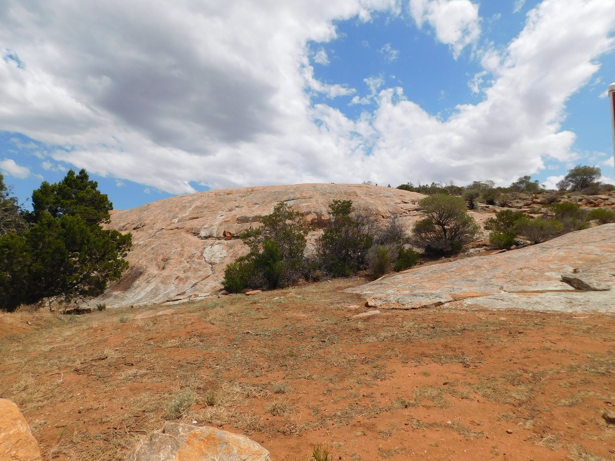
Secret Rocks
We passed through Whyalla and made our way out to Lowly Point just past the Gas Refinery and near the Lighthouse. There is a Free Camp at the boat ramp but it seemed a bit crowded. However, we found a parking bay right on the seafront in the late afternoon and spent a quiet night there. Earlier in the evening and into the dark local fishermen were trying their luck off the rocks below. I steep embankment down to the waters edge proved no hinderance to those with powerful four wheel drives who slid down and scrambled up the sandy bluff to a very narrow passageway below. It kept us entertained. We were expecting to be asked to move on but no one came and we fell asleep listening to the waves spluttering against the rocky shore.
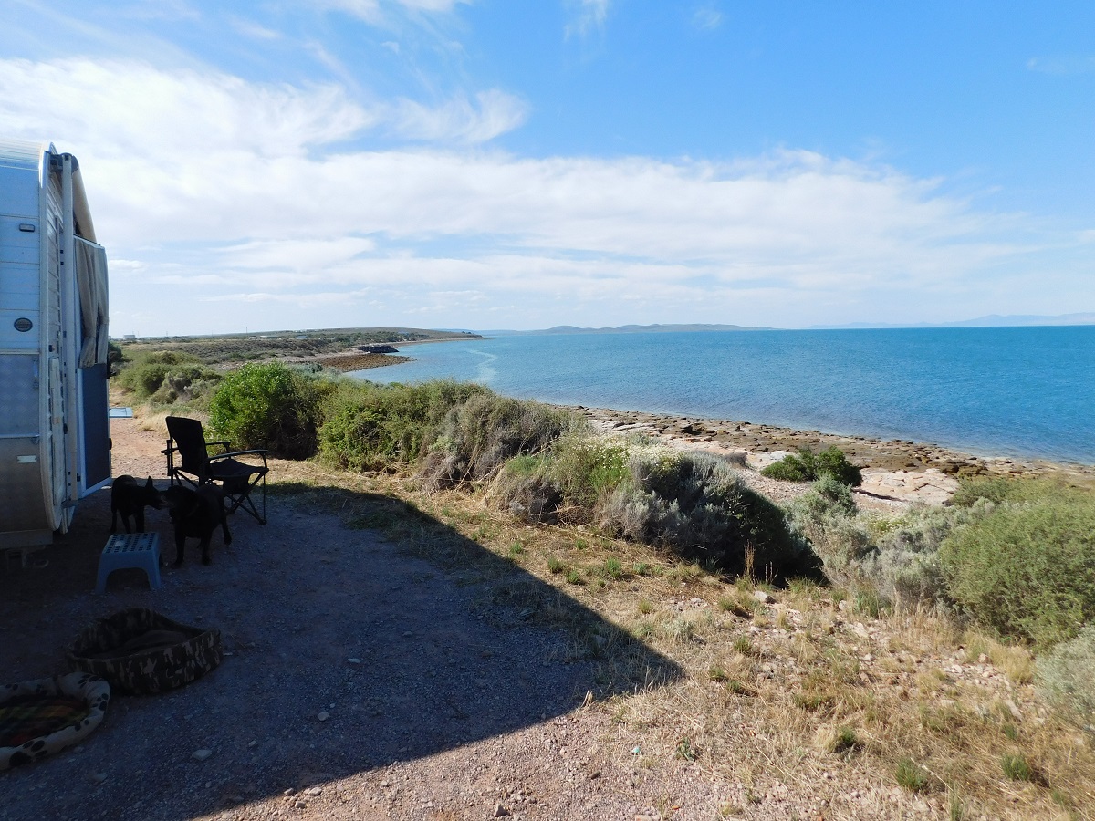
Beachfront
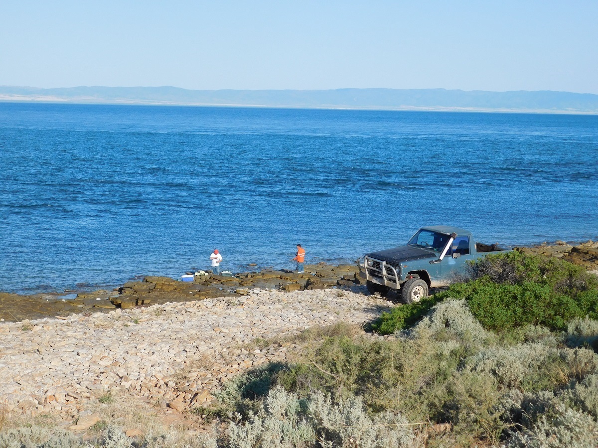
Local fishos
Monday morning saw us up and about early and on the road to Port Augusta where we invariably had a list of things to do. Then it was a test for the Isuzu towing the van up and over Horrocks Pass which it did quite comfortably and by mid afternoon we were back home again
Up Horrocks Pass